分类: environment

  • UPDATE: Atlantic System’s Development Chance Rises to 80 Percent

    UPDATE: Atlantic System’s Development Chance Rises to 80 Percent

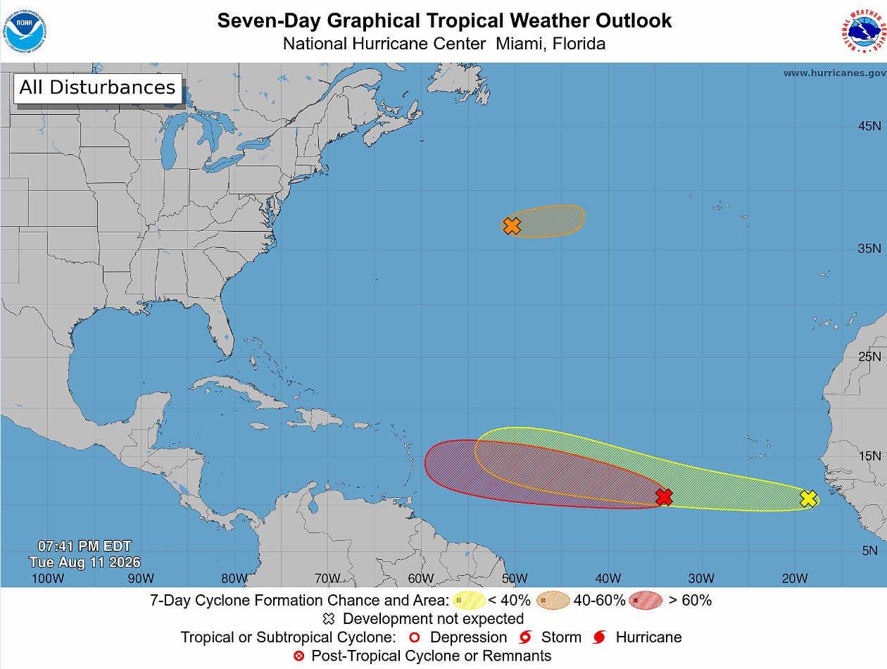
    As the 2024 Atlantic hurricane season progresses, meteorologists are tracking three separate disturbed weather systems across the basin, with one emerging as the most likely candidate to strengthen into a named tropical cyclone in the coming week. The U.S. National Hurricane Center (NHC) updated its outlook Tuesday evening, reporting that a tropical wave moving through the central Atlantic has seen its odds of organized development jump sharply, with forecasters now putting its seven-day formation chance at 80 percent.

    Designated by the NHC as System AL92, this disturbance was located roughly 700 miles southwest of the Cabo Verde Islands as of 8 p.m. ET Tuesday. While the system is still in its early stages of organization, the NHC noted that scattered showers and thunderstorms linked to AL92 have already begun to consolidate, a key early sign that tropical cyclone formation is underway. Forecasters project the system will continue on a westward to west-northwestward track across the central tropical Atlantic over the next several days, moving through an environment where ocean temperatures and wind patterns are growing increasingly favorable for strengthening.

    In its updated probability assessment, the NHC said AL92 now has a 60 percent chance of developing into a tropical depression within the next 48 hours, up from earlier lower estimates. If the system continues to organize as expected, it will become the season’s next named tropical storm once its sustained wind speeds reach 39 miles per hour.

    A second system, designated AL93, is tracking across the higher-latitude central Atlantic, far north of AL92. Forecasters say this system has a limited window for development, with a short-lived tropical depression or weak tropical storm possibly forming before the end of Wednesday. Beyond that, unfavorable conditions are expected to halt the system’s organization.

    The third system under watch is a newly emerged tropical wave that just moved off the west coast of Africa into the eastern Atlantic. Right now, this system’s shower and thunderstorm activity remains disorganized, and it has low odds of development in the near term. The NHC estimates just a 10 percent chance of formation within 48 hours, rising to only 20 percent over the full seven-day outlook window as it drifts westward across the eastern and central Atlantic.

    As of Tuesday night, the NHC confirmed there were no active tropical cyclones anywhere across the entire Atlantic basin. Forecasters will continue to issue daily updates on all three disturbed systems, with more frequent advisories going into effect once any system shows clear signs of sustained organization.
  • Brandweer blijft alert bij Ornamibo na grote brand en rookontwikkeling

    Brandweer blijft alert bij Ornamibo na grote brand en rookontwikkeling

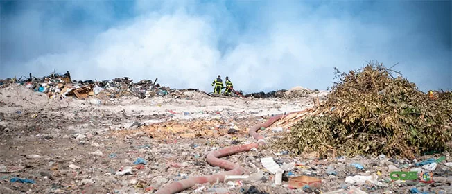
    A large blaze that broke out earlier this week at the Ornamibo landfill in Wanica-Zuidoost, Suriname, has been fully contained, though fire crews remain on site to monitor for lingering smoldering deep beneath the 9-meter-high waste mound, local officials confirmed Friday.

    District Commissioner Ernesto Muller told reporters the first report of the fire came in between 2:30 p.m. and 2:45 p.m. on Monday, with fire and police services dispatched immediately to the scene. What started as a small, contained ignition quickly escalated into an intense inferno that generated thick plumes of smoke by Monday evening, creating serious risks for both local residents and the surrounding ecosystem, Muller explained.

    While the main fire is now under control, crews have not pulled out of the site. The white smoke still visible rising from the waste mound does not indicate active open flame, according to fire department assessments, but officials are taking no chances: embers can still smolder unseen deep in the compacted waste pile, requiring continued monitoring and suppression work to prevent a reignition.

    Investigators have not ruled out arson as a potential cause of the blaze, Muller noted, though no concrete evidence of intentional ignition has been uncovered so far. National environmental authorities and the National Disaster Coordination Center have been involved in response efforts since Monday evening, working alongside local first responders to assess environmental and public health impacts.

    This blaze is far from an isolated incident: the Ornamibo landfill has a repeated history of fire outbreaks, which consistently pose threats to surrounding communities through toxic smoke exposure. In response to the recurring risk, Muller is pushing for urgent preventive changes to reduce the chance of future large-scale fires. He has already presented a proposal to fire department leadership and the Ministry of Public Works and Spatial Planning (OWRO) calling for the installation of permanent water hoses fitted with sprinklers across the site. The system would keep sections of the landfill consistently moist, slowing the spread of any new small ignitions before they can grow into out-of-control infernos.

    Beyond immediate fire prevention measures, Muller is also calling for a broader reassessment of Suriname’s waste management practices, pushing for a transition away from the current outdated open-air landfill model. “We need to move toward more modern, nature-friendly methods of processing our waste,” Muller said, noting that the current site creates ongoing harm to local agricultural and livestock operations, the broader regional ecosystem, and public health for nearby communities. He plans to convene talks with OWRO and other relevant stakeholders to explore long-term alternative waste solutions.

    Local officials have also issued public health guidance for residents living near the landfill. In the event of continued smoke emissions, residents are advised to keep all windows and doors closed tightly. Anyone who must go outside should wear a well-fitting face mask to reduce inhalation of smoke particles. Residents who develop respiratory issues after exposure are urged to contact a medical provider or seek emergency care immediately.

  • Belize River “Devastated” by Fish Kill, Researcher Says; Endangered Hicatee and Crocodiles Among the Dead

    Belize River “Devastated” by Fish Kill, Researcher Says; Endangered Hicatee and Crocodiles Among the Dead

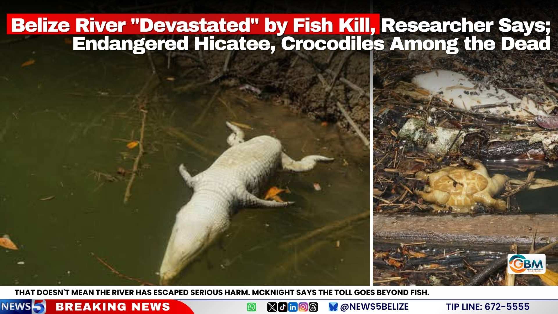
    A catastrophic mass wildlife mortality event along Belize’s primary waterway, the Belize River, has left ecologists sounding alarm bells over long-term ecosystem damage, after critically endangered species were confirmed among the thousands of dead animals. As of August 11, 2026, researchers report the worst of the die-off appears to be receding, but the irreversible harm already done threatens to alter the river’s ecological balance for years to come.

    Leading the on-site assessment is Dr. Donald McKnight, aquatic ecologist and research director at the Savannah Field Station near the Belize Zoo. McKnight explained that the river’s steady current has helped flush the harmful trigger of the kill through the system, meaning large-scale new deaths have become rare. “We’re still spotting a handful of fresh fish carcasses here and there, but the majority of the dead wildlife died several days ago, and the large-scale die-offs have stopped,” he noted in his on-river briefing.

    But the slowdown of deaths offers little comfort to conservation teams, who have documented that losses extend far beyond common fish species. Among the dead are multiple hicatee turtles — a critically endangered reptile that conservation programs have spent decades working to recover — as well as crocodiles. McKnight described the scale of loss as “pretty devastating” for the river’s unique, already vulnerable ecosystem.

    Local residents have provided key clues to the potential cause, reporting that the river’s water turned noticeably dark before clearing gradually in recent days. McKnight says this observation rules out a purely naturally occurring event, pointing instead to an external contaminant introduced into the river’s flow.

    “Algal blooms, one common cause of large fish kills, almost never develop in fast-flowing water systems like the Belize River,” he explained. “A bloom could form in a stagnant side channel or lagoon and then spill into the main river, but the water discoloration residents saw suggests an outside pollutant entered the system directly.”

    The leading working hypothesis points to agricultural runoff as the most likely culprit, McKnight said, such as an overflow from a pesticide or fertilizer retention pond that sent contaminated water into the river. Other potential causes, including toxic chemical pollution and algal toxin intrusion, have not been ruled out, however. Research teams are currently collecting water and tissue samples and coordinating with environmental authorities to pinpoint the exact source of the mortality event.

    Conservation scientists warn the damage will not end with the already confirmed deaths. Predators and scavengers that feed on the contaminated carcasses face secondary poisoning, which could extend the die-off to terrestrial and avian species connected to the river ecosystem. The loss of large numbers of hicatee and crocodiles — both keystone species that shape the river’s food web — is also expected to create cascading ecological impacts that will persist for generations.

    The Belize Department of the Environment’s formal investigation remains active as of the latest update. A precautionary public advisory first issued on August 5 remains in full effect, urging residents to avoid consuming any fish or aquatic resources harvested from the affected Belize River Valley region. The advisory also bans the use of untreated river water for drinking, cooking, food preparation, and consumption by livestock or domestic pets.

  • Tropical Disturbance Could Become Threat to Caribbean Islands

    Tropical Disturbance Could Become Threat to Caribbean Islands

    As weather monitoring agencies across the Atlantic track emerging cyclonic activity, a senior meteorologist from Antigua and Barbuda is calling on Caribbean communities to stay alert to a growing tropical disturbance that could put the region’s island chain at risk in the coming days.

    Dale Destin, the lead meteorologist for Antigua and Barbuda, issued a public advisory on Tuesday highlighting the active disturbance currently churning across the eastern stretch of the tropical North Atlantic. “There is a #TropicalDisturbance (red) of interest to the Caribbean over the eastern tropical North Atlantic. All are asked to monitor this system, as it could become a threat to the islands,” Destin shared in his social media alert.

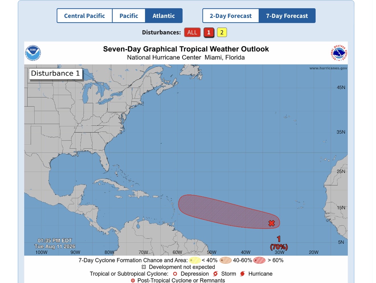
    Destin’s warning aligns with updated forecasts from the United States’ National Hurricane Center (NHC), which has upgraded the system’s odds of developing into a organized tropical depression to high probability by the end of this week. As of the NHC’s 2 p.m. Tropical Weather Outlook released Tuesday, the unorganized cluster of showers and thunderstorms is located roughly 550 miles southwest of the Cabo Verde Islands, off the western coast of Africa.

    Forecasters at the NHC note that atmospheric and oceanic conditions across the Atlantic are becoming steadily more supportive of cyclonic development over the next 48 to 72 hours. “A tropical depression will likely form during the latter half of this week while the system moves westward to west-northwestward across the central tropical Atlantic,” the agency’s official outlook stated.

    Current probability forecasts put the system’s chance of organizing into a tropical cyclone within 48 hours at 40%, while the seven-day development probability holds at a high 70%. While meteorologists emphasize it remains too early to definitively project what, if any, direct impacts the system will bring to Antigua and Barbuda or the broader Caribbean region, Destin’s early advisory underscores the need for residents to track the system’s westward progression closely and prepare for potential changes in conditions.

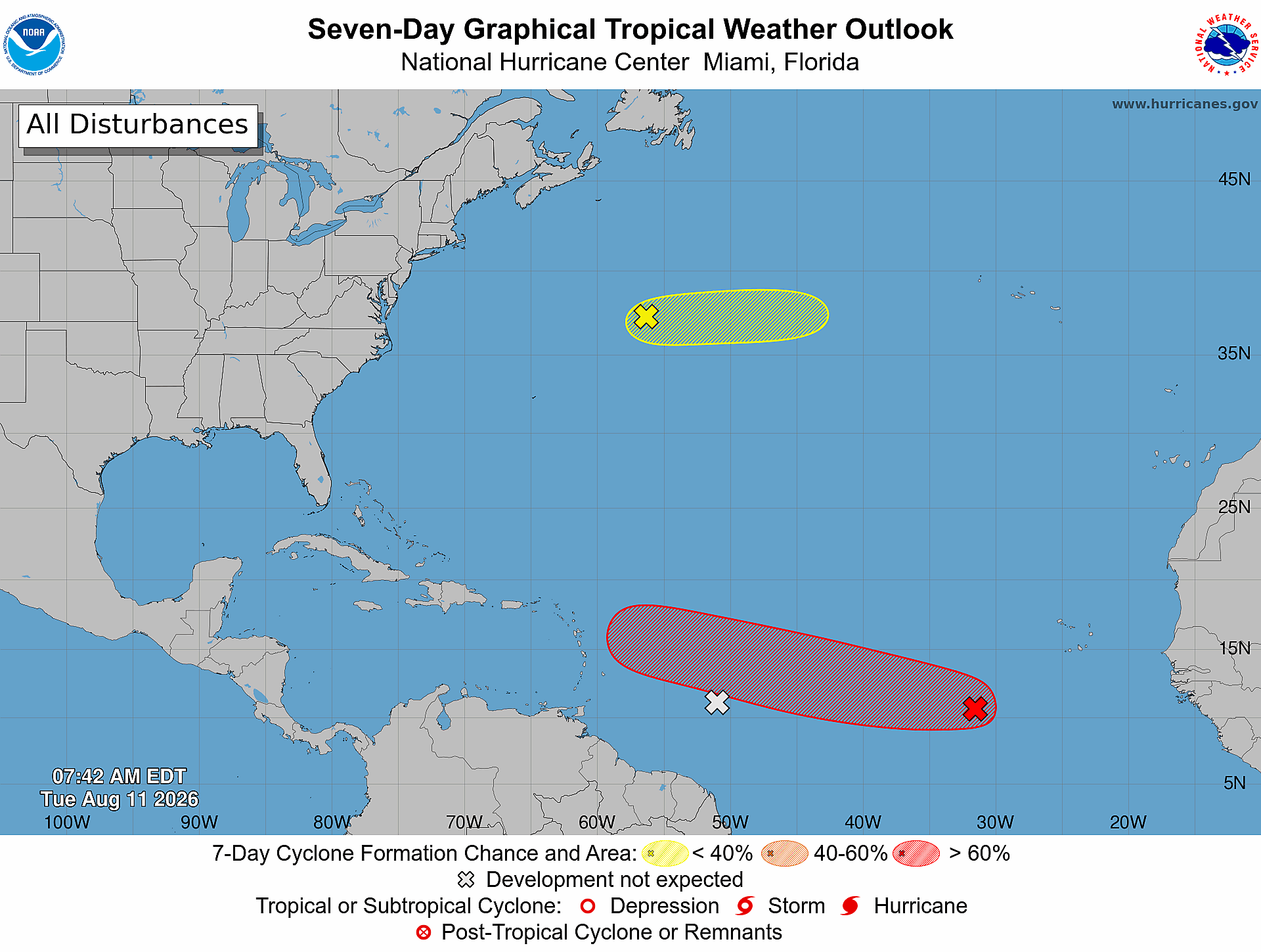
    In addition to the high-priority disturbance, forecasters have cleared a second system that was being monitored earlier this week. Destin confirmed that the previously tracked second area of interest, marked on regional weather maps with a grey X, is no longer forecast to develop into a cyclonic system.

    Separately, the NHC is continuing to monitor a third weather system: a trough of low pressure located roughly 750 miles east-northeast of Bermuda. This system carries a 20% probability of development over both the 48-hour and seven-day forecast windows. Forecasters project that the low-pressure trough will move into cooler ocean waters later this week, eliminating any chance of sustained cyclonic development by Thursday.

  • BMS discontinues dust haze advisory

    BMS discontinues dust haze advisory

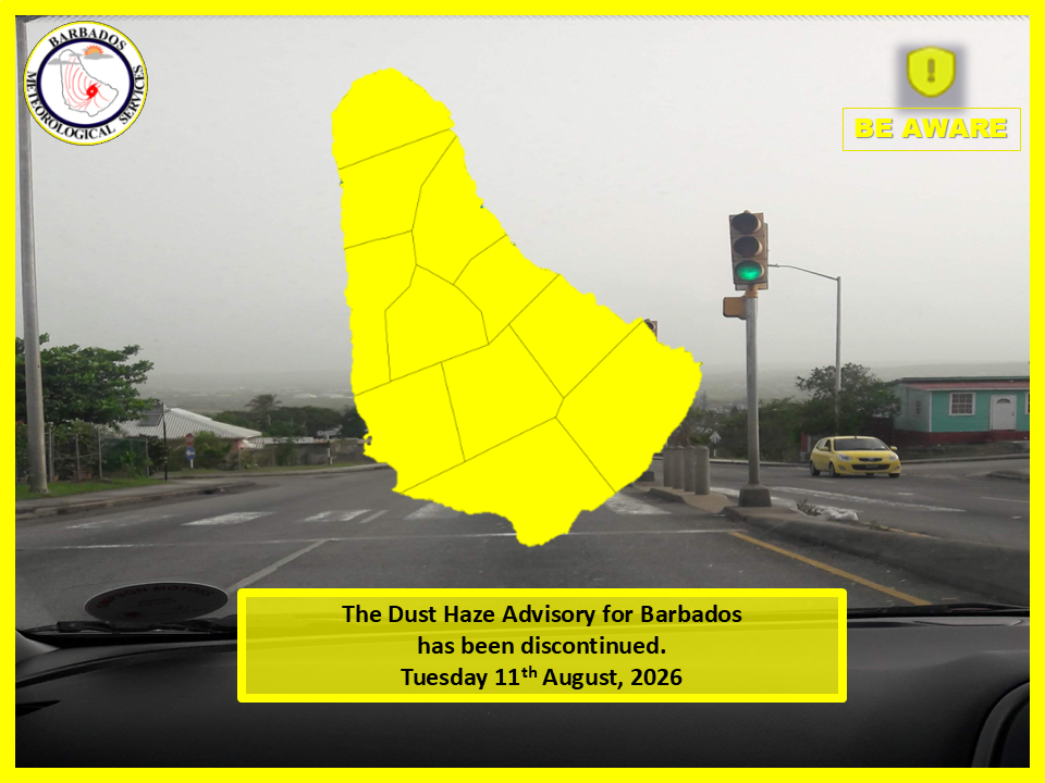
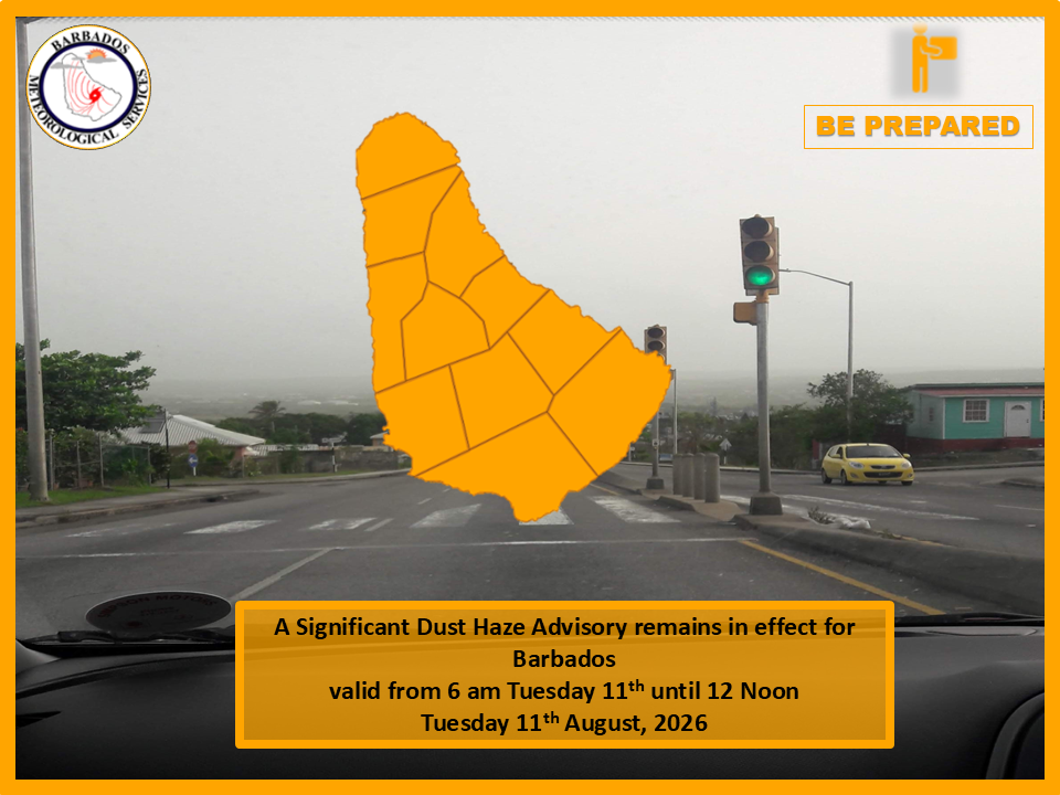
    After days of reduced air quality driven by a thick blanket of Saharan dust, Barbados has officially ended its public Significant Dust Haze Advisory, meteorological officials confirmed this week. The Barbados Meteorological Services (BMS) announced the discontinuation of the advisory at noon local time, attributing the improving air conditions to an incoming tropical wave that is pushing the bulk of the dust plume away from the island and the wider Caribbean region.

    While the strongest dust concentrations are receding, BMS cautions that residual light to moderate haze will linger across Barbados and its surrounding territorial waters through the end of the current day and overnight. For residents and travelers monitoring air quality, the reprieve from heavy haze may be short-lived: latest satellite imagery tracked a separate mass of moderate Saharan dust across the central Atlantic that is on track to reach Barbados starting Thursday, August 13, with impacts expected to last through the following weekend.

    Saharan dust plumes are a recurring seasonal phenomenon in the Caribbean, carried westward across the Atlantic by trade winds, and can trigger respiratory irritation, reduced visibility, and changes to local weather patterns during periods of high concentration.

  • NHC Tracking Two Systems in the Atlantic, One With High Chance of Development

    NHC Tracking Two Systems in the Atlantic, One With High Chance of Development

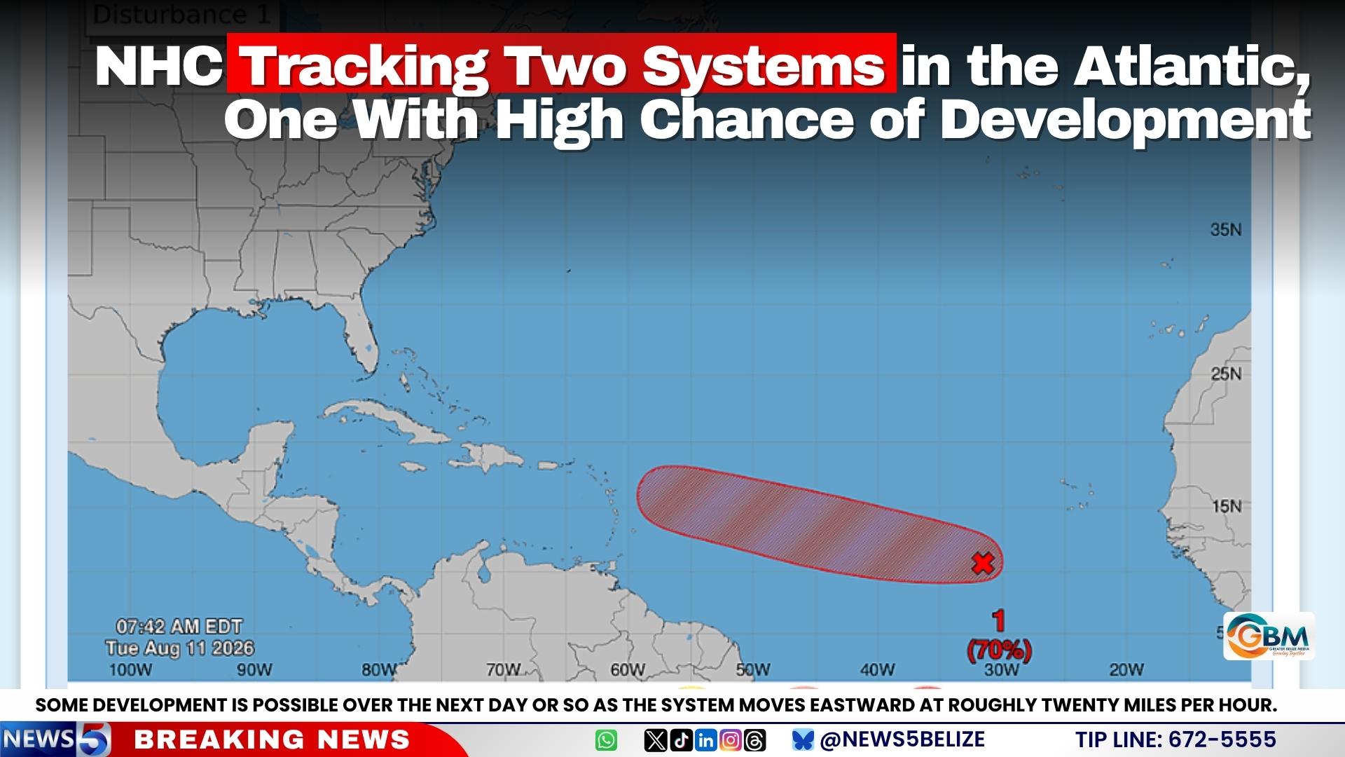
    As the 2026 Atlantic hurricane season continues, the United States National Hurricane Center (NHC) is keeping close watch on two separate low-pressure systems moving across the basin this week, with one system holding a strong probability of maturing into a tropical depression before the end of the week.

    Per the NHC’s latest official Tropical Weather Outlook, the first of the two monitored disturbances is situated in the central tropical Atlantic, centered roughly 500 miles to the southwest of the Cabo Verde Islands. While shower and thunderstorm activity linked to this low-pressure system has remained limited in recent observations, meteorologists with the agency have projected that environmental conditions will become increasingly conducive to strengthening over the coming 48 to 72 hours.

    Forecasters project that as the system tracks on a west to west-northwest course across the central tropical Atlantic, it will likely organize into a tropical depression during the second half of this week. Right now, the NHC assigns this system just a 30% probability of development within the next 48 hours, but that chance climbs significantly to 70% — a high likelihood rating — over the full seven-day forecast window.

    The second system under monitoring is a trough of low pressure located several hundred miles northeast of Bermuda, which is currently generating scattered showers and thunderstorms across the central subtropical Atlantic. The NHC notes that limited, slow development of this system cannot be ruled out over the next 24 to 48 hours as it travels eastward at around 20 miles per hour. However, the system is on track to reach much cooler ocean waters later this week, a shift in conditions that will halt any further organization by Thursday. For this second disturbance, the NHC pegs development odds at just 10% over both the 48-hour and seven-day forecast periods.

    Amid ongoing monitoring for the active hurricane season, the NHC confirmed that it will continue issuing regular updates on both systems as they progress across the Atlantic, updating forecast probabilities and development status as new observational data becomes available.

  • National Hurricane Centre: 70 per cent chance of Atlantic system developing

    National Hurricane Centre: 70 per cent chance of Atlantic system developing

    The U.S. National Hurricane Center (NHC) is actively tracking three distinct weather systems moving across the Atlantic Ocean this week, with one disturbance carrying a 70% probability of strengthening into a tropical depression within the next seven days. The first and most closely monitored system is currently positioned roughly 500 miles southwest of the Cabo Verde Islands off the west coast of Africa. Though it only generates scattered showers and isolated thunderstorms at this early stage, forecasters project that the system will enter a region of increasingly favorable atmospheric and oceanic conditions over the coming days. As the disturbance tracks generally west to west-northwest across the central tropical Atlantic, the NHC anticipates that a full tropical depression will likely form by the second half of this week. The odds of organized development within the next 48 hours stand at a more moderate 30%, before climbing to the 70% 7-day probability. A second system, a separate tropical wave, is located approximately 600 miles east of the Windward Islands. Like the first disturbance, it currently produces scattered, disorganized showers and thunderstorm activity, but forecasters say significant strengthening is extremely unlikely. As the wave approaches the Lesser Antilles, it will push through a broad expanse of dry air that inhibits tropical cyclone formation. The NHC estimates the chance of this system developing into a named cyclone is effectively zero across both the 48-hour and seven-day forecasting windows. Even with near-zero development potential, the weather system still carries localized hazards for the region: forecasters warn it could bring brief periods of heavy rain and sudden gusty winds to portions of the Lesser Antilles over the next 48 hours. The third system being monitored is a trough of low pressure located several hundred miles northeast of Bermuda. This system has a 10% chance of tropical development over the next seven days. It is projected to track eastward at around 20 miles per hour, and by later this week it will reach cooler North Atlantic waters, where conditions become far less hospitable for sustained tropical cyclone growth. Forecasters will continue updating development probabilities and track projections as the systems progress across the Atlantic, in line with standard hurricane season monitoring protocols.

  • Tropical storm Cristobal forms in the Atlantic

    Tropical storm Cristobal forms in the Atlantic

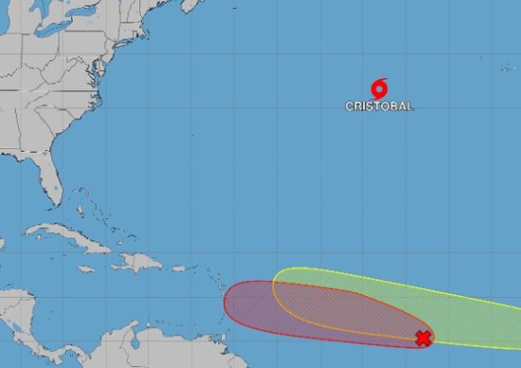
    The 2026 Atlantic hurricane season marked another key milestone on Wednesday, when the National Hurricane Center (NHC) confirmed the formation of Tropical Storm Cristobal, the third named storm of this year’s cycle.

    At the time of the announcement, the storm was positioned roughly 880 miles (1,417 kilometers) west of the Azores archipelago. It was tracking quickly eastward at a forward speed of 25 miles per hour (around 40 km/h), packing maximum sustained wind speeds of 45 miles per hour (72 km/h), the NHC reported.

    Crucially, forecasters have emphasized that Cristobal currently poses no danger to any populated coastal or inland regions. As of the latest update, no coastal watches or official warnings have been issued in association with the system.

    According to NHC projections, Cristobal is set to begin weakening over the next 24 to 48 hours as it progresses over cooler ocean waters, which sap the energy of tropical systems. Its stretched, elongated structure combined with its great distance from any landmasses means the storm is extremely unlikely to bring measurable impacts to the United States, the Azores, or the Iberian Peninsula, forecasters added.

    Cristobal’s emergence comes as the Atlantic hurricane season enters the lead-up to its annual peak activity period, prompting meteorologists to maintain close surveillance across the entire tropical Atlantic basin. Beyond Cristobal, the NHC is actively monitoring two other areas of disturbed weather that carry potential for tropical development. One of these systems, a tropical wave, currently has an 80% probability of organizing into a named storm over the next two days, per NHC estimates.

    Even with the uptick in tropical activity across the basin, Dominican meteorological officials have confirmed that none of the currently tracked systems pose an immediate direct threat to the Dominican Republic at this time.

  • 15 Scarlet Macaws Released Into the Wild

    15 Scarlet Macaws Released Into the Wild

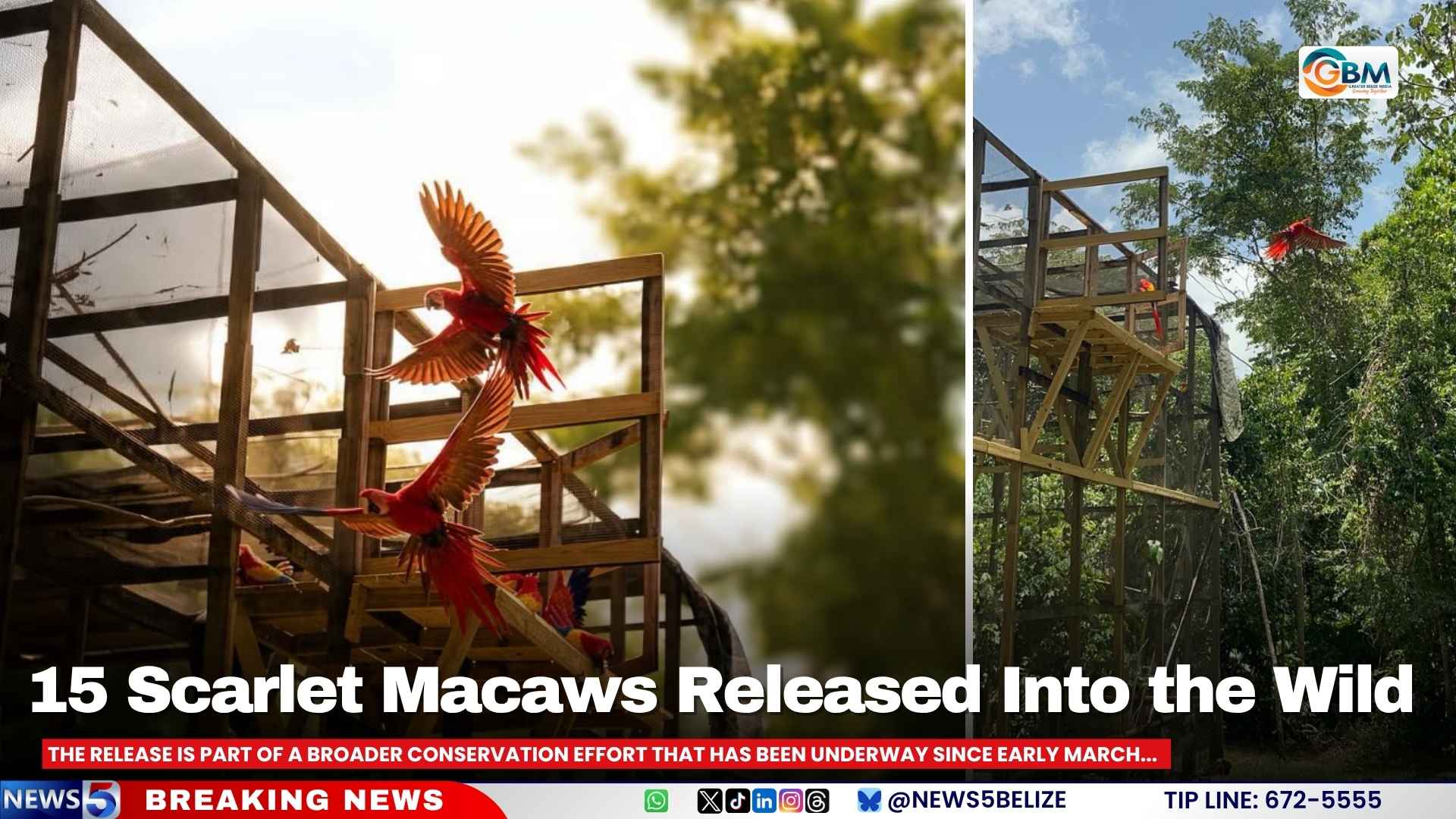
    On a Monday morning in August 2026, a landmark moment for Central American biodiversity unfolded in Belize’s forests: 15 rescued scarlet macaws took their first independent flights into the wild, marking a major milestone for a years-long collaborative conservation push led by two local organizations. The release, carried out jointly by Friends for Conservation and Development (FCD) and Belize’s Forest Department, capped off an intensive rehabilitation process that began when the birds were pulled from high-risk survival situations.

    Rescue interventions for Belize’s scarlet macaws are only authorized as a last resort, following strict protocols established by the Forest Department. Most triggers for rescue stem from scenarios that drastically raise the risk of poaching or death, such as three macaw chicks competing for space and resources in a single nesting cavity. After being pulled from these dangerous situations, each bird spent an average of 100 days receiving specialized care in a dedicated rehabilitation facility before release.

    The rehabilitation process was carefully designed to prepare the macaws for full independence in their natural habitat. After initial feeding and medical care, the birds were transferred to large flight cages, where they built muscle mass, honed their flying skills, and regained the natural instincts needed to forage and avoid threats in the wild. When the release cage door swung open on Monday, the macaws first gathered at their familiar supply of fruit and nuts, before one by one venturing into the open forest. Some soared deep into the tree canopy immediately, while others lingered near the release site, testing their new freedom. For minutes after the release, the forest echoed with the macaws’ distinctive squawks as the flock settled into their new home.

    This release is just one component of a broader, ongoing scarlet macaw conservation initiative that launched in early March 2026, when FCD’s Research Unit began systematic biological monitoring of wild macaw populations across Belize. The core of this effort is consistent, on-the-ground presence near macaw nesting cavities, a strategy that serves two key goals: tracking the growth and development of wild chicks, and deterring poachers who target young macaws before they are able to fly. To date, the program has supported 24 macaw chicks that have successfully fledged from their natural nesting sites.

    Despite these gains, the conservation program continues to face significant challenges from the illegal wildlife trade. Already this year, two wild macaw chicks have been stolen by poachers, who are locally referred to as “guaqueros.” Stolen macaws are typically smuggled across the border into Guatemala for the illegal pet trade, a multi-million dollar black market that has decimated parrot populations across Central America. To counter this transnational criminal activity, FCD and Belize’s Forest Department have partnered with Guatemalan authorities to maintain a binational taskforce that shares intelligence and coordinates cross-border operations to disrupt trafficking networks. Even with this collaborative framework in place, conservation officials acknowledge that gaps remain: it is still nearly impossible to track the exact number of scarlet macaws lost to illegal trafficking each year, leaving long-term population projections uncertain.

  • Dust haze persists over Barbados, BMS extends advisory

    Dust haze persists over Barbados, BMS extends advisory

    A stubborn plume of dust haze has maintained its hold over Barbados and adjacent offshore waters for a second consecutive day this Tuesday, forcing the Barbados Meteorological Services (BMS) to extend a public health and safety advisory amid widespread, persistent dips in visibility across the Caribbean island.

    In an updated bulletin issued at 6 a.m. local time, the BMS confirmed that latest satellite tracking data shows a dense, moderate-intensity dust blanket covering both Barbados’ landmass and the surrounding territorial waters. While the prolonged hazy conditions have disrupted daily routines for residents, forecasters have outlined a clear timeline for improving conditions: dust concentrations are projected to thin out slowly through the early morning hours, with full, noticeable improvements in air quality and visibility expected to take hold by Tuesday afternoon.

    The extended advisory is currently scheduled to expire at 12 p.m. noon local time on Tuesday. In line with the advisory extension, national emergency and public health authorities have issued a call for all Barbados residents to stay vigilant. The public has been urged to keep up with real-time updates released by the BMS, the national Department of Emergency Management, the Government Information Service, and local media outlets. Officials also emphasized that all community members should adhere to any public health guidance put forward by the country’s Ministry of Health and Wellness as conditions develop.