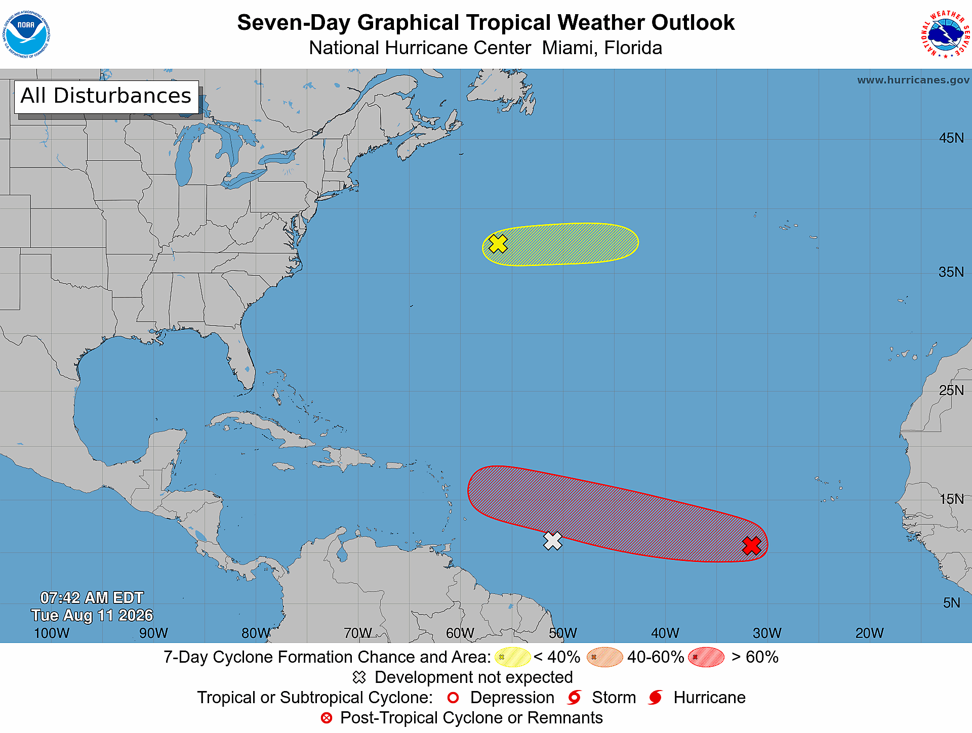
The U.S. National Hurricane Center (NHC) is actively tracking three distinct weather systems moving across the Atlantic Ocean this week, with one disturbance carrying a 70% probability of strengthening into a tropical depression within the next seven days. The first and most closely monitored system is currently positioned roughly 500 miles southwest of the Cabo Verde Islands off the west coast of Africa. Though it only generates scattered showers and isolated thunderstorms at this early stage, forecasters project that the system will enter a region of increasingly favorable atmospheric and oceanic conditions over the coming days. As the disturbance tracks generally west to west-northwest across the central tropical Atlantic, the NHC anticipates that a full tropical depression will likely form by the second half of this week. The odds of organized development within the next 48 hours stand at a more moderate 30%, before climbing to the 70% 7-day probability. A second system, a separate tropical wave, is located approximately 600 miles east of the Windward Islands. Like the first disturbance, it currently produces scattered, disorganized showers and thunderstorm activity, but forecasters say significant strengthening is extremely unlikely. As the wave approaches the Lesser Antilles, it will push through a broad expanse of dry air that inhibits tropical cyclone formation. The NHC estimates the chance of this system developing into a named cyclone is effectively zero across both the 48-hour and seven-day forecasting windows. Even with near-zero development potential, the weather system still carries localized hazards for the region: forecasters warn it could bring brief periods of heavy rain and sudden gusty winds to portions of the Lesser Antilles over the next 48 hours. The third system being monitored is a trough of low pressure located several hundred miles northeast of Bermuda. This system has a 10% chance of tropical development over the next seven days. It is projected to track eastward at around 20 miles per hour, and by later this week it will reach cooler North Atlantic waters, where conditions become far less hospitable for sustained tropical cyclone growth. Forecasters will continue updating development probabilities and track projections as the systems progress across the Atlantic, in line with standard hurricane season monitoring protocols.
National Hurricane Centre: 70 per cent chance of Atlantic system developing