分类: environment

  • Category 5 Hurricane Polo Barrels Toward Mexico’s Baja Peninsula

    Category 5 Hurricane Polo Barrels Toward Mexico’s Baja Peninsula

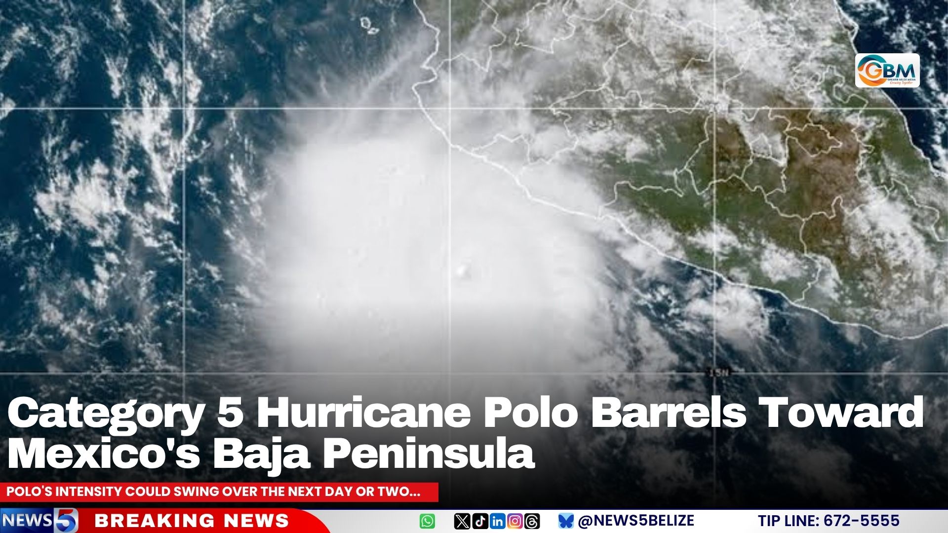
    A powerful Category 5 hurricane is posing imminent danger to northwestern Mexico and potentially the southwestern United States, as forecasters confirm Hurricane Polo has regained its maximum strength off Mexico’s Pacific coastline and is on a direct path toward Baja California Sur.

    As of the latest update from the U.S. National Hurricane Center (NHC) on September 25, 2026, the massive storm is positioned approximately 280 miles southwest of Cabo Corrientes, Mexico. Right now, Polo is carrying maximum sustained winds of 160 miles per hour, a threshold that puts it firmly in the highest tier of hurricane intensity on the Saffir-Simpson scale. At present, the system is moving west at roughly 12 miles per hour, pulling it temporarily away from Mexico’s mainland southwestern coast—but this trajectory is not expected to hold long, according to forecasters.

    Meteorologists have mapped out a clear shifting track for the storm over the coming days. They project that Polo will curve northwest by Saturday, shift to a northerly direction by Sunday, and finally make a turn toward the northeast on Monday. This path will bring the storm directly into contact with Baja California Sur, before it pushes further inland onto mainland Mexico.

    Hazardous impacts from the storm have already begun to reach coastal areas. Dangerous swells generated by Polo are currently battering southwestern Mexico’s shoreline, and these rough conditions are expected to spread northward along west-central Mexico’s coast and toward Baja California Sur through the end of the weekend. The NHC has issued urgent warnings that these building swells bring life-threatening risks including powerful rip currents, destructive high surf, and widespread coastal flooding that can put lives and property in danger.

    While some weakening is forecast in the near term, the threat will not dissipate entirely when the storm loses intensity. Meteorologists project that Polo will begin to gradually lose strength starting Saturday, after potential small fluctuations in intensity over the next 48 hours. Even as the storm system weakens, however, its vast plume of tropical moisture is expected to trigger extreme weather hundreds of miles from Polo’s core track. The NHC notes that remnant moisture from the hurricane may indirectly generate heavy downpours and dangerous flash flooding that extends all the way into the southwestern United States, putting communities across that region on high alert.

  • DNA-leden eisen onmiddellijke stillegging goudactiviteiten Pelin Bergi en onafhankelijk onderzoek

    DNA-leden eisen onmiddellijke stillegging goudactiviteiten Pelin Bergi en onafhankelijk onderzoek

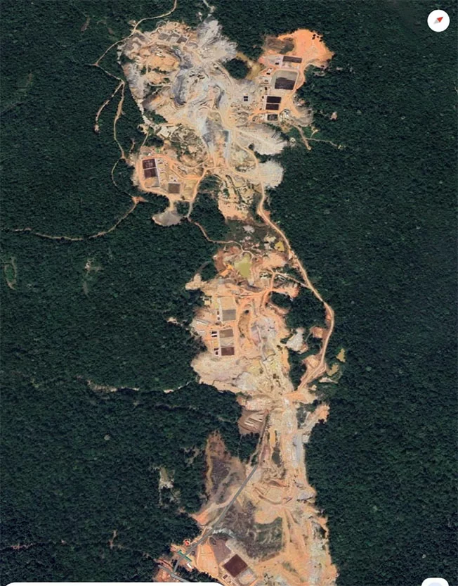
    Two members of Suriname’s National Assembly (DNA), Rabin Parmessar of the DNA and Michael Marengo of the NDP, have formally submitted a request to President Jennifer Simons calling for an immediate temporary suspension of all exploration, extraction and processing activities at the Pelin Bergi mining site near Kwakoegron. The request, submitted on September 25 via the Speaker of the National Assembly, follows an on-site inspection conducted by the lawmakers on September 19 alongside journalists and environmental activist Erlan Sleur from the non-profit organization Pro Bios.

    During their visit to the site, the parliamentary delegation observed clear signs of large-scale unregulated gold extraction operations, including significant portions of the mountain slope that had been excavated, with massive volumes of excavated material regularly transported to off-site processing locations. Based on their on-ground observations, the lawmakers note evidence pointing to the use of the controversial heap-leaching gold extraction method, which relies on cyanide to separate gold from ore. While the pair have not presented independent lab results confirming cyanide contamination in soil or surface water, they have raised urgent concerns about the unregulated handling, storage and disposal of toxic mining waste and potentially contaminated runoff water.

    Critically, the lawmakers warn that any unmanaged leakage of toxic substances could spread through local waterways that connect directly to two of Suriname’s most important river systems: the Saramacca River and the Suriname River. These water sources support drinking water supplies, livelihoods and ecosystem health for surrounding communities, so the pair argue that precautionary action is necessary before irreversible damage occurs. They are calling for on-site inspections by official agencies, secure collection of environmental samples, and independent testing of both soil and water quality to confirm the presence and extent of contamination.

    A core focus of the lawmakers’ request is clarifying the legal status of operations at Pelin Bergi. They are demanding the government disclose all details of which individuals or companies are conducting mining activities, what permits, concessions or legal agreements authorize the work, which government body granted those rights, and when the authorization was issued. Additional questions include how much gold and other minerals have been extracted and transported from the site in recent years, how production has been recorded, regulated and taxed, and what environmental regulations apply to the site.

    The letter also notes visible use of explosives at the site, prompting questions about whether legal permits for explosive use are in place and who supplied the materials. Of particular note, Pelin Bergi falls within the Area of Interest designated for an unincorporated joint venture between Rosebel Gold Mines (RGM), majority-owned by China’s Zijin Mining, and Suriname’s state-owned oil company Staatsolie. During the on-site visit, the delegation observed vehicles that local sources linked to Zijin/RGM, though the letter draws no definitive conclusions about company involvement and instead calls for a full independent investigation into any potential connection.

    The lawmakers also highlight potential financial risks to the Surinamese state. Under the terms of the joint venture, RGM holds a 70% stake and Staatsolie holds a 30% stake, meaning unregistered extraction would result in lost royalty and tax revenues for the state. The letter raises the possibility that mining has been ongoing for an extended period without complete production reporting, tax settlement or required royalty payments to the state – a claim presented as an unproven allegation requiring formal investigation, not a confirmed fact.

    To address all these overlapping concerns, Parmessar and Marengo are calling for a full independent multidisciplinary investigation that brings together environmental agencies, law enforcement, mining and hazardous materials experts, tax and financial regulators, and the Public Prosecutor’s Office. Their broadest demand is the immediate temporary halt to all mining activities at Pelin Bergi, which would remain in place until investigators confirm the legal identity of operators, the legitimacy of their operating authority, and full compliance with environmental and safety regulations.

    Framing the suspension as a necessary precautionary measure, the lawmakers argue that it is unreasonable to allow high-risk operations to continue for months while an investigation is ongoing. If competent authorities confirm immediate environmental or public health risks, or confirm that operations are proceeding without required legal authorization, the pair say appropriate enforcement action must follow. They have called on the government to deliver concrete, verifiable investigation results in the near term, and if violations are confirmed, demand that responsible parties are held legally accountable, and all damage to public health, the environment and state revenues is fully quantified.

  • CARACOL : 13.4 MW, Haiti’s largest solar power plant, to be operational next month.

    CARACOL : 13.4 MW, Haiti’s largest solar power plant, to be operational next month.

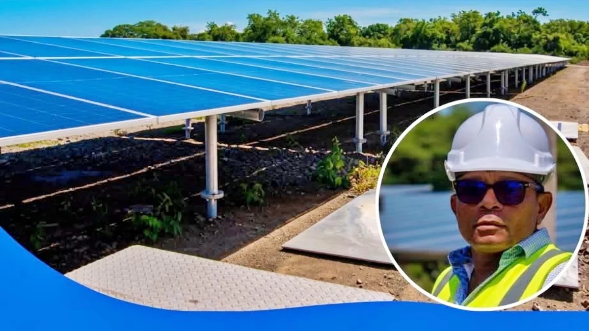
    As Haiti pushes forward with its clean energy transition, the country’s largest utility-scale solar power facility is on track to begin operations next month, bringing new hope for improved electricity access across the northern region.

    The milestone project, located in Caracol, Haiti’s far northern corridor, received a progress assessment in late September 2026 from Haiti’s Minister of Public Works Joseph Almathe Pierre Louis during an official site visit. This large-scale solar development is a core component of the Haitian government’s broader strategy to expand domestic power generation and speed up the shift away from fossil fuels toward sustainable, renewable energy sources.

    During the inspection, on-site technical teams shared detailed updates on remaining construction work and walked the minister through the facility’s technical specifications. Backed by $57 million in financing from the Inter-American Development Bank (IDB), the Caracol solar plant is distributed across two adjacent construction sites, which host a combined total of 21,276 photovoltaic panels. Just over two-thirds of these panels, 14,622 in total, are installed at the project’s second site.

    The plant’s power infrastructure includes two interconnected substations, with a combined total generation capacity of 13.4 MW. The first substation alone is engineered to deliver 9.5 MW of power. To address common challenges of renewable energy intermittency and maintain consistent stability for Haiti’s national grid, the project also integrates four utility-scale battery energy storage systems (BESS), each with a 3.7 MW capacity to store excess power generated during peak sunlight hours for use when sunlight is unavailable.

    Once the facility enters full commercial operations in October 2026, it will deliver approximately 5 MW of consistent power to Haiti’s national grid, directly strengthening electricity access for thousands of residential households and commercial operations across northern Haiti. Following his site visit, Minister Pierre Louis confirmed he was pleased with the construction team’s progress and reaffirmed the project’s on-schedule completion timeline.

  • Satellite Company Joins Alliance Supporting Antigua and Barbuda’s SIDS Agenda

    Satellite Company Joins Alliance Supporting Antigua and Barbuda’s SIDS Agenda

    In a landmark move that strengthens global collaboration for sustainable development, European Earth observation satellite operator GEOSAT has made history as the first European entity to join the SDG Data Alliance — the international coalition dedicated to unlocking data-driven progress toward the United Nations Sustainable Development Goals and the Antigua & Barbuda Agenda for Small Island Developing States (SIDS).

    The formal partnership agreement, signed with the PVBLIC Foundation — the New York-based non-profit that convenes the alliance — was finalized during the high-level week of the 81st UN General Assembly in New York, marking a major step forward in connecting European space technology with the most climate-vulnerable nations on Earth.

    As a member of the alliance, GEOSAT now joins an elite network of partners working alongside the United Nations and global stakeholders to expand access to very high-resolution (VHR) satellite imagery and geospatial data across more than 3,000 islands spanning nearly 40 SIDS, the coalition’s priority focus regions. VHR technology enables the capture of imagery that can distinguish ground objects smaller than one meter, delivering the granular detail needed for precision environmental and development planning.

    Under the partnership framework, the alliance will identify national and regional leaders to spearhead on-the-ground implementation. GEOSAT will contribute raw VHR imagery, which will be transformed alongside other alliance partners into actionable intelligence that supports better policy and operational decision-making. A key innovation of the collaboration is joint procurement of satellite capabilities, a model that allows small island nations to access advanced geospatial tools that most could not afford or implement independently. These capabilities span a wide range of critical use cases, including sustainable land management, agricultural productivity planning, forest conservation, coastal erosion monitoring, and rapid emergency response to climate-driven disasters.

    GEOSAT brings decades of proven operational experience to the alliance, holding recognition from the European Commission and the Copernicus Programme as one of only five accredited VHR satellite operators in Europe. The company has a long track record of delivering satellite coverage to public and private stakeholders across the continent, with a core mission of making space-derived data accessible to communities worldwide. In a notable prior collaboration with Airbus, GEOSAT launched VHR 24, the first complete high-resolution satellite coverage of the entire European landmass. It also contributes thousands of imagery captures annually for emergency response scenarios and is an active participant in the International Charter on Space and Major Disasters.

    The new membership builds on existing work GEOSAT has already completed in SIDS regions. In 2023, the company supported the launch of the Maldives Space Research Organisation (MSRO), contributing technical expertise and data to the organization’s inaugural Goidhoo Earth Observation Pilot. The project was later selected for showcase at the UN Peace Forum held in Paris, highlighting its successful model for local sustainable development. GEOSAT has already begun developing the first two new implementation pilots as part of its SDG Data Alliance partnership.

    “Satellite images and space-based information are critical assets to support populations in climate change adaptation,” said Francisco Vilhena da Cunha, Chief Executive Officer of GEOSAT. “By joining the SDG Data Alliance, GEOSAT commits to continue working to bring space to people, leveraging local knowledge and value chains that can lead to the sustainable use of Earth Observation for social development.”

  • Where Caribbean Conservation Stops at the Shoreline

    Where Caribbean Conservation Stops at the Shoreline

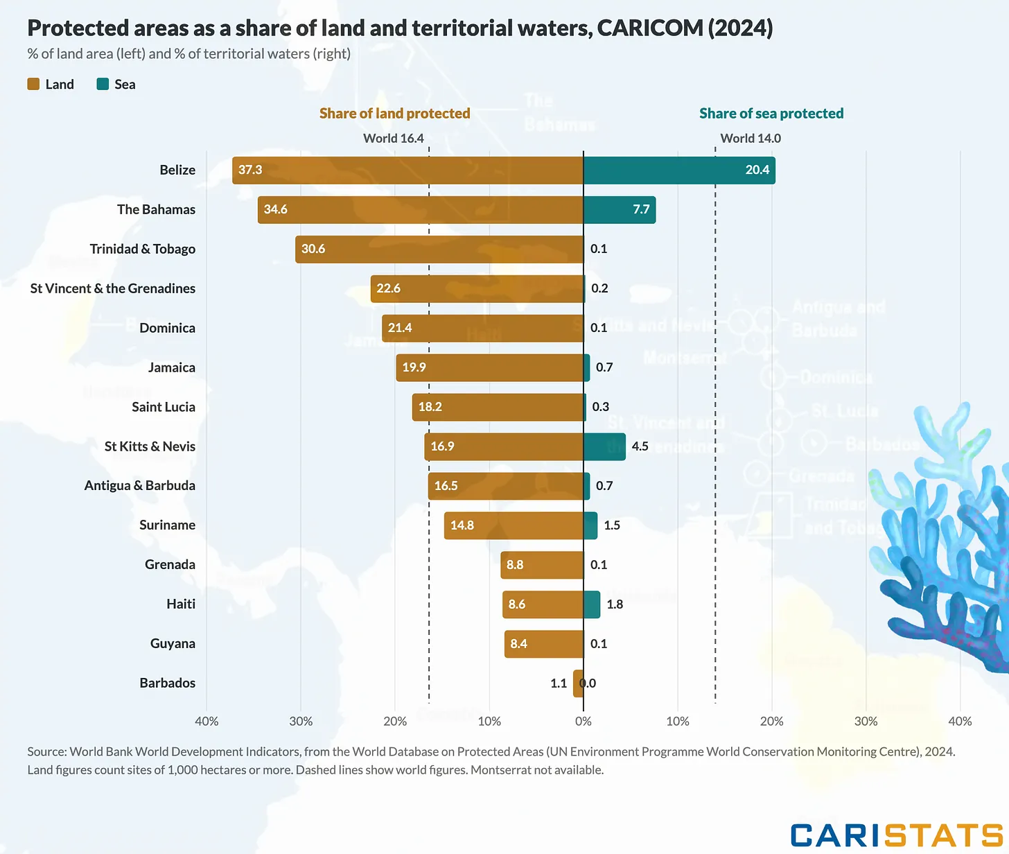
    For decades, conservation efforts across the Caribbean have prioritized the protection of vibrant coral reefs, sprawling marine sanctuaries, and endangered ocean species, drawing global funding, attention, and acclaim for preserving one of the world’s most biodiverse marine ecosystems. But a growing body of on-the-ground research and advocacy highlights a critical gap in regional environmental action: nearly all coordinated conservation work stops abruptly at the Caribbean’s shoreline, leaving coastal ecosystems, inland habitats, and the communities that depend on them disproportionately vulnerable to accelerating climate and human-driven threats.

    Coastal mangrove forests, which act as natural storm barriers, carbon sinks, and nurseries for juvenile fish, are among the most impacted by this gap. While mangroves sit at the intersection of land and sea, many marine-focused conservation initiatives do not extend inland to protect these root systems from clearing for coastal development, tourist resorts, and agricultural expansion. Similarly, inland watersheds that feed freshwater into coral reef systems are often unregulated, with runoff from pesticide use and unprocessed sewage spilling into coastal waters, fueling algal blooms that kill reefs already stressed by rising ocean temperatures.

    This disconnect between marine and terrestrial conservation also harms local communities, which bear the brunt of increased coastal flooding, erosion, and declining water quality when shoreline and inland ecosystems are left unprotected. Small-scale fishing households, in particular, see their catches drop when mangrove nurseries are destroyed, while low-lying coastal communities face greater risk of deadly storm surges as natural buffer habitats disappear.

    Conservation leaders argue that closing this gap requires a fundamental shift in regional environmental strategy, moving beyond siloed marine protection efforts to adopt integrated land-sea conservation frameworks that center the needs of local communities. They note that targeted funding for coastal and inland Caribbean conservation remains drastically underallocated, with less than 15% of regional environmental funding directed to areas above the high tide line, according to recent regional environmental reports. Bridging this divide, they say, is not just critical for protecting the Caribbean’s iconic natural landscapes—it is also essential for ensuring the long-term resilience of the region’s people and economies in the face of accelerating climate change.

  • We Are Mayreau reports steady ridge-to-reef progress

    We Are Mayreau reports steady ridge-to-reef progress

    Half a year into a landmark regional ecosystem restoration initiative, We Are Mayreau Inc. (WAM) has delivered tangible progress in building climate resilience across the Southern Grenadines, marking a critical milestone for small island developing states (SIDS) on the frontlines of climate change. The Targeted Ridge-to-Reef Ecosystem-based Adaptation Interventions (TREBAI) project, which connects conservation from mountain ridgelines down to coastal reef systems, has filled pressing gaps left by devastating extreme weather while unlocking unexpected ecological discoveries for the region.

    For low-lying island nations like Saint Vincent and the Grenadines (SVG), the urgency of integrated ridge-to-reef conservation cannot be overstated. Pollution and sediment runoff from inland agricultural areas travels to coastal reefs in mere days, leaving interconnected ecosystems extremely vulnerable to cascading damage. When Hurricane Beryl swept through the region in 2024, it destroyed nearly all existing coral nursery infrastructure and local farming operations, wiping out the limited natural and manmade buffers that help communities absorb future climate shocks. Since TREBAI launched in March 2025, WAM has moved quickly to reverse this damage and build more resilient systems for the long term.

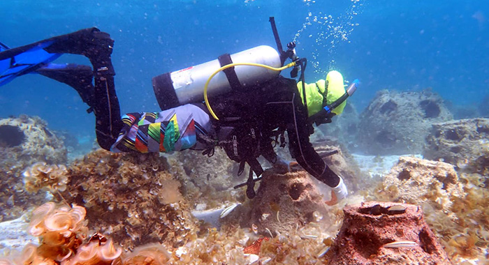
    One of the project’s most groundbreaking achievements is the establishment of the first transboundary coral genetic bank nursery in the Windward Islands. WAM’s new Mayreau-based facility currently holds three coral cultivation structures hosting 60 fragments of two critically endangered coral species — Staghorn (Acropora cervicornis) and Elkhorn (Acropora palmata) — transferred directly from partner sites in St. Lucia. This marks the first assisted gene flow (AGF) effort between Windward Island nations, and WAM, alongside SVG’s Richmond Vale Academy (RVA), is the first regional beneficiary of this shared cross-border genetic banking initiative. The nursery, located within the protected Tobago Cays Marine Park, is inspected and maintained weekly by a growing team of local coral gardeners, which has expanded from 5 to 11 members. For the first time in the project’s history, the team includes a female junior coral gardener, drawn from a pool of 18 applicants across Union Island, Mayreau and surrounding communities.

    On land, the initiative is equally focused on transforming agricultural practices to align with climate resilience. WAM has hired two full-time climate-smart agriculture coordinators to serve Union Island and Mayreau, and 25 local farmers have already enrolled in the organization’s capacity-building program. The project has also begun engaging three local primary schools to deliver an interdisciplinary, regionally tailored climate-smart farming curriculum, introducing sustainable stewardship practices to young community members early. To further expand workforce opportunities, WAM has partnered with SVG’s Ministry of Agriculture to develop formal work attachment programs for participants from the Southern Grenadines, with a core focus on creating stable, long-term livelihoods for local community members involved in both marine and land conservation work. For WAM, securing livelihoods and building community trust are treated as non-negotiable foundations for all successful conservation outcomes.

    In a surprise breakthrough that has drawn widespread regional attention, a reconnaissance dive in August — conducted in partnership with Dive Bequia off the coast of Battowia in the Northern Grenadines — uncovered more than 15 previously unrecorded wild colonies of Staghorn coral, a species long considered functionally extinct in SVG waters. This discovery marks a major win for marine conservation in the region, offering new genetic resources for future restoration efforts.

    Much of WAM’s work over the past six months has centered on expanding Reef Life Inc., a flagship blue social enterprise launched by WAM in 2022 that operates on a core principle: oceans, land, people and policy are interconnected parts of a single circular living system. Through community partnerships, immersive conservation experiences, hands-on restoration work, and public education, Reef Life centers traditional local knowledge while addressing the disproportionate climate injustice that already threatens livelihoods across the Grenadines. As the enterprise rebuilds following Hurricane Beryl, it is working to share its community-centered model and lay the groundwork for long-term sustainable livelihoods for residents of the region’s marine protected areas.

    TREBAI is led by CLEAR Caribbean, a UK-registered organization with regional operations based in St. Lucia, with on-the-ground implementation delivered by RVA and WAM across SVG. The project receives funding from the Caribbean Biodiversity Fund, with support from Germany’s Federal Ministry for the Environment, Climate Action, Nature Conservation and Nuclear Safety through the International Climate Initiative and KfW. CLEAR’s three-year sub-grant to WAM totals up to US$518,700, running through April 2029. WAM has also forged new partnerships with private sector stakeholders and continues to collaborate with multiple government ministries to expand skills training and professional development opportunities for its growing team.

    Six months into implementation, WAM Executive Director Marion Isaacs emphasized that the project’s greatest potential lies in its holistic, community-first approach. “We’re thinking holistically about what our islands and oceans need, and about the unique challenge and opportunity of being a small island state,” Isaacs said. “We embrace this smallness and can already feel massive potential building in what we’ve managed to bring to life so far. We focus on relationship-building, especially as we come from complex histories. For us, relationships are the new infrastructure: they strengthen our work, keep us committed, and hold us accountable in everything we organize, plan, and grow.”

    With a new marine conservationist joining the team as Reef Life’s Project Coordinator in September, WAM announced it expects implementation to accelerate over the coming six months. Upcoming milestones include completing open-water diving certification for all coral gardeners, expanding coral outplanting operations, finishing onboarding for all participating farmers, and launching the first round of community engagement meetings scheduled for September 2025.

  • Opvallend stil Atlantisch orkaanseizoen contrasteert met krachtige stormen in de Pacific

    Opvallend stil Atlantisch orkaanseizoen contrasteert met krachtige stormen in de Pacific

    The 2026 Atlantic hurricane season is making meteorological history for all the wrong reasons: as of late September, not a single hurricane has formed in the basin, marking the latest start to Atlantic hurricane activity on record. This unusual lull comes during what is typically the most active window of the year for Atlantic tropical cyclone development, leaving climate scientists stunned and fascinated by the stark divergence between the Atlantic and Pacific basins this year.

    On average, researchers from Florida State University note, the first hurricane of the Atlantic season forms between early and mid-August. While the 2026 season has spawned several weaker tropical storms, none have intensified to reach hurricane strength. Experts point to large-scale atmospheric conditions and the ongoing El Niño pattern as key factors suppressing storm formation, as these dynamics create an environment that makes it far harder for tropical systems to organize and strengthen in the Atlantic.

    This unprecedented quiet in the Atlantic does not mean the world’s tropics are free of dangerous storm activity, however. The Pacific basin, by contrast, is currently experiencing a hyper-active season with multiple powerful tropical systems churning across its waters, putting coastal communities across North America at risk.

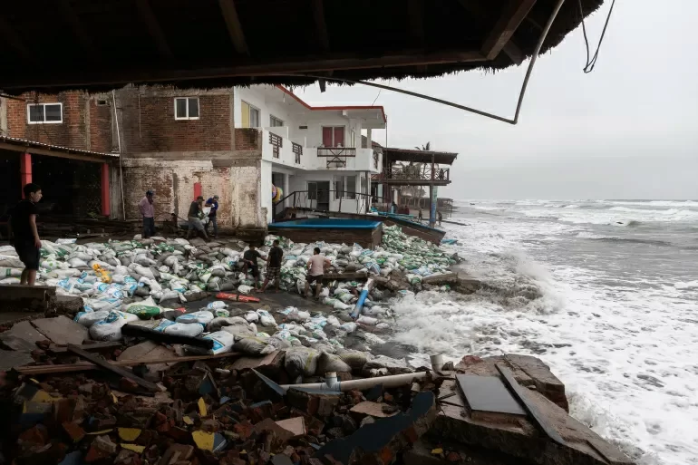
    Off Mexico’s western coast, Hurricane Polo is currently tracking west-northwest after temporarily reaching powerful Category 5 intensity. The U.S. National Hurricane Center’s latest update downgraded the storm to a strong Category 4 hurricane, though it still poses major threats to coastal regions. While the storm’s strongest winds remain mostly over open ocean, its outer rain bands have already reached sections of Mexico’s Michoacán coast, where local residents have stacked sandbags to buffer against large, destructive waves. Authorities warn the region remains at high risk of severe rainfall, flash flooding, and deadly landslides as the storm slowly passes.

    Further west across the Pacific, Tropical Storm Nolo is advancing toward Hawaii and steadily gaining strength. The National Hurricane Center projects Nolo will intensify into a full hurricane as it approaches the islands, and a tropical storm warning is already in effect for Hawaii County. Forecasters warn heavy downpours could trigger dangerous flooding across the region, prompting local officials to finalize emergency preparedness measures ahead of the storm’s arrival.

    A third named storm, Hurricane Odalys, is also spinning as a fully formed hurricane in the Pacific, located hundreds of miles southwest of the southern tip of Baja California, posing no immediate threat to populated coastal areas for now.

    This sharp, unusual contrast between the two major ocean basins has made the 2026 hurricane season a particularly valuable case study for atmospheric scientists. While the Atlantic sits unusually quiet at the peak of its storm season, the Pacific has produced multiple powerful tropical cyclones in recent months. Researchers are now analyzing this extreme divergence to refine their understanding of how large-scale climate patterns shape the conditions that give rise to tropical cyclones, and why hurricane activity can vary so dramatically from one year to the next.

    For communities in the path of active Pacific storms, the priority remains maintaining constant alertness. Mexican authorities are continuously monitoring rainfall levels and landslide risks across vulnerable coastal regions, while Hawaiian emergency teams have completed pre-storm preparations ahead of Nolo’s expected arrival.

    The Atlantic hurricane season does not officially end until November 30, leaving a window for late-season storm development that could still break this unprecedented dry spell. Even if a hurricane does form before the season closes, the record-long stretch without Atlantic hurricane activity has already secured the 2026 season a unique place in meteorological history. Scientists say this anomalous event offers a rare, invaluable opportunity to deepen knowledge of how atmospheric and oceanic conditions regulate the formation and growth of tropical storms, which could improve long-term forecasting of hurricane activity in coming years.

  • $220m water treatment project to begin in October

    $220m water treatment project to begin in October

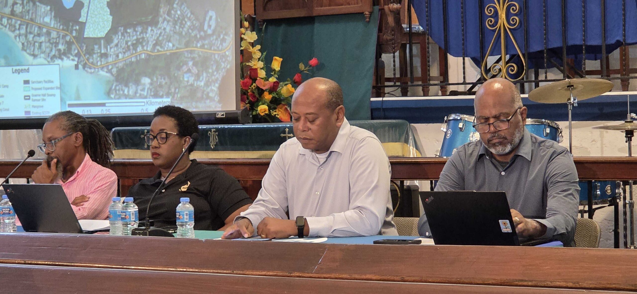
    Barbados is set to break ground next month on a landmark $220 million wastewater reclamation initiative designed to expand irrigation access for local farmers while advancing national environmental protection goals, the Barbados Water Authority (BWA) announced Wednesday. Project leaders detailed the full scope and timeline of the South Coast Water Reclamation Project during a public consultation town hall hosted at Hawthorne Methodist Church in Worthing, outlining how the innovative scheme integrates advanced tertiary wastewater treatment, renewable energy infrastructure, and ecosystem conservation to repurpose treated wastewater for agricultural irrigation.

    Major construction works are scheduled to run for 30 months, with completion targeted for May 2029. The primary contractor will remain on site to oversee the initial operational phase through May 2032, a arrangement designed to support hands-on technology transfer and comprehensive training for local BWA staff.

    The project’s multi-source international financing package brings together contributions from leading global climate and development institutions: an $80 million loan from the Inter-American Development Bank (IDB), a $60 million loan and $80 million grant from the Green Climate Fund, with additional backing via a debt conversion agreement with the European Investment Bank (EIB) that is supported by a $300 million guarantee.

    Shelley Parris, project manager with the BWA’s Project Execution Unit, explained that the core mission of the initiative is twofold: strengthen the resilience and reliability of Barbados’ water supply by expanding access to reclaimed water, while building capacity across national water management institutions. “The Government of Barbados is the ultimate project owner and sovereign counterpart governing the entire initiative, while the BWA has been appointed as the official executing agency,” Parris noted. She added that even with the project’s expected gains, which will boost per capita water availability from 98 cubic meters to 238 cubic meters by 2050, the island will still fall within global parameters for water scarcity, meaning long-term strategic resource management will remain a critical priority for the nation.

    The initiative is structured around four interconnected core components all aimed at upgrading Barbados’ national water management framework. First, infrastructure upgrades include the construction of a new South Coast Water Reclamation and Reuse Facility adjacent to the existing Harmony Hall treatment plant, which will upgrade current treatment capabilities from basic primary processing to advanced secondary and tertiary levels. Second, a 25-kilometer distribution pipeline will carry reclaimed water from the main Graeme Hall facility through Christ Church and portions of St George, all the way to River Plantation in St Philip. Third, a 7-megawatt solar photovoltaic system paired with battery storage will power the facility, offsetting its full energy demand with renewable energy. Fourth, institutional development will focus on capacity building, enhanced water quality monitoring, and specialized training for staff across the ministries of health, agriculture, and environment.

    Once operational, the pipeline network will supply consistent irrigation water to between 160 and 1,320 hectares of farmland, directly benefiting 210 small-scale farmers in communities including River Plantation, Silver Hill, and Gibbons Bog, plus an additional 260 producers located along the pipeline route. During the wet season, the system will also support managed aquifer recharge through purpose-built injection wells, helping to preserve the island’s precious reserves of clean drinking water.

    The treatment complex sits adjacent to Graeme Hall Swamp, a globally recognized Ramsar-listed wetland site. Upgrading to full tertiary treatment will cut down on harmful chemical runoff from urban and agricultural areas, protect coastal and marine ecosystems, and eliminate persistent local odour issues that have long impacted residents living near the existing facility.

    China Railway Shanghai Engineering has been awarded the contract for engineering, procurement, and construction, with global firm AECOM serving as local contract administrator and SAEDI Consulting Barbados overseeing environmental compliance for the scheme.

    Ian Constantine, project coordinator for the South Coast Water Reclamation Project, confirmed that preliminary site preparation works have already gotten underway near Harmony Hall. “The contractor has already commenced mobilisation on site. Currently, some of the temporary access roads have already been constructed,” Constantine shared during his technical presentation at the town hall. “Over 20 containers have already been delivered on site, alongside cranes and heavy construction vehicles. The master schedule for this project has been approved, and full construction is going to begin within October.” The first major structural work will focus on pouring the foundation for the plant’s main bioreactor tank, a process expected to take six to eight weeks, Constantine added.

    The project follows a design-build model, meaning all technical specifications must receive formal approval from the Barbadian government before any equipment is installed. To support local economic participation, the main contractor has contracted Barbadian small businesses for surveying, geotechnical engineering, heavy equipment rental, and site preparation works. Addressing early community concerns about construction impacts, project managers confirmed that initial dust complaints have already been resolved through the implementation of regular site watering and ground covering measures.

    Wednesday’s town hall formed a required part of the statutory public consultation process for the project’s Environmental and Social Impact Assessment (ESIA) and Environmental and Social Management Plan (ESMP). To ensure long-term operational reliability and sustainability, the finished facility will host an on-site water quality testing laboratory, and multiple independent regulatory agencies will conduct regular monitoring of both incoming influent and outgoing effluent water quality throughout the facility’s operational lifespan. Community outreach, dedicated liaison programs, and regular public progress briefings will continue throughout the 30-month construction period as works progress along the south coast corridor.
  • Who Owns the Riverbank? Older Land Titles Raise Questions

    Who Owns the Riverbank? Older Land Titles Raise Questions

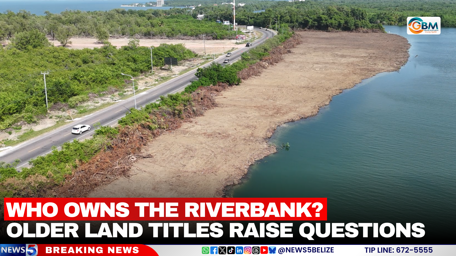
    A contentious three-acre clearing project along the banks of Belize River has thrown a spotlight on longstanding ambiguities in the country’s land regulation framework, particularly for waterfront development. The site, which was cleared all the way to the river’s edge, prompted a multi-agency joint investigation involving Belize’s Department of the Environment, Forest Department, and Lands Department, with inspectors confirming only a small number of mangroves sustained damage during the work.

    Anthony Mai, the nation’s Chief Environmental Officer, broke down the split regulatory responsibilities that have complicated oversight of this project and similar developments across the country. Under existing Belizean law, the Forest Department holds exclusive authority to oversee any clearing or modification of mangrove habitats, which are critical to coastal and riverine ecosystems. The Lands Department, by contrast, is tasked with managing the 66-foot river reserve—an established buffer zone set aside under the country’s Lands Act. This strip of land, officially designated as Crown land, was originally created to guarantee unimpeded public access to the nation’s waterways, and in recent decades it has also gained recognition for its key ecological roles, including reducing riverbank erosion, filtering runoff, and supporting aquatic biodiversity.

    To add another layer of environmental protection, official Environmental Compliance Plans for most waterfront developments require developers to preserve an intact 66-foot vegetated buffer along all water bodies, a rule designed to uphold the ecological functions the reserve is meant to protect. However, this particular plot of land complicates enforcement: officials from the Department of the Environment confirmed the land title for the three-acre parcel dates back to the 1960s, decades before the 66-foot reserve requirement was formally written into national law.

    Mai noted that this is not an isolated case. Across Belize, a small but significant number of pre-regulation land titles grant property ownership all the way to the water’s edge, creating a legal gray area that clashes with modern environmental and public access rules. The ongoing investigation into the Belize River clearing has renewed calls for policymakers to address these conflicting land rights, balancing the legal claims of longstanding title holders with the growing need to protect riverine ecosystems and maintain public access to Belize’s vital water resources. The clearing, which already extends to the waterline, has also stoked public concern over increased risks of river erosion and ecological degradation in the area, putting further pressure on regulators to clarify outdated land policies.

  • Burton says Dominica’s Geothermal Plant is now in commercial operation

    Burton says Dominica’s Geothermal Plant is now in commercial operation

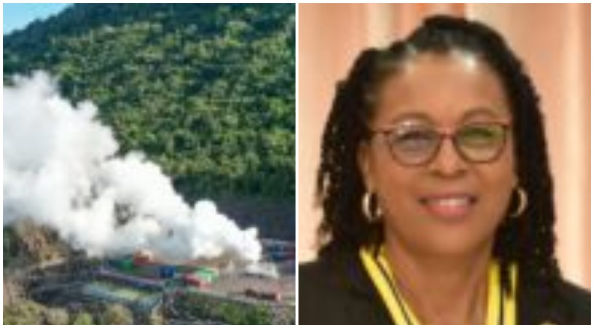
    Addressing the 79th United Nations General Assembly, Dominican President Her Excellency Sylvanie Burton has announced a landmark milestone for the Caribbean island nation’s clean energy transition: its long-planned geothermal power facility has officially entered commercial operation.

    The launch of the geothermal plant represents a transformative shift for Dominica’s energy sector, Burton explained. Prior to the project coming online, the country relied heavily on costly imported fossil fuels to meet a large share of its electricity demand. With the geothermal facility now fully operational, renewables account for roughly 84 percent of the country’s total electricity generation, putting Dominica firmly on track to meet its self-declared goal of achieving 100 percent renewable energy for all electricity production by 2030.

    Burton emphasized that the benefits of the geothermal project extend far beyond cutting carbon emissions. By reducing the country’s dependence on imported crude oil and refined petroleum products, Dominica is shielding its economy from volatile global energy price swings that have strained government budgets and household finances in many small developing nations in recent years. Beyond energy security, the project is already catalyzing new economic opportunities: creating local jobs, attracting green investment, and laying the groundwork for the emergence of new climate-focused industries across the island.

    “Our ambition is not merely to generate clean electricity. Our ambition is to use clean energy to transform our economy,” Burton told the assembled global leaders in her address.

    The Dominican president used her platform at the UN to issue a call to action for the international community, urging wealthier nations and multilateral development bodies to expand accessible financing and equitable partnership opportunities for climate-vulnerable small island developing states. Many of these nations face disproportionate climate risk despite contributing very little to global greenhouse gas emissions, and often lack the upfront capital needed to scale high-impact renewable energy projects.

    Burton pushed back against the narrative that small states cannot lead global climate action, noting that when provided with the necessary investment support, small nations can deliver ambitious, industry-leading progress on the clean energy transition while turning climate action into inclusive, sustainable economic growth.

    All emissions reduction targets and progress figures included in this report are drawn directly from Burton’s official address to the United Nations General Assembly.