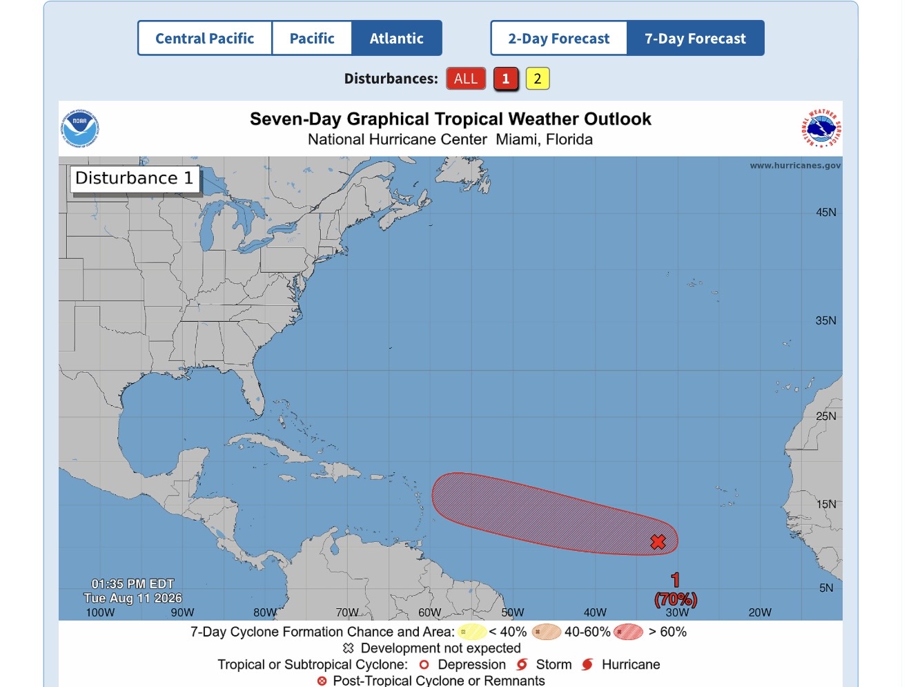
As weather monitoring agencies across the Atlantic track emerging cyclonic activity, a senior meteorologist from Antigua and Barbuda is calling on Caribbean communities to stay alert to a growing tropical disturbance that could put the region’s island chain at risk in the coming days.
Dale Destin, the lead meteorologist for Antigua and Barbuda, issued a public advisory on Tuesday highlighting the active disturbance currently churning across the eastern stretch of the tropical North Atlantic. “There is a #TropicalDisturbance (red) of interest to the Caribbean over the eastern tropical North Atlantic. All are asked to monitor this system, as it could become a threat to the islands,” Destin shared in his social media alert.
Destin’s warning aligns with updated forecasts from the United States’ National Hurricane Center (NHC), which has upgraded the system’s odds of developing into a organized tropical depression to high probability by the end of this week. As of the NHC’s 2 p.m. Tropical Weather Outlook released Tuesday, the unorganized cluster of showers and thunderstorms is located roughly 550 miles southwest of the Cabo Verde Islands, off the western coast of Africa.
Forecasters at the NHC note that atmospheric and oceanic conditions across the Atlantic are becoming steadily more supportive of cyclonic development over the next 48 to 72 hours. “A tropical depression will likely form during the latter half of this week while the system moves westward to west-northwestward across the central tropical Atlantic,” the agency’s official outlook stated.
Current probability forecasts put the system’s chance of organizing into a tropical cyclone within 48 hours at 40%, while the seven-day development probability holds at a high 70%. While meteorologists emphasize it remains too early to definitively project what, if any, direct impacts the system will bring to Antigua and Barbuda or the broader Caribbean region, Destin’s early advisory underscores the need for residents to track the system’s westward progression closely and prepare for potential changes in conditions.
In addition to the high-priority disturbance, forecasters have cleared a second system that was being monitored earlier this week. Destin confirmed that the previously tracked second area of interest, marked on regional weather maps with a grey X, is no longer forecast to develop into a cyclonic system.
Separately, the NHC is continuing to monitor a third weather system: a trough of low pressure located roughly 750 miles east-northeast of Bermuda. This system carries a 20% probability of development over both the 48-hour and seven-day forecast windows. Forecasters project that the low-pressure trough will move into cooler ocean waters later this week, eliminating any chance of sustained cyclonic development by Thursday.