分类: environment

  • Iberostar advances coral reef conservation with research lab in Bávaro

    Iberostar advances coral reef conservation with research lab in Bávaro

    As climate change continues to drive rising ocean temperatures and widespread coral bleaching across the Caribbean, tourism giant Iberostar Hotels & Resorts is stepping up its commitment to marine ecosystem protection through an expanded portfolio of coral reef conservation and restoration initiatives in the Dominican Republic.

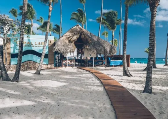
    At the company’s Playa Bávaro location, a dedicated on-site coral laboratory houses a specialized genetic bank preserving samples from nine distinct species of reef-building corals. The facility’s in-house team of scientific researchers carries out cutting-edge thermotolerance experiments, designed to map how different coral species react to elevated ocean heat levels. The data gathered from these studies will directly inform and strengthen future reef restoration projects across the region.

    All of these conservation efforts fall under the umbrella of Iberostar’s flagship sustainability program, “Wave of Change”, an initiative built to advance the principles of responsible tourism and safeguard vulnerable coastal ecosystems around the globe. To date, the company’s global nature conservation strategy has brought together more than 30 independent scientists and marine specialists, contributed to 13 peer-reviewed scientific publications, and developed two standardized restoration protocols that are now widely used by coral conservation professionals worldwide.

    In collaboration with the Dominican Republic’s Ministry of Environment and Natural Resources, with initial seed funding from the German Development Cooperation (GIZ), Iberostar has already completed the rehabilitation of roughly one hectare of degraded reef habitat within the Playa Bávaro tourism complex. This restored coastal zone now acts as a critical refuge for native endemic marine species, and functions as a natural seed source to support natural vegetation regeneration across nearby damaged ecosystems.

    Iberostar’s conservation footprint extends well beyond this single site in the Dominican Republic. Across the entire Caribbean region, the company operates seven underwater coral nurseries, where heat-tolerant coral fragments are grown before being outplanted to damaged reef sites. It also runs three land-based coral research laboratories, located in the Dominican Republic, Mexico, and Jamaica respectively.

    Most recently, the company laid the groundwork for long-term institutional collaboration on marine conservation: In February 2026, the Iberostar Foundation partnered with the Autonomous University of Santo Domingo to launch the Iberostar Sea Initiative, a program focused on advancing marine research, providing specialized conservation training, and facilitating cross-sector knowledge transfer. Just two months later, in April, Iberostar signed a formal partnership agreement with the Dominican Ministry of Environment to support coordinated conservation and restoration work for coastal and marine ecosystems in the popular tourist regions of La Altagracia and Puerto Plata.
  • Tropical Storm Cristobal weakens into depression

    Tropical Storm Cristobal weakens into depression

    In an update released Thursday, the Dominican Institute of Meteorology (Indomet) announced that Tropical Storm Cristobal has completed its transition into a remnant low-pressure system, with complete dissipation forecast to occur before the end of the day.

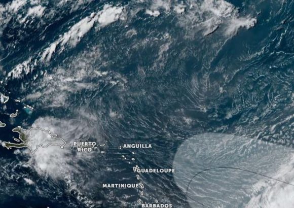
    As of the latest observation, the weakening system sits roughly 980 kilometers west of the Azores archipelago. It carries maximum sustained wind speeds of 55 kilometers per hour and is tracking eastward at a forward speed of around 26 kilometers per hour. Thanks to its current position and projected path, Indomet confirmed that Cristobal poses no immediate threat to Dominican territory, ruling out any risk of landfall or severe impact on the island nation.

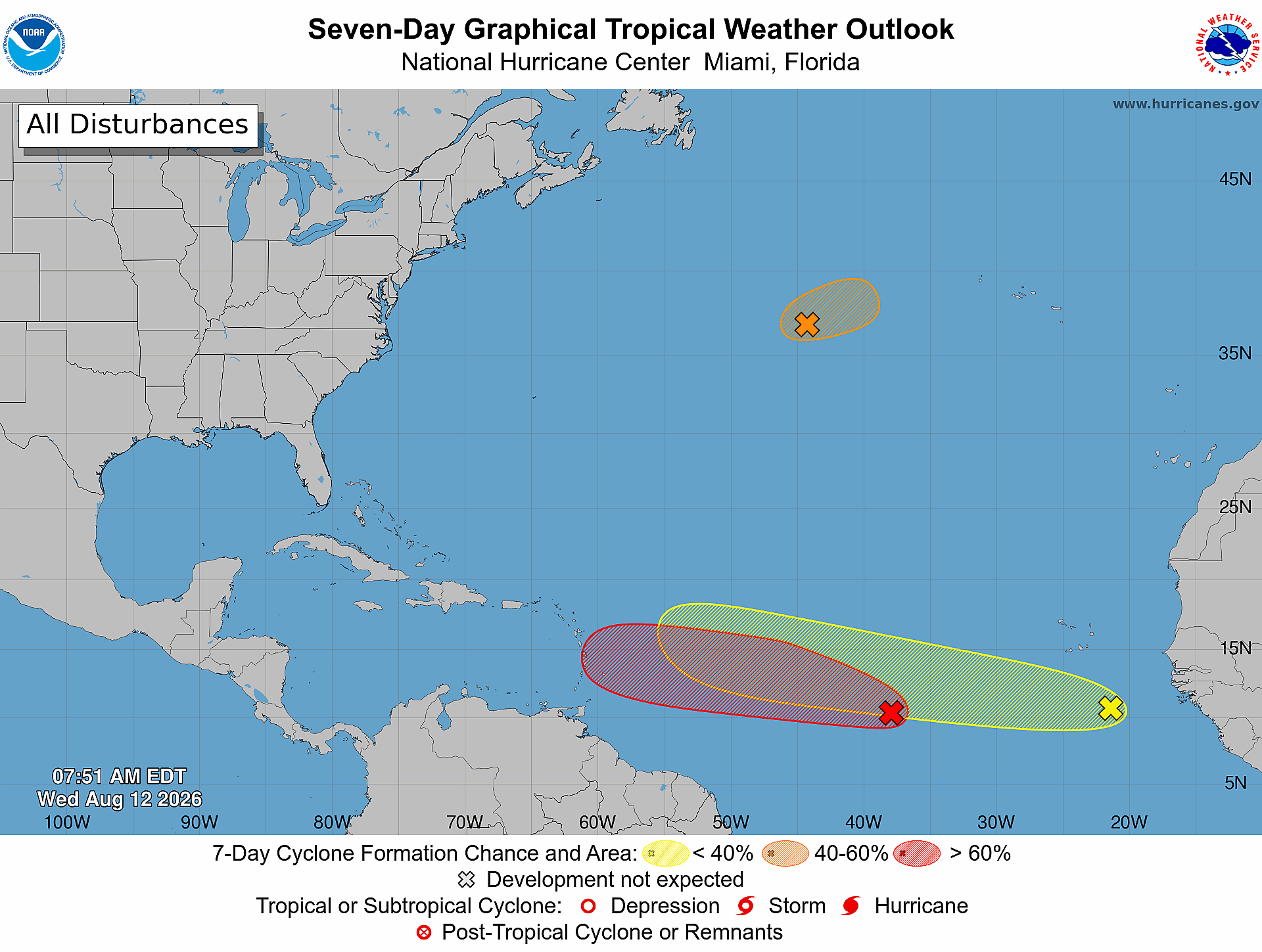
    While Cristobal fades, the agency’s meteorology teams are actively monitoring two separate tropical disturbances linked to tropical waves moving across the Atlantic basin. The first of these systems is positioned between the western coastline of Africa and the Lesser Antilles. Forecasters have assigned it an 80% probability of strengthening into a named tropical cyclone over the coming seven-day period. The second disturbance, located several hundred kilometers south-southwest of the Cape Verde Islands, has a lower but still notable 30% chance of development within the next 48 hours, with that probability rising to 50% when extended to the full seven-day forecast window.

    Beyond the Atlantic systems, ongoing weather activity is already affecting portions of the Dominican Republic. Indomet linked the steady rainfall impacting the country’s Caribbean coast and northeastern regions to a combination of a tropical wave and an upper-level trough moving through the area. The forecast calls for continued heavy downpours, scattered thunderstorms, and occasional wind gusts across multiple provinces, including Hato Mayor, Monte Plata, Sánchez Ramírez, La Vega, Duarte, Santiago Rodríguez, Dajabón, and Monte Cristi. Mountainous and border zones across these areas are expected to see the most intense weather activity.

    In response to the persistent rainfall, the National Forecast Center has issued and maintained a formal weather alert for the capital region of Santo Domingo, the National District, San Cristóbal, and Peravia. The alert was issued due to elevated risks of urban flooding as saturated stormwater systems struggle to handle continued precipitation.

  • Tropical Storm Cristobal No Threat to Caribbean

    Tropical Storm Cristobal No Threat to Caribbean

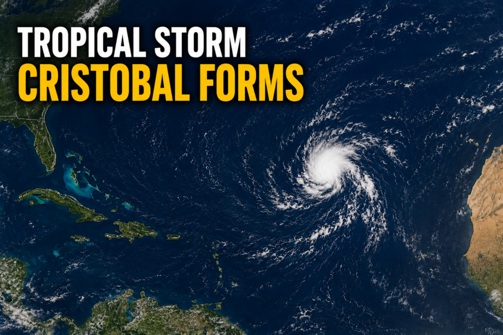
    The 2026 Atlantic hurricane season has marked its third named storm earlier than many forecasters expected, as Tropical Storm Cristobal has officially formed in the central subtropical Atlantic. The developing system, previously identified by meteorologists as Invest AL93, took shape in waters well to the west-southwest of the Azores archipelago, beating another larger disturbance monitored across the southern tropical Atlantic to earn a formal name.

    According to the latest update from the U.S. National Hurricane Center, published at 3 p.m. GMT on Wednesday, the newly christened storm is positioned near 36.7 degrees north latitude and 43.0 degrees west longitude. It carries maximum sustained winds of 45 miles per hour, the minimum threshold for a tropical storm, and is currently tracking quickly eastward across open ocean at 25 miles per hour.

    Thanks to its current position and projected forward path, Cristobal will remain hundreds of miles from any Caribbean landmasses for the entirety of its forecast lifecycle. No coastal watches, warnings, or emergency preparations have been issued for any regional communities in relation to this system.

    With Cristobal posing no immediate danger to populated coastal areas, regional meteorological agencies and disaster response teams are continuing to focus their monitoring efforts on the second disturbance, designated AL92, which is currently moving westward across the central tropical Atlantic.

  • BREAKING: Tropical Storm Cristobal Forms Over Central Atlantic

    BREAKING: Tropical Storm Cristobal Forms Over Central Atlantic

    The 2026 Atlantic hurricane season has marked its third named system, as Tropical Storm Cristobal officially formed over the central subtropical Atlantic on Wednesday. According to the latest official update from the U.S. National Hurricane Center (NHC), released in its 3 p.m. GMT advisory, the newly formed storm carries maximum sustained winds of 45 miles per hour, with gusts that reach even higher speeds.

    As of the advisory’s publication, the storm’s center was positioned approximately 880 miles west of the Azores archipelago, at coordinates 36.7 degrees North latitude and 43.0 degrees West longitude. Cristobal is currently tracking eastward at a fast clip of 25 miles per hour, though forecasters project a shift in trajectory and speed over the coming hours. The NHC predicts the storm will curve toward the east-northeast and decelerate through Wednesday and into Wednesday night.

    One of the most critical takeaways from the NHC’s update is that Cristobal poses no immediate danger to any coastal or inland landmasses. No coastal watches or warnings are currently in effect, and the agency has not identified any hazards that will impact populated or terrestrial areas. Tropical-storm-force winds extend only 90 miles outward from the storm’s center, all of which remain over open ocean waters.

    Meteorologists also expect Cristobal to be a short-lived weather system. The NHC’s forecast trajectory calls for gradual weakening starting in the near term, with the entire system expected to fully dissipate sometime on Thursday. As of Wednesday’s midday advisory, the storm’s minimum central pressure was measured at 1008 millibars. The next full public update on Cristobal’s status and track is scheduled to be released at 9 p.m. GMT Wednesday.

  • Tropical Depression has 80% chance of becoming a tropical cyclone within both 48 hours and seven days

    Tropical Depression has 80% chance of becoming a tropical cyclone within both 48 hours and seven days

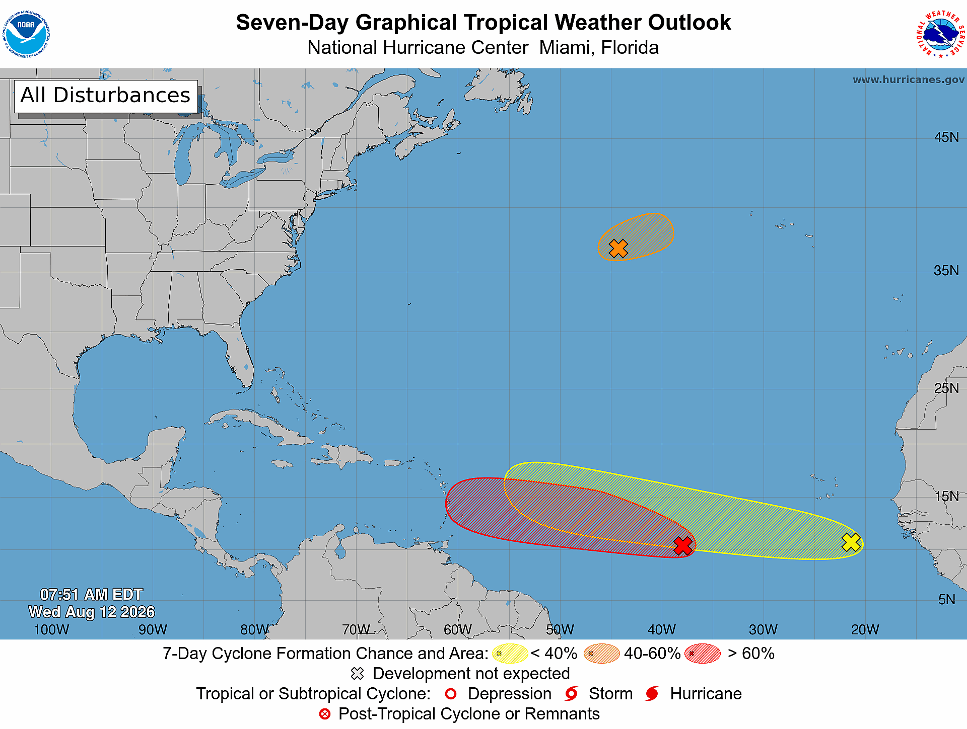
    Meteorologists at the U.S. National Hurricane Center are tracking three separate tropical systems across the Atlantic Ocean, with one disturbance showing sharply increased odds of strengthening into a named tropical cyclone in the coming week.

    In its latest public advisory issued at 8 a.m. Eastern Time Wednesday, the agency confirmed that Tropical Disturbance AL92 is currently generating disorganized showers and thunderstorm activity roughly 900 miles west-southwest of the Cabo Verde Islands, off the western coast of Africa. Favorable atmospheric and oceanic conditions are forecast to persist over the central tropical Atlantic over the next several days, which will create room for AL92 to steadily organize as it tracks along a west to west-northwest path.

    As of Wednesday’s update, forecasters have raised the probability that AL92 will develop into a tropical depression to 80% for both the 48-hour and seven-day forecasting windows. This marks a notable increase from earlier projections that put the system’s development odds lower.

    AL92 is not the only system being watched by hurricane specialists this week. A second disturbance, labeled AL93, is positioned around 1,050 miles east-northeast of Bermuda in the North Atlantic. This system currently holds a 50% chance of briefly strengthening into a tropical storm before it moves into much cooler ocean waters on Thursday, a shift that will halt any further development.

    The third system, a broad tropical wave that has just moved off the western coast of Africa, carries lower development odds at this stage. Forecasters assign it a 20% chance of organization within the next 48 hours and a 30% chance through the next seven days. Like AL92, it is expected to progress west or west-northwest across the tropical Atlantic basin over the coming days.

    The National Hurricane Center continues to issue regular updates on all three systems as the Atlantic hurricane season remains active, urging residents and maritime interests across the basin to monitor changes in forecasts over the coming days.

  • Sargassum Accumulates Along Jabberwock Beach

    Sargassum Accumulates Along Jabberwock Beach

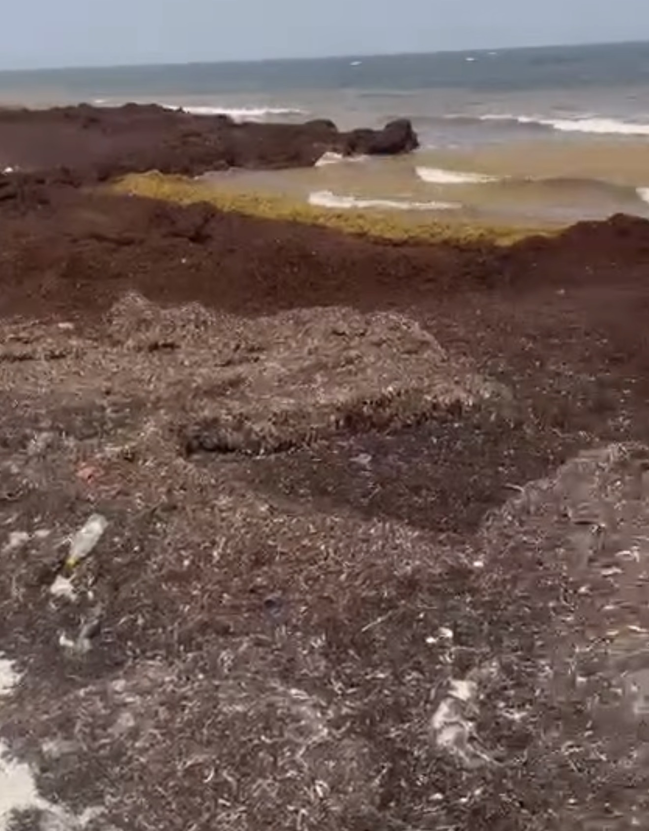
    A thick accumulation of brown sargassum seaweed has blanketed stretches of Jabberwock Beach, coating the shoreline and creating unwelcome conditions for visitors and local communities. This latest proliferation of the marine algae is part of a broader regional challenge, as Caribbean nations once again grapple with a major sargassum season that has become an annual environmental and economic concern.

    Projections from the University of South Florida’s Optical Oceanography Laboratory paint a worrying picture for the coming years: by 2026, the total volume of sargassum blooming across the Atlantic is expected to hit at least the second-highest level recorded since systematic monitoring began. This growing trend of increasingly large sargassum outbreaks has put mounting pressure on coastal communities throughout the Caribbean basin.

    Unlike many harmful invasive species, sargassum is a naturally occurring brown algae that forms large floating mats across the open Atlantic Ocean. Offshore, these mats actually play a valuable ecological role, serving as critical habitat and feeding grounds for a wide range of marine life, from small juvenile fish to sea turtles. The situation changes dramatically, however, when large quantities of the algae wash onto sandy shorelines and begin to decompose. As it breaks down, sargassum releases a pungent, unpleasant odor that drives away tourists and disrupts daily life for coastal residents.

    To combat the persistent problem, regional governments, beachfront hotels, and local tourism businesses have poured millions of dollars into annual cleanup operations and the installation of offshore containment barriers designed to stop sargassum from reaching shore. Beyond mitigation efforts, researchers and innovative entrepreneurs across the region and beyond are actively investigating potential commercial uses for the harvested algae, exploring applications that could turn the nuisance into a valuable resource. Promising areas of development include using sargassum as a base for organic agricultural fertilizers, a feedstock for renewable biofuels, and even a raw material for sustainable textiles and other consumer goods.

  • Hurricane season, the MARNDR is working in Ravine Sèche (Torbeck)

    Hurricane season, the MARNDR is working in Ravine Sèche (Torbeck)

    As hurricane season brings heightened risk of extreme weather and flooding across Haiti, the country’s Ministry of Agriculture, Natural Resources and Rural Development (MARNDR) has ramped up targeted risk-reduction interventions in vulnerable rural communities in Haiti’s southern region.

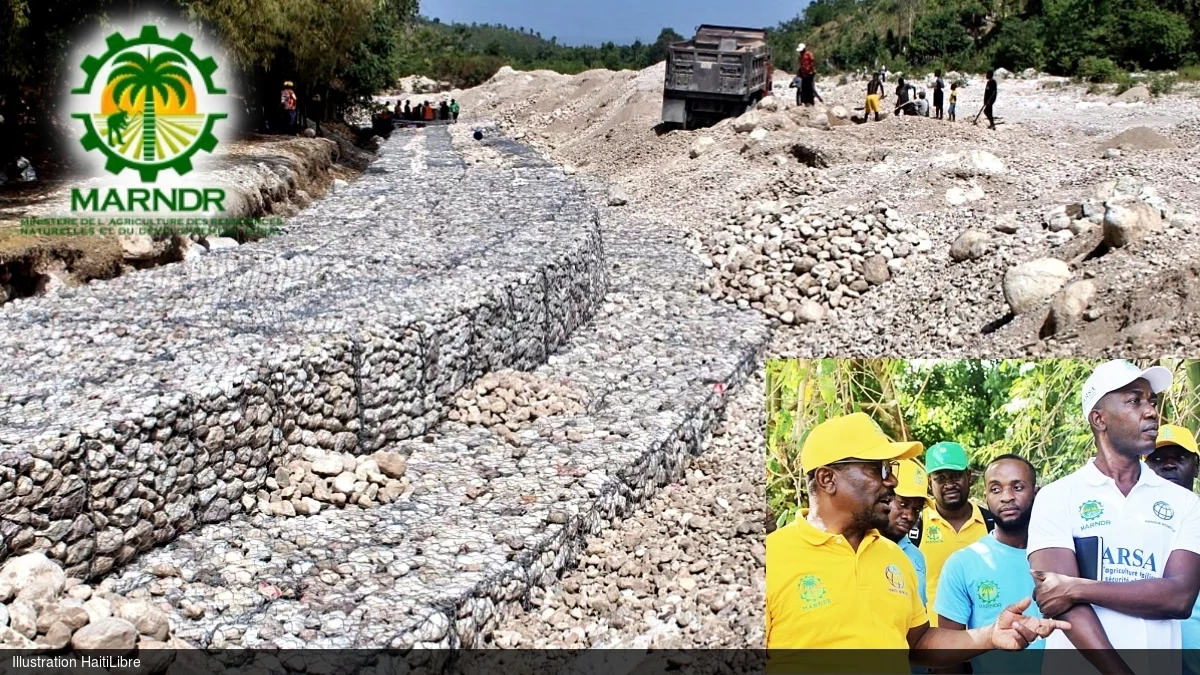
    In the 4th communal section of Péan, located within the commune of Torbeck, MARNDR is leading riverbank stabilization work along roughly 750 linear meters of Ravine Sèche through the Resilient Agriculture for Food Security Project (PARSA), an initiative backed by World Bank funding. The core goal of the infrastructure upgrade is to shield local residents and protect critical agricultural land from destructive erosion and flooding triggered by heavy seasonal downpours.

    Construction progress is already well advanced: project teams have installed more than 600 linear meters of reinforced gabion retaining walls, a structural solution designed to shore up eroding riverbanks, cut down on sediment loss, and lower the risk of catastrophic damage to adjacent farmland and local infrastructure.

    During an official inspection visit to the construction site, Agriculture Minister Marcelin Aubourg stressed that the project directly responds to longstanding safety concerns raised by local residents of Péan. He went on to highlight the significant agricultural potential of the Torbeck region, calling out the nearby Leblanc farm as a particularly valuable high-productivity agricultural site. Aubourg expressed public satisfaction with the pace and quality of work completed to date, commended the contracting firm for its on-the-ground efforts, and reaffirmed that the finished infrastructure will substantially reduce the harm extreme weather events inflict on the local community.

    Acknowledging the persistent threat that unregulated erosion of Ravine Sèche poses to the area, Aubourg also issued a public call for residents to remain vigilant and help protect the new infrastructure. He specifically warned against the removal or relocation of gabion stones by bad actors, a practice that would compromise the structural integrity of the riverbanks and put the entire community at risk.

    For local families that have lived alongside the unprotected ravine for years, the ongoing construction has been met with widespread relief and cautious optimism. For generations, these communities have faced repeated disruption to their farming operations and livelihoods from annual flooding and erosion, and the riverbank protection project marks the first concrete intervention to address this chronic threat.

    Beyond the long-term safety and food security benefits the finished works will deliver, the project has already generated immediate economic gains for local households. Dozens of area residents have been hired to support construction activities, giving them access to on-the-job income while the project progresses, creating a dual benefit for the rural community.

  • Lab Results Pending in Massive Belize River Fish Kill

    Lab Results Pending in Massive Belize River Fish Kill

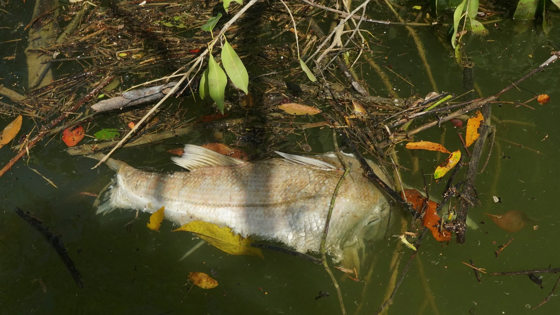
    Nearly one week after hundreds of dead fish and multiple endangered reptiles were found washing up along a 17.5-mile stretch of the Belize River Valley, Belizean environmental authorities are expanding their probe into the massive die-off, with final lab results that could pinpoint the root cause expected as early as next week.

    Preliminary on-site assessments have already confirmed dangerously depleted dissolved oxygen levels and other abnormal water chemistry across the affected river section, but investigators have not yet formally identified a triggering source or responsible party. To accelerate the inquiry, 13 local government and research agencies have pooled resources and expertise, marking a rare full domestic investigation that leverages Belize’s growing technical environmental capacity, rather than sending samples overseas for analysis.

    In addition to hundreds of dead fish—including large predatory species like snook that form a critical part of the river’s food web—reports of dead crocodiles and multiple hicatee turtles have escalated alarm among conservationists. The hicatee, a freshwater turtle native to Central America, is classified as critically endangered, with already severely depleted wild populations. Experts warn any additional mortality from events like this die-off poses a major long-term threat to the species’ survival.

    While the mass die-off appears to have stopped, researchers warn the ecological risks are not over. Dr. Donald McKnight, research director at the Savanna Field Station, which is conducting independent parallel research into the event, explained that toxins or contaminants that accumulated in dead fish could move up the food chain if scavenging birds and land animals consume the carcasses, expanding the impact beyond the river ecosystem.

    “Even though the fish have stopped dying, if birds and other animals continue to eat the dead fish, the impacts may spread out from the river and actually affect a broader community of organisms,” McKnight said. “We know that multiple hicatee died. Their populations are really low to begin with, they’re a critically endangered species, so any added mortality on the hicatee is a really big problem. And a lot of the species that were dying were the really big predatory fish, things like your snook. That’s a problem for multiple reasons, from ecosystem balance to local recreational and subsistence fishing.”

    Authorities have named two leading potential causes: agricultural runoff and recent widespread flooding in nearby farmlands. Satellite imagery captured before the die-off confirms severe flooding across large sections of agricultural land, including rice fields and sugar cane operations in the southern part of Santander Farm and surrounding properties. The large volume of floodwater, which would have picked up soil, fertilizers and other agricultural debris, drained directly into the Belize River.

    Nitrogen and phosphorus from agricultural fertilizers can fuel rapid, harmful algae blooms that deplete oxygen from water as they decompose, creating hypoxic (low-oxygen) conditions that kill fish and other aquatic life. So far, preliminary findings point to low dissolved oxygen rather than direct toxic chemical contamination as the immediate cause of death, but full chemical analysis of fish tissue and water samples is still ongoing.

    Public speculation has centered on operations by Santander Sugar, a major agricultural producer in Belize’s Cayo District, where the die-off occurred. The Belize Department of the Environment (DOE) launched a targeted inquiry into the company’s practices, but chief environmental officer Anthony Mai says Santander Sugar has fully cooperated with all inspection requests. The company has repeatedly stated it adheres strictly to its government-approved Environmental Compliance Plan, conducts routine internal monitoring to protect nearby waterways, recycles all process water rather than discharging it into the river, and repurposes sugar production waste as fertilizer for cane fields.

    Local technical experts are conducting all testing in-country using Belize’s own advanced equipment. The Pesticide Control Board has already completed an inspection of pesticide application practices at Santander Sugar, and the DOE is cross-referencing that data with results from the department’s in-house gas chromatography–mass spectrometry (GCMS) machine, a highly precise instrument capable of detecting a wide range of chemical contaminants. The Belizean National Institute of Standard and Industrial Research (SIRDI) is also supporting the investigation by conducting soil sampling from flood-prone agricultural areas upstream.

    Mai emphasized that carrying out the entire investigation with domestic expertise and infrastructure marks a major milestone for Belize’s environmental regulatory capacity. “This work is being done by local Belizean expert using local capacity and local technology. So I’m very pleased to say that for this, we didn’t have the need to send any samples abroad. It was done completely in country, which is a major step for us,” Mai said.

    As of the DOE’s latest update, lab results are on track to be finalized and released to the public by next week.

  • Public Urged To Avoid Crocodile Interaction

    Public Urged To Avoid Crocodile Interaction

    Following a recent near-miss between a crocodile and a group of socializing visitors in the popular coastal destination of Caye Caulker, Belize’s Forest Department alongside leading conservation groups have issued a urgent public warning, calling on both residents and tourists to avoid unsupervised interactions with the region’s native American crocodile population. The incident, which was captured on video and shared among wildlife experts globally, has renewed longstanding concerns about the growing risks of human-wildlife conflict driven by harmful feeding practices.

    Dr. Marisa Tellez, Executive Director of the Crocodile Research Coalition, noted a stark shift in crocodile behavior in Caye Caulker compared to a decade ago. Back in 2016, the region was held up as an international model for peaceful human-crocodile coexistence: crocodiles were abundant across the area’s coastal waters, but dangerous encounters remained extremely rare. Today, however, that balance has been upended by the rising trend of people intentionally feeding crocodiles, a practice reported by multiple local residents and visiting tourists to Tellez’s organization.

    Analysis of the video from the recent incident confirms that the approaching crocodile had become habituated to human presence through regular feeding, Tellez explained. After consulting with crocodile behavior specialists across the globe, experts agree that the animal’s bold approach to the group of people was not natural for wild American crocodiles. Intentional feeding rewires the reptiles’ natural instincts: instead of avoiding humans, they begin to associate human activity, from the sound of splashing water to human voices, with access to food. This conditioning draws crocodiles far closer to populated shorelines and recreational areas than they would naturally venture, greatly increasing the risk of aggressive encounters.

    For people who find themselves approached by a crocodile, Tellez shared critical safety guidance that counteracts common intuitive reactions. Many people’s first instinct is to splash and panic in the water, but this noise and movement actually signals to a crocodile that the target is injured or vulnerable, encouraging the animal to move closer. Instead, Tellez advises people to remain calm, move slowly toward the shore while keeping the crocodile in full view, and never turn your back to the reptile. Turning away can signal fear to a predator, increasing the likelihood of an attack.

    The Belize Forest Department is echoing this advisory, urging anyone who observes people feeding crocodiles or notices abnormally bold crocodile behavior near populated areas to report the activity immediately to authorities. Conservation groups emphasize that responsible coexistence, rooted in letting crocodiles retain their natural hunting instincts and fear of humans, remains the only sustainable way to protect both people and this protected crocodile population in Belize’s coastal ecosystems.

  • Belize’s Shrimp Production Triples as Industry Rebounds

    Belize’s Shrimp Production Triples as Industry Rebounds

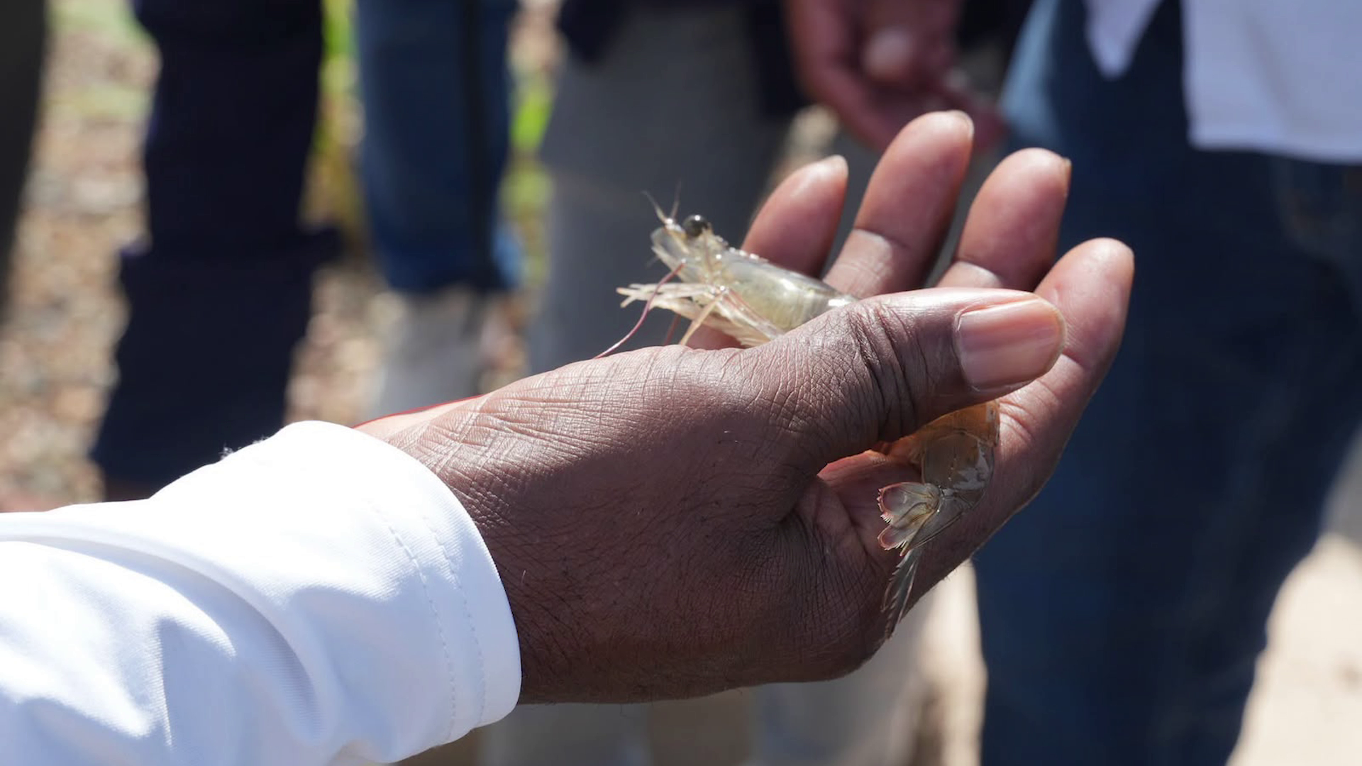
    More than 10 years after a deadly early mortality syndrome nearly collapsed Belize’s iconic shrimp aquaculture sector, the industry is staging a remarkable recovery that has exceeded early projections. Since 2020, total shrimp output across the country has tripled, pushing the total market value of the sector to nearly $25 million, according to government data.

    On August 11, Belize’s Minister of Agriculture Rodwell Ferguson toured two key industry facilities — Aqua Vista Shrimp Hatchery and the Aqua Mar Belize shrimp farm — to inspect the operations that are leading the sector’s rebound. During the visit, he highlighted how the transformation has been driven by three core shifts: the adoption of modern aquaculture technology, the development of more disease-resistant shrimp genetic strains, and a wave of targeted fresh private investment from international and local stakeholders.

    Ferguson shared context on the sector’s devastating decline in a phone interview, recalling that of the 17 operational shrimp farms active before the outbreak, just six remained open by 204. Early mortality syndrome, which killed more than 50% of shrimp populations in affected operations, forced mass closures across the country. Rebuilding the sector has been an uphill battle, Ferguson noted, because shrimp farming is a capital-intensive industry that requires significant upfront investment. Before any shrimp can be harvested, operators must dig and line specialized rearing ponds, purchase heavy machinery and processing equipment, and build on-site housing for security staff to protect stock from theft. That high barrier to entry slowed recovery efforts for years after the initial outbreak.

    The turning point came when Indian investor Ravi, who now leads the country’s revitalized shrimp production, acquired three key assets: a hatchery in Dangriga, a farm in Sik Grass, and the Aqua Mar operation in Independence. Ravi has poured extensive capital into upgrading facilities and implementing new disease management protocols, and he projects that by 2028, his operations alone will produce more than 8 million pounds of shrimp annually. That volume will be enough to meet full domestic demand for shrimp in Belize while leaving significant surplus for export to regional and global markets.

    Government officials now point to the shrimp industry’s rebound as a promising proof of concept for broader growth across Belize’s agriculture sector. With export expansion now a core goal, the recovery is expected to create new jobs, boost national export revenue, and serve as a model for revitalizing other aquaculture and agricultural sectors hit by disease and market disruption in recent years.