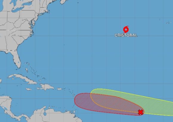
The 2026 Atlantic hurricane season marked another key milestone on Wednesday, when the National Hurricane Center (NHC) confirmed the formation of Tropical Storm Cristobal, the third named storm of this year’s cycle.
At the time of the announcement, the storm was positioned roughly 880 miles (1,417 kilometers) west of the Azores archipelago. It was tracking quickly eastward at a forward speed of 25 miles per hour (around 40 km/h), packing maximum sustained wind speeds of 45 miles per hour (72 km/h), the NHC reported.
Crucially, forecasters have emphasized that Cristobal currently poses no danger to any populated coastal or inland regions. As of the latest update, no coastal watches or official warnings have been issued in association with the system.
According to NHC projections, Cristobal is set to begin weakening over the next 24 to 48 hours as it progresses over cooler ocean waters, which sap the energy of tropical systems. Its stretched, elongated structure combined with its great distance from any landmasses means the storm is extremely unlikely to bring measurable impacts to the United States, the Azores, or the Iberian Peninsula, forecasters added.
Cristobal’s emergence comes as the Atlantic hurricane season enters the lead-up to its annual peak activity period, prompting meteorologists to maintain close surveillance across the entire tropical Atlantic basin. Beyond Cristobal, the NHC is actively monitoring two other areas of disturbed weather that carry potential for tropical development. One of these systems, a tropical wave, currently has an 80% probability of organizing into a named storm over the next two days, per NHC estimates.
Even with the uptick in tropical activity across the basin, Dominican meteorological officials have confirmed that none of the currently tracked systems pose an immediate direct threat to the Dominican Republic at this time.