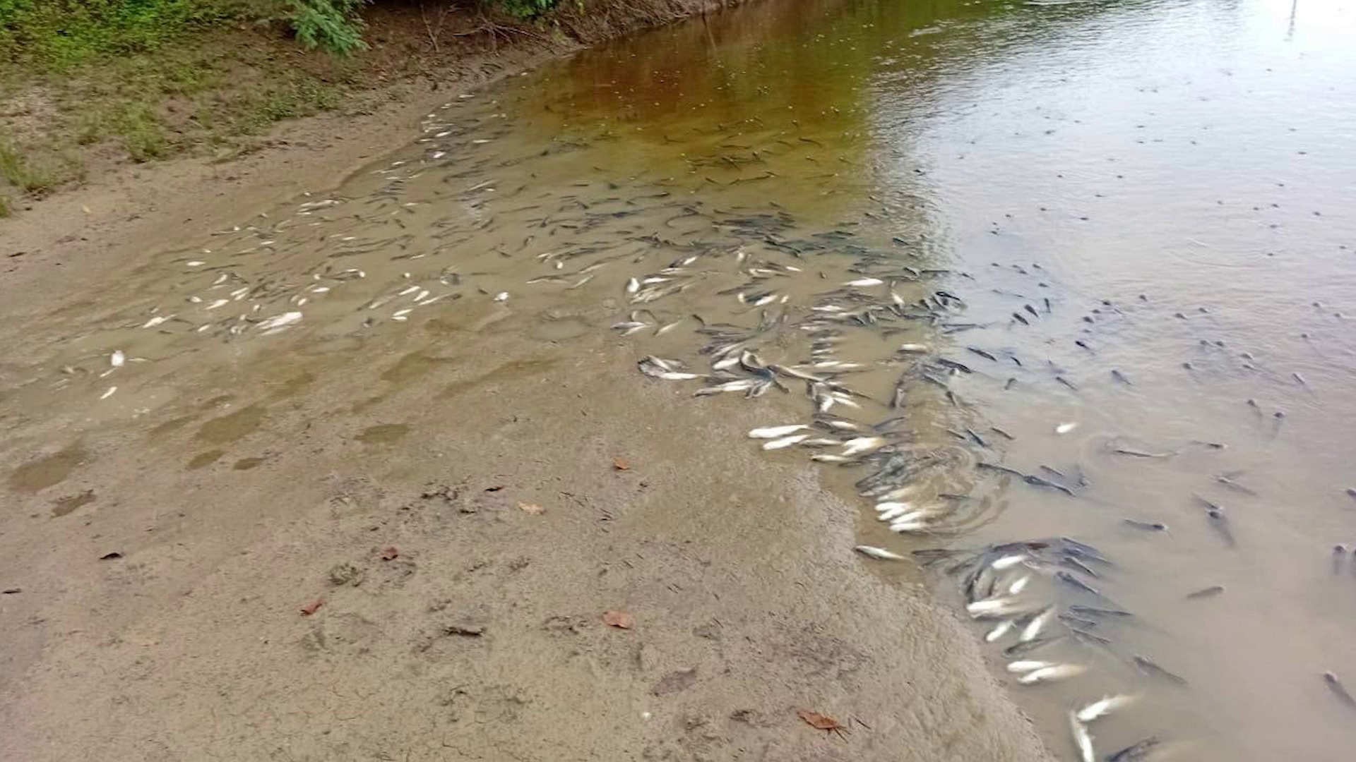
In the quiet Belize River Valley that has long sustained local communities, a sudden and unexplained mass fish death event has upended daily life, leaving residents demanding answers and prompting urgent government investigation. The event, which unfolded earlier this week, left dozens of dead fish bobbing along riverbanks, forcing authorities to issue an immediate warning barring public contact with aquatic life from the impacted stretch of water. As of August 6, 2026, the core cause of the die-off remains unconfirmed, though early preliminary data points to critically low dissolved oxygen levels in the affected water. For generations, communities along the Belize River have relied on the waterway for fishing, domestic use, and livelihood, turning this environmental disturbance into a pressing public concern that goes far beyond the dead fish washing ashore. Local resident Sharon Robinson, who lives in the community of Flowers Bank, drew a parallel to a similar die-off that hit the region roughly a decade ago, when a mass mortality event wiped out local lobster populations that have only recently started to recover. She suspects the source of the current contamination is located upstream on the Cayo side of the river, with pollutants carried downstream to the valley’s waters. A multi-agency investigation team, assembled in response to the incident, has already begun collecting water samples and mapping potential sources of pollution across the watershed, but investigators have yet to reach a definitive conclusion on what triggered the die-off. Ecologist Dr. Colin Young laid out one of the leading potential explanations for the oxygen depletion that has been tied to the fish kill. He noted that the region has recently seen heavy rainfall, which increases agricultural runoff carrying large volumes of sediment as well as nitrogen-based fertilizers from nearby farms into the river. When these nutrients and sediment enter the waterway, they fuel rapid, unchecked growth of algae and bacteria, which in turn consume most of the available dissolved oxygen in the water — creating hypoxic conditions that fish cannot survive in. Dr. Young added that the problem is not limited to this single event; for years, unregulated canal digging in the watershed has routinely deposited excess sediment, fertilizers, and other pollutants into the Belize River, creating a cumulative risk of harmful ecological events. He emphasized that slower, deeper, wider stretches of the river are particularly prone to trapping these pollutants, allowing oxygen levels to drop to lethal levels for aquatic life, even if the source of contamination is located much farther upstream. Currently, the Belize Department of the Environment (DOE) has maintained its strict safety advisory for residents: no consumption of fish or other aquatic life from impacted areas, no use of untreated river water for drinking, cooking, or watering livestock. The DOE has confirmed that the majority of local households receive safe treated water from Belize Water Services Limited (BWSL), but a significant number of residents still rely directly on the river for daily needs, making the warning a critical priority for public safety. Isabella Bank resident Francisca Madril shared the widespread community anxiety over the incident, saying she remains deeply concerned about the impact of the dead fish and contaminated water. Despite the uncertainty surrounding the cause and long-term impacts, many residents have reported early signs of improvement in recent days: water clarity has increased from the dark, murky conditions seen earlier in the week, and far fewer dead fish are seen floating downstream. That small improvement has not quelled resident concerns, however. Robinson explained that even with current low water levels, rising tides could carry contaminated water into residential yards, threatening backyard gardens and livestock that many families depend on. Dr. Young argued that while Belize already has strong environmental protection laws on the books to prevent unregulated sediment runoff and pollution, consistent enforcement has been lacking, allowing risky development and agricultural practices to continue unchecked. Development should not come at the cost of the river ecosystem that supports local communities, he emphasized. Now, residents across the Belize River Valley are calling for a full, transparent public investigation into the fish kill, and are demanding accountability for any parties found responsible for illegal pollution that contributed to the event. As investigators continue their work, the community remains on edge, waiting for confirmation of when their lifeline river will be safe to use again.
分类: environment
-
Hoe Gambiaanse vrouwen de mangroves herstellen die Banjul beschermen
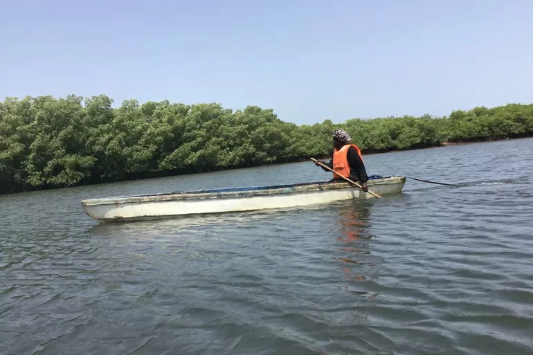
Before the midday sun scorches Gambia’s Atlantic coast, 34-year-old Fatou Jarjue waits for the tide to pull back from the Tanbi Wetlands. Pulling on thick gloves and sturdy socks, she pushes her hand-carved wooden canoe through narrow channels tangled with the sprawling, exposed roots of mangrove trees. Today, the empty pans stowed in her vessel are not meant for oysters—they will hold crabs that burrow in the wet mud beneath the water’s surface, as oyster harvesting is closed for the annual rainy season.
For Jarjue, a mother of one, life is inextricably tied to this vast coastal wetland. Salt-tolerant mangroves, which naturally anchor shorelines and buffer communities from erosion and storm surge, have provided for her family for generations: the trees host oysters, crabs, and fish that feed her household and generate her income, while their dense root systems act as a natural sea wall for her coastal community. On most days, her brother Musa follows in a smaller canoe to keep watch as she paddles deeper into the mangrove forest; on other days, she navigates the muddy waterways alone.
For generations, women in communities surrounding Tanbi Wetland have drawn their livelihood from these waters, and Jarjue continues that tradition. But unlike her predecessors, she has dedicated a large portion of her time to restoring the ecosystem that sustains her people. Just over one year since she began her restoration work, Jarjue says she has planted and restored more than 5,000 mangrove trees, reviving critical habitat that protects both the coast and the local fishing economy.
Raised in Ndangan, a small settlement of 300 people just two kilometers from Banjul, Gambia’s capital, Jarjue learned the rhythm of the wetlands from childhood. At 12 years old, she followed her mother into the mangroves, mastering the skills of oyster foraging, crab trapping, and fishing. For her, the forest was both a classroom and a lifeline. But over the years, she watched the ecosystem change: rising sea levels, accelerating coastal erosion, and shifting weather patterns have steadily eroded the mangrove cover that the entire community depends on. Rather than only harvest from the wetland, she chose to give back, launching her personal restoration effort.
Today, every trip into the mangroves combines harvesting with conservation work: she inspects young saplings, replaces damaged seedlings, and maps areas that need additional restoration. “Mangroves are part of our lives,” she explains. For Jarjue, environmental conservation and community survival are one and the same: the healthier the mangroves grow, the more secure the future for her family and neighbors.
As she paddles through the channels, Jarjue passes fully grown oysters clinging to mangrove roots, waiting for the next harvesting season to open. She leaves them undisturbed, proud to protect the stock that will support her community later in the year. While crabbing provides steady income during the rains, oysters remain the most profitable catch for local women: a standard milk can of oysters sells for roughly 100 Gambian dalasi (about $1.34), and demand at local markets consistently outpaces supply. “Oysters are hard work to harvest,” Jarjue says. “But that’s where the income is.”
Many people mistakenly believe the annual rainy season closure of oyster harvesting is rooted in fears that oysters become toxic during this period. But marine scientist Dawda Saine explains the policy is a deliberate conservation measure tied to ecology and food safety. The closure is part of Gambia’s national Oyster and Cockle Co-management Plan, designed to give oyster populations time to reproduce, grow, and replenish their numbers while reducing pressure on the wetland ecosystem.
“We don’t close the season because oysters are toxic,” Saine told Al Jazeera. “We close it to protect the resource. During the rains, increased runoff flushes more sediment and contaminants into the water, and oysters filter everything in the water they inhabit—this can impact their quality, taste, and safety.” By leaving oysters undisturbed during this period, both the ecosystem and consumers are protected, and the policy has become a widely accepted investment in future harvests for women like Jarjue.
Jarjue is one of dozens of women in Ndangan who have turned from traditional foragers to ecosystem stewards, all working to restore the mangrove habitat their lives depend on. For 48-year-old Sussan Colley, who has foraged oysters and fished the wetlands since her teens, the change brought by restoration is impossible to miss. She remembers when mangrove cover shrank, catches declined, and households that relied on the wetland faced growing food insecurity. As restoration projects took root, Colley saw a steady reversal: oysters returned, grew larger and faster, and the wetland became productive again.
“Mangroves have changed our lives for the better,” Colley said. For her, restoration is also about passing on a new legacy to the next generation. She teaches her children the traditional harvesting skills she inherited from her parents, but adds a new lesson: people must protect the natural systems that sustain them. “I want them to be able to make a living from this land,” she says, “but I also want them to understand how important mangroves are, and what role they play in all our lives.”
Jarjue and other local women received formal mangrove restoration training through a local conservation initiative that supports Gambian coastal communities building climate resilience. The program equipped them with skills to restore degraded mangrove habitats, protect fishing ecosystems, and strengthen their communities’ ability to withstand the impacts of climate change. For the women of Ndangan, the training transformed their relationship with the wetland: it is no longer only a place to harvest resources, but a shared responsibility to nurture and protect.
The work being done in Ndangan carries stakes that extend far beyond the small settlement, to the heart of Gambia’s capital. Banjul is a low-lying island city, increasingly threatened by rising sea levels, coastal erosion, and catastrophic flooding. Experts warn that a one-meter rise in global sea levels would submerge large parts of the capital, making the protection of remaining natural coastal barriers a matter of urgent national importance. This threat is not hypothetical: in 2022, severe flooding displaced thousands of Gambians, laying bare the extreme vulnerability of the country’s coastal communities.
For the communities surrounding Tanbi Wetland, mangroves are far more than an environmental resource—they are a natural coastal defense system that shields inland settlements from storm damage and sea level rise. Rohey Malick Lowe, mayor of Banjul, says the capital’s future is inextricably linked to the survival of the Tanbi mangroves. “Banjul is an island,” she told Al Jazeera. “If the mangroves disappear, the city disappears with it.” The mayor added that city officials are working to protect the capital from growing climate threats, but acknowledged significant remaining challenges, including ongoing degradation of parts of the wetland from unregulated human activity.
-
Here’s the Updated Hurricane Season Forecast
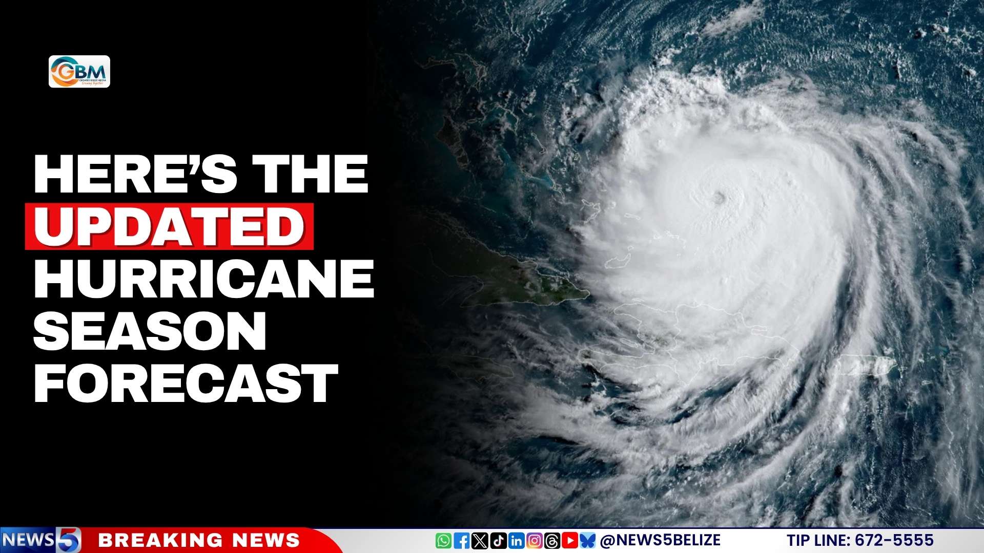
As the 2026 Atlantic hurricane season progresses, leading climate and weather agencies have released an updated outlook that brings a mixed picture of reduced cyclone activity but persistent hazards for Belize and the broader Caribbean region.
Contrary to initial projections, forecasters from both regional and international bodies now anticipate a below-average hurricane season for the Atlantic basin. The U.S. National Oceanic and Atmospheric Administration (NOAA) has adjusted its earlier forecast downward, now calling for between 7 and 13 named storms, 2 to 6 hurricanes, and just 0 to 2 major hurricanes categorized as Category 3 or higher on the Saffir-Simpson scale.
This reduction in tropical cyclone formation is largely tied to two key climate drivers shaping the region’s weather through the rest of the 2026 wet season, according to the Caribbean Climate Outlook Forum (CariCOF). Strengthening El Niño conditions, combined with ongoing warming of Caribbean surface waters, are reconfiguring atmospheric patterns across the basin. Additionally, CariCOF notes that frequent incursions of Saharan dust moving across the Atlantic will further act to suppress the development of new tropical cyclones.
However, experts emphasize that a drop in hurricane numbers does not eliminate weather-related threats for Belize. Even with fewer cyclones projected, the country remains at high risk of extreme flooding and sudden flash floods driven by excessive intense rainfall events that can occur independent of major storm systems. The public and local authorities have been urged not to lower their guard ahead of the peak risk period.
Beyond flood risks, CariCOF’s outlook warns of additional compounding hazards through September. Much of the Caribbean will see slower-than-usual rainfall accumulation paired with increasingly severe humid heat, while the same Saharan dust that suppresses cyclones will degrade regional air quality and exacerbate already high temperatures, creating additional risks for vulnerable populations.
-
What’s Killing the Belize River’s Fish? DOE Issues Warning
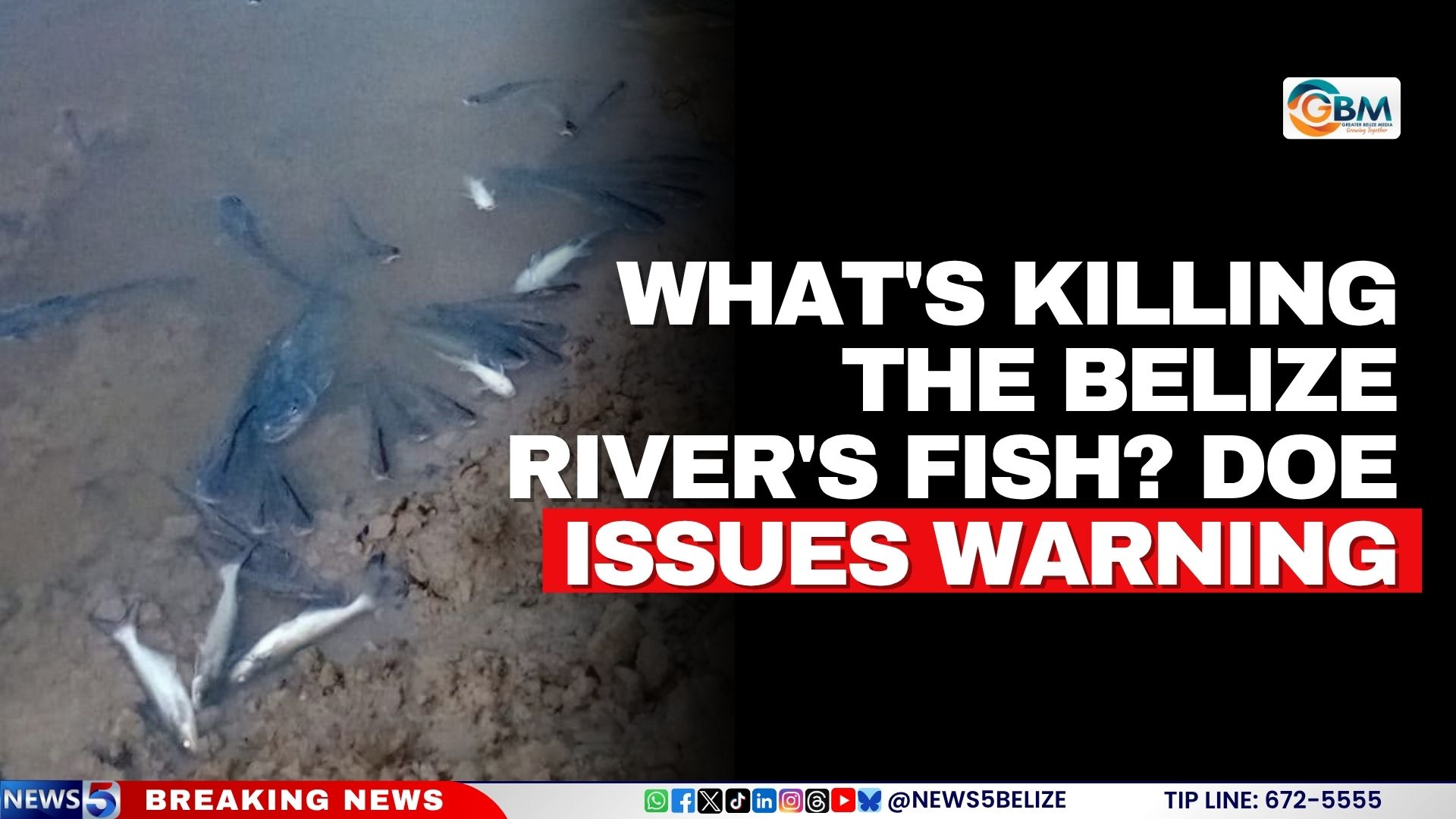
In early August 2026, widespread reports of dead fish floating along sections of the Belize River Valley triggered an urgent multi-agency investigation and a formal public health advisory from Belize’s Department of the Environment (DOE). Following the emergence of these troubling reports earlier this week, the DOE has moved quickly to coordinate a full assessment of the event and warn local communities of immediate health risks.
To ensure a thorough and cross-sectoral investigation, the DOE assembled a joint working group including representatives from Belize Water Services Limited (BWSL), the Ministry of Health and Wellness, the National Emergency Management Organization (NEMO), the national Fisheries Department, the Coastal Zone Management Authority and Institute, and the Ministry of Infrastructure Development and Housing. This collaborative team has launched a comprehensive review of potential contributing factors to the fish kill, covering multiple lines of inquiry.
Investigators have carried out systematic water quality monitoring and sample collection across the affected stretches of the river, alongside on-site assessments of recent land-clearing operations, mapping of potential points of unauthorized wastewater discharge, and reviews of other human activities that could disrupt the river’s aquatic ecosystem. As of the latest DOE update, the full root cause of the mass fish mortality event has not yet been confirmed, prompting officials to roll out broad precautionary measures to protect public safety.
In an official press release, the DOE advised residents and visitors to strictly avoid consuming any fish or other wild aquatic resources harvested from the affected areas of the Belize River Valley. The advisory extends beyond human consumption: officials also warn against using untreated river water for drinking, cooking, or any food preparation, and urge livestock owners and pet owners to keep animals away from unprocessed river water until further investigations are completed and the all-clear is given.
Importantly, the DOE has clarified that these precautions do not apply to treated municipal drinking water distributed by BWSL. The water utility has formally confirmed that all water currently supplied from its regional treatment plant continues to meet national potable water quality standards, remains safe for human consumption, and that there has been no interruption to regular water delivery services across the affected area.
In addition to issuing public health guidance, the DOE has reminded the general public of existing environmental regulations: under the 2009 Environmental Protection Regulations, the discharge of untreated wastewater or non-compliant effluent into any natural waterbody is classified as a criminal offense, and the agency will pursue enforcement action against any violations identified during the ongoing investigation. Officials note that full analysis of water and environmental samples is still underway, and they will release updated findings and adjust public advisories as more information becomes available.
-
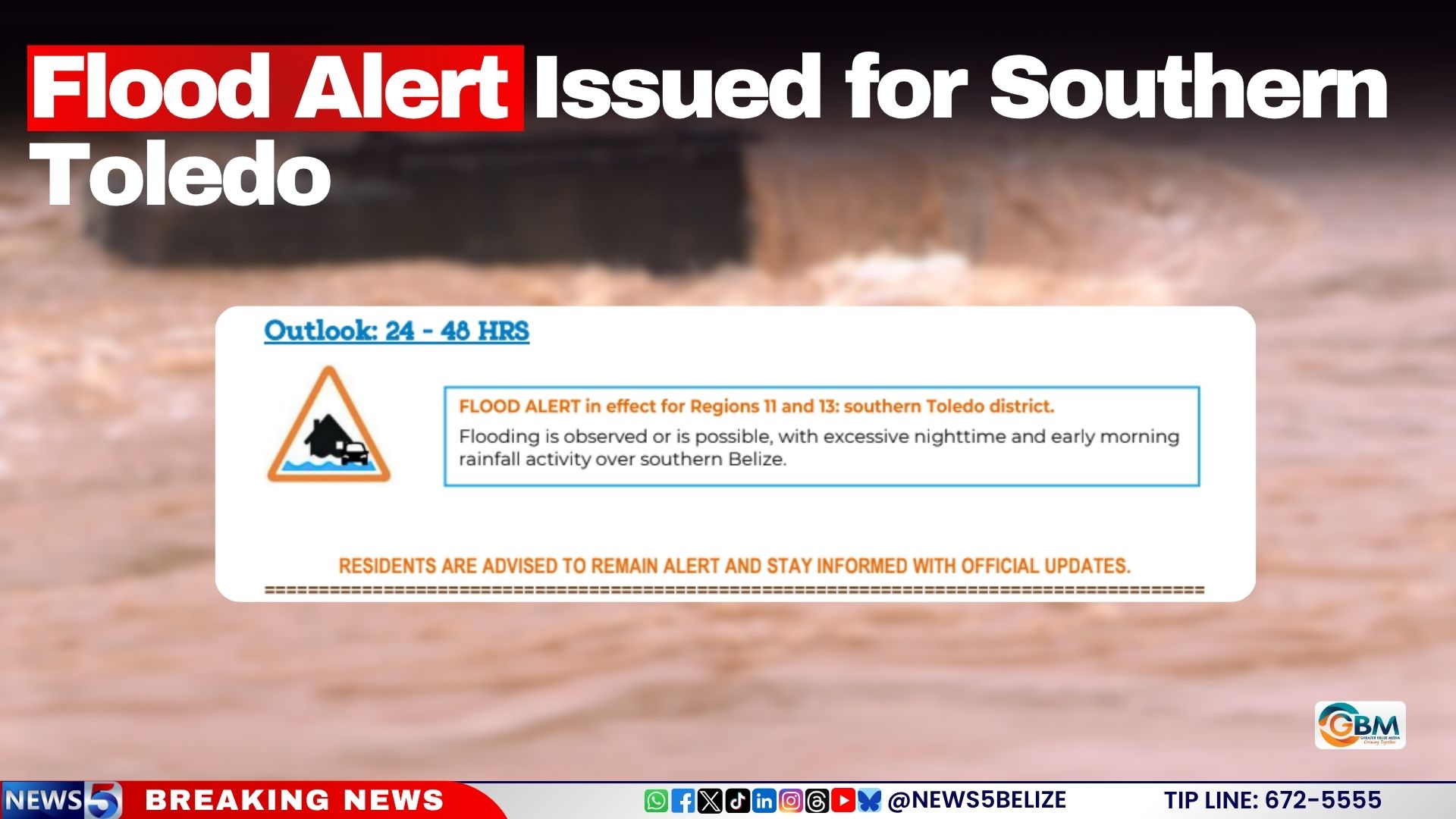
Flood Alert Issued for Southern Toledo
As of August 6, 2026, authorities in Belize have issued an urgent flood alert for the southern Toledo district, warning residents that dangerous flooding could strike within the next 24 to 48 hours amid ongoing overnight and early morning rainfall across the region. The official forecast, released at midday by the Belize Ministry of Sustainable Development, Climate Change and Solid Waste Management, outlines a mixed picture of river levels across the country, with most major waterways sitting at or below long-term normal averages. However, key hydrological systems in the southern half of the nation have already risen above safe baseline levels, bringing immediate flood risk to local communities. The Moho River, one of the largest watercourses in southern Belize, has crossed the official flood threshold at the Blue Creek South monitoring site, where water levels have now risen above the height of the local bridge, creating impassable and unsafe conditions for travel. Other at-risk water bodies include the Temash River, the Sittee River, and Gales Point Lagoon, all of which are currently running well above their normal seasonal levels. By contrast, a number of other major rivers across Belize remain in safe ranges: the Rio Grande and Sarstoon River sit below normal levels, while the northern and central Belize water systems including the Rio Hondo, New River, Belize River, Sibun River, Mopan River and Macal River are all at or below normal levels, with no immediate flood threats reported for these areas. Local officials are urging all residents in southern Toledo and surrounding high-risk zones to stay vigilant, monitor official government updates continuously, and prepare emergency supplies and evacuation plans in case weather conditions deteriorate and flood risks escalate in the coming days.
-
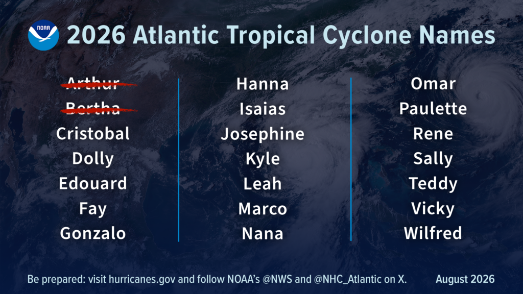
NOAA Revises Atlantic Hurricane Outlook, Still Expects Below-Normal Season
As the 2026 Atlantic hurricane season heads toward its climatological peak in early September, the U.S. National Oceanic and Atmospheric Administration (NOAA) has reaffirmed its initial projection that the region will see substantially below-normal cyclone activity. The updated outlook, published Thursday, points to a rapidly strengthening El Niño event as the dominant factor suppressing storm formation and growth across the Atlantic basin.
Per NOAA’s revised prediction, the entire Atlantic will see between seven and 13 named storms total, counting the two systems that have already formed through the current stage of the season. Of these projected storms, two to six are expected to strengthen into full hurricanes, and just zero to two are forecast to reach major hurricane status – the classification reserved for systems with sustained wind speeds of 111 mph (178 km/h) or greater, ranking Category 3 or higher on the Saffir-Simpson scale.
The agency puts the probability of the season ending below the long-term average at 75%, with just a 20% chance of near-normal activity and a mere 5% chance of activity exceeding average levels. This updated outlook shows almost no shift from NOAA’s initial seasonal forecast released back in May, reflecting the consistent trajectory of climate conditions shaping the season.
To put the projections in context, an average Atlantic hurricane season typically generates 14 named storms, seven hurricanes, and three major hurricanes. Through the first half of the 2026 season, only two named storms – Tropical Storm Arthur and Tropical Storm Bertha – have formed, and neither gained enough strength to reach hurricane status. Both systems originated in the Gulf of Mexico before making landfall in Louisiana, bringing heavy downpours to the Gulf Coast; Arthur also spawned multiple tornadoes across the region during its passage.
Ken Graham, director of NOAA’s National Weather Service, stressed that storm strength measured by wind speed does not capture the full scope of potential harm from tropical systems. “Inland rainfall is a major cause of damage from tropical storms and hurricanes, as Arthur demonstrated,” Graham noted. “That’s why it’s important to prepare for every storm that’s projected to impact your area, even if it never reaches hurricane strength.”
Forecasters confirm that the primary force limiting Atlantic storm activity this year is the strengthening El Niño, which first developed in the equatorial Pacific back in June. El Niño alters global wind patterns to increase vertical wind shear across the entire Atlantic basin – a condition that tears apart developing tropical systems before they can organize and intensify, sharply reducing the overall number of storms that form.
Matt Rosencrans, NOAA’s lead seasonal hurricane forecaster, explained that El Niño has solidified its role as the overriding climate influence for the 2026 Atlantic season. “When El Niño emerges, it usually becomes the dominant factor in total hurricane season activity, and this El Niño continues to get stronger every month,” Rosencrans said. “Compared to a mature El Niño, other mechanisms play a smaller role in determining the number and intensity of tropical storms in the Atlantic basin.”
Two secondary climate factors are also factored into the outlook: near-average sea surface temperatures across the Atlantic and a neutral West African monsoon. Forecasters note both will have far less impact on overall seasonal activity than the strengthening El Niño event.
While the Atlantic is set for a quieter than usual season, El Niño has the opposite effect on Pacific hurricane activity, pushing both the Eastern and Central Pacific basins toward above-average seasons this year. NOAA continues to project 15 to 22 named storms for the Eastern Pacific, where seven named storms – including two hurricanes and one major hurricane – have already formed, matching the above-average trajectory the agency initially predicted.
NOAA underlines one critical caveat to its seasonal outlook: the broad projection of total storm activity does not include predictions for where any individual storm will make landfall. Landfall location is determined by short-term atmospheric patterns that can only be reliably forecast roughly one week in advance, the agency notes. The U.S. National Hurricane Center continues to issue regular, updated forecasts, watches and warnings for all active tropical systems to keep at-risk coastal communities informed.
-
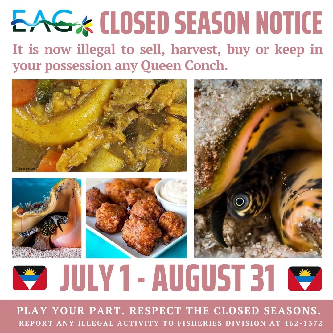
Reminder: Queen Conch Closed Season Remains in Effect Until August 31
ST. JOHN’S, Antigua and Barbuda – As the 2026 annual queen conch closed season enters its second month, local authorities and environmental conservation groups have reissued a public reminder to all residents, commercial fishers, and businesses across the twin-island nation that harvesting, trading, or holding queen conch remains illegal through August 31.
This seasonal regulatory closure, which runs from July 1 to August 31 each year, aligns with the species’ critical annual breeding cycle. The pause in human harvesting activity gives queen conch populations unimpeded space to mate and reproduce, laying the groundwork for more robust population growth in the coming years. As one of Antigua and Barbuda’s most ecologically and economically valuable marine resources, long-term protection of queen conch is tied directly to the sustainability of the local fishing industry and the health of the nation’s coastal marine ecosystems.
The Environmental Awareness Group (EAG), a leading local environmental advocacy organization, has emphasized that widespread public compliance with the closure rule is essential to preserving the species for future generations. Environmental advocates have called on community members to not only adhere to the regulations themselves but also remain vigilant for any suspicious activity related to the protected conch.
Any member of the public who suspects illegal harvesting, sale, or possession of queen conch during the closed season is instructed to report the activity immediately to the national Fisheries Division via the dedicated contact line at 462-1372, enabling rapid enforcement of conservation rules.
-
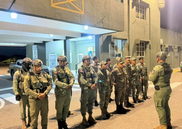
Operation Environmental Commitment 2.0 recovers 775 acres of protected land
In a large-scale coordinated environmental enforcement sweep across the Dominican Republic, government agencies have reclaimed hundreds of acres of protected natural territory, taken hundreds of illegal occupants into custody, and dismantled a wide network of unlawful infrastructure built in ecologically sensitive zones.
Dubbed “Environmental Commitment 2.0,” the operation was spearheaded by the country’s National Environmental Protection Service (SENPA), with cross-agency support from the Ministry of Defense, Ministry of Environment, national armed forces, the Specialized Environmental Prosecutor’s Office (PROEDEMAREN), and the General Directorate of Migration. Enforcement teams targeted 14 distinct protected areas spread across the nation, where reports of unauthorised occupation and ecosystem degradation had been mounting for months.
By the conclusion of the multi-site operation, authorities had recovered a total of 775 acres of protected land that had been illegally seized and exploited. A total of 384 individuals were taken into custody for alleged environmental crimes: of those detained, 381 are Haitian nationals and three are Dominican citizens.
Teams also moved to eliminate all unlawful infrastructure established on the protected land, demolishing 30 informal shacks used by illegal occupiers, removing 27 illegally erected boundary fences, and clearing 11 unauthorised farms carved out of protected ecosystems. In addition to the physical structures, law enforcement seized 39 pieces of tools and heavy equipment linked to illegal environmental activity, alongside six pickup trucks and one motorcycle that investigators allege were used to facilitate these unlawful operations.
Senior officials from the participating agencies emphasized that the high-profile sweep is a clear demonstration of the Dominican government’s formal zero-tolerance policy toward activities that threaten the country’s unique protected ecosystems. These activities include illegal land grabbing, slash-and-burn agricultural practices, unregulated logging, and unauthorised construction within protected natural zones — all of which cause irreversible damage to biodiversity, disrupt native habitats, and undermine long-term conservation efforts.
Moving forward, the Ministry of Defense, Ministry of Environment, and PROEDEMAREN have confirmed that joint, interagency enforcement operations will continue on a regular basis. The ongoing commitment is designed to safeguard the Dominican Republic’s valuable natural resources, ensure full compliance with national environmental legislation, and deter future illegal incursion into protected areas.
-
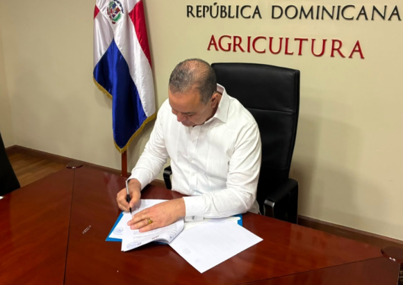
Dominican Agriculture Ministry and Indomet partner to strengthen climate resilience
In a landmark step to address growing climate volatility in the agricultural sector, the Dominican Republic’s Ministry of Agriculture and the Dominican Institute of Meteorology (Indomet) have formalized a new collaborative agreement focused on upgrading the nation’s climate risk management systems. The deal was signed in Santo Domingo by Agriculture Minister Francisco Oliverio Espaillat Bencosme and Indomet Director Gloria Ceballos, marking a coordinated effort to merge specialized climate and water data with day-to-day agricultural planning across the country.
At its core, the partnership is designed to bridge the gap between scientific meteorological research and on-the-ground agricultural practice, enabling small-scale and large-scale producers alike to make more informed decisions that account for shifting weather patterns. Unlike past disconnected initiatives, this agreement institutionalizes data sharing between the two agencies, putting climate expertise directly in the hands of the farming communities that need it most.
One of the most significant components of the new agreement is the planned expansion of the Agroclimatic Roundtables, regular collaborative forums that bring together a cross-sector group of stakeholders: professional meteorologists, leading agricultural scientists, local agricultural extension agents, and working farmers. At these roundtables, participants walk through the latest long and short-term weather forecasts, evaluate how projected conditions—from extended dry spells to unexpected heavy downpours—will impact local crops, and co-develop customized farming guidance tailored to the unique ecological and agricultural conditions of each Dominican region.
Beyond expanding the roundtable program, the initiative includes a suite of complementary activities to embed climate adaptation across the sector. These include the regular publication of specialized agroclimatic bulletins that distill complex climate data into accessible, actionable updates for producers, ongoing hands-on training programs for both working farmers and agricultural technical staff, and sustained cross-agency exchange of the latest technical and scientific research related to climate and agriculture. The partnership will also provide active support for the development and implementation of public policies that prioritize building long-term resilience in the Dominican agricultural sector.
Government and agency leaders emphasized that the agreement fills a critical gap in the nation’s approach to climate and agriculture. By helping farmers anticipate and prepare for climate-related events such as severe droughts, intense tropical rainfall, and record high temperatures, the partnership is expected to cut widespread crop and income losses that have hit Dominican farming communities in recent years. Beyond reducing immediate risk, officials noted, the initiative will strengthen the nation’s overall food security and encourage the adoption of more environmentally sustainable farming practices that align with long-term climate adaptation goals.
-
Caribbean faces jobs, tourism and agriculture risks as El Niño threatens livelihoods – ILO
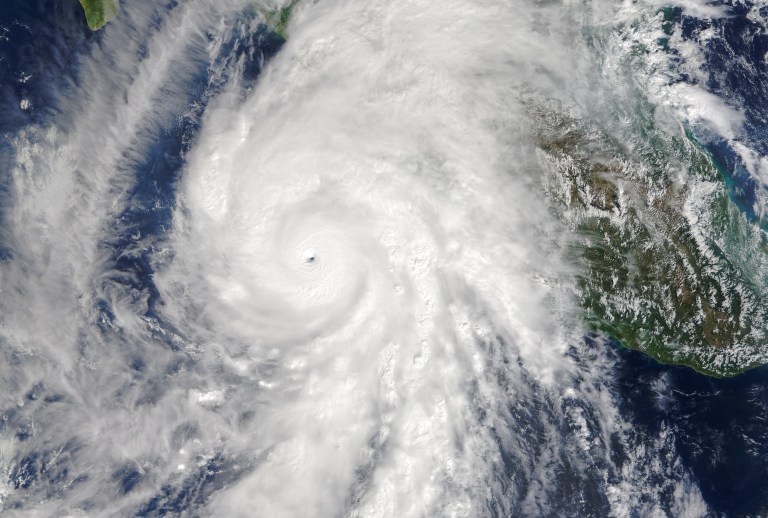
A new analysis from the International Labour Organization (ILO) has sounded the alarm over the 2026-2027 El Niño event, projecting that it will put widespread pressure on employment and household stability across the Caribbean, with three key economic sectors facing the gravest risks. El Niño, a recurring natural climate cycle defined by anomalous warming of surface waters in the central and eastern Pacific, is known to reshape global weather systems, triggering extreme events ranging from severe drought and record heatwaves to intense flooding across different parts of the world. For the Caribbean, the ILO forecasts that the upcoming 2026-2027 cycle will bring prolonged drought, depleted water reserves, and extreme heat events that will hit core industries particularly hard. Agriculture, which supports smallholder and commercial production of staple crops including maize, beans, and wheat alongside high-value exports like coffee and sugarcane, commercial fisheries, and the tourism sector that forms the backbone of many Caribbean national economies are identified as the most exposed to climate disruption from the event. In its policy brief focused on projected labor market impacts across Latin America and the Caribbean, the ILO lays out a cascade of interconnected risks that extend far beyond immediate weather disruption. The extreme conditions brought by El Niño are expected to cut overall employment levels, push down worker incomes, and degrade already poor working conditions, with disproportionate harm falling on three groups: informal sector workers, rural communities, and people who earn a living through outdoor labor. The report outlines multiple secondary threats that amplify harm for vulnerable populations: El Niño-driven disruptions to food production will worsen existing food insecurity, push up prices for both food and energy, reduce overall workplace productivity, and increase the likelihood that households pushed into poverty will turn to child labor to make ends meet. Additional long-term labor market impacts include widespread loss of rural incomes, increased flows of climate-driven labor migration, a further expansion of informal work that offers little to no protections, and dangerous levels of heat stress that threaten the health and safety of outdoor workers. Fabio Bertranou, ILO Deputy Regional Director for Latin America and the Caribbean, emphasized that the upcoming El Niño event presents an unprecedented challenge to maintaining employment and decent work across the region. Bertranou noted that the final scale of harm will be determined by how well national governments prepare: strong, responsive labor market institutions, robust social protection frameworks, and inclusive social dialogue are critical to shielding the most vulnerable workers from harm. The ILO’s report also highlights a key structural vulnerability that makes Caribbean workers particularly at risk: the region’s already high rates of informal employment mean that the majority of workers lack access to social protection coverage and other formal support systems that help households absorb and recover from climate-related economic shocks. Even with these stark projections, the ILO stresses that the worst outcomes are not inevitable. National governments can drastically reduce risk by taking targeted preemptive action: expanding and strengthening social protection coverage for all workers, investing in climate-resilient infrastructure that can withstand extreme weather, updating occupational safety and health standards to address heat-related risks, expanding accessible early warning systems to help communities and businesses prepare, and fostering ongoing social dialogue between governments, employers, and worker representatives. The organization is calling on regional policymakers to reframe El Niño not as a one-off weather event, but as a systemic threat that can reshape regional economies, labor markets, and employment outcomes for years. Addressing this threat requires coordinated, cross-sector action to protect workers and preserve livelihoods across the Caribbean ahead of the predicted event, the report concludes.