分类: environment

  • Dominica strengthens efforts to build more climate-resilient agriculture

    Dominica strengthens efforts to build more climate-resilient agriculture

    Against a backdrop of growing climate uncertainty across small island developing states, Dominica has advanced its long-term goal of climate-resilient, eco-friendly agriculture through a cross-regional sustainability initiative supported by German development funding. The collaborative project, which brings together agricultural stakeholders from across Latin America and the Caribbean, centers on transforming on-the-ground soil and water management practices to help farming communities adapt to shifting climate patterns while cutting harmful environmental impacts from traditional agricultural activities.

    Leading implementation on the ground is Dominica’s Division of Agriculture, which has rolled out the Integrated Soil Conservation and Soil Fertility Improvement Demonstration Project, a targeted program built exclusively to meet the needs of local smallholder and commercial farmers. Unlike broad policy frameworks that lack practical application, this initiative prioritizes hands-on learning, connecting farmers directly with proven techniques to boost natural soil nutrient levels, slow or stop widespread soil erosion, and adopt production methods that align with long-term environmental protection goals. At its core, the project balances two critical priorities for the island nation: raising overall agricultural productivity to support food security and rural livelihoods, while protecting the long-term health and productive capacity of Dominica’s limited agricultural land assets.

    To cap off the project’s core technical phase, a team of agricultural specialists from Argentina’s National Institute of Agricultural Technology (INTA) conducted an official three-day working visit to Dominica from August 12 to 14, 2026. During their mission, the INTA experts delivered customized technical guidance to local agricultural extension officers and participating farmers, sharing evidence-based soil management approaches refined through decades of research and field testing across diverse South American agricultural landscapes. Their knowledge sharing focused on actionable strategies that can be adapted to Dominica’s unique tropical soil and climate conditions to maintain healthier, more productive farmland over time.

    As the final scheduled technical field mission under the regional initiative, the INTA visit marks a key milestone in Dominica’s broader efforts to build agricultural resilience to climate change and embed sustainable land management into mainstream farming practices across the island. Project organizers and local agricultural officials note that the techniques and strategies shared during the visit will provide a lasting foundation for ongoing scaling of sustainable agriculture across Dominica, supporting the nation’s goals of climate adaptation, environmental protection, and food security for years to come.
  • Atlantic Tropical Wave Has 50% Chance of Development This Week

    Atlantic Tropical Wave Has 50% Chance of Development This Week

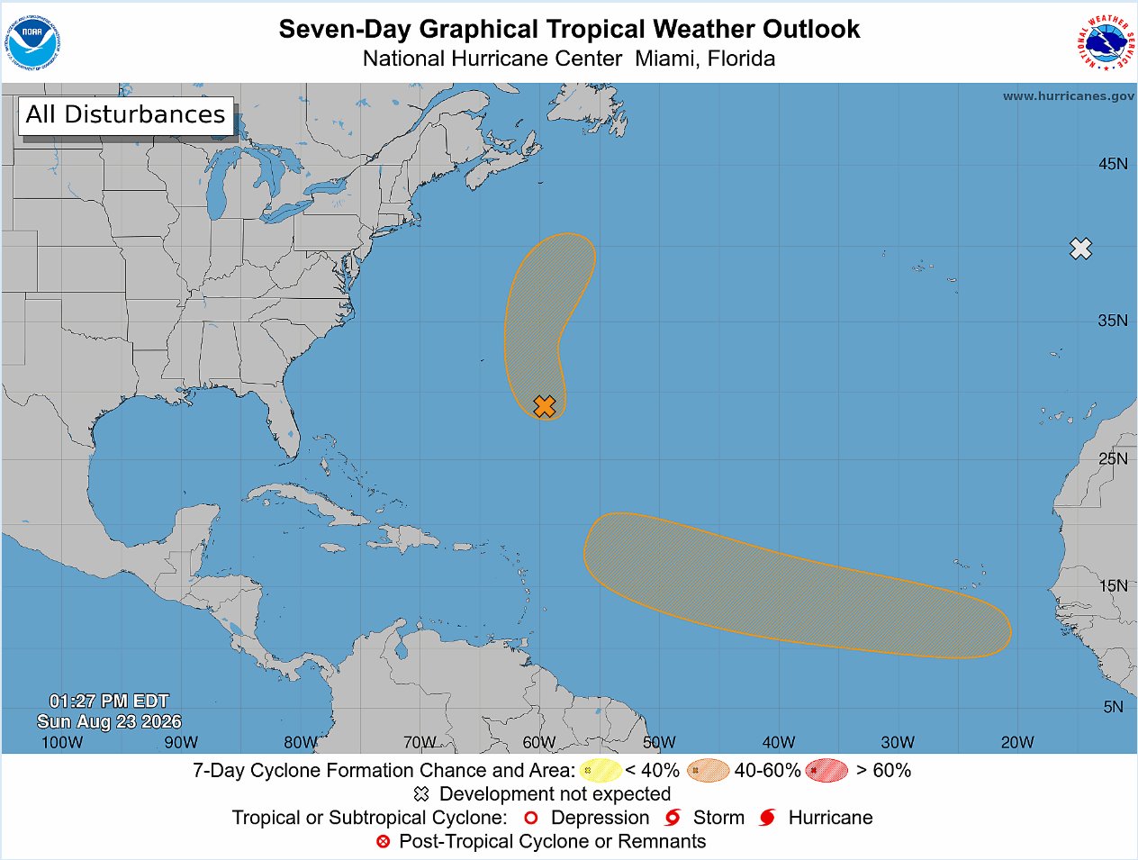
    The United States National Hurricane Center (NHC) is currently tracking three distinct tropical weather systems across the Atlantic Ocean, with one long-disturbance showing moderate odds of strengthening into a organized tropical depression within seven days.

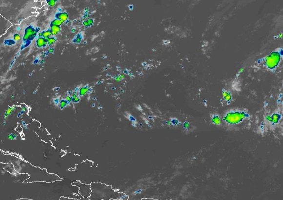
    In its latest 2 p.m. Sunday update to the routine Tropical Weather Outlook, forecasters outlined that a tropical wave is projected to exit the western coastline of Africa starting Monday. This wave is expected to spawn a new area of low pressure in the opening days of the week, though current conditions are not expected to support immediate strengthening. The NHC’s official probability models put the chance of this system organizing over the next 48 hours at near-zero, a figure that climbs to 50% when the forecast window extends to seven days.

    Forecasters note that atmospheric and oceanic environmental conditions will only be marginally favorable for development over this period, with any potential formation of a tropical depression most likely falling between the middle and end of the week. If the system continues to evolve as projected, it will track steadily westward across the eastern and central portions of the tropical Atlantic, moving at a forward speed between 15 and 20 miles per hour.

    A second, separate area of low pressure is already active roughly 400 miles southeast of Bermuda, and it has begun showing clear signs of increasing organization. This system is forecast to track north and north-northeast, staying well to the northeast of Bermuda as it moves. Over the next two days, the NHC assesses it has a 40% chance of developing into either a tropical depression or a named tropical storm.

    The third system being monitored, located just a couple hundred miles off the western coast of Portugal, has been removed from the list of systems likely to develop. Forecasters now say it has no meaningful chance of gaining subtropical characteristics before it moves inland over Portugal and Spain early Monday.

  • Tropical Wave Near Africa Has 40% Chance of Development

    Tropical Wave Near Africa Has 40% Chance of Development

    The United States’ National Hurricane Center (NHC) has begun active surveillance of an approaching tropical disturbance that is projected to exit the western coastline of Africa this coming Monday, kicking off a new period of heightened monitoring for potential cyclonic activity in the Atlantic basin.

    After this tropical wave moves out over open Atlantic waters, meteorologists forecast that a low-pressure system could gradually develop in association with the disturbance. Current atmospheric and oceanic conditions across the region are only marginally supportive of further strengthening of the system, forecasters note.

    Over the coming seven-day window, the emerging system has a 40% probability of organizing into a tropical depression as it tracks westward across the eastern and central portions of the tropical Atlantic, moving at a steady forward speed of between 15 and 20 miles per hour, according to NHC projections.

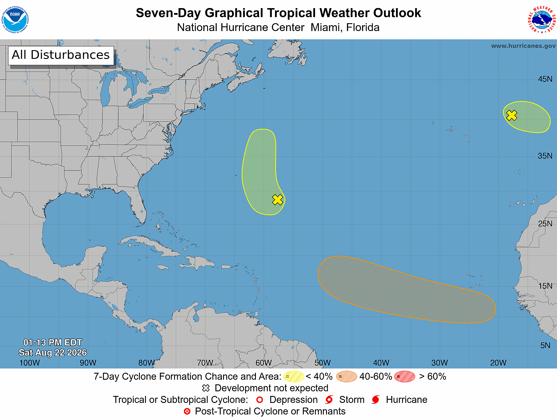
    In addition to this newly identified African tropical wave, the NHC is also keeping close watch on two separate weather systems already located across the subtropical Atlantic. Both of these existing systems are rated as having a low probability of undergoing tropical or subtropical development over the next week, leaving the new disturbance off Africa as the highest-risk system currently being tracked by the center.

  • Temporary rains are forecast this Sunday, but temperatures will remain hot

    Temporary rains are forecast this Sunday, but temperatures will remain hot

    The Dominican Republic’s National Institute of Meteorology (Indomet) has issued a detailed weather forecast outlining mixed atmospheric conditions across the country this week, while also monitoring a new tropical system developing over the Atlantic Ocean. Two key atmospheric features—a approaching tropical wave and a stationary trough—are set to trigger heavy rainfall across multiple provinces, with precipitation expected to hit different regions at different times over the coming days.

    Early on, the bulk of the downpours will target a cluster of northern, eastern, and southern Dominican localities, including Samaná, María Trinidad Sánchez, Duarte, Sánchez Ramírez, La Romana, San Pedro de Macorís, Santo Domingo, and La Altagracia. By the afternoon hours, the wet weather will shift west and northwest, bringing rain to Monte Plata, Santiago Rodríguez, Dajabón, Elías Piña, and the northern section of the San Juan province.

    Even with the incoming rain, however, the country will not see immediate relief from sweltering conditions. Indomet has cautioned that high air temperatures will persist, creating a dangerous elevated thermal sensation that can raise the risk of heat-related illness. To help residents stay safe, the institute has issued public guidance: stay hydrated by drinking water regularly throughout the day, and opt for lightweight, loose-fitting clothing made of breathable fabrics in light colors that reflect rather than absorb heat.

    Looking ahead to the coming week, Indomet is tracking a new tropical disturbance that is projected to exit the west coast of Africa early next week. Following its emergence from the African continent, the system is expected to organize into a low-pressure area as it moves westward across the Atlantic. Current climate models give the developing system a 50% probability of strengthening into a named tropical cyclone within the seven-day window after it forms. While the system remains hundreds of miles from Dominican territory at this early stage, Indomet has emphasized that it is critical for the public and emergency management teams to closely monitor its evolution as it tracks across the ocean.

    For the coming days, temperature ranges across the country will settle between overnight lows of 24°C to 26°C, with daytime highs forecast to reach between 34°C and 36°C, maintaining the warm, humid conditions that have dominated the region.

  • Saudi Solar Project in Belize Faces Lengthy Delays

    Saudi Solar Project in Belize Faces Lengthy Delays

    Belize’s push to strengthen national energy security and expand its renewable energy portfolio has hit significant unexpected snags, with two high-priority infrastructure projects facing prolonged holdups, Prime Minister John Briceño has confirmed. Among the most high-profile is a large-scale Saudi-funded solar energy initiative, which has been stuck in bureaucratic limbo despite years of planning and final approval of its multi-million dollar financing.

    Briceño explained that Belize moved quickly to secure financing from Saudi Arabian development partners early in the project planning process. While Saudi authorities approved the requested loan almost immediately, moving through the large institution’s multi-layered procedural steps has stretched on for years. As a large global actor with a wide range of competing domestic and international priorities, Saudi administrative bodies have moved slowly to advance the Belize project, Briceño noted. Currently, Belizean authorities are just at the stage of identifying and engaging qualified developers ready to break ground on the solar installation.

    A second key renewable project, a 40-megawatt energy storage facility that is being backed by a $100 million loan from the World Bank, has faced its own unusual barrier: a squatter who occupied the project site for two full years. The site, located in San Pedro, is owned by Belize Electricity Limited (BEL), and the squatter claimed to be occupying the land to protect native iguana populations. Briceño dismissed the claim as a fraudulent pretense for illegal occupancy, stressing that the site is not a unique or critical protected habitat for the species.

    The prime minister revealed he held meetings with World Bank officials this week to push for unblocking the project, criticizing Washington-based bureaucratic processes for holding up progress over an illegal occupancy that should not derail a nationally critical infrastructure initiative. If the energy storage project were operational, Briceño noted, Belize would already be able to import low-cost excess energy from Mexico during overnight hours, when imported power costs just 3 to 4 cents per unit, delivering significant savings to consumers and strengthening the country’s energy grid resilience.

    The delays come as Belize has made expanding renewable energy capacity a core policy goal to reduce dependence on imported fossil fuels and boost long-term energy affordability and security for households and businesses across the country.

  • Belize City Commuters Embrace Electric Buses

    Belize City Commuters Embrace Electric Buses

    More than two years after launching a small-scale pilot electric bus program, Belize City is moving forward with a major expansion of its clean public transit initiative, responding to overwhelming demand from local commuters who have quickly embraced the zero-emission service. The city’s pilot launched with just two electric buses, but early results have convinced leaders to add four more vehicles to the growing e-Ride network, with the Belize City Council now accepting competitive bids from suppliers to complete the purchase.

    Neil Hall, e-mobility consultant and E-Transit Coordinator for the Belize City Council, shared that early adoption has far outstripped initial projections for the program. “Our buses consistently operate at full capacity, and during peak rush hour periods, they often run over capacity with standing passengers,” Hall explained. “We are fortunate our vehicles are equipped to accommodate this level of demand safely.”

    Currently, the two pilot electric buses only serve a limited core route covering a small section of Belize City, leaving many surrounding neighborhoods without access to the clean transit option. Hall noted that expanding the network will open up the benefits of electric public transit to a far larger share of the city’s population, giving commuters a new alternative to existing private transit services.

    Hall emphasized that the expansion is not intended to displace existing transit providers, but rather to give residents choice. “We’re not trying to take anybody’s business, but we will make it possible for others to choose us if they so desire,” he said.

    Among the most praised features of the e-Ride service are the quality-of-life benefits that set electric buses apart from traditional fossil-fuel models. The vehicles operate with near-silent performance, produce zero tailpipe pollution, and avoid the soot and exhaust fumes common to older diesel buses. They also deliver a far smoother, more comfortable ride for passengers.

    An unexpected but widely appreciated accessibility feature has also made the service a hit with vulnerable residents: all e-Ride buses are low-floor models, requiring just one small step to enter the vehicle. This design makes boarding far easier for senior citizens, people living with disabilities, and commuters who use wheelchairs or mobility walking aids.

    “We didn’t know that when we stepped in, that we’d be helping so many people to get through their day and make their lives that much easier,” Hall added.

    Official ridership data underscores the program’s popularity: over the first two years of pilot operation, more than 380,000 passenger trips have been taken on the two electric buses. To fund the purchase of four additional buses, the city will draw from proceeds of its municipal bond issue. Once the new vehicles arrive, leaders plan to extend service to entirely new routes across the city, as well as adjust the existing pilot route to better serve demand.

  • Panamakanaal beperkt dagelijks scheepvaartsverkeer door El Niño

    Panamakanaal beperkt dagelijks scheepvaartsverkeer door El Niño

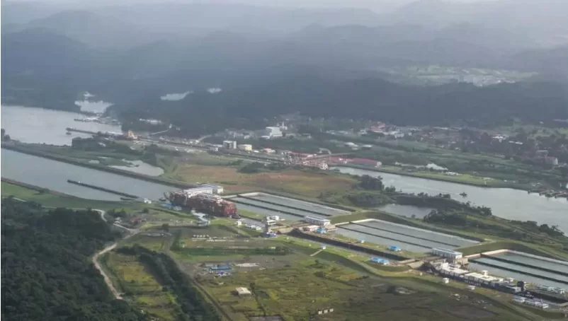
    One of the world’s most critical maritime trade arteries is facing unprecedented strain from extreme drought, driven by one of the strongest El Niño events in recent decades. The Panama Canal Authority (ACP) announced in late August 2026 that it will implement deep cuts to the number of vessels allowed to transit the iconic interoceanic route starting September 3, responding to plummeting water reserves that are essential to the canal’s lock operations.

    Currently, the waterway accommodates 32 vessels per day. Under the new restrictions, that number will first drop to 34 daily transits on September 3, before falling further to 32 daily passages by September 15. Additional water conservation measures have already been put in place, including a reduction in the maximum allowable draft for large vessels, to slow the depletion of stored water.

    Unlike most major shipping routes, the 108-year-old Panama Canal, which connects the Atlantic and Pacific Oceans, relies entirely on rainwater collected in two artificial reservoirs—Gatún Lake and Alhajuela Lake—to operate its lock system. The locks, which raise and lower vessels between the different ocean levels, consume large volumes of water with every transit. This year, an extreme drought across Central America, amplified by El Niño, has brought far less rainfall than expected to the canal’s watershed.

    El Niño, a cyclical climate phenomenon characterized by elevated sea surface temperatures in the central and eastern equatorial Pacific, reshapes global weather patterns, shifting wind currents, atmospheric pressure and rainfall distribution. For Central America, this shift consistently brings prolonged dry conditions and below-average precipitation. This year’s event has been particularly severe, pushing drought conditions across much of the region: just last week, Honduras declared drought emergencies for 80 percent of its national territory.

    The impact of the canal’s new restrictions extends far beyond Panama’s borders. The waterway handles roughly 5 percent of total global maritime trade volume, and carries approximately 40 percent of all container cargo that enters or departs the United States, serving as a vital link connecting trade flows between the Americas, Asia and Europe. Any disruption to transit capacity has immediate ripple effects on global supply chains, shipping schedules and logistics costs.

    This is not the first time drought has forced cuts to canal operations. Similar restrictions on daily transits and vessel draft were implemented in 2019 and 2023 during previous dry periods. But canal officials warn that the current crisis is more severe, as drought conditions are becoming increasingly frequent and intense due to long-term climate change, which has made rainfall patterns across Central America far less predictable.

    ACP officials emphasized that the immediate cuts are a necessary measure to protect the long-term sustainability of the canal, rather than just a short-term response to the current dry spell. In the longer term, the authority is working on permanent solutions, including upgrades to water management infrastructure and targeted investments to reduce the canal’s vulnerability to future drought events. As El Niño conditions persist through the end of 2026, the canal faces a prolonged period of uncertainty as it works to maintain reliable operations for the global shipping industry.

  • Wereldwijd bereiden overheden zich voor op historische El Niño

    Wereldwijd bereiden overheden zich voor op historische El Niño

    A rapidly intensifying El Niño, on track to become one of the most severe climate events of the 21st century, is already unleashing catastrophic extreme weather across every major region from South Asia to Central America, forcing governments worldwide to roll out urgent emergency response measures and allocate billions in emergency funding to mitigate damage. El Niño, a naturally occurring climate pattern driven by unusually warm ocean surface temperatures across the central and eastern tropical Pacific, is known to upend global weather systems, elevating the risk of widespread droughts, catastrophic flooding, record-breaking heatwaves, and destructive wildfires. Meteorologists have warned that the 2024–2025 El Niño event is shaping up to be one of the strongest ever recorded. In the Indian Ocean island nation of Sri Lanka, the event has already sparked a crippling, widespread drought that has devastated agricultural regions in the island’s hill country, where laborers tend to the country’s iconic tea crops, one of the nation’s top export commodities. Water levels in hundreds of small local reservoirs across the country have plummeted to just 10% of their total capacity, leaving nearly 72,000 residents across seven hard-hit districts without consistent access to safe drinking water. As of Thursday, a senior Sri Lankan government official confirmed that the national administration has allocated 4.8 billion Sri Lankan rupees, equivalent to approximately $14 million, to fund emergency water trucking operations. Under the current plan, affected households receive 75 liters of water every two to three days, distributed via truck convoys deployed from less arid regions of the country. Sri Lanka’s Environment Minister Dammika Patabendi told reporters that the government initially expected the El Niño peak to arrive around November, but updated forecasts have pushed that timeline forward, requiring an urgent adjustment to national response plans. “We will revise and expand our response measures wherever necessary,” Patabendi stated. While the annual monsoon season is expected to bring heavy rainfall to the island after September, Patabendi warned that drought conditions could reemerge as early as early 2025, prolonging the crisis for vulnerable communities. Thousands of miles away in Southeast Asia, Indonesia is grappling with an unprecedented wildfire crisis amplified by El Niño-driven dry conditions. Since the start of 2024, wildfires have destroyed more than 200,000 hectares of land — an area roughly three times the size of Indonesia’s capital city of Jakarta. July alone saw 95,000 hectares burned, as record-dry conditions create ideal fuel for fast-spreading blazes. Thick, toxic smog has blanketed major urban centers including Palangkaraya, the capital of Central Kalimantan province on the island of Borneo, pushing local air quality to hazardous levels. The city’s mayor has advised residents to wear protective face masks and avoid unnecessary time outdoors, while motorists forced to travel navigate dense brown haze that severely reduces visibility on roads. Indonesian Forestry Minister Raja Juli Antoni announced Wednesday in Palangkaraya that authorities have prepped expert teams to carry out cloud seeding operations, which involve injecting clouds with silver iodide to stimulate rainfall, to extinguish active blazes and prevent new outbreaks. “As soon as there is even the slightest hint of a cloud suitable for seeding, and if it is technically feasible, we will carry out a weather modification operation,” Antoni said. Preparations for extreme El Niño impacts are also underway across the Americas. The United States has announced plans to deploy a military hospital to the coast of Peru next year to help the South American nation manage projected public health and humanitarian impacts from the event. In Central America, Honduras’s government has issued drought emergencies covering 80% of the country’s total territory, including the capital Tegucigalpa. Sustained dry conditions linked to El Niño have destroyed staple crop harvests across the country and caused widespread mortality of livestock, threatening food security for millions of vulnerable Honduran households. As forecasts continue to point to a stronger and longer-lasting event than initially predicted, governments across the globe are accelerating emergency planning to avoid a cascading global climate disaster.

  • 100% of Belize’s Ocean by 2030: What Does this New Ocean Alliance Mean?

    100% of Belize’s Ocean by 2030: What Does this New Ocean Alliance Mean?

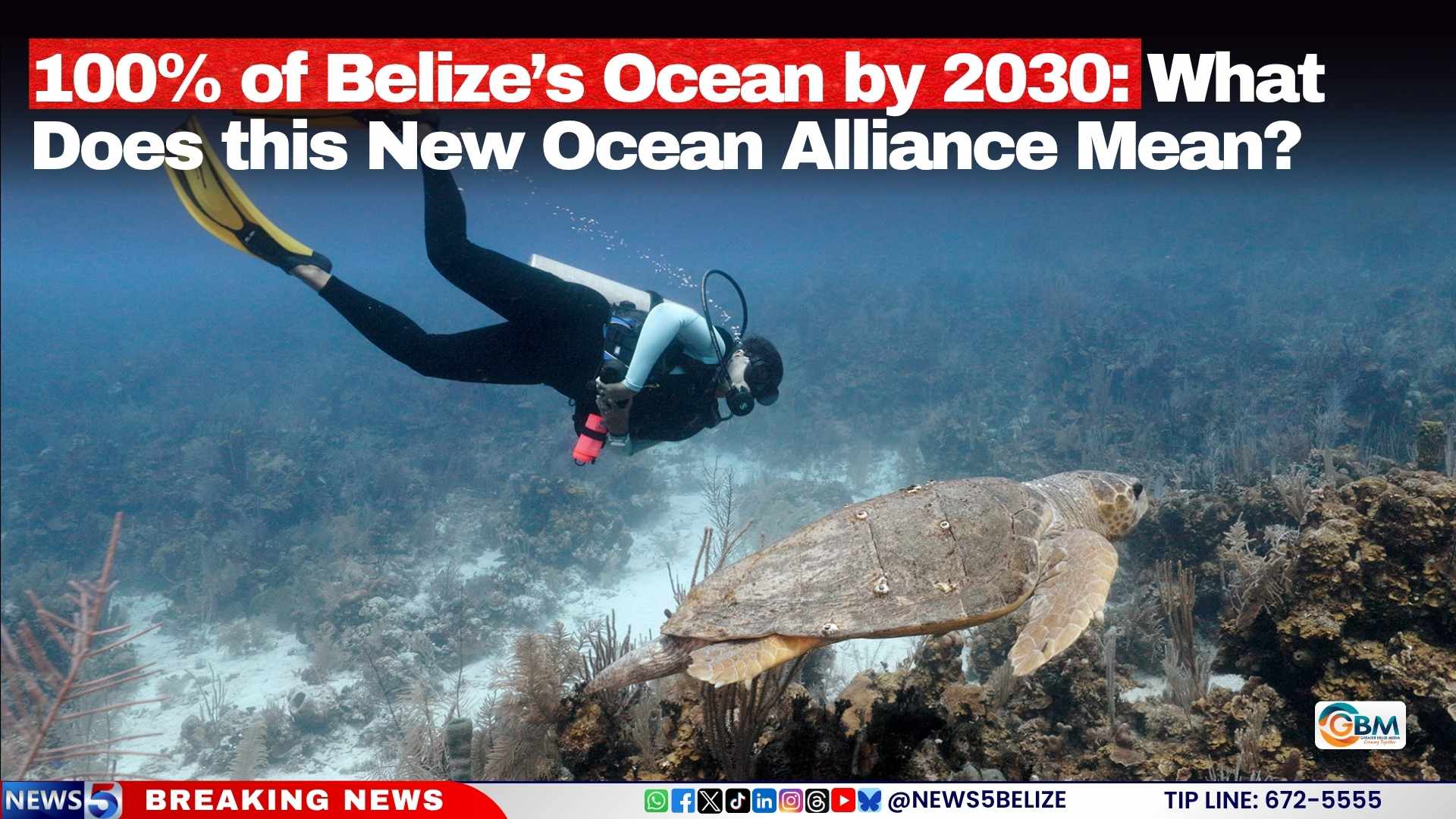
    In a landmark step for global marine conservation, the Central American nation of Belize has formally committed to sustainably managing 100% of its jurisdictional ocean territory by 2030, joining an expanding global alliance that now protects nearly two-fifths of the world’s national waters.

    The government announced its official membership in the 100% Alliance for Sustainable Ocean Management during a formal announcement on August 21, 2026. Coordinated by the World Resources Institute, the alliance works to secure binding political commitments from coastal and maritime nations to advance comprehensive, science-based sustainable ocean governance across all their national waters.

    Belize’s entrance into the alliance does not represent an entirely new policy direction, but rather a formal consolidation of years of existing marine conservation work already underway in the country. These pre-existing efforts include the national Belize Sustainable Ocean Plan, the country’s Blue Bonds conservation financing commitments, and ongoing marine spatial planning initiatives that map out sustainable use of different ocean zones.

    To support Belize’s work under the new alliance framework, the Inter-American Development Bank (IDB) has signed a formal cooperation agreement with the Belizean government to deliver targeted support for the country’s national ocean agenda. Under the terms of the agreement, IDB will provide specialized technical assistance to strengthen core foundational systems for Belize’s ocean conservation efforts, including policy development, marine data collection and analysis, governance structures, and sustainable financing frameworks. This support will directly advance the existing Sustainable Ocean Plan and enable the rollout of a broader, cross-sector National Oceans Programme.

    In an official statement following the announcement, Belize Prime Minister John Briceño emphasized that the alliance membership aligns with the country’s long-term priorities for both people and the environment. “Belize’s decision to join the 100% Alliance is about ensuring that every part of our ocean is managed with purpose, for our people, our economy, and future generations,” Briceño said. “It gives us an opportunity to bring our existing commitments and investments together under one national ocean vision, supported by strong science, clear planning, and sustainable financing.”

    The upcoming National Oceans Programme is designed to coordinate sustainable development and conservation priorities across key ocean-reliant sectors in Belize, including commercial and artisanal fisheries, coastal tourism, natural disaster and coastal erosion resilience, and marine pollution reduction. Beyond coordination, the programme will also position Belize to attract additional investment from public, private, and results-based financing sources to fund high-priority ocean conservation and sustainable development projects across the country.

    With Belize’s membership, the alliance now includes the 19 member states of the Ocean Panel, alongside fellow new entrants Colombia, Panama, and the Republic of Korea, bringing the total share of the world’s national waters covered by alliance commitments to 40 percent.

  • Rains and Indomet monitors three systems with cyclonic potential

    Rains and Indomet monitors three systems with cyclonic potential

    Santo Domingo, Dominican Republic – August 22, 2026 – The Dominican Institute of Meteorology (Indomet) has released a detailed daily weather forecast for the nation, outlining scattered rain events, thunderstorm activity, elevated temperature risks, and ongoing monitoring of potential tropical cyclone development across the Atlantic basin. According to the agency’s Saturday report, the day’s unstable weather conditions are driven by two key atmospheric factors: a slow-moving trough and daytime solar heating, which will combine to produce uneven precipitation across different regions of the country through the next 24 hours.

    Indomet’s forecast breaks down weather activity by time frame and geographic zone. In the morning hours, wind-driven cloud systems have already begun bringing isolated showers and thunderstorms to eastern and northern coastal towns including La Altagracia, La Romana, El Seibo, Higüey, and Samaná. After midday, the combined influence of the trough and increasing daytime heating will trigger greater cloud buildup, expanding the zone of active weather to the central, southern, and greater capital regions. San Pedro de Macorís, Monte Plata, San Cristóbal, La Vega, Monseñor Nouel, Azua, San Juan, Elías Piña, and all of Greater Santo Domingo can expect scattered heavy downpours, thunderstorms, and possible sudden wind gusts through the late afternoon, with activity tapering off as temperatures cool heading into the evening. Overnight and into early Sunday morning, scattered light to moderate showers are expected to persist across the country’s eastern and northeastern localities.

    Temperatures across the Dominican Republic will remain unusually high through the forecast period, with a heightened thermal sensation that poses mild health risks for vulnerable populations. To help residents stay safe, Indomet has issued a series of public health recommendations: maintain steady hydration by drinking water frequently, opt for light, loose-fitting, pale-colored clothing that reflects solar radiation, avoid prolonged unprotected exposure to direct sunlight, and prioritize staying in cool, well-ventilated spaces during the hottest parts of the day.

    In addition to land-based weather warnings, Indomet has released guidance for maritime activity along the country’s coastlines. On the Caribbean coast, specifically in waters south and southwest of Pedernales, abnormal wind and wave conditions have prompted the agency to urge operators of small, fragile, and medium-sized vessels to exercise extreme caution when operating near the shore and avoid venturing into open ocean. This precautionary advisory is expected to be lifted by late afternoon as weather conditions stabilize. All other sections of the Caribbean coast, as well as the entire Atlantic coast of the Dominican Republic, remain open to all navigation with no restrictions in place.

    Beyond the daily forecast, Indomet is currently monitoring multiple areas of potential tropical cyclone development across the Atlantic Ocean as part of its regular hurricane season monitoring program. The agency reports that a tropical wave is projected to emerge off the western coast of Africa early next week. Conditions are expected to be favorable for gradual organization after the system moves offshore, with current models indicating a 20% probability that the system will strengthen to tropical cyclone status within the next seven days. While the system remains hundreds of miles from the Dominican Republic at this stage, Indomet has emphasized that continuous monitoring of its track and intensification is critical for public safety planning.

    Indomet is also tracking two other disorganized weather systems across the eastern Atlantic, both of which carry very low odds of tropical cyclone development in the next 48 hours. The first system, located northeast of the Azores, has a 20% chance of organization, while the second, positioned east-southeast of Bermuda, has just a 10% probability of strengthening into a cyclone. The agency confirmed that neither of these systems poses any current threat to the Dominican Republic or its surrounding waters.

    To ensure the public has access to the most up-to-date weather information, Indomet is urging all residents to check for regular updates through its official web portal at www.indomet.gob.do, as well as its official social media channels @indometrd.