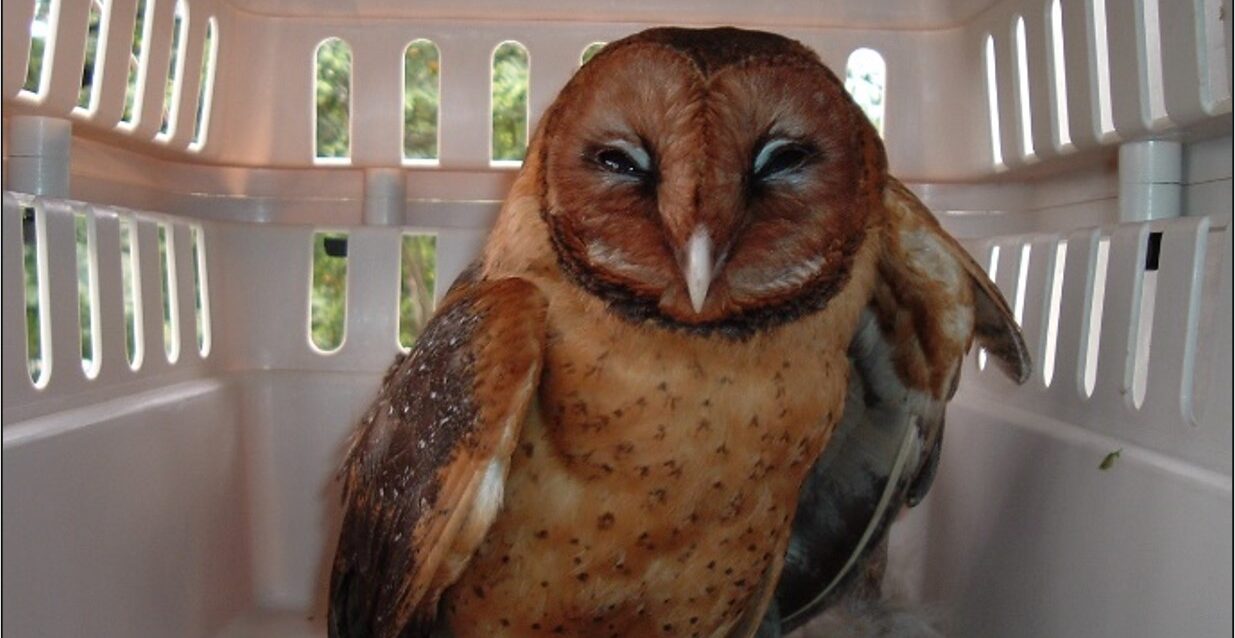
For generations of residents across the Caribbean island of Dominica, the local barn owl has been a familiar, if often nocturnal, presence. Many islanders have spotted the stealthy raptor roosting in local church buildings, caught a glimpse of its silent flight overhead, or woken to its distinctive screech after dark. Known by two traditional local names, the species is called *chawan* by Kwéyòl speakers, while communities in the Marigot and Wesley regions that speak Kòkòy refer to it as *jombie bòd*, or jumbie bird. As a permanent resident breeder, the owl lives and reproduces exclusively on the island year-round.\n\nAs a nocturnal apex predator, the Dominica barn owl hunts under cover of darkness, with an unusually broad diet that supports the island’s natural ecological balance. Its prey includes a wide range of species: small mammals such as rats and bats, large insects, lizards, and multiple bird species including seasonal migratory visitors. A decades-old field expedition to study the owl’s feeding habits offers clear evidence of this diverse diet. In the late 1990s, three researchers – retired Dominican forestry officer and lifelong bird enthusiast Bertrand ‘Dr. Birdy’ Jno. Baptiste, a French ornithologist based in Guadeloupe, and the original author of this report – climbed a rickety wooden ladder to access a long-standing owl nest inside the iconic steeple of the now-demolished Portsmouth Roman Catholic Church. By dissecting several regurgitated owl pellets collected from the nesting site, the team uncovered the preserved skeletons of bats, rats, large insects and multiple bird species, matching the expected dietary profile of the resident adult, which observed the group silently from its perch above throughout the research work.\n\nUntil recent taxonomic updates, the Dominica owl was classified as part of the widely distributed common barn owl species, *Tyto alba* – long labeled the most geographically widespread owl species on the planet. With a natural range spanning Africa, Asia, Australia, Europe and the Caribbean, and introduced populations on Oceanic islands brought in for rodent control, the species showed marked physical variation across different regions. Unlike common barn owls found across most of the world, which have a distinct white facial disc bordered by an orange ring and lighter overall plumage, owls native to the Lesser Antilles have dark brown feathers and a fully dark facial disc. These consistent physical differences led taxonomists to reclassify the Lesser Antilles population as a separate standalone species, renamed the Lesser Antilles barn owl with the scientific name *Tyto insularis*, restricted only to the Windward Islands of Grenada, St. Vincent, the Grenadines and Dominica.\n\nFurther detailed analysis of the Lesser Antilles barn owl population uncovered even more distinct differences between island groups. Researchers confirmed that the Dominica population has unique physical traits that set it apart from barn owls on the other Lesser Antillean islands. As a result, the Dominican population has now been reclassified as a unique endemic subspecies, with the new scientific designation *Tyto insularis nigrescens*, while populations on Grenada, St. Vincent and the Grenadines retain the classification *Tyto insularis insularis*.\n\nThis new classification adds *Chawan*, as the owl is locally known, to Dominica’s growing list of endemic bird species – animals found nowhere else on Earth other than the Nature Isle. It now joins the island’s iconic endemic Sisserou Parrot (*Amazona imperialis*), the Jaco Parrot (*Amazona arausiaca*), and the Kalinago Wren (*Troglodytes martinicensis*) as a unique biological treasure found only within Dominica’s borders.\n\nBeyond its new taxonomic status, there are several fascinating and little-known facts about this unique endemic raptor. Unlike many wild raptors that prefer undisturbed old-growth forest, some of Dominica’s barn owls favor man-made structures like church steeples and abandoned warehouses as roosting and nesting sites, bringing them into close proximity with local communities. The owls also occasionally compete with larger native bird species for prime nesting real estate: several years ago, one pair of owls took over a pre-existing tree cavity nest built by parrots in Mone Diablotin National Park’s rainforest, with the resident owl even resting outside the entrance to enjoy daylight views on occasion.\n\nLike all owls, the Dominican subspecies has a number of extraordinary biological traits. Newly hatched barn owl chicks are covered in pure white down, which is gradually replaced by signature dark brown plumage as they mature. All owls, including the Dominica barn owl, can rotate their heads nearly 270 degrees – three-quarters of a full rotation – an incredible anatomical adaptation that lets them survey their surroundings without moving their bodies.\n\nFor many local communities, the owl also carries deep cultural and superstitious meaning. A long-held local belief holds that if an owl’s screech is heard in a village or town, it signals the impending passing of an elderly resident in the area, tying the raptor closely to local folklore and traditions that have persisted for generations.
分类: science
-

Partial lunar eclipse will be visible across Dominican Republic tonight
Stargazers and astronomy enthusiasts across the Dominican Republic are marking their calendars for a striking celestial event in late August 2026, when a deep partial lunar eclipse will glide across the night sky, fully visible across the country if weather conditions cooperate. This astronomical showcase, which unfolds across the night of August 27 and into the early hours of August 28, will offer one of the most dramatic lunar events visible from the Caribbean nation in recent years.
The eclipse follows a clear, step-by-step timeline for viewers based in the capital city of Santo Domingo, with the first subtle phase of the event kicking off at 9:23 p.m. local time on August 27. This opening stage is the penumbral eclipse, when the Moon begins to enter Earth’s faint outer shadow, a change that is often barely perceptible to the untrained eye. Roughly an hour later, at 10:33 p.m. the same night, the partial eclipse officially begins: the Moon starts moving into Earth’s darkest, central shadow, called the umbra, creating a distinct, gradually growing dark bite across the lunar surface.
The peak of the event, known as maximum eclipse, is scheduled for 12:12 a.m. local time on August 28. At this exact moment, nearly 93% of the Moon’s entire diameter will be tucked inside Earth’s umbra, turning that portion of the lunar disk a deep, coppery red for observers. Following the peak, the partial eclipse concludes at 1:51 a.m., when the Moon exits the umbra, and the final penumbral phase wraps up entirely by 3:01 a.m.
In total, the full sequence of the eclipse from the start of the penumbral phase to the end stretches approximately 5 hours and 38 minutes, with the partial phase — the most visually striking portion of the event — lasting roughly 3 hours and 18 minutes. For viewers in Santo Domingo, the geometry of the event adds to its viewing appeal: at the time of maximum eclipse, the Moon will sit roughly 61 degrees above the horizon in the south-southeast direction, a position that creates ideal viewing conditions as long as skies remain clear of cloud cover.
While the Dominican Republic is positioned perfectly to watch the event, it is far from the only region with front-row seats. According to NASA data, the eclipse will also be visible across most of North America and South America, as well as portions of western Europe and western Africa. Astronomy groups across the Caribbean are already encouraging casual observers to head to locations with minimal light pollution to get the clearest view of the rare deep partial eclipse, which will bring a dramatic celestial display to skywatchers across the hemisphere.
-

2C12: A Cuban candidate against cancer
After years of targeted research focused on expanding local, accessible cancer treatment options, Cuban scientists at the island nation’s Center for Molecular Immunology (CIM) have announced that their novel immunotherapy candidate 2C12 is ready to enter its first clinical trial for patients with advanced melanoma. The announcement, shared officially via CIM’s public Facebook page on Monday, marks a key milestone for Cuba’s push toward domestic pharmaceutical sovereignty amid long-standing trade restrictions that limit access to costly imported cancer drugs.
Designed to function similarly to pembrolizumab, a widely used global immunotherapy that activates the body’s own immune system to attack malignant tumor cells, 2C12 was developed in response to two overlapping challenges: the exorbitant price tag of many cutting-edge cancer treatments on the international market, and Cuba’s constrained ability to import these life-saving medications due to the United States’ decades-long economic, commercial, and financial blockade. For Cuban patients and healthcare systems, the homegrown candidate offers a potential path to a more affordable, widely available alternative to currently inaccessible immunotherapies.
The first-phase clinical trial will enroll patients diagnosed with advanced melanoma, an aggressive form of skin cancer that has progressed to the point where surgical removal is no longer feasible or has spread to distant organs and tissues across the body. Multiple leading Cuban medical institutions will collaborate on the research, combining expertise from oncology centers across two provinces. In the capital city of Havana, teams from the National Institute of Oncology and Radiobiology and the Hermanos Ameijeiras Clinical Surgical Hospital will lead local trial operations, while the Dr. Celestino Hernández Robau Territorial University Oncology Hospital will oversee participant recruitment and care in Villa Clara province.
Patients or their family members interested in learning more about trial eligibility requirements and participation opportunities are directed to reach out directly to oncology specialists at the participating medical sites. For Cuban science, the advancement of 2C12 to clinical testing represents far more than a new potential cancer treatment: it is a tangible outcome of decades of investment in domestic biomedical research, and a major step forward in the country’s goal of building full sovereign capacity to develop and produce its own life-saving medications.
-
Search for Columbus-era shipwrecks off Puerto Plata enters decisive phase in 2027
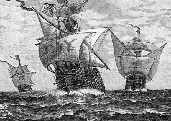
Decades of historical speculation about the fate of vessels from Christopher Columbus’s landmark voyages to the Americas will move toward a critical turning point in 2027, following initial underwater surveys that uncovered more than 40 unusual seabed features near La Isabela, on the northern coast of the Dominican Republic’s Puerto Plata province. These geophysical anomalies are considered strong candidates for submerged archaeological sites tied to early European exploration of the New World.
The multinational research initiative is a collaborative effort between UNESCO, the Dominican Republic government, and Spanish cultural institutions, centered on answering a longstanding historical question: do the remains of ships from Columbus’s 1493 second voyage to the Americas still lie preserved in the waters off La Isabela. La Isabela holds major historical significance as one of the first permanent European settlements established by Spanish colonizers in the Americas, making any associated shipwrecks extraordinarily valuable to scholars of early transatlantic history. Beyond vessels from the Columbus era, the project also holds potential to uncover lesser-studied shipwrecks spanning a 300-year period from the 1500s through the late 1700s.
Two preliminary geophysical survey missions carried out in 2024 and 2026 mapped the seabed and identified the 40 irregular features that do not match natural geological formations. Alejandro Gumá Ruiz, a culture officer specializing in underwater heritage at UNESCO, noted that while remote sensing has pinpointed promising sites, targeted excavation is the only way to confirm whether these anomalies are indeed man-made archaeological remains.
A joint working commission with representatives from UNESCO and Spain is scheduled to convene in early 2027 to finalize budget arrangements and confirm that sufficient funding is secured to launch the full excavation phase. If the work moves forward, researchers could uncover the remains of 16th and 17th century Spanish galleons and other vessels that played key roles in the early history of transatlantic trade and exploration.
All fieldwork and preservation efforts will adhere to the standards set out in the 2001 UNESCO Convention on the Protection of the Underwater Cultural Heritage, which mandates that submerged archaeological remains should be preserved in their original underwater location whenever possible, rather than being recovered and moved to museums. This framework prioritizes long-term conservation for future research, rather than extraction for display or private collection.
The project brings together a diverse team of international specialists from leading academic and research institutions across five countries: the Dominican Republic, Spain, Mexico, Argentina, and the United States. Beyond the archaeological insights, a major discovery of Columbus-era shipwrecks would also strengthen La Isabela’s bid to become the Dominican Republic’s second UNESCO World Heritage Site. The country’s first listing, the Colonial City of Santo Domingo, was added to the register in 1990.
Alongside advancing the exploration project, UNESCO issued a renewed warning about emerging threats to global underwater cultural heritage. The organization highlighted that human-caused climate change is accelerating the degradation of submerged archaeological sites, with ocean acidification eroding wooden and stone ship remains and more intense, frequent hurricanes disrupting seabed contexts and damaging fragile structures. UNESCO also emphasized the urgent need for stronger international legal frameworks to block unregulated treasure hunting that loots historical sites, as well as the development of more effective preservation strategies to protect vulnerable underwater heritage for future generations.
-
Dominica’s night sky set for a spectacular partial lunar eclipse on Friday
Stargazing enthusiasts across the Caribbean island of Dominica are gearing up for one of the most anticipated celestial events of 2026, a near-total partial lunar eclipse that will bring a striking Blood Moon display to local skies — provided weather conditions stay clear for the overnight show.
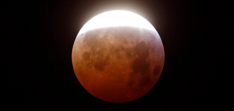
While astronomers classify the event as a partial lunar eclipse, it will come remarkably close to a full total eclipse when viewed from Dominica. At the peak of the spectacle, roughly 93.9% of the Moon’s full disk will be covered by Earth’s darkest, central shadow, the umbra, creating a visual almost indistinguishable from a total eclipse for casual observers.
The event will unfold in stages across the night of Thursday, August 27 and into the early hours of Friday, August 28. The first subtle phase, known as the penumbral eclipse, kicks off at 9:23 PM local time on August 27, when the Moon begins sliding into Earth’s faint outer shadow. This initial phase is often hard to spot with the naked eye, but the show becomes unmistakable starting at 10:33 PM, when the Moon first touches the darker umbra. From that point onward, observers can watch as Earth’s curved shadow slowly creeps across the lunar surface.
The highlight of the night, maximum eclipse, arrives at exactly 12:12 AM on August 28. This is when the coverage of the Moon hits its 93.9% peak, and the full effect of the rare coloring becomes visible. The eclipsed portion of the Moon will take on a deep, dramatic reddish, copper, or crimson hue — a phenomenon popularly called a Blood Moon.
This iconic red coloring is not a random coincidence: according to NASA, it forms as sunlight passes through Earth’s atmosphere before reaching the lunar surface. Shorter blue wavelengths of light scatter out as they move through the atmosphere, while longer red and orange wavelengths bend through the air and are redirected onto the eclipsed Moon, creating the characteristic Blood Moon glow.
After the maximum peak, the shadow begins to retreat. The partial eclipse phase concludes at 1:51 AM, with the Moon leaving the umbra, and the final faint penumbral phase wraps up entirely by 3:01 AM.
Unlike the dangerous solar eclipses that require special protective gear to view safely, this lunar event is completely accessible to all skywatchers. No specialized optical equipment is needed to enjoy the main display; the eclipse is perfectly safe to view with the naked eye, meaning anyone can step outside at the right time and look toward the Moon to see the spectacle. Those with binoculars or a small telescope will be able to make out finer details of the shadow’s edge and the gradient of colors across the Moon’s face, but even unassisted viewing will deliver a stunning show for those lucky enough to have clear skies.
Local astronomy groups and skywatching enthusiasts are already encouraging residents and visitors to mark their calendars for the event, noting that near-total partial eclipses of this magnitude are relatively rare occurrences for any given location.
-

China stelt lancering Chang’e-7-maanmissie uit, jacht op waterijs op pauze
China has announced a last-minute delay to its highly anticipated Chang’e-7 lunar mission, a groundbreaking unmanned expedition targeted at the moon’s south pole that aimed to detect and study buried water ice deposits. The mission, originally scheduled for launch within the next few days from the Wenchang Space Launch Center on China’s southern island province of Hainan, was called off after Chinese space authorities determined the probe failed to meet pre-launch technical requirements.
In a brief statement released Sunday, the China National Space Administration confirmed that the mission will not proceed within its originally planned launch window this year. The decision followed a comprehensive technical evaluation conducted under the core guiding principles of caution, reliability, and a commitment to ensuring absolute mission success. No further details have been provided on the specific issues that prompted the delay, and no revised launch date has been announced to date.
As the seventh mission in China’s expanding Chang’e lunar exploration program, Chang’e-7 is widely regarded as the most technologically sophisticated unmanned lunar mission the country has ever developed. The multi-component mission consists of four separate craft: an orbiter that will circle the moon, a main lander, a wheeled rover, and an innovative small flying robot capable of crawling, jumping, and hovering across challenging lunar terrain. Its primary objective is to touch down in the permanently shadowed craters that dot the moon’s south pole, a remote region where planetary scientists suspect large, viable deposits of water ice have been preserved over billions of years.
The discovery and characterization of lunar water ice carries enormous strategic and scientific value for future human deep space exploration. These deposits could be processed to produce drinking water, breathable oxygen, and even rocket propellant — resources that are critical to establishing a long-term permanent human outpost on the moon. This potential has turned the lunar south pole into the epicenter of a new global space race, led primarily by China and the United States. While the U.S. has deployed multiple probes targeting the region, no mission to date has successfully completed core sampling and verification of accessible water ice deposits.
Prior to the delay announcement, experts noted that Chang’e-7 was positioned to become the first mission to achieve this historic milestone, and the postponement could temporarily shift the dynamics of the ongoing global lunar competition. “With Chang’e-7, China’s lunar program is shifting from pure exploration to a focus on resource utilization,” Yuqi Qian, a lunar geologist at the University of Hong Kong, previously told CNN. The mission was expected to deliver definitive answers on whether the lunar south pole holds enough usable water ice to support future human activities, marking a key step forward in global lunar research.
China’s lunar program takes its name from Chang’e, the traditional Chinese moon goddess. The program’s most recent prior mission, Chang’e-6, made global history in 2024 as the first probe ever to return rock and soil samples from the far side of the moon, a feat that demonstrated China’s growing advanced deep space exploration capabilities. As of now, the timeline for Chang’e-7’s new launch date remains unclear.
-

Onderzoek: Visafval kan grondstof worden voor visolie en kippenvoer
Across Suriname’s thriving fishing industry, large volumes of fish byproducts — including heads, fins, bones, scales, offal, and unwanted bycatch — have long been treated as valueless waste, discarded in landfills or dumped at sea. This widespread practice not only squanders potentially useful organic material packed with proteins, fats, and minerals but also creates unnecessary environmental pressure. Now, a new undergraduate study from Anton de Kom University of Suriname (AdeKUS) has uncovered a practical, sustainable path to repurposing this discarded material into high-value products: crude fish oil and nutrient-adequate starter feed for broiler chickens.
The research was completed by Mukhlis Karsodjojo, who earned his Bachelor of Science in Agricultural Production with a specialization in Agroprocessing from the university’s Faculty of Technological Sciences on August 17. Karsodjojo’s core research objective was to identify ways to unlock greater economic value from the residual waste streams generated by Suriname’s domestic fishing sector, turning a widespread disposal problem into a usable local resource.
To test viable approaches for extracting fish oil from fish waste, Karsodjojo evaluated two eco-friendly extraction methods: wet rendering and enzymatic hydrolysis, testing both on waste from a single fish species and mixed-species waste residues. Both methods successfully produced usable crude fish oil, which the study assessed across key metrics including total yield, color, odor, and mineral oil contamination. The analysis found that enzymatic hydrolysis delivered a significantly higher oil output than wet rendering, marking it as the more efficient and effective green extraction method for small-scale local operations.
In the second phase of the study, Karsodjojo explored integrating processed fish waste into starter feed for young broiler chickens. He developed custom feed formulations that combined processed fish byproducts with locally available Surinamese ingredients, then tested the nutritional content of these blends, measuring moisture, ash, protein, fat, and carbohydrate levels. When compared to mass-produced commercial starter feed currently sold in Suriname, the custom blends met all requirements for adequate nutrient content, proving the concept’s nutritional viability.
While the research confirms the technical feasibility of this circular economy approach, it also highlights a key remaining barrier to widespread adoption: on small production scales, the cost of manufacturing the custom fish-based starter feed currently exceeds the price of standard commercial alternatives. Despite this economic challenge, the study emphasizes that the approach delivers meaningful systemic benefits: it reduces total waste volumes, cuts reliance on imported feed ingredients by leveraging local raw materials, and creates new economic value from material that would otherwise be discarded entirely.
Karsodjojo’s work concludes that Suriname has significant untapped potential to utilize fish byproducts more sustainably, but notes that further research is still needed. Future studies should focus on developing effective refining methods for the crude fish oil extracted from waste, and on identifying process adjustments to lower production costs for the chicken starter feed to make it competitive with commercial options. The research was supervised and reviewed by a team of academic advisors including dr. ir. F. van Genderen, dr. A. Kent, ing. S. Moeljoredjo, M. Jaggan, and prof. L. Ori.
-

Government supports INTEC and AI Robotix Alzheimer’s research project
In a major push for advanced neurodegenerative disease research in the Caribbean, the government of the Dominican Republic has announced its formal backing for an ambitious Alzheimer’s research project led by two domestic institutions: the Technological Institute of Santo Domingo (INTEC) and AI technology firm AI Robotix. Merging expertise across four cutting-edge fields—artificial intelligence, neuroscience, molecular biology, and data science—the initiative aims to unlock groundbreaking new strategies for the early detection, prevention, and therapeutic intervention of Alzheimer’s, a progressive neurodegenerative condition that affects millions of people globally.
The collaborative project was officially presented to top Dominican government leaders last week during a closed-door meeting held at the National Palace in Santo Domingo. Attendees included President Luis Abinader, Vice President Raquel Peña, and José Ignacio Paliza, Minister of the Presidency. Leading the presentation were Arturo El Villar, rector of INTEC, and Juan Carlos Guilbe, chief executive officer of AI Robotix, who outlined the project’s core objectives and long-term impact potential for both the Dominican Republic and global Alzheimer’s research.
At the core of the project is the application of sophisticated artificial intelligence models, which are designed to process and analyze massive datasets of existing scientific and biomedical research findings. Unlike traditional research methods that require researchers to manually sort through thousands of studies, the AI system can identify subtle, previously unrecognized patterns across disparate datasets and generate evidence-based new hypotheses. These generated hypotheses will then serve as guiding frameworks for future clinical and basic science research into Alzheimer’s treatments, potentially accelerating the pace of discovery dramatically.
The initiative has assembled a diverse team of both domestic and international experts to advance its work, bringing together interdisciplinary perspectives that are rarely combined in traditional Alzheimer’s research. Among the leading global specialists joining the team is Ricardo Allegri, a prominent Argentine neurologist and psychiatrist with decades of acclaimed work in neuroscience and Alzheimer’s research. He will collaborate alongside local lead researcher Manuel Colomé, a professor at INTEC, as well as a cohort of specialized experts in artificial intelligence, molecular biology, and data science from institutions across the region and beyond.
Per statements from INTEC, the project carries far-reaching implications beyond the search for new Alzheimer’s tools and treatments. Institutional leaders noted that the successful execution of the initiative could establish the Dominican Republic as a leading regional hub for high-impact scientific research, technological innovation, and advanced translational health research. Most notably, the project is designed to serve as a global proof of concept, demonstrating how cross-sector collaboration, interdisciplinary expertise, and artificial intelligence can be leveraged to tackle some of the most pressing unmet global health challenges of the 21st century.
-

Can Man’s Best Friend Read Your Mood? Science Says Yes!
For centuries, dog owners have anecdotally claimed their four-legged companions can sense when they are happy, upset, or distressed. Now, a groundbreaking 2026 study from the University of Vienna has turned this common observation into hard scientific evidence, confirming that dogs’ brains process and differentiate between distinct human emotional states in measurable ways.
Led by researchers Laura Cuaya and Raúl Hernández-Pérez, the investigation used advanced machine learning algorithms to analyze full-brain functional scans of domestic dogs as the animals viewed images of human faces displaying four core emotions: happiness, anger, fear, and sadness. What the team found offers unprecedented insight into the canine social brain: regions of the dogs’ brains tied to higher-order cognitive function and reward processing only activated when the animals were shown images of happy human faces.
The research also confirmed that dogs can successfully distinguish between different categories of negative human emotion. While negative expressions did not spark activity in the brain’s reward centers, separate, distinct neural activation patterns emerged for fear, anger, and sadness — providing direct neurological proof that dogs do not lump all negative human moods together.
Cuaya and Hernández-Pérez attribute this ability to thousands of years of domestication. Over generations of coexisting alongside humans, dogs’ brains have undergone evolutionary changes that fine-tuned their social cognitive skills to understand and cooperate with people. For domestic dogs, a human smile is not just a random facial gesture: it acts as a direct, biologically encoded reward, the study concludes.
To assemble their study cohort, the researchers recruited well-behaved pet dogs from local parks, adding two of their own border collies, named Odín and Kun-kun, to the participant group. The team was transparent about key limitations of their work: the overall sample size remained small, dogs were shown static photographs rather than dynamic, in-person facial expressions, and all participants came from nurturing home environments, meaning results may not apply to dogs with different life backgrounds.
This research is part of a broader, ongoing program of study focused on how canines interpret human communication and behavior. Moving forward, the research team plans to expand their work to explore how dogs integrate multiple signals — facial expressions, body language, vocal intonation, and even human scent — to build a complete understanding of the people around them.
-

Hundreds of Shooting Stars to Be Visible From Antigua and Barbuda Tonight
Stargazers across Antigua and Barbuda are preparing for a rare chance to witness one of the most spectacular annual celestial events, as the Perseid meteor shower reaches its peak activity overnight between Wednesday and early Thursday.
Astronomy experts have outlined a clear window for optimal viewing, noting that the best opportunity to spot shooting stars will fall between 2 a.m. and dawn on Thursday, with the highest frequency of meteors projected to occur between 3 a.m. and 5 a.m. This prime window is only accessible if atmospheric conditions stay clear of heavy cloud cover, forecasters add.
For new and experienced observers alike, simple preparation can drastically improve the viewing experience. Aspiring sky-watchers are advised to seek out a remote, dark spot far from the glow of urban streetlights and artificial light pollution. While viewers should initially orient themselves toward the northeastern sky to align with the shower’s radiant point, Perseid meteors can appear in any part of the overhead sky, so experts recommend keeping a broad, open gaze rather than focusing on a single small area.
Unlike many deep-space celestial events, the Perseid meteor shower requires no specialized optical equipment such as binoculars or telescopes to enjoy. In fact, using such gear can narrow the field of view and reduce the chance of catching meteors. Observers are also reminded to put away mobile phones and other glowing screens at least 20 minutes before beginning their viewing session, as this gives human eyes time to fully adjust to low-light conditions and become sensitive to the faint streaks of fast-moving meteors.
This year’s shower comes with an unusual advantage for sky-watchers: the peak of Perseid activity aligns perfectly with a new moon. A new moon produces virtually no moonlight, eliminating the single largest source of natural light interference that often obscures fainter meteors in other years. This alignment creates what experts call near-ideal conditions for viewing across Antigua and Barbuda.
The Perseid meteor shower is a recurring annual event, triggered when Earth’s orbit carries it through the trail of icy debris and dust left behind by the periodic comet 109P/Swift-Tuttle. As small particles from the comet’s trail enter Earth’s upper atmosphere at speeds of more than 130,000 miles per hour, they vaporize due to friction, creating the bright, glowing streaks that people know as shooting stars.
Under perfectly dark, clear sky conditions, astronomers estimate that up to 100 meteors per hour can be spotted during the Perseid peak. However, the actual number visible to observers in Antigua and Barbuda this year will still depend on local factors including cloud cover, the level of nearby light pollution, and how far a viewing site is from urban development.