分类: science

  • Dominican Republic hosts 31st International Congress of Caribbean Archaeology

    Dominican Republic hosts 31st International Congress of Caribbean Archaeology

    SANTO DOMINGO – The Caribbean’s most prominent academic gathering focused on unlocking the history of the region’s Indigenous societies and centuries of colonial rule has officially opened its doors in the Dominican Republic, with the 31st International Congress of Caribbean Archaeology (IACA/AIAC) kicking off in the capital city of Santo Domingo.

    Running through July 18 in Santo Domingo’s iconic Colonial City district, the week-long event has drawn 237 archaeological specialists from 23 countries and territories around the world. The congress serves as a platform for these scholars to share groundbreaking new findings, debate evolving interpretations of the Caribbean’s pre-Columbian societies and viceregal era, and foster cross-border collaboration. All core academic sessions are being hosted at the auditorium of the Dominican Telecommunications Institute (Indotel) Cultural Center.

    The 2024 congress is organized by the Academy of Sciences of the Dominican Republic, in formal partnership with four leading regional cultural and research institutions: the García Arévalo Foundation, Centro León, the Guahayona Institute, and the Casa del Cordón Taíno Cultural Center. Additional institutional and financial support comes from a wide network of public and private entities, including the Dominican Ministry of Culture, Vice Ministry of Cultural Heritage, General Directorate of Museums, the Central Bank of the Dominican Republic, and Banco Popular, among other cultural organizations.

    The academic program is structured across 15 specialized thematic symposia, featuring a total of 97 individual presentations that showcase cutting-edge methodological advances in the field. Research topics span a diverse range of modern archaeological techniques, from ancient DNA sequencing and isotopic analysis to starch grain studies, archaeozoology, archaeobotany, underwater archaeology, and digital heritage documentation using photogrammetry and 3D modeling. Participating researchers hail from many of the world’s top academic and research institutions, including Harvard University, the Max Planck Institute for Evolutionary Anthropology, the University of Copenhagen, the University of Minnesota, and Leiden University, bringing diverse global expertise to the regional conversation.

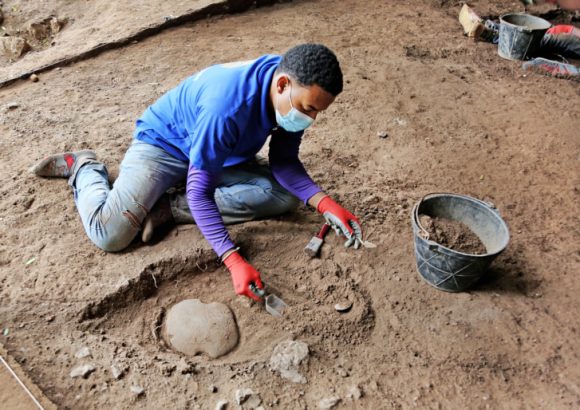
    Beyond formal lecture hall sessions, the congress has planned a full slate of complementary cultural and field-based activities for attendees throughout the week. These include public academic lectures hosted at the Academy of Sciences of the Dominican Republic, guided tours of the Museum of Underwater Archaeology, a hands-on skills workshop at Centro León in the city of Santiago, and a guided on-site archaeological survey at prehistoric sites located within the Cabo Samaná Natural Monument.

    Event organizers emphasized that hosting the congress carries broader strategic and cultural significance for the Dominican Republic. Beyond providing a space for scientific exchange, the gathering strengthens the country’s position as a leading regional hub for archaeological research and international collaborative work, while also raising global awareness of the need to preserve and study the Caribbean’s extraordinarily diverse and understudied cultural heritage.

  • UWI confirms Venezuela quakes caused Cedros coastline rise

    UWI confirms Venezuela quakes caused Cedros coastline rise

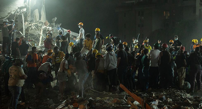
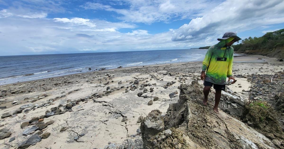
    Two of the deadliest earthquakes to hit northern Venezuela in recent memory have left a visible geological mark more than 300 miles away on the southwestern coast of Trinidad, researchers from The University of the West Indies (UWI) Seismic Research Centre (SRC) have confirmed in their first official assessment of the unusual coastal shift. The back-to-back magnitude 7.2 and 7.5 quakes that struck Venezuela last month have killed more than 2,000 people, displaced thousands more as homeless, and left hundreds unaccounted for, with search and rescue operations still ongoing in the hardest-hit La Guaira State. Just days after the large seismic event, residents of Cedros’ Galfa coastline reported a shocking transformation: large stretches of shoreline had lifted nearly instantaneously, leaving hundreds of stranded sea creatures trapped between new rock formations and exposing new sections of previously submerged land.

    Initial on-site observations by geologist Xavier Moonan put the maximum elevation gain from the sudden uplift at roughly 20 feet. Moonan also noted unusual natural oil seeps bubbling up through new shallow rippling pools formed by the shifted terrain. In its preliminary analysis released this week, the UWI SRC confirmed that the extreme coastal movement was directly triggered by energy from the Venezuelan twin earthquakes, drawing a parallel to similar geological fracturing that followed a large 6.9 magnitude quake near Trinidad in 2018.

    Trinidad’s southern coast sits atop a major east-west geological formation called the Southern anticline, a folded rock system crisscrossed by active faults, the SRC explained. This structure creates a linear geological corridor along the south coast that allows pressurized water, oil, and gas trapped deep below the surface by tectonic plate movement to rise toward the crust, resulting in a dense concentration of mud volcanoes across the region.

    Mud volcano formations are defined by fluid-saturated substrate close to the surface, which gives the surrounding ground very low shear wave velocities. Because shear waves—one of the primary types of seismic energy generated by earthquakes—travel far slower through softer, less compact rock and sediment, these geologically unique areas become far more sensitive to shaking from large distant earthquakes, the research team noted.

    The two Venezuelan quakes occurred along the same interconnected fault system, shared nearly identical focal mechanisms, and struck within minutes of one another, meaning they can effectively be treated as a single massive seismic event that produced more than 10 minutes of continuous shaking across the region. Testing at the L’Envieuse mud volcano near Icacos, just west of Cedros, found the natural fundamental vibration frequency of the local geology before the quake was exactly half the frequency of the seismic waves from the Venezuelan earthquakes. This resonance effect amplified the shaking energy, reactivating subterranean mudflows and triggering the sudden coastal uplift seen in Galfa.

    “These unique geological responses are to be expected on Trinidad’s south coast and other regions with similar geology after large magnitude seismic events,” the SRC assessment noted. “As such, targeted efforts must be made to mitigate future risk to lives and livelihoods located in these geologically susceptible areas.” The center plans to release a full, comprehensive report after completing additional on-site testing and data analysis.

    This is not the first time large seismic activity has triggered extreme coastal and land movement in Cedros. In August 2018, a 6.9 magnitude quake centered off Trinidad’s coast caused widespread infrastructural damage across the island, with tremors felt as far away as Barbados, Guyana, St Lucia, and Venezuela. In Cedros, the shaking fractured large sections of land, crumpled key roadways, and cut off dozens of farmers participating in a local food production project from their agricultural plots in the Los Iros area. Farmers reported massive ground cracks that swallowed farming equipment, destroyed crop fields and livestock storage structures, and drained local ponds. Just one year ago, renewed activity at the nearby Los Iros mud volcano triggered a similar coastal uplift at the local beach, pushing some sections of shoreline up as long as 20 feet. That event left key agricultural routes impassable during peak farming season and caused thousands of dollars in lost crop and infrastructure damage for local producers, according to on-the-ground reports from environmental activists and farmers.

  • PUCMM study finds building materials and vegetation drive urban heat in Bayahibe

    PUCMM study finds building materials and vegetation drive urban heat in Bayahibe

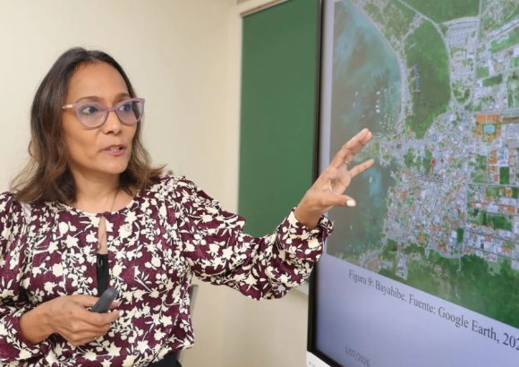
    In the Dominican Republic coastal community of Bayahibe, a groundbreaking academic study from the Pontifical Catholic University Madre y Maestra (PUCMM) has uncovered clear causal connections between localized urban temperature fluctuations and three key urban design factors: construction materials, exterior building colors, and the density of green vegetation across the city. This investigation, which focuses on the well-documented Urban Heat Island (UHI) effect – a common environmental phenomenon where developed urban zones register consistently higher temperatures than their undeveloped rural peripheries – was formally unveiled to the global scientific community during the 21st International Congress of Scientific Research, hosted by the Dominican Republic’s Ministry of Higher Education, Science and Technology (MESCyT).

    To reach their evidence-based conclusions, the PUCMM research team conducted on-the-ground temperature and infrastructure surveys across 24 distinct city blocks, collecting granular data from 355 individual buildings to map how different urban features shape local heat levels. Their analysis confirmed that urban districts dominated by heat-absorbent materials including asphalt, concrete, and zinc roofing, paired with sparse tree coverage, recorded the highest peak and average temperatures in the entire study area. By comparison, residential neighborhoods with extensive tree planting and large expanses of permeable, water-absorbent ground surfaces stayed significantly cooler throughout the study period, even during peak midday heat. The team also added nuanced findings about building design: light-colored exterior facades, most notably pure white coatings, reflect far more incoming solar radiation away from building structures, preventing excess heat from building up in urban surfaces and air. Darker facade pigments, by contrast, trap solar energy, driving up both surface and ambient air temperatures across surrounding blocks.

    The study’s authors issued a urgent warning about the growing risks of the UHI effect for small coastal Caribbean cities like Bayahibe, which already face overlapping climate hazards including accelerating sea level rise, increasing ocean warming, and more frequent, more intense extreme heat events driven by global climate change. To mitigate these rising risks, the research team put forward a set of actionable, accessible policy and design recommendations: expanding the total area of urban green space and street tree planting city-wide, switching to high-reflectance construction materials for new development and retrofits, and investing in shaded public gathering spaces to protect vulnerable communities from extreme heat. These changes, the authors note, would not only improve public thermal comfort and reduce heat-related health risks but also cut overall city energy consumption for air conditioning, creating secondary environmental and economic benefits for local residents.

  • Dominican Republic to join Beata Submarine Ridge expedition

    Dominican Republic to join Beata Submarine Ridge expedition

    In a major step forward for Caribbean marine conservation, the Dominican Republic’s Ministry of Environment and Natural Resources has announced it will participate in a groundbreaking international scientific expedition set for 2028. The mission will focus on the Beata Submarine Ridge, a unique deep-sea geological formation and ecosystem that lies in shared territorial waters between the Dominican Republic and neighboring Colombia.

    The entire expedition will be hosted aboard REV Ocean, the world’s largest purpose-built ocean research vessel, which is equipped with cutting-edge instrumentation for deep-ocean exploration that far outpaces many standard research vessels. Collaborating teams of scientists from both the Dominican Republic and Colombia will lead on-site investigations into three core areas: deep-sea biodiversity, dynamic oceanographic processes, and the structure of fragile underwater habitats across the ridge.

    To build a holistic understanding of this understudied ecosystem, the research team will deploy advanced sampling techniques to collect a wide range of critical data. This includes sequencing environmental DNA to map hidden species populations, measuring the prevalence of microplastic pollution in a remote deep-sea environment, and analyzing ecological connectivity between the ridge and surrounding shallow marine habitats.

    Per the Dominican Ministry of Environment, the data and insights generated by this expedition will directly inform evidence-based conservation planning for the Orlando Jorge Mera Marine Sanctuary and other established protected marine areas across the country’s Caribbean coast. This work also aligns with the global 30×30 conservation initiative, a widely adopted international target that aims to place at least 30% of the world’s oceans under effective protection by 2030.

    Dominican government officials emphasized that the participation in this cross-border scientific mission highlights the nation’s ongoing commitment to advancing marine biodiversity research and advancing sustainable, collaborative ocean management across the Caribbean region.

  • Seismic activity is being monitored in the Dominican Republic due to the historical frequency of large earthquakes.

    Seismic activity is being monitored in the Dominican Republic due to the historical frequency of large earthquakes.

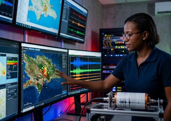
    Located on the tectonic boundary between the North American and Caribbean plates, the Dominican Republic has long stood as one of the most seismically vulnerable nations in the Caribbean. Now, leading seismic engineering researchers are expanding targeted monitoring initiatives across the country’s two most dangerous active fault lines to better understand earthquake patterns and strengthen disaster risk preparedness.

    Claudia Germoso, a seismic engineer and research professor at the Technological Institute of Santo Domingo (INTEC), explains that geological records show large earthquakes in the region tend to strike roughly every 50 years on average. This historical pattern has kept the country’s seismological community on high alert, even as specialists universally acknowledge that precise earthquake prediction remains beyond current scientific capabilities.

    The Dominican Republic’s history of catastrophic seismic events underscores the urgency of this work. In August 1946, the island of Hispaniola (which the Dominican Republic shares with Haiti) was hit by the largest earthquake recorded in its instrumental seismic history, an event documented by the National Center of Seismology of the Autonomous University of Santo Domingo (CNS-UASD) that set a benchmark for the nation’s disaster risk planning.

    Currently, the highest priority for monitoring efforts is the Septentrional fault, a major strike-slip geological fracture running through the Dominican Republic’s northern region. Stretching from the coastal town of Montecristi across the Cibao Valley, through Samaná Bay, and out into the Atlantic Ocean, this horizontal slip fault is classified as the country’s most seismically hazardous geological structure. As part of a new dedicated monitoring project, research teams have begun installing a network of specialized seismic sensors along the fault’s full length. These sensors will capture granular data on small-scale seismic activity, allowing scientists to build a far more detailed picture of how the fault behaves under tectonic pressure. Germoso notes that the deployed monitoring stations are already delivering more accurate recordings of seismic activity, significantly strengthening geological risk assessments for the northern region.

    Monitoring efforts are not limited to the north, however. Researchers are also keeping close watch on the Enriquillo-Plantain Garden fault, the country’s second major high-risk fault line located in southern Hispaniola. This strike-slip fault stretches from Jamaica across southern Haiti and into southwestern Dominican Republic, running along the edge of the Sierra de Bahoruco before extending into the Caribbean Sea. The fault gained global attention in 2010, when it generated a magnitude 7.0 earthquake that killed more than 300,000 people and left widespread destruction across Haiti’s capital Port-au-Prince, cementing its reputation as a major tectonic threat.

    For planning and construction purposes, the Dominican Republic’s current national seismic code divides the country into two zones: high seismic hazard and moderate seismic hazard, a classification that guides building safety standards across all regions. Germoso emphasizes that continuous investment in scientific monitoring of both major active faults is critical to improving the nation’s understanding of regional seismic activity, and ultimately to more effective disaster risk management that saves lives and protects infrastructure.

    For context, seismic faults are fractures in the Earth’s crust where blocks of crustal rock have shifted relative to one another, driven by constant tectonic plate movement. When stress along these fractures builds up over decades and is suddenly released, the energy release generates the shaking associated with earthquakes and tremors. Both the Septentrional and Enriquillo faults form part of the larger boundary between the North American and Caribbean plates, whose ongoing horizontal movement generates nearly all of the Dominican Republic’s seismic activity.

  • 88% of the sand on beaches attractive to tourism in the Dominican Republic comes from marine organisms

    88% of the sand on beaches attractive to tourism in the Dominican Republic comes from marine organisms

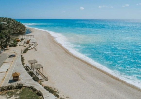
    A groundbreaking new study led by researchers from the Technological Institute of Santo Domingo (INTEC) has upended long-held assumptions about the origin of sand on the Dominican Republic’s most popular tourist beaches, finding that nearly 90% of the sand is made up of fossilized remains of marine organisms rather than geologically derived sediment.

    Conducted by INTEC’s Nanotechnology Laboratory under the leadership of chemical physics professor Dr. Melvin Arias, the research analyzed sand samples from eight of the country’s top coastal tourist destinations: El Morro, Dorada, El Portillo, Bibijagua, Isla Saona, Guayacanes, Punta Salinas, and Bahía de las Águilas. The team’s structural analysis confirmed that 88% of sand across these sites is produced by what researchers call natural marine “carbonate factories” — formations built from the accumulated skeletons of dead corals, red algae, and mollusks.

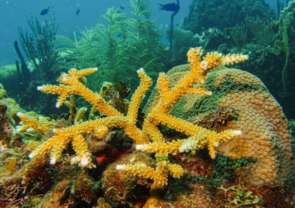
    This discovery carries major implications for coastal conservation, as it confirms that the physical stability of the Dominican Republic’s coastlines and their ability to resist erosion depend entirely on the health of nearby coral reef ecosystems, not gradual geological processes. The study warns that any damage to these marine habitats, whether from pollution, excessive land runoff, or more frequent extreme weather events driven by climate change, would halt the natural production of new sand. Without this continuous natural replenishment, coastal erosion would accelerate dramatically, leading to permanent loss of coastal land that forms the foundation of the country’s $10 billion tourism industry.

    Beyond erosion risk, the study explains the unique visual appeal that draws millions of visitors to Dominican beaches each year: the high concentration of biological carbonate material is what gives the sand its signature pale color and fine, soft texture — the key aesthetic and commercial selling point for the country’s coastal hotel zones. Researchers also noted that poor coastal management practices, such as the common practice of burying sargassum seaweed directly on beaches, already threaten this ecosystem by altering sand’s natural chemical composition and pH balance.

    Over the long term, researchers explain, gradual changes to sand composition paired with ongoing coral reef degradation will break the natural cycle of marine sediment replenishment, undermining the geomorphological stability of entire coastlines. One of the most valuable contributions of the new research is the creation of the first comprehensive mineralogical baseline for Dominican beaches. This dataset will now allow the Dominican National Geological Survey and environmental management agencies to track the rate of coastal erosion over time by comparing modern sand chemical composition against future measurements.

    The study also yielded reassuring findings for tourist and environmental health: rigorous physicochemical testing confirmed the complete absence of toxic heavy metals including lead, arsenic, chromium, nickel, and cobalt across all eight studied beach sites. At Bahía de las Águilas, where 87.8% of sand is made of coral-derived aragonite, researchers documented the presence of diatoms — a sensitive species of microalgae that acts as a natural bioindicator of water quality. Their presence confirms the beach remains entirely free of pollution, a major win for conservation efforts in the protected coastal area.

    The research also highlighted rare exceptions to the biological sand origin rule, driven by geological processes. Punta Salinas in the Peravia province breaks the national trend: its sand is formed from volcanic rock fragments (quartz and magnetite) carried downstream from inland mountains by the Ocoa, Baní, and Nizao rivers. Similarly, the distinct reddish hue of sand at El Morro in Monte Cristi can be traced directly to erosion of the area’s iron-rich coastal cliffs.

    The multi-institutional research project, which included contributions from researchers at the Autonomous University of Santo Domingo, the University of Calabria, and the University of Puerto Rico, has been published in the peer-reviewed *Journal of Coastal Research* to share its findings with coastal scientists and managers around the world.

  • UWI urges preparedness after major Venezuela earthquakes

    UWI urges preparedness after major Venezuela earthquakes

    On Wednesday, two massive earthquakes, measuring magnitude 7.2 and 7.5 respectively, struck Venezuela just 39 seconds apart — the strongest seismic events the country has recorded in more than 125 years. By Friday, the United Nations confirmed the death toll had climbed to at least 235, with expectations of further increases as search and recovery operations continue.

    The worst damage is concentrated in La Guaira state, roughly 30 kilometers north of the capital Caracas, where at least 250 structures have been damaged or completely destroyed. Critical public infrastructure across the affected area remains severely impaired: electricity grids, water supplies, and telecommunications networks are largely non-functional, road and air transport networks are blocked. Maiquetía International Airport, the country’s primary international gateway, remains closed due to structural damage, local hospitals are operating under mass casualty response protocols, and emergency shelters have been established to house hundreds of displaced families.

    Immediately after the quakes, a regional tsunami warning was issued for Caribbean coastal areas, but officials canceled the alert within days after specialists analyzed data from regional monitoring stations and deep-ocean tsunami detection systems. No measurable large tsunami was detected, and forecast wave heights remained far below dangerous thresholds.

    The back-to-back major seismic events sparked widespread public concern across the Caribbean, particularly after a separate earthquake was recorded between Trinidad and Tobago and Grenada shortly after the Venezuela quakes. Officials at the University of the West Indies Seismic Research Centre (UWI-SRC), the leading agency responsible for monitoring earthquakes, volcanoes, and tsunamis across the English-speaking Eastern Caribbean, have moved to calm growing public anxiety while emphasizing the ongoing need for proactive preparedness in the seismically active zone.

    Erouscilla P. Joseph, director of the UWI-SRC, explained that while both the Venezuela quakes and the smaller tremor near Trinidad and Tobago fall within the broad Caribbean-South American plate boundary zone, they stem from distinct tectonic processes. “At this time, there is no evidence that the earthquakes are directly related to the same fault system,” Joseph noted. While large seismic events can alter stress distribution across nearby tectonic structures, she added, establishing a direct causal link between separate individual events is rarely scientifically feasible.

    UWI-SRC has recorded a small uptick in regional seismic activity following the Venezuela earthquakes, a common geologic adjustment after major stress release, the agency confirmed. Joseph emphasized that while a magnitude 7.5 quake qualifies as a major regional event, such events occur somewhere across the globe nearly every year. Though the Venezuela quake ranks among the largest global seismic events of 2026, it is not among the most powerful recorded worldwide in the last decade. What makes the event unusual, Joseph explained, is its proximity to heavily populated areas and the extremely short interval between the two major quakes. “It is relatively uncommon but not unprecedented,” she said, adding that the 39-second gap between the 7.2 and 7.5 events points to a complex rupture process that released massive accumulated tectonic stress over just a few minutes. Preliminary analysis confirms the quakes occurred within the active Caribbean-South American plate boundary, which hosts major fault systems including the El Pilar-San Sebastián network and associated offshore structures. Detailed surveys are still ongoing to pinpoint the exact fault segment responsible for the rupture.

    Addressing concerns that the Venezuela quakes could trigger a major seismic event closer to Trinidad and Tobago, Joseph confirmed that aftershocks are expected in the immediate vicinity of the original quakes, and some of these may be felt in southern Caribbean nations. However, she stressed that there is currently no scientific evidence to suggest the Venezuela events have directly increased the risk of a major earthquake in Trinidad and Tobago. Echoing the UWI-SRC’s core guidance, Joseph said, “The public should not be alarmed, but they should be prepared. Trinidad and Tobago, like Venezuela and many other Caribbean countries, is located within an active seismic region where earthquakes can occur. Events such as this remind us of the importance of preparedness.”

    Joseph also outlined how the impact of a similar magnitude quake near Trinidad and Tobago would vary based on multiple key factors: the event’s depth, its distance from population centers, local geologic ground conditions, and the seismic resilience of existing buildings and infrastructure. Older structures constructed without modern seismic building codes are far more vulnerable to damage than newer builds, and a strong nearby quake could cause widespread damage to critical infrastructure including utilities, transportation networks, and public and commercial buildings. Because of this, Joseph noted that ongoing investment in updating building codes and improving public preparedness remains a critical priority for all regional governments.

    In a public safety guidance update, Joseph addressed common reactions during strong shaking, such as the instinct to run outside immediately, which has been captured in viral videos from the Venezuela quakes. She warned that moving during intense shaking dramatically increases the risk of injury from falling debris, broken glass, or collapsing structural elements. The internationally recommended safety protocol remains “Drop, Cover and Hold On” until shaking stops, after which people can calmly evacuate to a safe open area away from damaged structures if needed.

    UWI-SRC is urging all members of the public across the Eastern Caribbean to use this high-profile event as an opportunity to update their personal and family emergency preparedness: residents are encouraged to review earthquake safety protocols, identify pre-planned safe spots in homes and workplaces, secure heavy furniture and appliances that could topple during shaking, assemble emergency supply kits, and confirm family emergency communication plans.

    “It is natural to feel concerned when a major earthquake affects a neighbouring country, particularly one with which we share such close ties,” Joseph said. “The SRC remains committed to monitoring seismic activity across the region and providing timely, reliable information so that individuals, communities and governments can make informed decisions. This earthquake is a reminder that while we cannot prevent earthquakes, we can reduce their impacts through preparedness. The goal is not to be fearful, but to be ready.”

    The agency maintains continuous real-time monitoring of seismic activity across the Eastern Caribbean, and publishes updates through its official website and social media platforms including Facebook, Instagram, and X (formerly Twitter). UWI-SRC is encouraging all residents to follow these official channels for accurate, up-to-date information and to prioritize emergency preparedness in the seismically active region.
  • CRFM Scientific Conference Technical Papers and National Reports

    CRFM Scientific Conference Technical Papers and National Reports

    The Caribbean Regional Fisheries Mechanism (CRFM), a leading regional body dedicated to sustainable fisheries management across the Caribbean basin, has announced a major milestone for marine science and policy research in the region: the complete proceedings from its 20th Anniversary Scientific Conference are now accessible to the public via the organization’s official digital platforms.

    The released material is structured into two distinct, comprehensive volumes to support easy navigation for researchers, policymakers, industry stakeholders, and students. Volume 1 compiles peer-reviewed technical papers covering cutting-edge research on fisheries ecology, stock assessment, sustainable harvesting practices, climate change impacts on marine ecosystems, and innovative aquaculture development across the Caribbean. Volume II gathers in-depth national reports submitted by member states, documenting on-the-ground status of fisheries and aquaculture sectors, regulatory updates, and ongoing conservation initiatives.

    Among the national reports available for individual download is the full *National Report on the Status of Fisheries and Aquaculture in Grenada*, which is hosted directly on the CRFM’s website for dedicated access. Both the full two-volume special publication and individual research papers are listed on CRFM’s official publications page, allowing users to access content in open-access formats.

    A standard content disclaimer notes that NOW Grenada does not take responsibility for the viewpoints, statements, or third-party contributed media featured in the conference proceedings, and provides a channel for users to report any content that violates community guidelines or terms of use.

  • Leisure : Did you know ? #35 (video)

    Leisure : Did you know ? #35 (video)

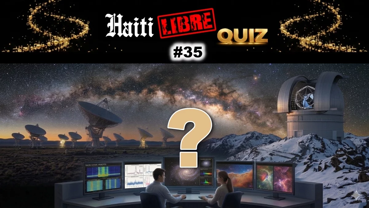
    In its latest installment of the popular twice-weekly general knowledge segment “Did You Know?”, Haiti-based online quiz platform Quiz.HaitiLibre has turned its spotlight to one of astronomy’s most intriguing cosmic objects: red dwarf stars. This 35th entry of the educational series shares lesser-known facts about these tiny, abundant stars that shape our understanding of the Milky Way and the search for life beyond Earth.

    Red dwarfs hold the title of the most widespread stellar bodies across the entire universe, accounting for roughly three-quarters of all stars within the Milky Way galaxy alone. Unlike the massive, blazing Sun that powers our solar system, red dwarfs are far smaller and cooler, a physical characteristic that gives them their distinctive dim, reddish hue. A particularly remarkable trait of these stars is their extraordinarily slow consumption of hydrogen fuel, which grants them a lifespan measured in hundreds of billions of years—far outstripping the current 13.8-billion-year age of the universe itself.

    For the global astronomy community, red dwarfs have emerged as a particularly fascinating area of study, largely because they frequently host systems of rocky planets similar in size to Earth. This has made them top candidates for searching for potentially habitable worlds beyond our own solar system, even as significant challenges remain. The habitable zone—the range of orbital distances where liquid water could theoretically exist on a planet’s surface—lies extremely close to a red dwarf’s dim surface. This proximity almost always leads to synchronous rotation, meaning one side of the planet is permanently exposed to stellar radiation while the other remains in perpetual darkness. Compounding this challenge, red dwarfs are prone to powerful, violent stellar flares that can strip away the atmosphere of any nearby orbiting planet, erasing any chance for life as we know it to evolve.

    Despite these formidable barriers to habitability, red dwarfs remain a primary target for astronomers hunting for extraterrestrial life, especially our closest cosmic neighbors. This educational fact feature is just one of hundreds of free quizzes available on Quiz.HaitiLibre, a digital platform that caters to knowledge seekers of all ages. As part of the platform’s June 2026 monthly update, 31 new quiz games were added on June 1, bringing the total number of available interactive quizzes to 150. The platform adds new content every month, covering a vast range of topics from local Haitian culture and current affairs to global general knowledge across science, history, and more.

    All quizzes on Quiz.HaitiLibre are exclusive to the platform, free to access, and require no user registration. Each topic includes three difficulty levels: easy, intermediate, and expert, to accommodate casual learners and experienced trivia buffs alike. The entire collection is available in both French and English, making it accessible to a broad audience of users.

  • Summer officially begins: interesting facts you may not know

    Summer officially begins: interesting facts you may not know

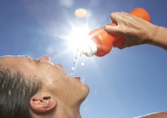
    Calculations from the National Astronomical Observatory confirm that the 2026 summer season in the Northern Hemisphere officially kicked off at 10:24 a.m. local time on June 21, marking the annual summer solstice event. The solstice occurs when the sun reaches its northernmost celestial point, achieving the highest midday altitude in the Northern Hemisphere sky and bringing the longest period of daylight of the entire year. This year’s summer run will span 93 days and 16 hours, closing out on September 23 when autumn officially begins.

    The term “solstice” itself traces its roots to the Latin phrase meaning “sun standing still,” a name inspired by a little-known scientific pattern: for several days surrounding the solstice, the sun’s maximum daily altitude changes very little, creating the illusion that it has stopped moving along the horizon. A key global climate pattern also accompanies the solstice: while the Northern Hemisphere transitions into the warmer, longer-day summer season, the Southern Hemisphere simultaneously reaches its winter solstice and begins the coldest season of the year.

    Beyond the popular cultural associations of summer with coastal getaways and beach vacations, the warmest season offers a host of unique stargazing and astronomical opportunities. On summer’s short, warm nights, several of the solar system’s brightest planets are visible to the naked eye at different times: Mercury, Venus, and Jupiter come into view shortly after the sun sets, while Mars and Saturn can be spotted before dawn breaks. One of the most iconic summer celestial features is the Summer Triangle, a distinct asterism formed by three bright stars—Altair in the Aquila constellation, Deneb in Cygnus, and Vega in Lyra—that stands out clearly against the dark summer sky.

    For 2026, skywatchers have an extra special astronomical event to mark on their calendars: a partial solar eclipse set to occur on August 12. Astronomy experts have highlighted this as one of the most anticipated celestial events of the year, offering a rare chance to observe the moon pass between Earth and the sun and partially obscure the solar disk during the summer months.