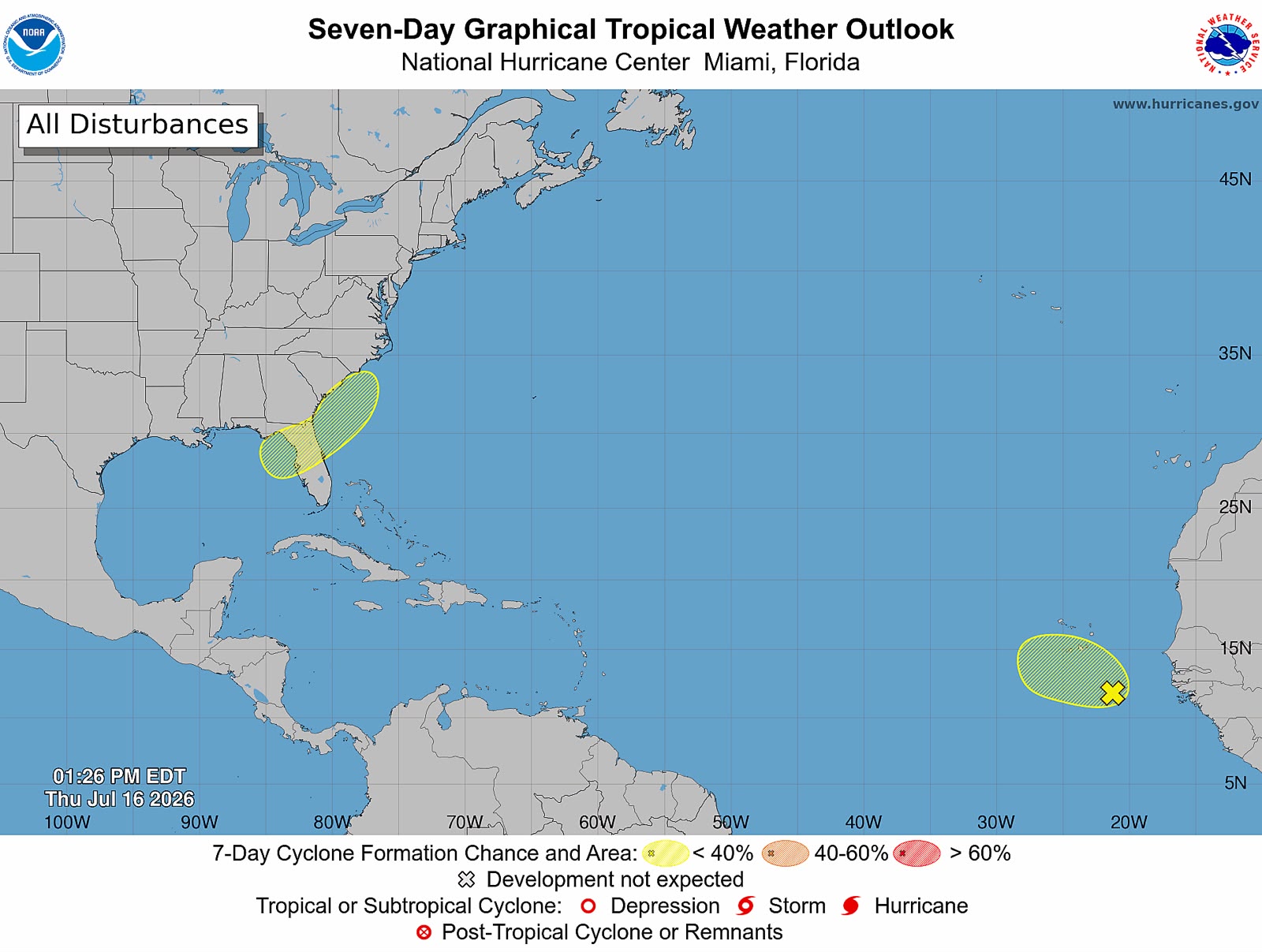
Meteorologists at the U.S. National Hurricane Center are keeping a close watch on an emerging tropical disturbance in the extreme eastern Atlantic Ocean, though current projections indicate the system will remain weak throughout its projected west-northwest track away from the African coastline.
Located several hundred miles southeast of the Cabo Verde Islands, the disturbance currently generates scattered, unstructured showers and thunderstorm activity across the surrounding waters. While forecasters acknowledge that minor, slow strengthening could occur over the next 48 hours, broader atmospheric conditions are expected to degrade significantly by the start of the weekend, putting a firm cap on any potential intensification.
Tracking west-northwest at a steady speed of roughly 10 miles per hour (equivalent to 16 kilometers per hour), the system carries just a 10% probability of organizing into a tropical depression within both the next two days and the coming seven-day forecast window.
The primary barrier to development, according to meteorologists, is the system’s expected trajectory through the dry, dust-filled Saharan Air Layer, a mass of arid atmospheric conditions that is well-documented to suppress thunderstorm formation and prevent the organization of tropical cyclones.
As of the latest update, the disturbance poses no immediate risk to any Caribbean nations, including Antigua and Barbuda, and no adverse weather impacts are forecast for landmasses along its current path across the open Atlantic. Forecasters have confirmed they will continue daily monitoring of the system to track any unexpected changes in structure or intensity.