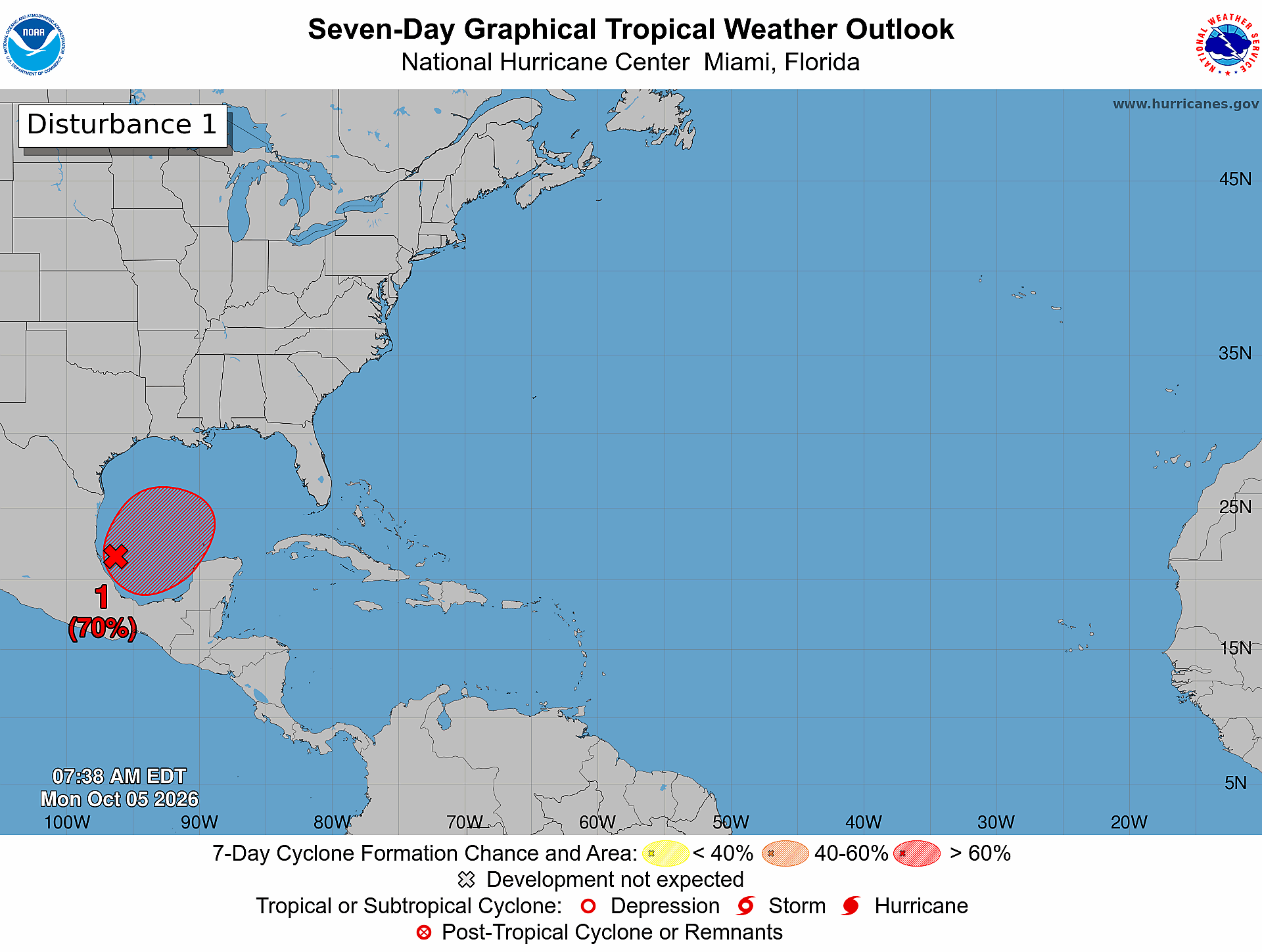
A nascent tropical disturbance churning across the Gulf of Mexico is on track to intensify into the first hurricane of the 2026 Atlantic hurricane season by the end of this week, AccuWeather has projected in an updated forecast. The system, which has already begun organizing at a faster pace than the meteorological firm’s initial projections, is set to encounter atmospheric conditions that will steadily fuel its growth over the coming days.
“The storm is already becoming better organized faster than expected, and the environment around it is becoming increasingly favorable for strengthening,” explained Nicholas Arman, AccuWeather’s leading hurricane specialist. According to the firm’s forecast timeline, the disturbance will strengthen over the open waters of the Gulf to reach Category 1 hurricane strength by Friday, October 9, earning the official name Isaias.
After reaching hurricane intensity, the system will begin tracking northward and encounter increased wind shear, a meteorological phenomenon that tears apart organized storm structures. This will prompt the storm to weaken before it makes landfall as a powerful tropical storm near the border between Mississippi and Alabama early Saturday morning, forecasters project.
The incoming storm is expected to deliver extreme rainfall across southern portions of Alabama and Mississippi, with cumulative totals predicted to range between 8 and 12 inches across the region. AccuWeather warns that isolated pockets near the landfall zone could see rainfall reach as high as 25 inches, creating extreme flood risk. Along the Gulf Coast, widespread wind gusts between 40 and 60 miles per hour are anticipated, with extreme isolated gusts potentially hitting 100 miles per hour.
Moisture from the system will then spread northward into parts of the Ohio Valley, before shifting east toward the Carolinas and southern Virginia. Forecasters have issued warnings for multiple hazards across the impacted region, including flash flooding, widespread power outages, structural property damage, and mudslides in hilly and mountainous higher elevations. As of Tuesday, the system was already bringing moderate rainfall to Mexico’s Bay of Campeche coastline, with no direct threat to the Caribbean nations of Antigua and Barbuda, which lie hundreds of miles east of the storm’s current development path.
Notably, this late-season storm development comes amid what has been a historically quiet 2026 Atlantic hurricane season to date. AccuWeather attributes the prolonged lull in storm formation to strong wind shear tied to the ongoing development of Super El Niño conditions, which have suppressed cyclonic development across the vast majority of the Atlantic basin. If the system fails to strengthen to hurricane strength before October 8, the 2026 season will break a 121-year record for the latest formation of the first Atlantic hurricane, surpassing the previous benchmark set in 1905.