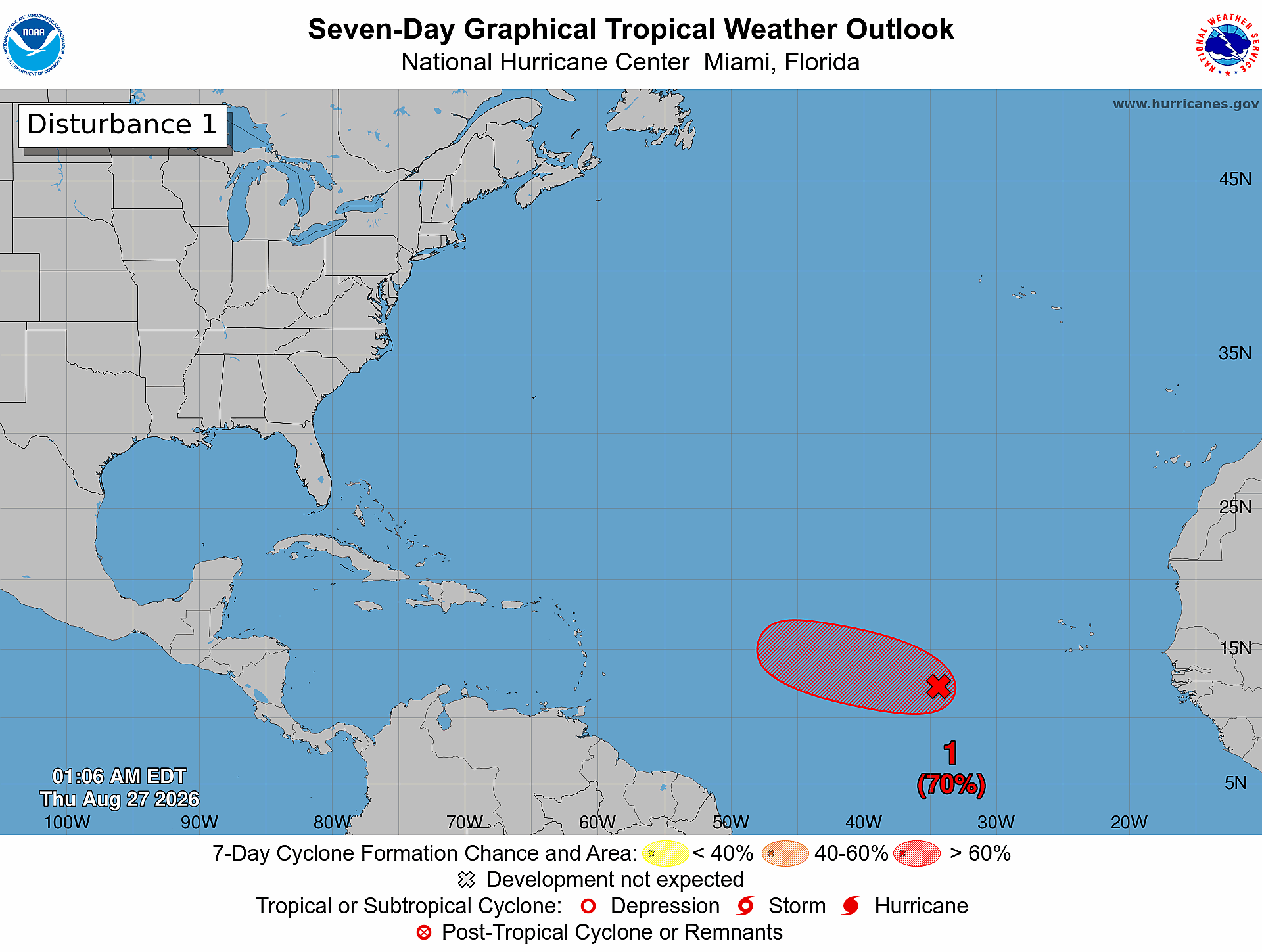
A nascent low-pressure disturbance churning in the Atlantic Ocean, positioned west-southwest of the Cabo Verde Islands, is on track to potentially strengthen into a short-lived tropical depression or named tropical storm by the end of Thursday, U.S. weather forecasters have announced.
As of 2 a.m. local time on August 27, latest satellite data reveals that the disorganized clusters of showers and thunderstorms tied to the system, officially labeled AL96 by meteorological authorities, have grown increasingly structured and consolidated over the course of the overnight period. This steady trend toward organization has put the system on track for potential tropical cyclone development in the coming hours.
If the current pace of organization holds, official weather advisories for the developing system will be issued later Thursday to keep coastal interests and ocean users updated on its progress. Forecasters assign a 70% probability of cyclonic formation both within the next 48 hours and across the coming seven-day outlook window.
Despite the high odds of short-term development, the long-term outlook for the system is limited by unfavorable atmospheric and oceanic conditions. Starting Friday, environmental factors including increasing wind shear and cooler sea surface temperatures are expected to turn hostile, halting any further strengthening and likely leading to the system’s quick dissipation. This means any tropical cyclone that forms will likely be short-lived, with little chance of prolonged intensification as it moves across the eastern Atlantic.