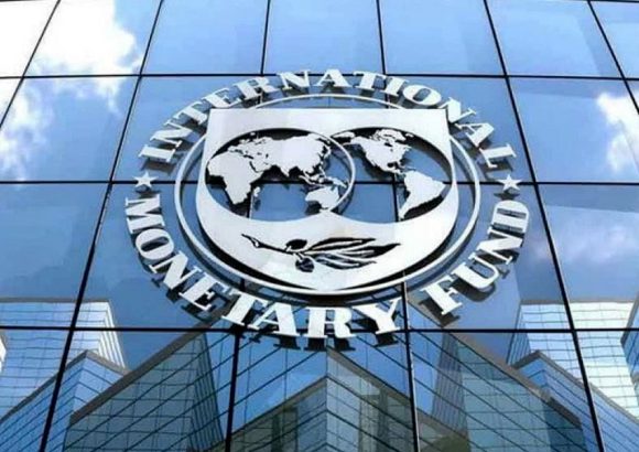
标签: Dominican Republic

多米尼加共和国

  • Samaná Bayport to handle three cruise ships simultaneously

    Samaná Bayport to handle three cruise ships simultaneously

    The Dominican Republic is set to elevate its position as a top Caribbean cruise destination with the development of the new Samaná Bayport, a transformative infrastructure project announced by Jean Luis Rodríguez, executive director of the Dominican Port Authority (Apordom). Designed to address growing regional demand for cruise tourism, the facility will deliver unmatched capacity for the area, with ability to accommodate three large cruise vessels at the same time.

    At the core of the terminal’s design is an innovative SeaWalk floating pier, engineered to host massive ships carrying as many as 5,000 passengers. This cutting-edge infrastructure places Samaná Bayport among a small group of select Caribbean destinations that have adopted this advanced pier technology. The remaining two docking spots will support anchored vessels via tender services, expanding the port’s ability to handle surging visitor volumes during peak travel seasons.

    Backed by a total investment of $22 million U.S. dollars, the project prioritizes environmental stewardship from its inception, integrating industry-leading sustainable design features. Key environmental components include a on-site wastewater treatment system and targeted conservation measures tailored to protect the sensitive marine ecosystem of Samaná Bay, aligning the development with global standards for responsible tourism.

    The economic benefits of the project are already materializing for local communities. Rodríguez confirmed that construction phase has created roughly 150 direct employment positions and another 500 indirect jobs across local supply chains and support services. Once fully operational, the port is projected to generate 100 permanent direct jobs and 600 ongoing indirect roles, anchoring long-term employment for the region.

    Economic projections forecast that the port will contribute approximately $10 million U.S. dollars in annual revenue directly from cruise operations, with an additional $9 million in annual revenue generated through spin-off tourism-related services across the local economy. Beyond direct revenue and job creation, the development is strategically positioned to diversify Samaná’s tourism offerings, opening new market opportunities for local small businesses, independent artisans, and regional service providers. By balancing expanded tourism capacity with rigorous environmental protection, Samaná Bayport is set to become a model for sustainable, inclusive tourism growth in the Caribbean.

  • Abinader declares regional emergency in five provinces and National District

    Abinader declares regional emergency in five provinces and National District

    In response to widespread destruction caused by an active low-pressure weather system moving across the Dominican Republic, national president Luis Abinader has enacted Decree 234-26, establishing a regional state of emergency across six hard-hit jurisdictions. The official measure, announced publicly on April 12, extends emergency status to the provinces of Puerto Plata, Espaillat, Valverde, Santiago, Santo Domingo, as well as the country’s National District, the capital’s administrative core.

    The declaration of emergency was not an arbitrary action: it follows all formal procedural requirements laid out in the nation’s 147-02 Risk Management Law, and was prompted by urgent damage assessments submitted by two of the country’s top disaster response bodies, the Emergency Operations Center (known locally by its Spanish acronym COE) and the National Emergency Commission (CNE). Government officials confirmed that days of unrelenting heavy downpours, intense thunderstorms and gusty strong winds have left a trail of destruction across multiple sectors of the impacted regions. Critical public infrastructure, private residential housing, commercial agricultural operations and other key productive industries have all sustained significant harm that has disrupted daily life for local residents.

    By formally activating the state of emergency, the Dominican government has cleared the way for faster deployment of critical assets to affected communities. The accelerated rollout of dedicated financial resources, heavy response equipment and trained disaster response teams is now authorized, with two core goals: first, to reduce the ongoing harm inflicted by the adverse weather system, and second, to restore full normal operations and daily life to the most severely impacted communities in the shortest possible timeline.

  • The Dominican Republic has had two hydrometeorological events per year in the last decade

    The Dominican Republic has had two hydrometeorological events per year in the last decade

    Over the 30-year period spanning from 1995 to 2024, the Dominican Republic has recorded 75 major hydrometeorological events, with tropical depressions and storms making up the vast majority of these extreme weather occurrences, according to newly released data from the country’s National Statistics Office (ONE).

    The national statistical agency’s comprehensive analysis breaks down the makeup of these 30 years of weather events: 15 were classified as tropical depressions, 29 were categorized as tropical storms, and the third most common type was Category 1 hurricanes, which hit 10 times over the study period. When looking at more recent trends from the past 10 years, ONE found that the annual frequency of these hydrometeorological events has held steady, holding to an average of two recorded events per year.

    Beyond frequency and type, the data also highlights a clear seasonal concentration of extreme weather. More than 65% of all recorded events over the 30-year window occurred in just two months: August and September, aligning with the peak of the annual Atlantic hurricane season that impacts the Caribbean nation.

    Geographically, the impact of these events is not evenly distributed across the Dominican Republic’s provinces. ONE’s data identifies five provinces that have seen the highest number of hydrometeorological event trajectories between 1995 and 2024: La Altagracia leads with 8 recorded trajectories, followed by Azua with 7, and San Juan and Elías Piña tied at 6 each, with La Vega rounding out the top five at 5.

    In addition to mapping long-term weather trends, the 2024 data also sheds light on how Dominican households are preparing for extreme weather events. The statistical office reports that nearly 65% of households across the country took proactive preventive steps in 2024, reinforcing doors, roofs and windows when receiving alerts about incoming natural hazards.

    Other common preparedness actions taken by residents include securing loose furniture and household appliances (practiced by 20% of households), properly securing propane gas tanks to reduce risk (17.7%), relocating to the home of a family member or friend for safety (13.3%), and stockpiling emergency supplies and non-perishable food ahead of an event (12.5%).

  • COE reports more than 700 displaced people, isolated communities, and maintains alert for 26 provinces

    COE reports more than 700 displaced people, isolated communities, and maintains alert for 26 provinces

    Torrential rainfall that hit several northern and central provinces of the Dominican Republic Saturday night has triggered devastating flash flooding, leaving hundreds of residents displaced and disrupting critical infrastructure across the affected region, the nation’s Emergency Operations Center (COE) confirmed in an official update Sunday morning.

    In its latest situation bulletin, the COE detailed the widespread human and material toll of the disaster: across the hard-hit provinces of Puerto Plata, Monte Plata, Valverde, and María Trinidad Sánchez, the flooding has damaged 145 residential properties, forced 725 people from their homes, and left 167 residents taking temporary refuge in government-run emergency shelters. Twelve entire communities remain cut off from surrounding areas, blocked by floodwaters that have made local roads impassable.

    Beyond housing and displacement, the disaster has also triggered a major public health crisis by cutting off drinking water access for more than 113,000 users across the affected region. Seventeen regional aqueduct systems have been knocked out of commission by the heavy rains and flood damage, leaving vast swathes of the impacted population without access to safe running water.

    In response to the ongoing hazard, the COE has activated its highest-level red alert for four of the most severely impacted provinces: Puerto Plata, Espaillat, María Trinidad Sánchez, and Valverde. The alert bars non-essential travel and mandates emergency response teams to remain on standby for rapid rescue and relief operations.

    An additional 15 provinces and administrative areas remain under lower-level yellow alert, warning residents of ongoing risks of flooding and landslides. The areas under yellow alert include Monseñor Nouel, Sánchez Ramírez, Santiago, La Vega, Monte Cristi, Elías Piña, Samaná, Santiago Rodríguez, San Cristóbal, Santo Domingo Province, the National District, Monte Plata, San José de Ocoa, Duarte – with particular focus on the high-risk Bajo Yuna region – and Hermanas Mirabal.

  • Meteorologist explains April rains reignite the debate: which is the rainiest month in the Dominican Republic?

    Meteorologist explains April rains reignite the debate: which is the rainiest month in the Dominican Republic?

    For many people living in or familiar with the Dominican Republic, a widespread misconception has persisted: that the country’s wettest weather aligns with November, or that unusually heavy early-spring downpours in recent years have shifted the peak rainfall to April. But 30 years of systematic climate measurements tell a far different story, according to a leading Dominican meteorologist.

    Cristopher Florian, a climatology specialist at the Dominican Institute of Meteorology (Indomet), shared the findings in an exclusive interview with local newspaper HOY, debunking the common misconception about the country’s rainfall patterns. Long-term climatological data collected consistently across decades confirms that May actually holds the title of the Dominican Republic’s rainiest month, with June ranking as the second wettest, Florian explained.

    “That conclusion is firmly established by climatological science, drawn from three decades of continuous rainfall measurements across monitoring sites across the country,” Florian told reporters. The meteorologist added that while extreme heavy precipitation events have occurred in April and November in recent years, that short-term trend is not enough to upend long-held climate patterns.

    To formally declare a shift in a region’s long-term climatology, scientists require a continuous 30-year dataset to filter out short-term random weather fluctuations and identify sustained trends, Florian noted. “We still need many more years of consistent measurements to confirm that April or November have overtaken May and June as the country’s rainiest months,” he clarified.

    Beyond correcting the long-held misconception, Florian also issued a practical forecast for the coming days, warning residents that widespread rainfall will persist through the weekend. He projected that precipitation levels will climb notably on Sunday, and the wet weather will continue into Monday with increased intensity. This forecast raises the risk of several hazardous conditions, including swelling of rivers, streams and mountain ravines, as well as flash urban flooding in low-lying developed areas, the meteorologist cautioned.

  • Bridge over Camú River collapses; dozens of homes flooded and extensive damage in Puerto Plata

    Bridge over Camú River collapses; dozens of homes flooded and extensive damage in Puerto Plata

    On Saturday night, torrential downpours swept across the Dominican Republic’s Puerto Plata province, leaving a trail of widespread destruction that has disrupted communities and cut off critical transportation links. Two major bridge structures sustained serious damage, while rising floodwaters inundated dozens of residential properties across multiple municipalities.

    The most critical infrastructure failure occurred on the region’s popular tourist corridor, where the Camú bridge collapsed entirely, trapping residents and cutting off access to the surrounding area. A parallel crisis unfolded in the Altos de la Boca sector of Los Hidalgos, where a second bridge was rendered impassable by flood-driven damage, creating another isolated pocket of the province.

    Flooding was not limited to infrastructure damage, with multiple low-lying communities across Villa Montellano registering severe inundation. Neighborhoods including Los Ciruelos, El Tamarindo, Monte Bravo, and the La Maternidad district all reported standing floodwaters that entered residential homes. In one dramatic incident in Monte Bravo, an entire family was forced to climb onto the roof of their flooded property to escape rising waters, where they waited for rescue before being pulled to safety by teams from Amber Rescue.

    In the municipality of Imbert, communities along the Bajabonico River including Baraguana, Barrabás, and La Yaguita all saw widespread flooding as the waterway overflowed its banks. The same pattern of river-driven inundation was reported across three additional municipalities: Guananico, Altamira, and Villa Isabela, where dozens of additional homes were flooded.

    Beyond flooding and infrastructure damage, the heavy rain also triggered multiple landslides along the Puerto Plata-Navarrete highway. Slope failures were recorded in the El Copey community of Altamira, as well as at the main entrance to the highway’s tunnel, closing sections of the critical intercity route.

    In response to the crisis, José Ignacio Paliza, the Dominican Republic’s Minister of the Presidency, announced that an official emergency assessment and relief mission would launch in the early hours of Sunday. Paliza confirmed the government’s commitment to supporting impacted families in a post to his official social media account, writing, “We are heading to Puerto Plata to assist the families affected by the heavy rains of the last few hours. God is in control!”

  • Government asks the population to stay away from rivers and coasts

    Government asks the population to stay away from rivers and coasts

    Residents of the Dominican Republic are preparing for severe weather this weekend, after national authorities activated full emergency response protocols on Friday ahead of an approaching frontal system forecast to bring heavy, widespread rainfall across much of the country. The announcement followed a high-level coordination meeting led by President Luis Abinader at the National Palace in Santo Domingo, where officials confirmed the government would operate in permanent session to monitor the storm’s progression and coordinate rapid responses to any emerging hazards.

    Following the meeting, Juan Manuel Méndez, general director of the country’s Emergency Operations Center (COE), issued clear guidance to the public: all residents are asked to avoid recreational visits to coastal areas, and to cooperate fully with mandatory evacuation orders for communities located in high-risk, vulnerable zones. Méndez emphasized that public compliance is critical to preventing avoidable loss of life, stressing that non-cooperation during evacuations could put both residents and first responders at unnecessary risk.

    Two tiers of weather alerts are currently in effect across 19 provinces and the National District. Five provinces — Monseñor Nouel, Santiago Rodríguez, Santiago, La Vega, and Monte Cristi — are under yellow alert, indicating elevated risk of severe weather impacts. A green alert, signaling preliminary preparedness is required, covers the National District, the province of Santo Domingo, Elías Piña, San José de Ocoa, Monte Plata, Puerto Plata, Dajabón, Duarte (with a specific focus on the vulnerable Lower Yuna region), San Cristóbal, Valverde, San Juan, Independencia, and Bahoruco.

    According to updates from the Dominican Institute of Meteorology (Indomet), rainfall is set to begin in the early hours of Saturday and persist through the entire day. Over a 24 to 48-hour window, total precipitation accumulation is expected to reach 100 to 125 millimeters across most affected areas, driven by the combination of the approaching frontal system and an associated trough. Forecasters project rain will intensify through Saturday afternoon, bringing moderate to extreme downpours, with risks of isolated hailstorms, severe thunderstorms, and strong wind gusts. The hardest-hit areas are expected to include Greater Santo Domingo, Monte Plata, Sánchez Ramírez, Duarte, Monseñor Nouel, La Vega, Espaillat, Hermanas Mirabal, and much of the Cibao region, with particularly severe conditions forecast for the Central Mountain Range, the country’s border region, and southwestern provinces.

    Méndez warned that widespread soil saturation will increase the likelihood of flash flooding across large swathes of the country, and alert levels may be upgraded to higher tiers if the weather system intensifies beyond current projections. In addition to flood risk, Indomet has flagged hazards including urban flooding, rising water levels in rivers and streams, landslides in hilly terrain, and sudden wind gusts. The agency noted that alert levels will be updated continuously over the next 72 hours as new weather data becomes available.

    Alongside storm warnings, meteorological officials added that hot, humid conditions will persist before and after rain events, driven by warm, moist wind flow from the east and southeast. In urban areas, the heat index will reach particularly high levels, prompting Indomet to recommend that residents wear lightweight clothing, stay hydrated by drinking plenty of fluids, and limit extended exposure to direct sunlight.

    President Abinader reaffirmed the government’s commitment to proactive preparation, stating that national authorities will remain on constant alert to monitor every development of the weather system across the entire country, with resources pre-positioned to respond to any emergency that arises. “The Government will be attentive to every situation throughout the country, both to anticipate and to react in any case,” Abinader said. Méndez echoed this call for vigilance, urging all residents, even those not currently under elevated alerts, to follow guidance from civil protection agencies, monitor official weather updates closely, and avoid complacency. He added that residents should never attempt to cross swollen rivers, streams, or ravines while rain is ongoing, a leading cause of storm-related fatalities in tropical weather events.

  • What does flood insurance really cover? A guide to protecting your assets.

    What does flood insurance really cover? A guide to protecting your assets.

    As extreme weather events grow more frequent across the globe, homeowners and vehicle owners face increasing urgency to understand the fine print of their insurance policies to safeguard their valuable assets. Leading insurance provider Mapfre has recently broken down common misconceptions around flood and water damage coverage, highlighting critical gaps that many policyholders only discover after disaster strikes.

    For residential and commercial multi-risk property policies, Mapfre’s Technical Director of General and Property Insurance Yesenia Vásquez confirmed that flood protection is included as a standard feature in most contracts. However, the company warns of a common cost-cutting choice that leaves many property owners unprotected: customers can opt to voluntarily remove flood coverage from their policy to reduce their annual premium. While this choice lowers immediate costs, Vásquez emphasized that it can lead to devastating financial losses when extreme flooding occurs.

    Mapfre also draws a clear technical distinction between flooding and other forms of water damage that are not covered by standard flood policies. For insurance purposes, flooding is officially defined as water originating outside a property that inundates and penetrates the building, damaging both the structural core (including walls and flooring) and personal or commercial contents such as furniture and equipment. In contrast, Vásquez noted that water damage resulting from internal issues like clogged pipe leaks, failing roof seals, or general poor maintenance does not qualify as flooding, and these claims will be denied under standard flood coverage. These types of damage are considered the responsibility of the property owner, who is expected to complete routine upkeep to prevent avoidable failures.

    When it comes to personal and commercial vehicles, the rules around water damage coverage differ significantly from property policies. Francisco Pérez Cuevas, Mapfre’s Technical Director of Auto Insurance, explained that water and flood damage is never included as an automatic feature of basic auto insurance policies. Instead, drivers must add this coverage as a separate add-on to their existing contract to be protected.

    Pérez Cuevas also pushed back against the widespread marketing term “full coverage insurance”, noting that this phrase is more of a promotional tool than a technically accurate description of a policy. “Many consumers assume that a ‘full coverage’ policy protects them against every possible risk, but that simply is not the case,” he explained. “It is essential that every policy holder review their specific coverage line-by-line, and explicitly ask their insurance provider whether their contract includes water and flood damage for their vehicle.”

    To help property and vehicle owners avoid costly surprises when filing a claim, Mapfre experts have outlined three core checks every insured person should complete before disaster strikes:

    First, always distinguish between flooding and routine leaks. Insurance is designed to cover extraordinary, external natural events, not damage that results from a property owner’s failure to complete routine maintenance on internal systems like pipes and roofs.

    Second, verify that both the physical structure of your property and all personal or commercial contents inside are explicitly included in your flood coverage. Flooding can damage everything from a building’s foundation to household appliances, and gaps in coverage can leave major costs uncovered.

    Third, never assume coverage based on the marketing name of your policy. Always ask your insurance advisor to provide a full written breakdown of all excluded risks, so there is no confusion when you need to file a claim.

    At its core, effective asset protection against rising extreme weather relies on more than just paying insurance premiums. It requires a clear understanding of exactly what your policy covers, and where exclusions apply. The difference between recovering your property after a flood and suffering a total financial loss often comes down to reviewing the details of your insurance contract before a disaster occurs.

  • Dominican Republic increased the number of provinces under Red Alert for 4 Provinces due to heavy rain and flood risk

    Dominican Republic increased the number of provinces under Red Alert for 4 Provinces due to heavy rain and flood risk

    The Dominican Republic’s emergency management authorities have rolled out a three-tiered national alert system, placing four northern provinces on the highest risk red alert as adverse weather conditions threaten widespread flooding across large swathes of the country.

    The four red-flagged provinces, which face the most severe potential hazards, are Puerto Plata, Valverde, Espaillat, and María Trinidad Sánchez. Beyond these high-risk zones, the country’s capital National District and an additional 14 provinces have been placed under yellow alert, signaling a moderate level of danger, while the remaining seven provinces carry the lowest-level green alert status, indicating minimal immediate risk.

    The nation’s Emergency Operations Committee (COE), which manages disaster preparedness and response, confirmed that the tiered alerts were triggered by growing threats of multiple flood types. At-risk areas face potential overflow across rivers, small streams, and natural ravines, alongside the looming possibility of sudden flash floods and standing water in dense urban areas.

    This latest alert update draws on official data and forecasts from two leading national institutions: the Dominican Institute of Meteorology (Indomet) and the National Institute of Hydraulic Resources (INDRHI). Technical assessments from both agencies confirm that atmospheric conditions across the country remain primed for sustained rainfall. A slow-moving trough connected to an active frontal system has kept moisture levels elevated, leaving already saturated soils in high-risk provinces far more vulnerable to runoff and flooding. Local authorities are urging residents in alert zones to monitor official updates, prepare for potential evacuation, and avoid low-lying flood-prone areas through the duration of the weather event.

  • Santiago Civil Defense highlights the preventive work of the Santiago City Council in the face of rains

    Santiago Civil Defense highlights the preventive work of the Santiago City Council in the face of rains

    As forecasters warn of incoming heavy precipitation across the Dominican Republic’s Santiago province, local Civil Defense leadership has publicly commended the proactive flood risk reduction work led by Santiago’s municipal mayor, Ulises Rodríguez.

    Francisco Arias, regional director of the Dominican Civil Defense, highlighted that the municipal government has prioritized critical pre-storm preparedness tasks across high-risk neighborhoods and geographic hotspots. These interventions include clearing debris from natural ravines, unclogging urban drainage systems, removing accumulated waste from bridge approaches, collecting scattered solid waste from residential areas, and pruning overgrown tree branches that could threaten infrastructure during storms.

    The work has already been fully rolled out across a range of priority zones, Arias confirmed, including 20th Street, 8th Street, the communities of Nibaje and Hoya de Caimito, and the high-risk Devil’s Ravine — all locations long identified as prone to dangerous waterlogging during heavy downpours. Beyond the physical infrastructure work, Arias noted that municipal crews have maintained a consistent, visible presence in these flood-prone areas to respond quickly to emerging hazards as the rain approaches.

    In his remarks, Arias also extended recognition to Arismendi Dajer, the municipal government’s general secretary, and the full team of local municipal staff who have collaborated to advance the preparedness campaign.

    Arias explained that pre-event mitigation is a core component of effective disaster management: by addressing hazards before storms hit, officials can dramatically cut the risk of destructive flooding and keep local residents safe. “Our Civil Defense teams have been continuously moving through vulnerable neighborhoods to share safety guidance with residents, and the Mayor’s Office has complemented that work with on-the-ground infrastructure upgrades that directly reduce flood risk,” he explained.

    All of these coordinated actions fall under a broader, holistic disaster preparedness strategy designed to protect both the lives and property of Santiago residents, Arias added, emphasizing that the municipal government remains in a constant state of readiness to address any weather-related emergency.

    In a final update, Arias confirmed that the interagency Prevention, Mitigation, and Response Committee (PMR) has already been activated, with round-the-clock monitoring of shifting weather conditions already underway. Since the previous day, Civil Defense response brigades have been door-to-door in at-risk communities, walking local families through the key safety steps they should follow if flooding does develop.