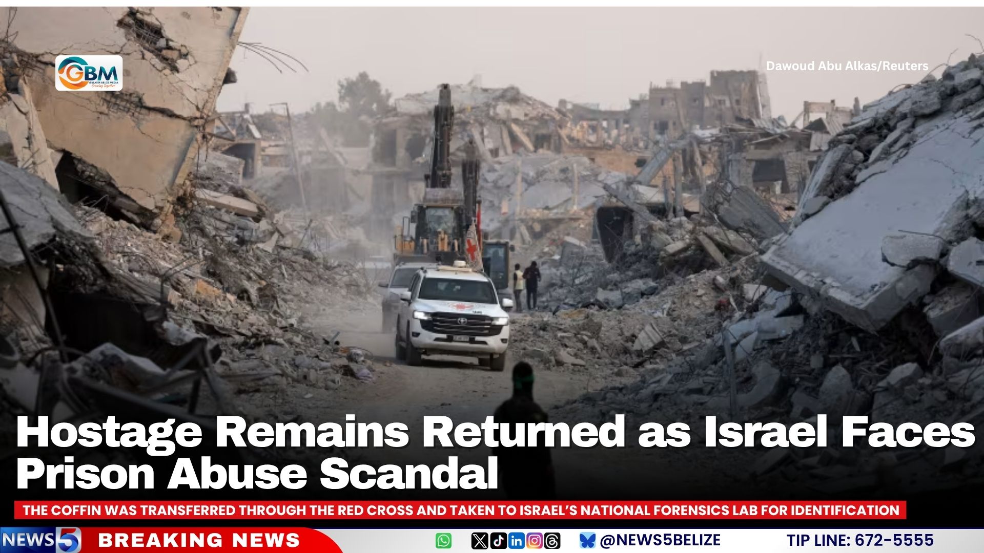
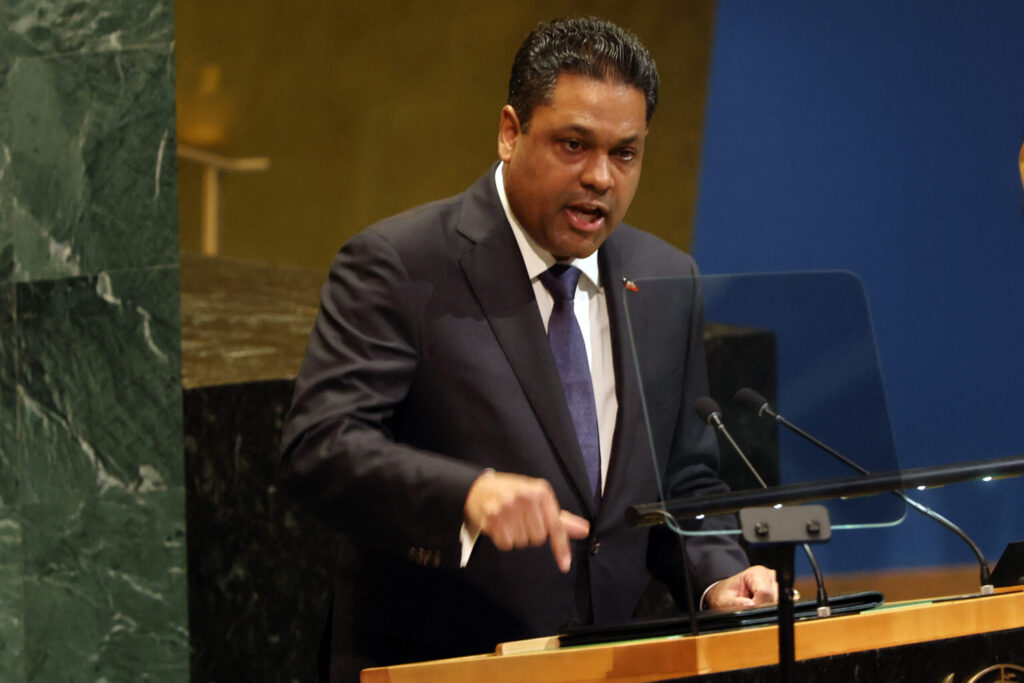
Israel has received the remains of another deceased hostage from Gaza, as part of a US-brokered ceasefire agreement that began last month. The coffin, transferred through the Red Cross, was taken to Israel’s national forensics lab for identification. This follows the handover of three bodies on Sunday, including one killed during Hamas’s October 7, 2023, attack on Israel. Earlier attempts to return remains had strained the ceasefire, with Hamas claiming to have returned three bodies on October 28, which Israel could not confirm. In response, Prime Minister Benjamin Netanyahu ordered immediate strikes in Gaza, resulting in at least 104 Palestinian deaths, including many children. Despite these tensions, the ceasefire has largely held, with U.S. President Donald Trump describing it as ‘very solid’ in a recent interview. Concurrently, Israel is grappling with a growing scandal involving alleged abuse of Palestinian detainees at the Sde Teiman military prison. The army’s top legal officer, Maj. Gen. Yifat Tomer-Yerushalmi, was arrested over suspicions related to the unauthorized release of a video showing the abuse. The facility, which has been criticized for harsh treatment, is set to be phased out, and the video’s airing has sparked widespread outrage.
分类: world
-
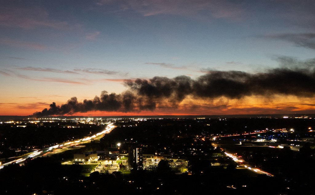
At least 9 dead after cargo plane crashes near Louisville airport
A tragic UPS cargo plane crash in Louisville, Kentucky, has resulted in at least nine fatalities, with fears of more casualties as search and rescue operations persist. The McDonnell Douglas MD-11, en route to Hawaii, crashed shortly after takeoff from Louisville Muhammad Ali International Airport at approximately 5:15 pm on Tuesday. The aircraft burst into flames upon impact, devastating nearby businesses. Kentucky Governor Andy Beshear described the incident as ‘heartbreaking’ and ‘unimaginable,’ expressing concern for the affected families. UPS confirmed three crew members were aboard but has not yet disclosed casualty details. This marks the deadliest crash in UPS’s history. The airport has since resumed operations, while investigations by the Federal Aviation Administration and the National Transportation Safety Board are underway. The crash has reignited concerns about the U.S. air traffic control system, already strained by staffing shortages and outdated equipment.
-
UK government deploys Royal Navy to support disaster relief efforts in Jamaica
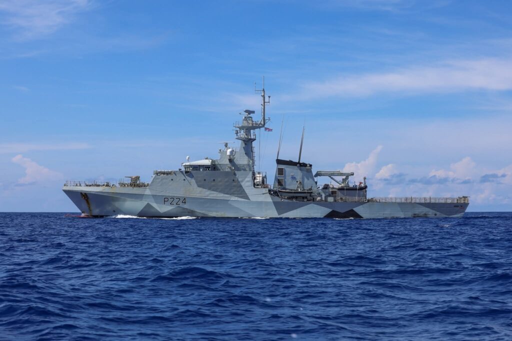
In a significant move to bolster disaster relief efforts in Jamaica, the British Offshore Patrol Vessel, HMS Trent, arrived in Falmouth, Trelawny, on November 4, equipped with specialized personnel and resources to assist communities devastated by Hurricane Melissa. The vessel, manned by a 75-member crew including expert engineers, is set to play a pivotal role in infrastructure assessments and emergency repairs, working in close collaboration with Jamaican authorities.
UK Defence Secretary John Healey emphasized the critical role of the British Armed Forces in disaster relief missions, stating, ‘Our Royal Navy and British Army personnel bring invaluable engineering expertise to support local recovery efforts. This deployment reflects Britain’s commitment to standing with those in need during times of crisis.’
Chris Elmore, Minister for the Caribbean, highlighted the UK government’s relentless efforts to deliver relief supplies to the hardest-hit areas. ‘The arrival of HMS Trent marks a crucial step in restoring vital infrastructure and supporting communities most affected by the hurricane,’ he said.
The deployment is part of a broader UK support package for Jamaica, which includes over 3,000 shelter kits, 1,500 solar-powered lanterns, and a Rapid Deployment Team from the Foreign, Commonwealth & Development Office (FCDO) to provide consular assistance to affected British nationals. Additionally, the UK has pledged £7.5 million in emergency funding to address immediate humanitarian needs in the region.
British High Commissioner to Jamaica, Alicia Herbert, reaffirmed the UK’s commitment to Jamaica’s recovery. ‘The arrival of HMS Trent symbolizes our enduring partnership and dedication to helping Jamaica rebuild stronger and more resilient communities in the wake of Hurricane Melissa,’ she stated. The funding is facilitating the delivery of essential relief items and the deployment of UK humanitarian and technical experts to coordinate aid efforts effectively.
-
Caribbean transitions into the dry and cool seasons in December
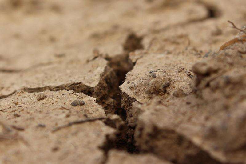
The Caribbean Climate Outlook Forum (CariCOF), headquartered in Barbados, has released its latest seasonal forecast, predicting a decline in tropical cyclone activity and excessively hot, humid days as the region transitions into the cooler, drier months of December. The report, covering the period from November 2023 to January 2024, highlights the influence of La Niña conditions, marked by cooler-than-average sea surface temperatures in the central and eastern equatorial Pacific Ocean, driven by stronger trade winds. This, combined with unusual warmth in the Subtropical North Atlantic, has introduced significant uncertainty into the seasonal climate predictions. Despite this, CariCOF anticipates a steady reduction in tropical cyclone activity and extreme heat in November. However, the ABC Islands, Belize, and the Lesser Antilles are expected to experience high rainfall intensity and frequent showers, raising the risk of flooding, flash floods, and related hazards. The forecast also warns of increasing dry spells in The Bahamas and the Greater Antilles, with drought conditions likely to emerge by late January in areas already experiencing water shortages. As of late October, severe short-term drought has been reported across the Windward Islands, Aruba, parts of the Dominican Republic, and Guadeloupe, while long-term drought is expected in southwest Dominica, northern Jamaica, northern Guyana, St. Croix, and St. Vincent.
-
Haiti appeals to international community to help restore security
Haiti has issued a heartfelt appeal to the international community for assistance in restoring security and stability in the nation, which is currently grappling with rampant gang violence. Criminal gangs have seized control of nearly the entire capital, Port-au-Prince, and its surrounding areas, plunging the country into chaos. Laurent Saint-Cyr, President of the Transitional President Council (TPC), made the plea during his address at the second World Summit for Social Development in Doha, Qatar. He specifically called on nations to contribute effectively to the Gang Suppression Force (GSF), a United Nations Security Council-approved initiative established on September 30th. Saint-Cyr emphasized that operationalizing the GSF swiftly, while drawing lessons from the Multinational Security Support Mission, is a critical step toward international solidarity. He underscored that peace, stability, and security are essential for the social development that Haitians and people worldwide deserve. The GSF, authorized to deploy up to 5,550 personnel, aims to neutralize, isolate, and deter criminal gangs, secure critical infrastructure, and facilitate humanitarian access through intelligence-led operations. Saint-Cyr highlighted the TPC’s commitment, formed in April 2024, to restore security with international support and prepare for free and credible elections to fulfill the aspirations of the Haitian people. He also addressed the aftermath of Hurricane Melissa, which claimed 43 lives, left 21 injured, and 13 missing, exacerbating Haiti’s vulnerabilities. Rescue teams are working tirelessly to reach devastated communities in the southwest, where landslides and flooding have ravaged over 30 towns and villages. The Haitian government is prioritizing security, elections, humanitarian response, and economic recovery, including reintegrating former child soldiers through vocational training and relocating displaced individuals with dignity. Saint-Cyr stressed the urgent need for international support to transition from short-term aid to sustainable investment, ensuring long-term stability and development.
-
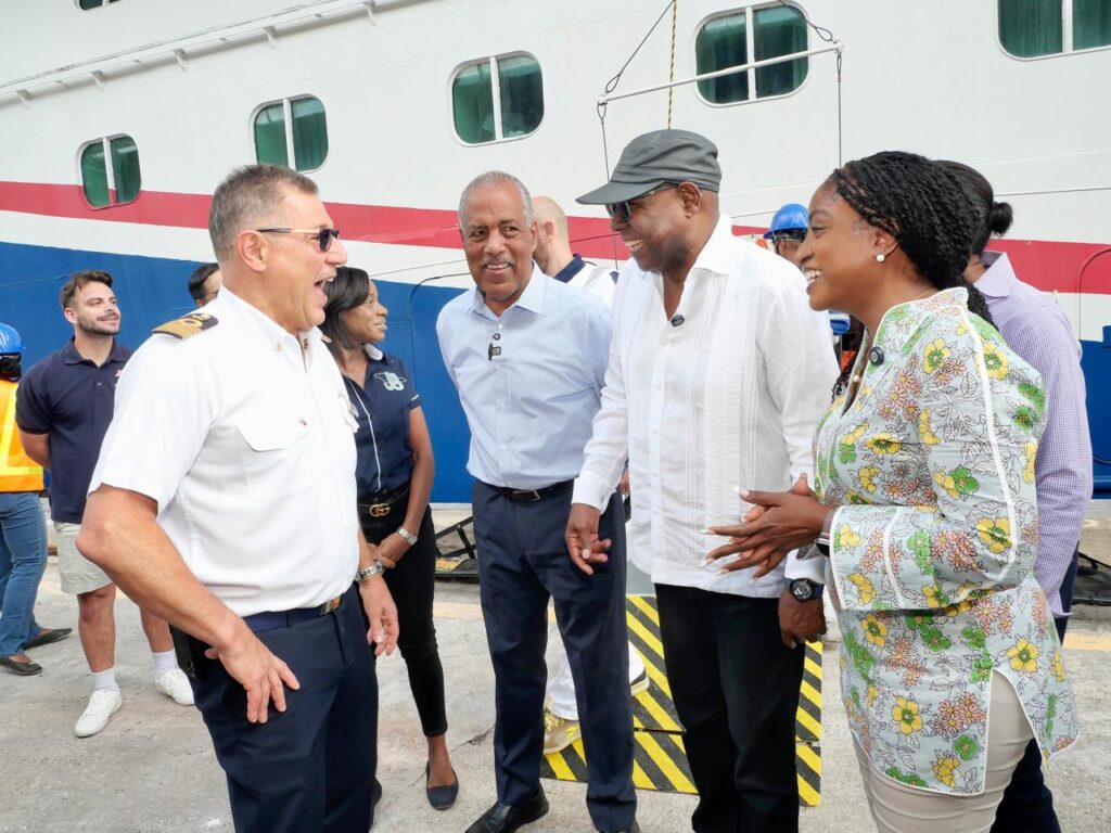
Cruise industry rallies behind Jamaica with over US$3m in hurricane relief
In a remarkable display of solidarity, several of the world’s foremost cruise companies have collectively pledged over US$3 million to support Jamaica’s recovery efforts in the aftermath of Hurricane Melissa. Carnival Corporation, Royal Caribbean Group, and Disney Cruise Line have each committed US$1 million, while Norwegian Cruise Line Holdings (NCLH) has contributed up to US$100,000, with additional matched donations from employees and passengers.
-
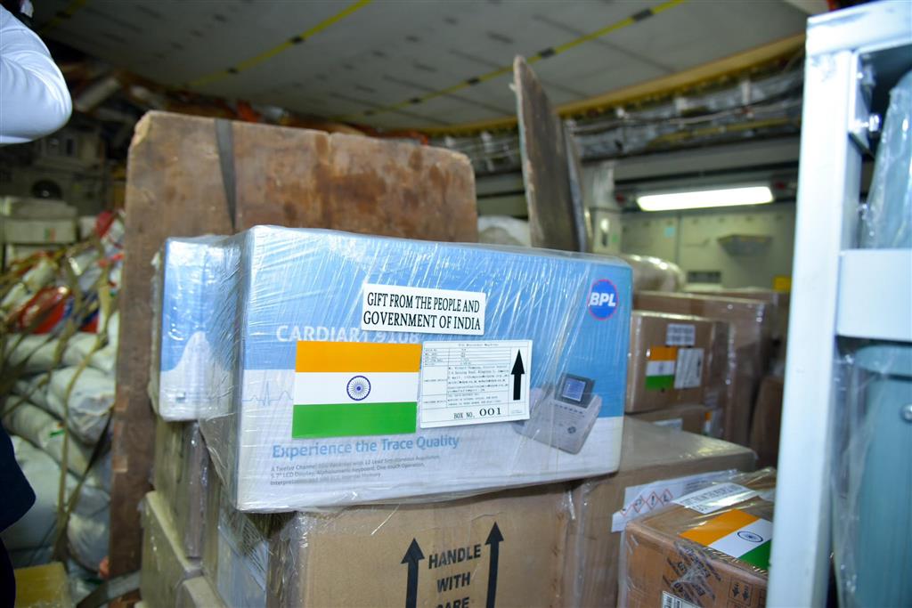
India sends aid to Cuba & Jamaica for recovery from Hurricane Melissa
India has dispatched a significant humanitarian aid shipment to Cuba, Bolivia, and Ecuador, each receiving 20 tons of essential supplies. The consignment, which departed from New Delhi on Tuesday, includes rehabilitation materials, food, medicine, medical equipment, generators, hygiene kits, and other critical items, as confirmed by the Indian Foreign Ministry. This initiative underscores India’s commitment to supporting its Global South partners in times of natural disasters, aiding their recovery and reconstruction efforts. Indian Foreign Minister highlighted the nation’s solidarity with these countries, emphasizing the importance of collective action in addressing global challenges. India has a longstanding history of providing humanitarian assistance to Cuba, particularly in the aftermath of hurricanes and earthquakes. The aid for Cuba is timed to coincide with the upcoming visit of Pabitra Margherita, India’s Minister of State for External Affairs and Textiles, who will also tour Bolivia and Ecuador. During his visit to Cuba, Margherita is expected to discuss enhancing bilateral relations, with a focus on health and medicine, digital public infrastructure, and capacity building.
-
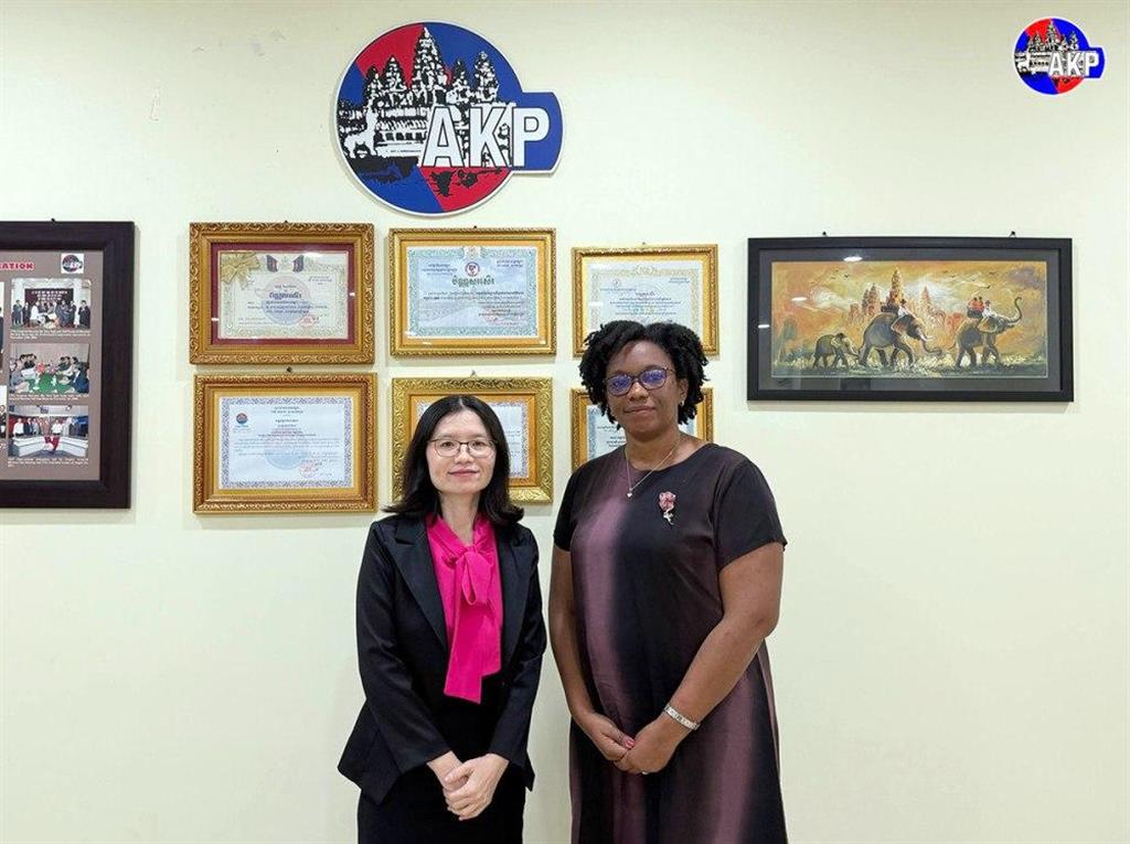
Prensa Latina and AKP highlight positive collaboration
The enduring partnership between the Agence Kampuchea Presse (AKP) and Prensa Latina, Cuba’s leading news agency, has been a cornerstone in fostering mutual understanding and cooperation between Cambodia and Cuba. Initially established in 2012 and revitalized in October 2022, this collaboration is rooted in a shared dedication to truth and the objective dissemination of information about their respective nations. AKP Director General Nimul Sokmom and Cuban Ambassador to Cambodia, Milena Zaldivar, recently highlighted the significance of this alliance during a cordial meeting. Since the renewal of their agreement, AKP has published over 500 news reports about Cuba in English, Khmer, and French, showcasing the resilience, achievements, and unwavering solidarity of the Cuban people. Ambassador Zaldivar emphasized the pivotal role of this media partnership in strengthening the bonds of friendship and cooperation between the two nations. She also commended AKP’s consistent coverage of Cuba’s struggles, particularly its condemnation of the U.S. government’s prolonged economic, commercial, and financial blockade, which has persisted for over six decades.
-
Ambassador Dorbrene O’Marde to Represent Antigua and Barbuda and CARICOM at Africa Celebrates 2025
Ambassador Dorbrene O’Marde, Chairman of the Antigua and Barbuda Reparations Support Commission (ABRSC), has been selected to represent Antigua and Barbuda and the Caribbean Community (CARICOM) at the upcoming Africa Celebrates 2025 event in Addis Ababa, Ethiopia, from November 4–9. Ambassador O’Marde will serve as a featured speaker and panelist at the Africa Reparation Forum and Diaspora Africa Konnect, both hosted at the African Union and United Nations headquarters in the Ethiopian capital. The event’s theme, aligned with the African Union’s agenda, is “Justice for Africans and People of African Descent Through and Beyond Reparations.” The forum will delve into the socio-economic implications of reparatory justice and discuss strategies for leveraging diaspora resources to foster investment, heritage preservation, and sustainable economic growth across Africa and the Caribbean. In their invitation, organizers lauded Ambassador O’Marde’s leadership as Chairperson of the ABRSC and Vice-Chair of the CARICOM Reparations Commission, emphasizing his critical role in sharing insights on reparations as a catalyst for development and unity among people of African descent. Africa Celebrates aims to promote cultural exchange, trade, and innovation within Africa and its diaspora. Its objectives include showcasing Africa’s cultural and creative diversity, encouraging the patronage of African-made goods, and advancing intra-African trade, investment, and tourism, with a particular focus on empowering women and youth. Since its inception in 2021, the event has grown exponentially, with participation increasing from 12 countries in its inaugural year to over 40 African nations and diaspora communities by 2024. Organizers anticipate that the 2025 edition will be the largest yet, featuring contributions from 13 countries and a diverse array of cultural, business, and academic leaders.
-
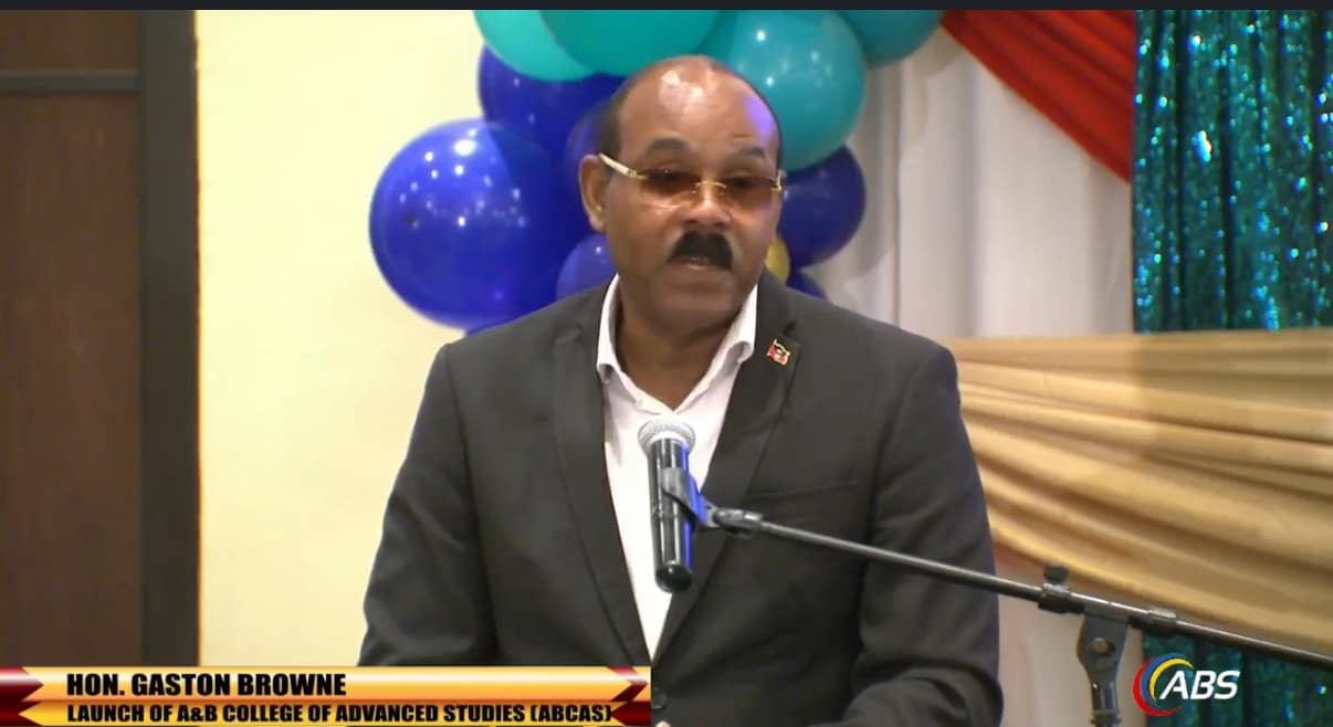
Prime Minister to Lead Antigua and Barbuda Delegation to COP30 in Brazil
Prime Minister Gaston Browne is set to spearhead Antigua and Barbuda’s delegation at the 30th United Nations Climate Change Conference (COP30), scheduled to take place in Belém, Brazil, from November 5 to 21, 2025. The high-profile event will convene global leaders, international organizations, and senior officials to accelerate climate action, with a particular emphasis on renewable energy, carbon markets, and financial mechanisms for adaptation and addressing loss and damage. Browne is anticipated to champion the cause of climate justice and sustainable financing, underscoring the existential threats posed by rising sea levels and extreme weather events to Small Island Developing States (SIDS). The delegation comprises Climate Ambassador Ruleta Camacho-Thomas, Environment Director Diann Black-Layne, and technical experts from the Ministry of Health, Wellness, Environment, and Civil Service Affairs. Health Minister Sir Molwyn Joseph will participate in the Ministerial Segment, focusing on discussions related to environmental health and resilience.