分类: environment

  • Gouddossier 4: Grensakkoord nog in de ijskast, ecologische ramp langs Marowijnerivier

    Gouddossier 4: Grensakkoord nog in de ijskast, ecologische ramp langs Marowijnerivier

    Along the Marowijne River, which forms a disputed border between Suriname and French Guiana (an overseas department of France), an unfolding environmental disaster is raising urgent alarms from French authorities, indigenous communities, and scientific bodies. More than five years after Suriname signed a 2021 border agreement for the river, the country has yet to ratify the deal, leaving the river’s hundreds of islands and unclarified border zones as safe havens for criminal networks and unregulated gold prospectors.

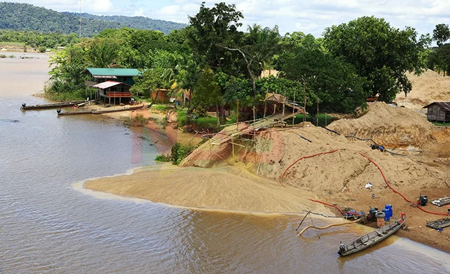
    On the Surinamese side of the river, illegal gold miners are poisoning ecosystems with mercury and causing irreversible destruction to riverbanks and island habitats, according to on-site inspections and data gathered by French enforcement agencies. During an aerial survey organized by EMOPI – the French Guiana-based mining police unit – the scale of the damage was laid bare: miners use heavy machinery to strip riverbank terrain and rely on mercury to extract gold, leaving behind excavated shorelines, toxic standing water, widespread erosion, and heavily contaminated river water that crosses the unmarked border into French territory.

    Sébastien Linares, EMOPI’s project manager based in Cayenne, explained that after Suriname dismantled 30 illegal mining barges (known locally as skalians) in 2022 – the last major crackdown on the activity praised by French authorities – prospectors simply shifted operations to Surinamese riverbanks, inland areas, and unclaimed river islands. By 2023, Linares’s team counted at least 37 active shoreline mining sites and 9 exploited islands, some of which have been in continuous operation since 2019. Today, just two to three small illegal barges remain active opposite the Gran Santi region of French Guiana.

    Mercury contamination from the mining has emerged as a major public health time bomb for communities on both sides of the border. French public health officials regularly test hair samples from French Guiana residents to track mercury exposure, and have recorded a 25% increase in contamination levels in the most remote river communities since 2005. The average mercury concentration measured in residents of the Upper Marowijne region currently sits at 12 μg/g – exceeding the World Health Organization’s (WHO) safety threshold of 10 μg/g, and far outstripping the 1.5 μg/g limit French authorities set for children. This discrepancy led French Ambassador Nicolas de Lacoste to summarize the cross-border harm with the quip: “You get the gold, we get the mercury.”

    Indigenous Wayana communities in southeastern Suriname are facing even more extreme contamination, documented through their own community-led monitoring program, the Wayana Biocultural Monitoring System. Jupta Itoewaki, an indigenous rights activist working with the program, shared that local tests have recorded mercury levels up to 8,469 times the WHO safety limit, and arsenic levels as high as 4,623 times the accepted standard. Wayana residents are exposed to these toxins daily through contaminated drinking water and food sources, but Itoewaki notes that the Surinamese government has failed to conduct systematic medical monitoring of affected communities, calling the state itself a contributor to the crisis.

    Itoewaki added that illegal mining activity has grown visibly across southeastern Suriname along both the Marowijne and Lawa Rivers, with prospectors including Brazilian garimpeiros (artisanal miners), Surinamese nationals, and criminal actors operating from the French side. Supply chains for the illegal operations are largely run by Chinese business owners along the Surinamese riverbank, who operate stores catering exclusively to mining needs. When French authorities conduct raids on illegal sites, miners simply retreat across the unclear border to Suriname to resupply before returning to the region.

    France has already enacted strict regulations to limit mining harm on its side of the river: all legal gold mining requires a strict permit that limits operations to a maximum 25-hectare area for just four years, and requires full ecological restoration of mining sites – including returning soil, waterways, and vegetation to their original pre-mining state – before operations can conclude. Mining police maintain continuous inspection authority to enforce these rules. However, French officials say the lack of action from Suriname and the unratified border agreement have rendered cross-border enforcement ineffective, describing current efforts as “mopping with the tap left open.”

    Ambassador de Lacoste told reporters that urgent coordinated cross-border action is needed to protect the river’s unique ecosystem and the communities that depend on it. The French Scientific Council for the Amazon Park has also joined the call for immediate intervention, noting that contamination already affects more than 300 populated areas on the French side of the border. Ratification of the 2021 border agreement would not immediately end illegal mining, de Lacoste acknowledged, but it would establish a formal joint governance body – the Maroni River Council – and create the legal framework needed for coordinated enforcement against illegal activity. Once borders are clearly demarcated, authorities can crack down on the criminal networks that use unclaimed islands as bases for operations, he added.

    Beyond illegal mercury mining, Itoewaki warns that the Wayana community now faces a new environmental threat: large-scale industrial mining permitted by the Surinamese government that would use cyanide for extraction. The Surinamese government has awarded a 102,000-hectare concession to a Canadian mining company on traditional indigenous territory, a move that is legal under Surinamese law but violates the Inter-American Court of Human Rights’ 2015 ruling requiring Suriname to obtain free, prior, and informed consent from indigenous communities for development on their lands. Itoewaki says the community’s traditional leader was only informed after the concession was granted, without translation or input into the decision.

    For the Wayana, ratification of the border agreement is a necessary first step to curb cross-border illegal activity, but not a complete solution. Itoewaki argues that a bilateral agreement negotiated without including the Wayana as legitimate territorial authorities repeats the patterns of colonial control that created the current crisis. “We call for ratification of the protocol, but it must also be paired with formal recognition of our land rights,” she said. “Without that, nothing will change for our river.”

    French officials also note that cracking down on illegal gold mining would also help address broader cross-border crime, including human trafficking, drug smuggling, and contraband trade that thrives in the ungoverned border zone. France has offered to support Suriname in cutting off the illegal supply lines that sustain mining operations, but says progress cannot happen until the border agreement is ratified.
  • Met Office Says No Flood Warning in Place Despite Trough Bringing Heavy Rain

    Met Office Says No Flood Warning in Place Despite Trough Bringing Heavy Rain

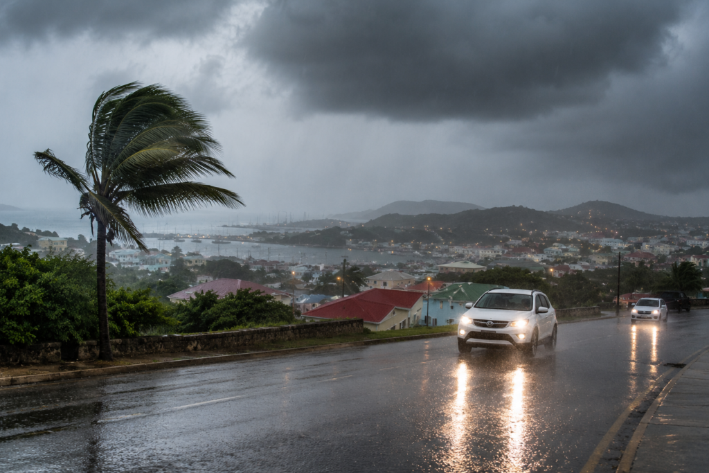
    A low-pressure trough system is currently driving unstable atmospheric conditions across Antigua, Barbuda, and the broader Leeward Islands, bringing dense cloud cover, frequent thunderstorm activity and sustained periods of intense rainfall that have put local officials on alert. The Antigua and Barbuda Meteorological Service has issued an urgent advisory calling on all residents to maintain the highest level of caution amid the ongoing adverse weather event.

    Meteorological officials warn that the persistent unsettled conditions carry significant safety risks for the public. Heavy downpours are already cutting visibility across large swathes of the islands, creating slick, dangerous driving conditions on both urban and rural roads, especially in regions that have recorded the highest rainfall accumulations. In response to these hazards, authorities have issued a clear appeal to all motorists to reduce speed, allow extra stopping distance, and avoid unnecessary travel for the duration of the system’s passage over the islands.

    As of the latest update, the meteorological service has not issued formal flood watches or warnings for the territory. However, forecasters have stressed that this status could change rapidly: if current high-intensity rainfall continues, a formal flood advisory will be activated to alert at-risk communities to potential flooding of low-lying areas.

    According to current meteorological projections, the trough system is expected to begin moving away from the region, with conditions forecast to steadily improve through the course of this afternoon and into tonight. The Antigua and Barbuda Meteorological Service has confirmed that it will maintain continuous monitoring of the weather system and issue timely updates to the public as new information becomes available.

  • Verón-Punta Cana planning proposal focuses on sustainable transportation

    Verón-Punta Cana planning proposal focuses on sustainable transportation

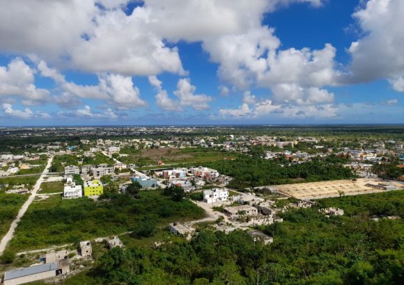
    In the Verón-Punta Cana region of the Dominican Republic, a bold new urban development framework is set to transform the country’s most high-profile tourism destination, reorienting all future growth around the core principle of sustainable mobility. The Verón-Punta Cana Territorial Planning Plan (POT) proposes a systemic overhaul of the area’s transportation infrastructure, addressing growing mobility challenges that have come with the region’s rapid tourism and residential expansion.

    At the heart of the proposal is a redesigned hierarchical road network that categorizes routes into four functional tiers: expressways, arterial roads, collector roads, and local roads. This clear functional separation is designed to streamline traffic flow, cut down on chronic congestion, and improve overall road safety for all users. Beyond motor vehicle infrastructure, the plan prioritizes expanding accessibility and infrastructure for non-motorized travel and shared public transit, with the explicit goal of reducing the region’s overwhelming dependence on private passenger vehicles.

    Aligned with global best practices for Sustainable Transit-Oriented Development (TOD), the initiative aims to build a more interconnected, walkable community. The plan maps out integrated pedestrian paths and cycling corridors that link residential neighborhoods directly to employment hubs, commercial districts, public service facilities, and major transit stops, eliminating the common disconnect between where people live and where they work, shop, and access services.

    One of the most notable innovations in the proposal is the creation of Verón-Punta Cana’s first formal, integrated bicycle lane network. Unlike recreational cycling paths that are common in many tourist regions, this network is designed to function as a core part of the area’s public transportation system. The routes will connect residential areas, workplaces, public facilities, and transit stations, and will meet strict international standards for safety, including adequate width, nighttime lighting, clear signage, and physical barriers separating cyclists from motor vehicle traffic.

    To further advance the plan’s safety and sustainability goals, the proposal designates protected mobility corridors along two major regional routes: Frank Rainieri Boulevard and the Verón-Bávaro Ring Road. Within these corridors, developers will be prohibited from constructing permanent structures or adding parallel service roads, a restriction intended to preserve the corridors’ primary transportation function, reduce encroachment on public right-of-way, and create a safer, more pleasant environment for pedestrians and cyclists. The corridors will feature purpose-built pedestrian paths, separated bike lanes, and added public urban amenities to enhance user experience.

  • Environment Ministry highlights progress in protecting Yaque del Norte River

    Environment Ministry highlights progress in protecting Yaque del Norte River

    In Santo Domingo, the Dominican Republic’s Ministry of Environment and Natural Resources has announced notable progress in the multi-stakeholder protection and restoration of the Yaque del Norte River basin, one of the country’s most critical hydrological systems. The initiative, led by Environment Minister Paíno Henríquez, is a core component of a sweeping national plan designed to shore up long-term water security across the Dominican Republic’s most important river basins, which also include the Haina and Nizao watersheds.

    Officials emphasize that the Yaque del Norte basin fulfills irreplaceable roles for the nation, supplying drinking water to millions of residents, supporting large-scale agricultural production, providing input for hydroelectric power generation, and sustaining a wide range of unique native biodiversity. To advance restoration goals, the Ministry of Environment is coordinating implementation of targeted projects across multiple priority areas: reforestation of degraded riparian zones, soil conservation to reduce sediment runoff, comprehensive watershed restoration work, and integrated cross-sector water resource management.

    Partners in these efforts include the National Institute of Hydraulic Resources (INDRHI), local municipal governments, agricultural producers, grassroots community organizations, and international environmental and development partners. Beyond on-the-ground restoration work, authorities have also strengthened regulatory oversight, conducting mandatory technical environmental reviews for all proposed projects that could impact rivers and other surface water bodies. This step ensures that all development activities adhere strictly to national environmental regulations while still supporting balanced, sustainable economic growth across the region.

    One of the most high-profile undertakings in this national strategy is the Watersheds and Climate-Resilient Communities (CReW-RD) project, a $90 million initiative funded by the Green Climate Fund. The program focuses on restoring ecologically critical hydrological ecosystems, boosting local communities’ ability to withstand the impacts of climate change, and scaling up nature-based solutions to water and climate challenges. The Yaque del Norte River basin has been designated as one of the primary intervention zones for the large-scale program.

    Ministry leadership reaffirmed that strategic investment in the protection of the Dominican Republic’s watersheds is a foundational requirement to guarantee stable long-term water supplies, reduce land degradation and erosion, restore damaged native ecosystems, and lay the groundwork for inclusive, sustainable economic development across the country for decades to come.

  • Thunderstorms, Lightning and Heavy Rain Reported Across Antigua and Barbuda as Tropical Wave Passes

    Thunderstorms, Lightning and Heavy Rain Reported Across Antigua and Barbuda as Tropical Wave Passes

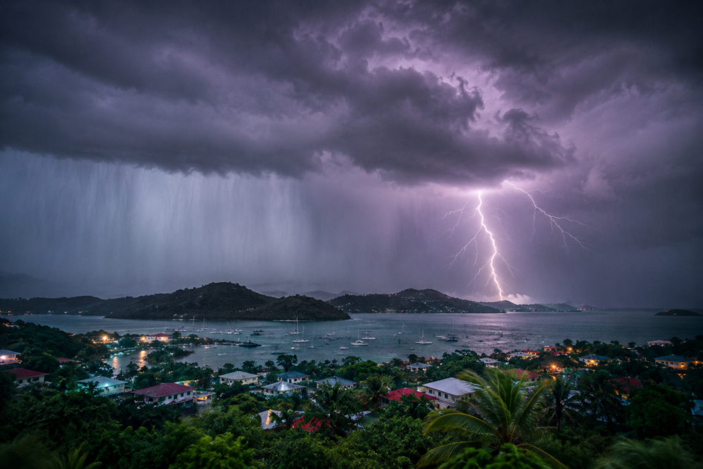
    On Sunday, the twin-island nation of Antigua and Barbuda faced severe disruptive weather as a passing tropical wave brought hours of heavy rain, repeated lightning strikes, and intense thunderstorms across both islands. Local residents in multiple residential communities shared firsthand accounts of rapid, torrential downpours that swept through neighborhoods, paired with bright, frequent flashes of lightning that illuminated overcast skies.

    Meteorologists attribute the volatile conditions to residual moisture and persistent atmospheric instability left in the tropical wave’s wake. These conditions have created a favorable environment for the development of scattered and isolated thunderstorms across the entire country, with unstable weather patterns projected to hold as the system continues its slow movement across the islands.

    In response to the hazardous conditions, national safety officials have issued urgent public safety guidance aimed at reducing the risk of lightning-related injuries. Officials emphasize that lightning can travel as far as several miles from the core of a storm system, meaning strikes can occur even when no rain is falling at a location. For this reason, the public is strongly advised to move to safe shelter immediately whenever thunder is audible. The only recommended safe spaces are fully enclosed permanent buildings and vehicles with solid metal hard tops.

    Until at least 30 minutes have passed since the last sound of thunder, officials warn the public to avoid a wide range of high-risk locations. These include open outdoor spaces, coastal beaches, natural bodies of water such as rivers and ponds, constructed swimming pools, tall isolated trees, utility poles, overhead power lines, and metal perimeter fences, all of which increase the risk of being struck by lightning.

    As unstable weather conditions are set to continue in the coming period, local authorities are urging all residents to stay informed by regularly checking official meteorological updates. They also encourage community members to reach out to check on the well-being of vulnerable family members and neighbors, and maintain a heightened state of alert to respond to changing weather conditions.

  • Antigua and Barbuda Marks International Day for the Conservation of the Mangrove Ecosystem

    Antigua and Barbuda Marks International Day for the Conservation of the Mangrove Ecosystem

    ST. JOHN’S, Antigua – In a push to highlight the irreplaceable ecological and economic value of mangrove forests to the twin-island nation, Antigua and Barbuda’s Department of the Blue Economy has organized a full slate of educational and community-focused events to observe the International Day for the Conservation of the Mangrove Ecosystem.

    In an official statement released to mark the annual observance on Sunday, the department outlined the wide-ranging, critical roles mangrove ecosystems play across the country. Beyond anchoring coastlines to slow erosion and buffer against destructive storm surges, these coastal forests underpin marine biodiversity, act as highly effective carbon sinks, and boost the nation’s overall capacity to adapt to the accelerating impacts of climate change.

    The first of this year’s scheduled activities took place July 24, when department organizers hosted an interactive educational workshop for attendees of the National Library Summer Camp. Through a mix of engaging educational games and hands-on learning experiences, young campers explored core themes including local marine biodiversity, coastal protection strategies, marine pollution prevention, and the natural water purification function mangrooves provide.

    The series of observance events will continue July 27 with a community mangrove-themed public mural project, led entirely by students from J.T. Ambrose Primary School. The mural will be painted at the Recreation Ground on Independence Drive, located directly opposite the Roman Catholic Church of St. Joseph and St. Patrick, with work running from 9 a.m. to 3 p.m. and open to public observers.

    Department officials emphasized that while mangroves rank among the most biologically productive ecosystems on the planet, they are also one of the most threatened. These coastal forests serve as critical nursery habitats for commercially important marine species including fish, crabs and lobsters, providing a natural foundation that supports the nation’s commercial fishing industry, coastal tourism sector, and small coastal communities that rely on both for livelihoods.

    Data shared by the department adds further context to mangroves’ outsized environmental impact: Healthy mangrove ecosystems naturally filter industrial and agricultural pollutants from coastal waters, boosting water quality for both marine life and human communities, while reducing the destructive force of hurricanes and seasonal flooding. On a global scale, mangrove forests can store up to four times more carbon per hectare than most terrestrial tropical forests, and provide permanent or migratory habitat for hundreds of species of fish, birds and other wildlife.

    To extend the impact of the international observance beyond scheduled events, the Department of the Blue Economy is calling on all Antigua and Barbuda residents to join ongoing mangrove conservation efforts. Simple actionable steps the department highlights include cutting down on single-use plastic consumption to reduce marine plastic pollution, avoiding damage to intact coastal mangrove habitats, participating in local community coastal clean-up drives, and spreading public awareness of mangroves’ importance to friends and family.

    Closing the official message, the department adopted the event slogan “Healthy Mangroves. Healthy Oceans. Stronger Communities,” and encouraged local residents to share their own personal mangrove conservation activities on public platforms to honor the international observance and inspire broader action.

  • Bescherm onze mangroven: het is nu tijd om in actie te komen!

    Bescherm onze mangroven: het is nu tijd om in actie te komen!

    On July 26, the world observes annual World Mangrove Day, a moment that draws sharp focus to the extraordinary ecological, economic and social value of Suriname’s extensive mangrove forests – one of the largest and most ecologically critical mangrove ecosystems in the Caribbean and South American region.

    Far more than just a belt of trees lining Suriname’s coastline, these unique intertidal forests deliver a wide array of irreplaceable benefits to the nation and its people. They act as a natural coastal barrier, slowing erosion and buffering inland communities from devastating storm surges and flooding. They serve as critical nursery habitats that support juvenile fish and hundreds of other wildlife species, underpinning the livelihoods and food security of thousands of small-scale fishers across the country. Perhaps most importantly in an era of accelerating climate crisis, mangroves sequester carbon far more effectively than many terrestrial forest types, helping Suriname absorb the impacts of rising sea levels and broader climate change.

    Despite these critical benefits, Suriname’s mangroves face growing, multifaceted threats that are pushing these fragile ecosystems toward increasing degradation. Climate change-driven impacts including accelerating sea level rise, prolonged droughts and altered hydrological patterns have already caused measurable harm. On top of these natural stressors, unregulated human activity and inadequate ecosystem management have disrupted natural ecological processes across large swathes of mangrove habitat. Even previously robust, healthy mangrove stands are now showing signs of damage when water flow is blocked and emerging threats are not addressed in a timely manner, experts warn.

    World Mangrove Day serves as a critical reminder that raising awareness alone is not enough to reverse these trends – tangible, coordinated action is urgently required. This means investing in science-based, sustainable mangrove management, developing clear long-term conservation plans, securing consistent and sufficient funding for protection and maintenance, and forging close collaborative partnerships between government agencies, ecological researchers and local coastal communities. Protecting mangroves is not just an environmental priority: it is central to Suriname’s public safety, food security and long-term economic stability. Safeguarding these ecosystems is equivalent to safeguarding Suriname’s future.

    Recent, comprehensive research conducted at the Bigi Pan mangrove reserve in Nickerie – one of Suriname’s most important coastal protected areas – offers a actionable blueprint for effective conservation. The study documented strategies to restore degraded mangrove areas and strengthen protection for intact healthy forest, and put forward a series of evidence-based recommendations for improved management of Bigi Pan. These include deeper collaboration between stakeholder organizations, sustained adequate funding, regular ecological monitoring, stricter enforcement of existing conservation regulations, and expanded leadership roles for local communities that live in and around the reserve. The Bigi Pan project demonstrates that meaningful conservation outcomes are achievable when scientific expertise, indigenous and local knowledge, and proactive policy are aligned. The management and monitoring frameworks developed for Bigi Pan can now serve as a replicable model for other mangrove areas across Suriname’s coastline.

    On this World Mangrove Day, the Anton de Kom University of Suriname and the Mangrove Forum Suriname are calling on the Surinamese government to elevate mangrove protection and sustainable management to a top national priority. To deliver meaningful progress, clear regulatory frameworks, defined institutional responsibilities, sustained public funding, and decision-making rooted in rigorous scientific research are all essential. Equally indispensable is the active participation of citizens and local coastal communities, who bear the closest connection to these ecosystems and depend most directly on their health.

    The appeal extends beyond government: policymakers, researchers, civil society organizations, development partners and all people of Suriname are called on to unite around shared mangrove stewardship. Protecting these ecosystems is a collective shared responsibility for all stakeholders.

    The future of Suriname’s entire coastline and the livelihoods of the communities that call it home are inextricably linked to the future of the nation’s mangroves. Without urgent action, Suriname will not only lose one of its most unique natural treasures: it will also face increasing damage from flooding and coastal erosion, declining fish stocks that threaten food security, and heightened national vulnerability to the impacts of climate change.

    While public awareness is a critical first step, it is not sufficient to reverse current trends. Communities and individuals must speak up and contribute to decision-making that shapes the future of mangroves and the communities that depend on them. Now is the time for urgent action: the current rate of mangrove degradation must be slowed, and ultimately halted, to protect Suriname, its future generations, and all who rely on a healthy, resilient coast. Every person has a role to play, because the benefits of intact mangroves touch every member of Surinamese society.

    This call to action is being amplified during the first ever Mangrove Run, held July 26, 2026 in Nieuw Nickerie. Far more than a recreational public event, the run serves as a collective call to action for all people to join the effort to protect Suriname’s mangroves. Mangroves belong to all of Suriname, their value stretching from the local coastline to global climate stability, and from the present day to the far future.

    This statement is issued by Prof. dr. Sieuwnath Naipal, on behalf of the Anton de Kom Universiteit van Suriname and the Mangrove Forum Suriname.

  • “This Is What Our Guests Are Coming to See”: Fish Die-Off Reported in Caye Caulker

    “This Is What Our Guests Are Coming to See”: Fish Die-Off Reported in Caye Caulker

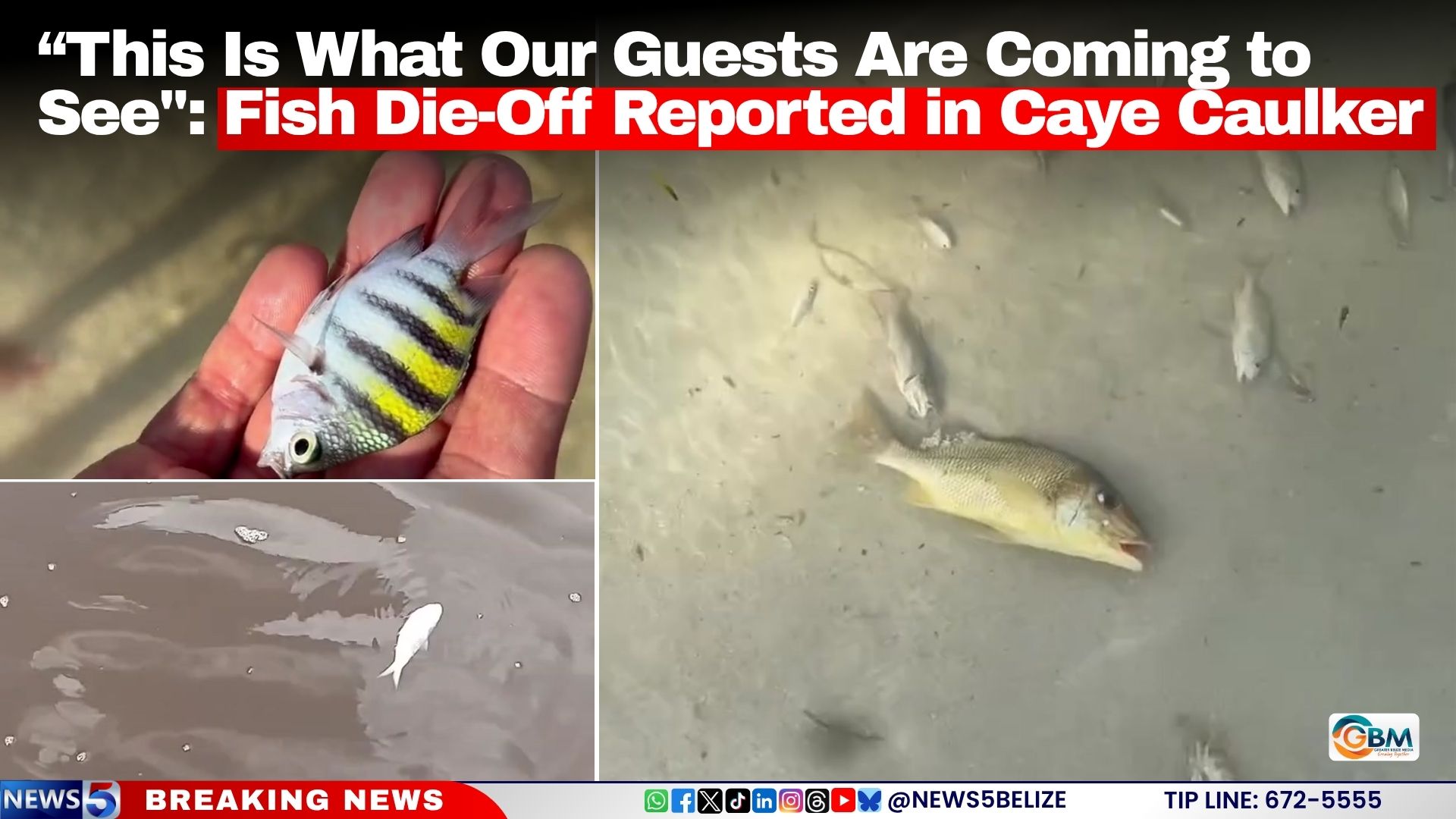
    On July 25, 2026, a devastating mass mortality event of small fish has hit the Caribbean island of Caye Caulker, leaving local communities reeling and demanding answers after footage captured hundreds of lifeless fish drifting across the waters surrounding La Isla Cariñosa.

    The ongoing incident has triggered widespread alarm among island residents, who report that the stench of decaying fish has already drifted across multiple residential zones in the village. As speculation grows over the root cause, many locals are pointing to the persistent, years-long buildup of sargassum seaweed along the island’s coastlines, questioning whether the unmanaged influx has pushed the fragile coastal ecosystem past its breaking point.

    One local resident, who spoke on condition of anonymity, placed blame squarely on the worsening sargassum crisis and criticized national authorities for failing to implement meaningful solutions. “The cause is clear: it’s the sargassum, and politicians have refused to invest in a real, long-term fix,” they said. “We can’t fault our local village council — they don’t have the budget or resources to handle a problem this big. But the responsible minister can’t stand by and claim there’s no funding to address this.”

    Another resident shared a firsthand account of the events leading up to the mass die-off, recounting unusual activity along the island’s popular north split on Thursday. “All that sargassum washed up onto the north split shore Thursday evening,” they explained. “We saw hundreds of birds gathering to feed, and even crocodiles came out in the early afternoon to feed on the bait fish that were already alive but clearly struggling. When we woke up the next morning, every last fish was dead. And nothing has touched the carcasses since.”

    A third resident’s widely shared video offers a stark visual of the damage: murky, brown-tinged coastal waters littered with the pale bodies of dead small fish, with what appears to be a dead eel floating among the remains. “This is what our tourists come to Caye Caulker to see? Brown, polluted water and dead fish,” the resident said in the footage, describing the unregulated sargassum influx as “a plague that is choking all our marine life.”

    As of press time, no official cause for the die-off has been confirmed by environmental or government authorities. However, marine scientists have long warned of the severe risks that decomposing sargassum poses to nearshore marine ecosystems. When large accumulations of the seaweed break down, they rapidly deplete dissolved oxygen levels in surrounding waters, while releasing toxic gases and compounds that place lethal stress on fish, shellfish, and other aquatic organisms.

  • WEATHER (6:00 AM, July 25): Weak unstable conditions are affecting the area

    WEATHER (6:00 AM, July 25): Weak unstable conditions are affecting the area

    Residents across the Lesser Antilles region are bracing for a day of mixed, unpredictable weather on Friday, driven by multiple overlapping atmospheric systems that have prompted official caution for vulnerable communities and outdoor operators. This morning’s forecast calls for widespread cloud cover interspersed with scattered showers, which may ramp up to moderate or heavy intensity in localized areas, with a chance of isolated thunderstorms popping up across the territory.

    As the day transitions into afternoon and overnight, the conditions will shift only slightly. Most areas will stay mostly cloudy with a light haze, holding just a handful of scattered showers through the evening. After midnight, storm activity will pick up again, bringing back scattered showers and the continued threat of isolated thunderstorms.

    Meteorologists trace the day’s unsettled weather to a mid- to upper-level atmospheric trough carrying excess moisture and atmospheric instability, which is the primary driver of today’s cloudy, showery conditions. The bigger shift on the horizon is an approaching tropical wave, which is expected to bring widespread cloud cover, showers and thunderstorms starting across the southern Lesser Antilles this afternoon. Those stormy conditions are projected to track northward overnight, continuing through Sunday across the northern parts of the region.

    In light of this forecast, authorities are urging residents living in low-lying areas, steep hillsides, and other zones that are historically prone to flooding, landslides and falling rock debris to stay vigilant and take proactive steps to protect property and personal safety.

    A secondary atmospheric hazard is also building through the day: Saharan dust concentrations, which are low across the region this morning, are expected to climb steadily starting this afternoon. People living with pre-existing respiratory conditions, including asthma, chronic allergies and other breathing impairments, are advised to closely monitor changing air quality conditions and follow recommended precautions such as limiting prolonged outdoor exposure to reduce health risks.

    For marine and coastal activities, conditions across the next 24 hours remain mostly favorable, with sea states ranging from slight to moderate. Along the territory’s west coast, wave heights are expected to hover around 3 feet, while the more exposed east coast will see larger swells reaching near 7 feet. While general marine activities can proceed safely, small craft operators are reminded to maintain extra caution, especially when operating in open offshore waters where conditions can change quickly.

  • Central America Braces For El Nino’s Effects on Agriculture

    Central America Braces For El Nino’s Effects on Agriculture

    As the 2026–2027 El Niño phenomenon looms over Central America, bringing projected drought, erratic extreme weather events, and growing threats to regional crop yields and food stability, agricultural leaders from across the region gathered in San José, Costa Rica on July 24, 2026 to hammer out a unified, collaborative strategy to mitigate the coming impacts.

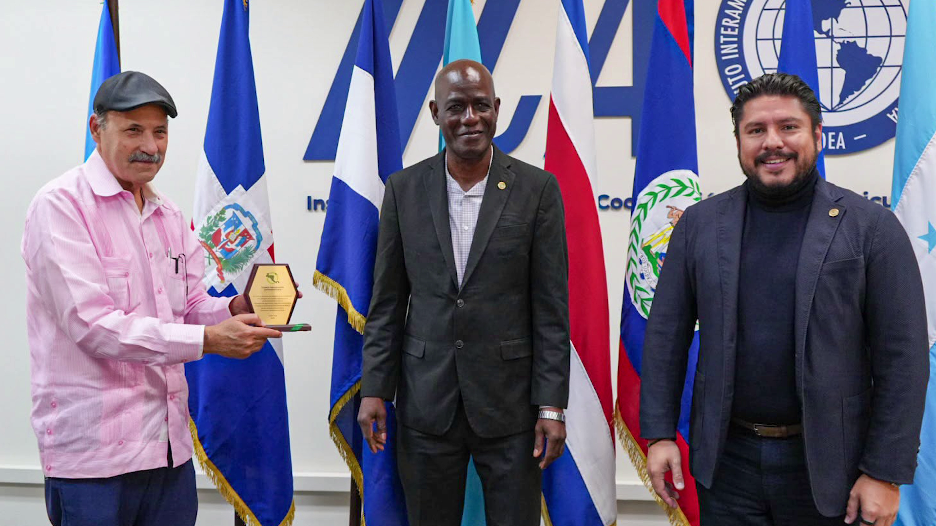
    The meeting was chaired by Belize’s Agriculture Minister Rodwell Ferguson, who currently serves as Pro Tempore President of the Central American Agricultural Council (CAC), the regional body coordinating the effort. Ferguson opened discussions by emphasizing that no single nation in the region has the capacity to address El Niño’s far-reaching agricultural disruptions alone, arguing that cross-border coordination and shared resources are the only viable path to protecting vulnerable farming communities and maintaining food access across Central America.

    In an interview following the gathering, Ferguson outlined the core priorities the bloc has agreed to advance over the next six months. The top immediate goal is securing targeted grant funding to support smallholder and commercial farmers across the region, who are already beginning to feel El Niño’s effects. “Technically yes, it’s upon us, I believe until July of 2027, and every country is already feeling the effects of it,” Ferguson explained.

    El Niño is already manifesting unevenly across the isthmus: some nations are grappling with record-breaking heatwaves that have drained critical water reserves for irrigation, while others have already faced unseasonable extreme rainfall and intense tropical storm activity that has damaged standing crops. Even as El Niño is a natural climate pattern that cannot be stopped, Ferguson stressed that regional leaders cannot afford inaction.

    Following the meeting, the CAC has mandated each member state to draft a national needs assessment and action plan within the coming weeks, to be aligned with a regional coordinated framework. The bloc’s shared approach will center on pooling limited national resources and leveraging combined advocacy to unlock international grant funding, since existing domestic resources across the region are insufficient to address the scale of the challenge. Ferguson noted that regional integration is not just an economic principle — it is a critical tool for collective resilience in the face of climate-driven shocks, ensuring that all member states can access the support they need to protect their agricultural sectors and keep food supplies stable for local populations.