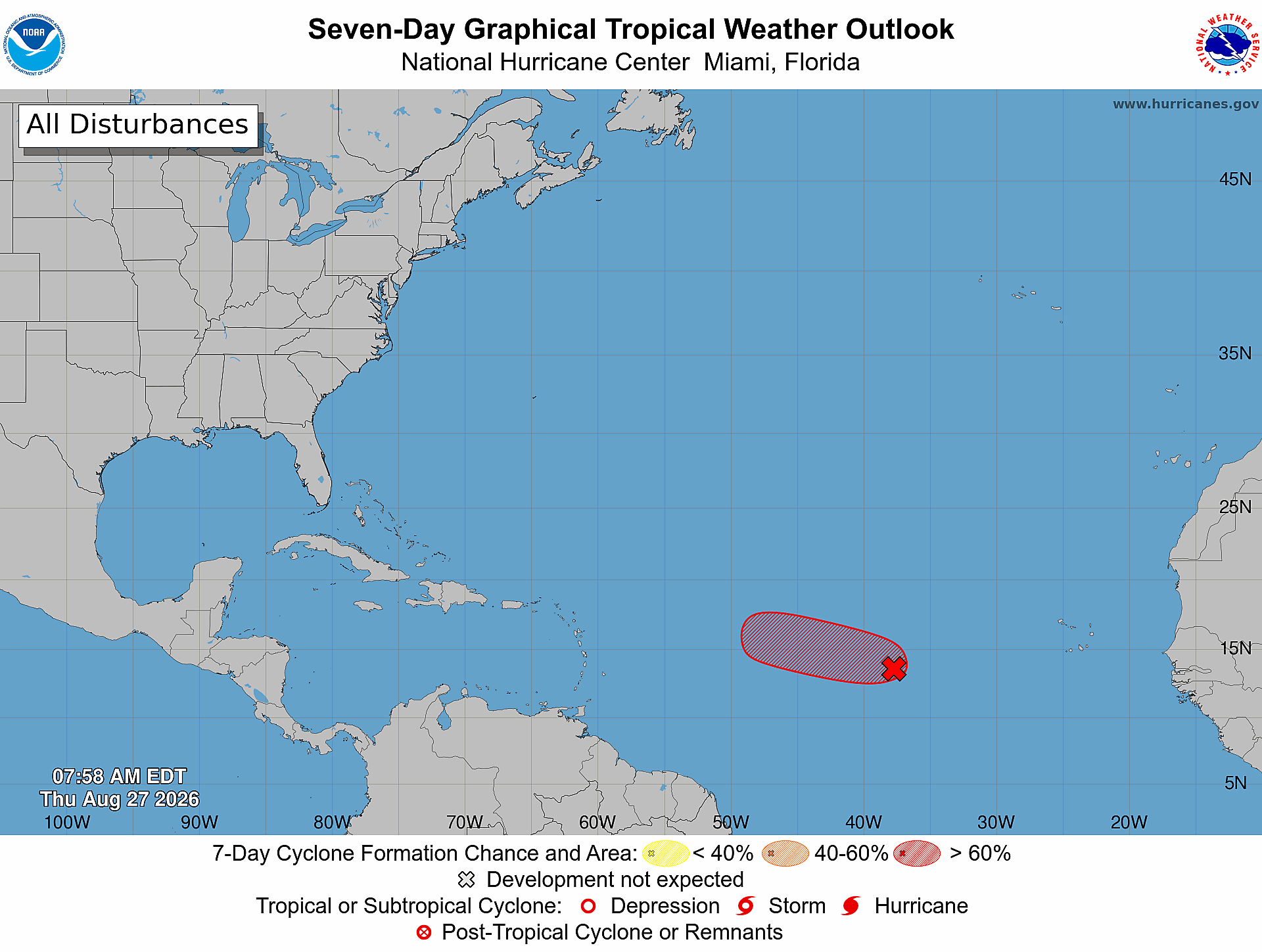
The National Hurricane Center (NHC) has sharply upgraded its probability forecast for tropical cyclone development in a low-pressure zone spanning the central tropical Atlantic, now putting the likelihood of formation at 90% across both the 48-hour and seven-day forecasting windows.
Designated as System AL96, the weather disturbance has shown clear signs of increasing organization through overnight hours, according to readings collected from satellite and microwave imaging. As of the latest update, the system is currently tracking roughly midway between the western African coastline and the Windward Islands.
Forecasters at the NHC note that if the current trend of gradual strengthening continues, official storm advisories will likely be issued for what would become a short-lived tropical storm as early as later this Thursday. That said, the favorable conditions allowing the system to organize are not expected to persist. Starting Friday, atmospheric and oceanic environmental conditions are projected to turn increasingly hostile for cyclone development, a shift that is expected to halt any further strengthening of the system and likely end its development cycle entirely.
In the wake of the upgraded forecast, local authorities and the NHC have issued a reminder to residents across Antigua and Barbuda, as well as communities across the broader Caribbean region, to remain alert and continue tracking official updates for any changes to the system’s track and intensity over the coming days.