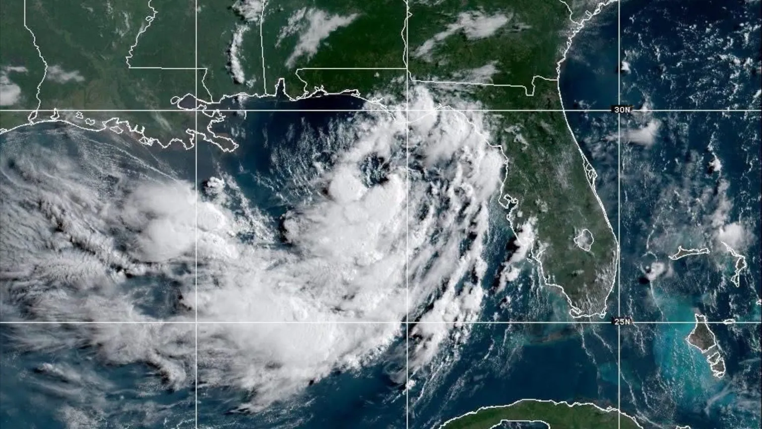
As the 2024 Atlantic hurricane season gains early momentum, the U.S. Gulf Coast is bracing for significant disruptive weather, with Tropical Storm Bertha poised to bring heavy downpours, life-threatening coastal flooding and isolated severe weather to much of the American Southeast this week. As of Monday afternoon, the National Hurricane Center (NHC), the Miami-based agency that monitors Atlantic and Pacific tropical weather systems, reported that the named storm was circling roughly 105 miles (165 kilometers) south of Panama City, Florida, packing sustained maximum wind speeds of 40 miles per hour (65 kilometers per hour), right at the threshold for tropical storm classification.
In its official forecast, the NHC projected that Bertha will track slowly near or parallel to the northern Gulf of Mexico coastline over the coming three days, moving northwest at just 3 miles per hour, with tropical storm-force winds extending 70 miles out from the storm’s central circulation. The slow-moving system is forecast to bring hazardous conditions to four Gulf Coast states: Alabama, Florida, Louisiana and Mississippi, as it drifts westward toward the Texas coastline.
Forecasters warn that accumulated rainfall could reach as much as 8 inches (20 centimeters) in hard-hit areas by the end of this workweek, creating a high risk of flash flooding in low-lying and urban regions where drainage systems can become overwhelmed quickly. Additionally, isolated tornadoes are possible across parts of Florida through midweek, and coastal areas in Louisiana and Mississippi are expected to see storm surges of 1 to 4 feet above normal tide levels — a surge that the NHC warns could become life-threatening in vulnerable low-lying coastal communities.
As of Monday evening, an updated NHC bulletin indicated that the storm is likely to intensify gradually over the next 48 hours before a projected landfall near New Orleans, Louisiana, on Wednesday. In preparation for the storm’s arrival, local New Orleans officials have begun distributing sandbags to residents to help reinforce properties against incoming floodwaters, and have asked homeowners and business owners to clear debris from local storm drains to improve drainage capacity.
The storm’s approach comes as the U.S. South is already grappling with a sustained period of sweltering summer heat, adding an extra layer of risk for residents who may lose power amid storm-related outages. After making landfall, the NHC forecasts that Bertha will gradually weaken, degrading to a tropical depression by Thursday and likely dissipating entirely by the end of the week as it approaches the Texas coast.
This storm is only the second named storm of the 2024 Atlantic hurricane season, following Tropical Storm Arthur, which brought moderate flooding to parts of the U.S. East Coast last month. A tropical storm watch is currently in effect from the Ochlockonee River in Florida westward to the Jefferson/Plaquemines Parish border in Louisiana, urging residents to monitor updated forecasts and follow any evacuation orders issued by local officials.