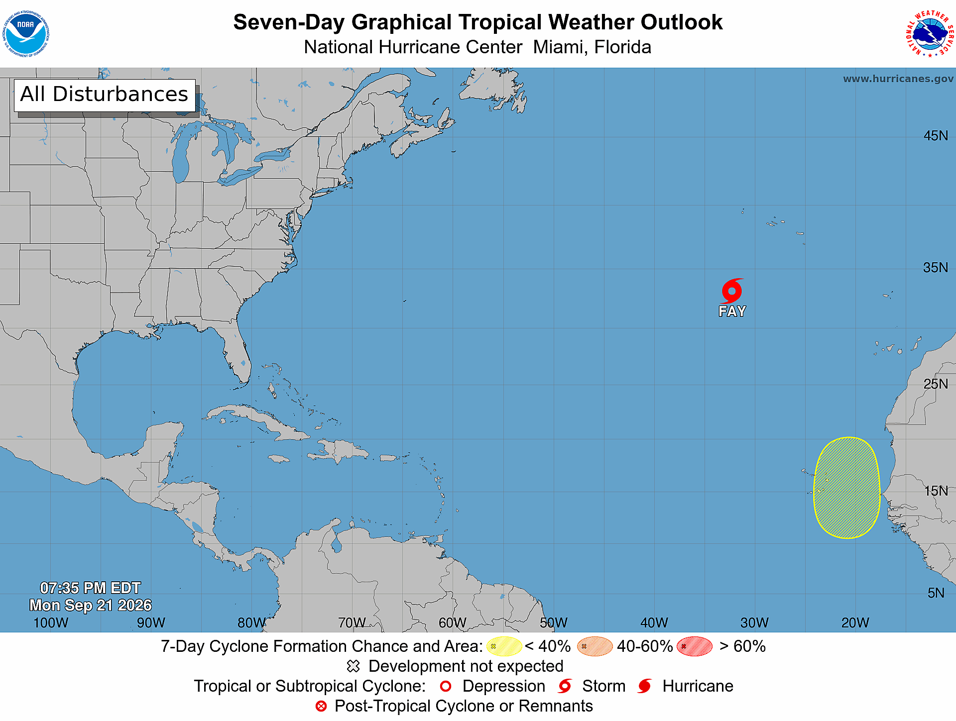
The U.S. National Hurricane Center (NHC) is closely tracking a newly emerged tropical disturbance that is projected to exit the western coast of Africa this Wednesday, bringing the potential for gradual cyclonic development across the eastern Atlantic later this week. In its official Monday update to the routine Tropical Weather Outlook, forecasters noted that any organization of the low-pressure system will likely unfold at a slow pace as it tracks westward past the Cabo Verde Islands over the coming days.
As of the latest forecast, the NHC assigns a near-zero probability of tropical cyclone formation within the next 48 hours, with a 20% chance of gradual development over the full seven-day forecasting window. This marks a downward revision from earlier projections, which had pegged the seven-day formation chance at 30% in a previously released outlook captured via screenshot.
For the moment, the disturbance sits hundreds of miles east of the Caribbean basin, and forecasters have confirmed that it poses no immediate danger to Antigua and Barbuda, or any other territories across the Leeward Islands chain. In a separate update on active Atlantic systems, Tropical Storm Fay continues to hold its structure as it churns across the central Atlantic Ocean, positioned several hundred miles to the southwest of Portugal’s Azores archipelago with no immediate threats to populated coastal areas.