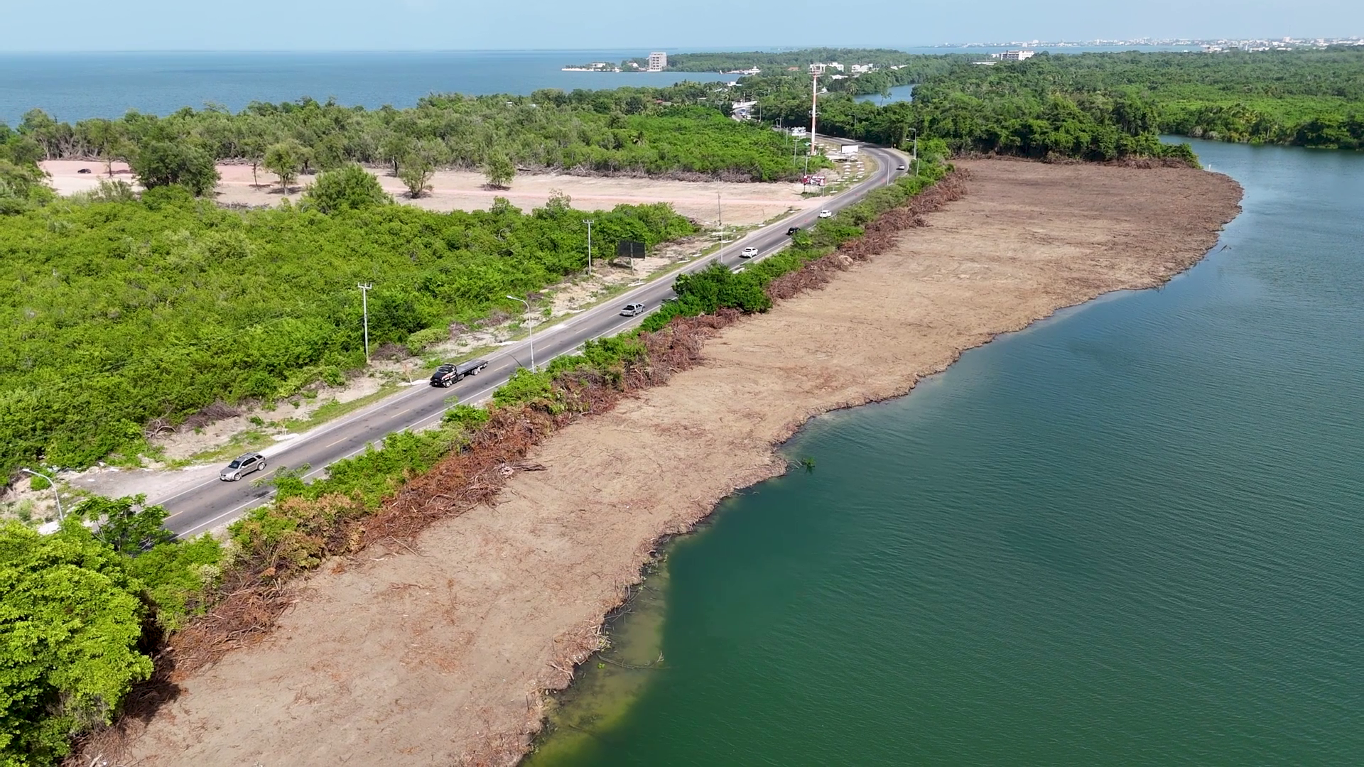
In a development that has raised urgent red flags among environmental experts and local authorities, a seven-acre riverside property along the Belize River has been completely stripped of all vegetation between the water’s edge and the embankment of the Philip Goldson Highway, triggering widespread fears of accelerated riverbank erosion and irreversible damage to the local riparian ecosystem. The incident, located at the 6.5-mile mark of the major highway, is now the subject of a formal joint investigation by three of Belize’s top government agencies: the Department of the Environment (DOE), the Forest Department, and the Lands Department.
In a surprising turn of events, the property’s owner, Sanju Chulani, told reporters he only requested a light clearing to improve visibility of the land plot, and was stunned by the full extent of vegetation removal carried out by his contracted crew. Chulani’s account has added an extra layer of complexity to the ongoing investigation, which is focused on two core goals: assessing the full environmental damage caused by the clearing, and determining whether any existing environmental or land use regulations were violated in the process.
Anthony Mai, Chief Environmental Officer at the DOE, confirmed that a cross-departmental inspection team has been assembled to assess the site. “We are aware of the issue, and we have put together a team that will go out and conduct a full on-site inspection. Representatives from each of the three agencies are participating, and we will be able to share further updates once the assessment is complete,” Mai stated in a press briefing.
When questioned about Belize’s longstanding 66-foot reserve requirement for riparian land, Mai explained the historical and ecological context of the regulation. He noted that in earlier decades, land titles were often issued all the way to the water’s edge, but the passage of the Lands Act formalized a requirement for private landowners to leave an undisturbed 66-foot buffer from the high-water mark of any water body. Crucially, this 66-foot reserve is officially classified as crown public land, not private property, Mai clarified.
The original purpose of the buffer was to create a public easement, ensuring all Belizeans could retain access to and enjoyment of the country’s waterways, rather than allowing private owners to block public access. Over time, scientific research has also confirmed the buffer’s critical ecological functions: it prevents riverbank erosion, filters runoff pollution, and supports native riparian biodiversity. In particularly sensitive environmental zones, Mai added, required buffers can extend as far as 200 feet from the water edge to protect fragile ecosystems.
Mai explained that while the buffer regulation is formally outlined in the Lands Act, the DOE enforces the requirement through the environmental clearance process for development projects. When a project receives environmental approval, the DOE creates a binding environmental compliance plan — a formal contract signed with the developer that outlines all buffer protection requirements and other environmental rules. Investigators are currently working to determine whether any regulations were broken in this case, and what enforcement actions may be required once the inspection is complete.