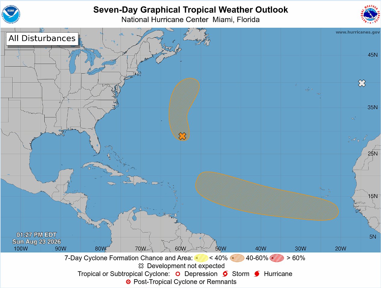
The United States National Hurricane Center (NHC) is currently tracking three distinct tropical weather systems across the Atlantic Ocean, with one long-disturbance showing moderate odds of strengthening into a organized tropical depression within seven days.
In its latest 2 p.m. Sunday update to the routine Tropical Weather Outlook, forecasters outlined that a tropical wave is projected to exit the western coastline of Africa starting Monday. This wave is expected to spawn a new area of low pressure in the opening days of the week, though current conditions are not expected to support immediate strengthening. The NHC’s official probability models put the chance of this system organizing over the next 48 hours at near-zero, a figure that climbs to 50% when the forecast window extends to seven days.
Forecasters note that atmospheric and oceanic environmental conditions will only be marginally favorable for development over this period, with any potential formation of a tropical depression most likely falling between the middle and end of the week. If the system continues to evolve as projected, it will track steadily westward across the eastern and central portions of the tropical Atlantic, moving at a forward speed between 15 and 20 miles per hour.
A second, separate area of low pressure is already active roughly 400 miles southeast of Bermuda, and it has begun showing clear signs of increasing organization. This system is forecast to track north and north-northeast, staying well to the northeast of Bermuda as it moves. Over the next two days, the NHC assesses it has a 40% chance of developing into either a tropical depression or a named tropical storm.
The third system being monitored, located just a couple hundred miles off the western coast of Portugal, has been removed from the list of systems likely to develop. Forecasters now say it has no meaningful chance of gaining subtropical characteristics before it moves inland over Portugal and Spain early Monday.