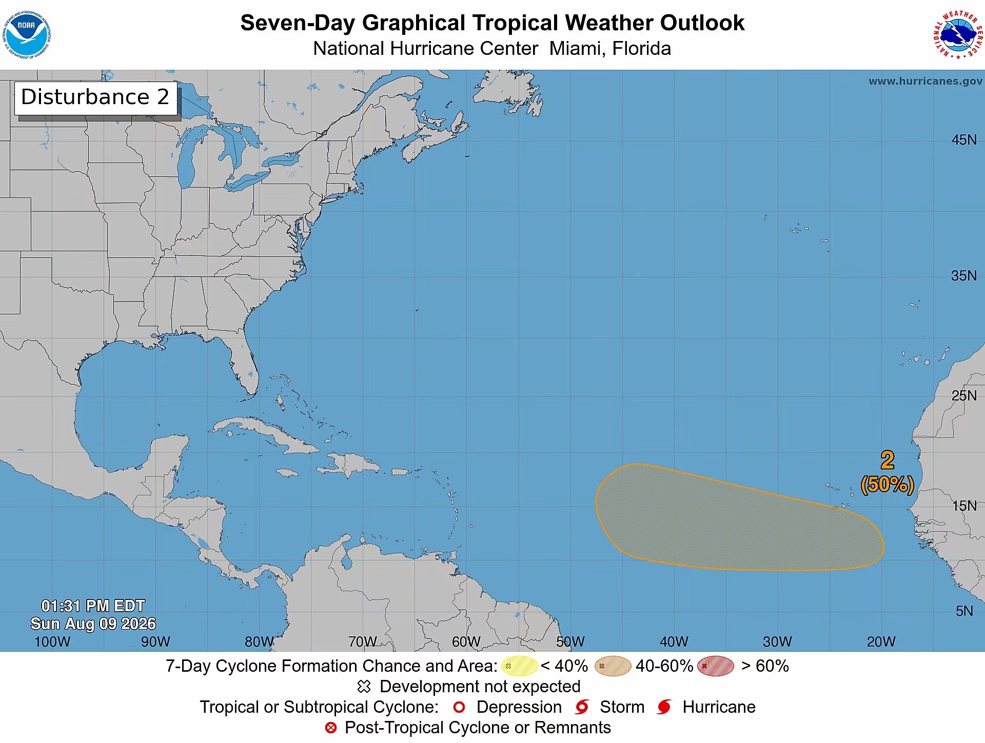
As weather forecasters track evolving conditions across the Atlantic basin, the probability that a newly identified tropical wave will develop into a organized weather system has climbed to 50% over the coming week, with experts noting a tropical depression could emerge later in the week.
Labeled Disturbance 2 by meteorological authorities, the broad low-pressure system is projected to emerge off the western coastline of Africa in the early days of this week. As the disturbance drifts on a steady path that will take it westward to west-northwestward across the eastern and central stretches of the tropical Atlantic, environmental conditions are predicted to grow increasingly supportive of slow, steady development of the system.
According to the latest forecasting outlook from the U.S. National Hurricane Center, the odds of the disturbance organizing into a tropical cyclone are effectively zero over the next two days. That probability is set to rise to a medium 50% by the end of the seven-day monitoring window, with the agency’s outlook mapping a broad swath of the tropical Atlantic extending hundreds of miles westward as the potential development zone.
At its current projected position and movement track, the system remains a long distance from the Lesser Antilles island chain, and officials have confirmed that it poses no immediate danger to the twin-island nation of Antigua and Barbuda. Even so, the system’s consistent projected westward trajectory means that meteorologists will need to closely monitor its evolution and path shifts over the coming days.
Local authorities have urged all residents of Antigua and Barbuda to keep up to date with official bulletins and updates issued by the Antigua and Barbuda Meteorological Service, as forecasters continue to assess the system’s development and its eventual path across the Atlantic.