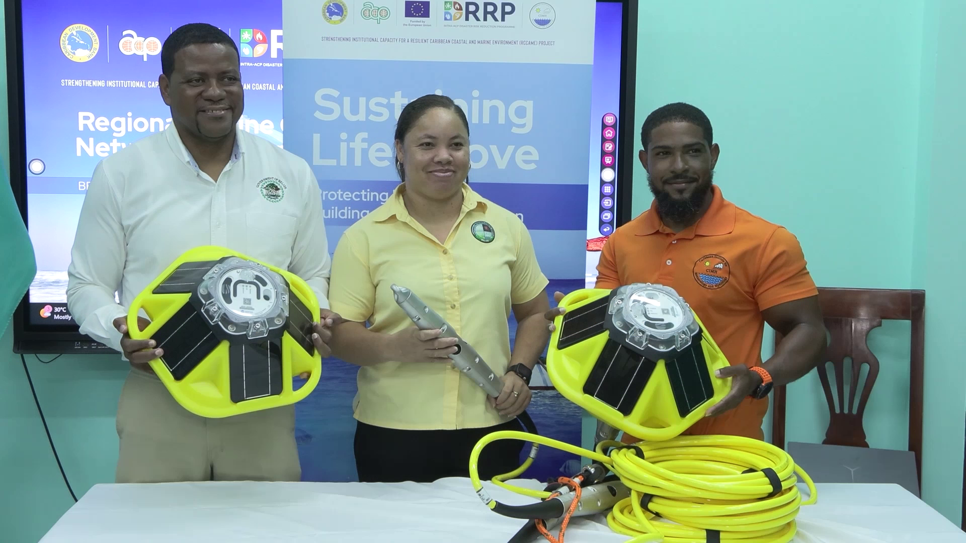
Belize is set to dramatically upgrade its ocean and coastal monitoring capabilities following the handover of three cutting-edge marine monitoring stations, a donation that will fill a long-standing data gap for the Central American nation’s vulnerable coastal communities.
The new infrastructure, which carries a total value of $66,000, was provided by the Caribbean Institute for Meteorology and Hydrology (CIMH), with project financing sourced from the European Union and channeled through the Caribbean Development Bank. It forms part of a broader regional initiative called Strengthening Institutional Capacity for a Resilient Caribbean Coastal and Marine Environment, a multi-component program that also covers air quality management, advanced climate prediction modeling, climate and public health linkages, cross-institutional knowledge exchange, and improved natural hazard forecasting.
For years, Belize’s National Meteorological Service has operated an extensive network of weather tracking infrastructure across its mainland, with a small number of existing offshore stations limited to the Cayes region. However, these older installations only collect data on atmospheric conditions such as air pressure, temperature, and wind speed, leaving a critical gap in continuous monitoring of ocean-specific variables that shape weather patterns and coastal risk. Ronald Gordon, Belize’s Chief Meteorologist, explained that the new stations will close this gap, expanding the country’s capacity to issue timely early warnings and build long-term resilience for populations that live and work along Belize’s extensive coastline.
CIMH mission lead Courtney Forde noted that the addition of these monitoring buoys marks a key milestone for improving hurricane forecasting across the entire Caribbean region. By gathering consistent, on-site ocean data, scientists can refine climate and weather models, leading to more accurate predictions of storm intensity and trajectory that benefit not just Belize but neighboring island nations as well.
Belize’s meteorological service has identified three priority locations for installing the new stations: Glover’s Reef, English Caye, and the Southern Turneffe Atoll, all ecologically and economically critical marine areas that are particularly exposed to coastal hazards. As part of the handover process, technical training on equipment installation and operation was provided to representatives from key local stakeholders, including the Belize Port Authority, the Turneffe Atoll Marine Reserve management team, and the national Fisheries Department.
Senior Climatologist Shanea Young noted that demand for improved marine data has been growing among local sectors for years. Organizations ranging from port regulators to marine conservation groups have long depended on generalized forecasts and satellite data, but the new stations will deliver high-resolution, on-the-ground observations of sea surface temperature and other key ocean variables that have not been available locally before. This will not only strengthen national early warning systems for extreme weather but also improve the quality of weather, ocean, and climate information provided to all end-users across the country.
Each of the three stations is equipped with solar-powered, satellite-connected weather buoys, alongside purpose-built floats, moorings, anchors, and an integrated suite of specialized sensors. The technology allows for continuous, 24/7 monitoring of a wide range of both marine and atmospheric conditions, including wave height and activity, sea surface temperatures, wind patterns, and atmospheric pressure. The real-time data collected will be used to strengthen disaster preparedness, improve forecasting accuracy, and support long-term monitoring and protection of Belize’s ecologically rich coastal and marine environments.