In the wake of catastrophic torrential rain and widespread flooding that left Belize’s transportation network severely damaged, industry experts have highlighted geospatial technology as a transformative tool to address the nation’s long-running infrastructural vulnerabilities and build climate-resilient public assets. The call for adoption came during the recent Infrastructure Intelligence and Geospatial Innovation Forum, hosted by local technology firm Fultec Systems, where cross-sector professionals from surveying, engineering, agriculture, and infrastructure development gathered to explore how integrated digital tools can reorient traditional infrastructure planning and maintenance.
Just one week before the forum, extreme rainfall and flooding once again exposed how precarious Belize’s roads and bridges remain even after recent upgrades. The Coastal Plain Highway, which underwent a major renovation just three years ago, already suffered noticeable structural damage from the flood waters — a clear example, experts say, of the gaps in current infrastructure assessment and design practices. Proponents argue geospatial technology fills these gaps by delivering granular, real-time data on road conditions, drainage systems, and structural integrity, allowing engineers to pinpoint at-risk weak points before they escalate into catastrophic failure.
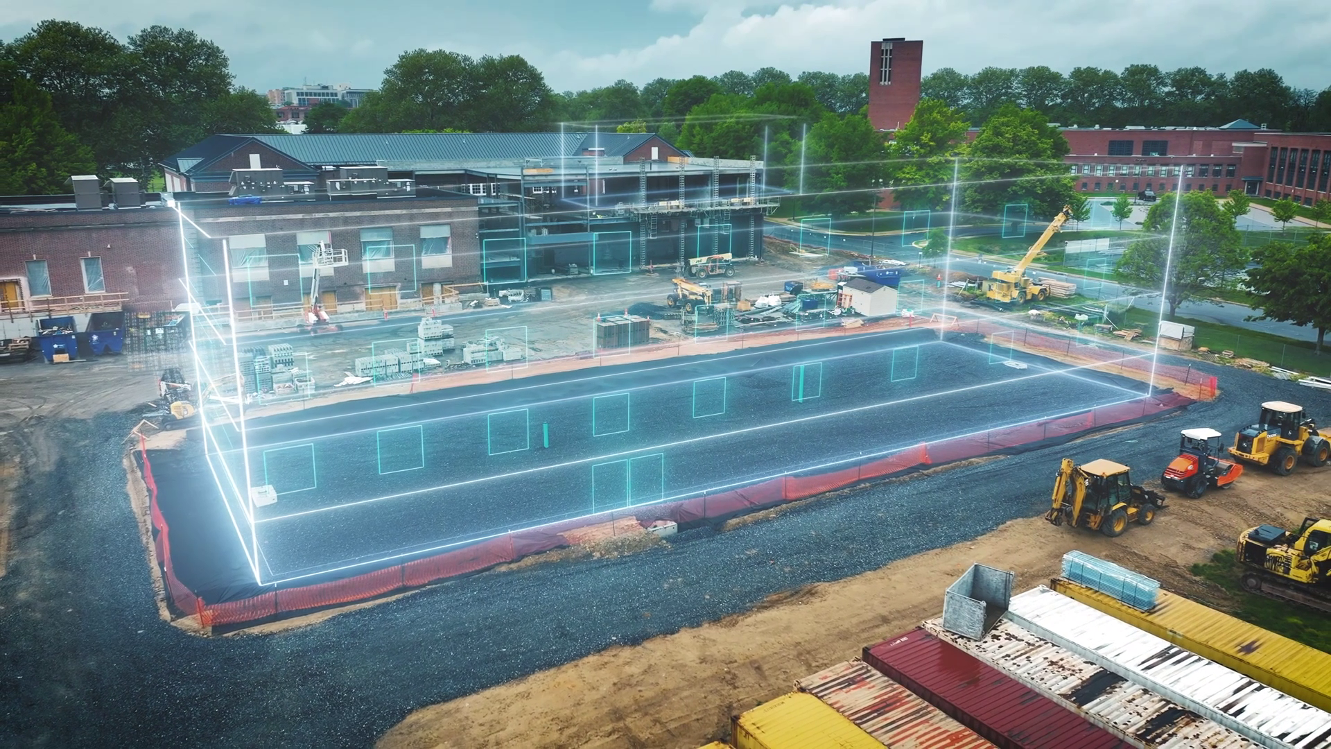
Carlos Sanabria, president of Puerto Rico-based infrastructure firm HLCM Group Inc., explained that the modern geospatial toolkit encompasses a wide range of accessible, high-precision tools: “We are talking drones, we are talking traditional total stations, terrestrial laser scanners, mobile laser scanners, GNSS system or GPS, which is commonly known to collect data for whatever is needed in terms of surveying, construction, and infrastructure development.”
Compared to traditional manual surveying methods, these modern tools outpace outdated practices on every metric: they capture far larger datasets, complete work in a fraction of the time, and deliver substantially higher accuracy. This depth of data not only enables early damage detection but also informs more robust design for new infrastructure, creating assets better equipped to withstand the increasing frequency of extreme weather driven by climate change.
Chad Lewis, Latin American Channel Manager for global geospatial solutions provider Trimble, noted that neighboring countries in the region have already integrated these tools into daily infrastructure operations. “Some of the reality capture platforms that we’ve sold into some of the neighboring countries is pavement inspections, if you will, right? Some of the road conditions throughout the territory are not in what we call a great state right now. So we can use some of the technologies to drive these roads, capture the current state, and identify where we need to do the repairs, right? These countries are really embracing the technology and using it day to day. It’s great to see.”
Trevor Reneau, General Manager of Belize’s Fultec Systems Ltd., emphasized that the technology is already available locally, and his firm’s work focuses on expanding access to training, local support, and ongoing upgrades for sectors across the country. He highlighted the dramatic efficiency gains the technology delivers: “Like for instance, you might look at the 3D modeling, which is the Trimble X9, and back in the days, you used to use maybe an X-ray machine, and it would take maybe an entire week to do it. But now, with the 3D modeling aspect of the X9, you might be doing it within seven minutes. So you see how efficient that technology is in bringing it within your organization.”
Farid Hode, a sales engineer at Trimble, added that precise data is the core value of these tools, especially as critical infrastructure ages beyond its original design lifespan. “This can work for example, infrastructure like roads and bridges. Those are usually designed for, like, maybe fifty to seventy-five years maximum. But we know that in practice, these assets, these structures are living for longer than that. So we need to make sure that there’s no structural deformation on them and this data’s gonna help us understand that.”
Reneau noted that Belizean industry professionals are already rolling out training programs to help local organizations master geospatial tools effectively. While neighboring countries including Guyana and Suriname have already advanced in adopting these solutions, the forum made clear that Belize now has a clear pathway to catch up, modernize its infrastructure practices, and build a more resilient transportation network fit for a changing climate. The report was filed by News Five’s Britney Gordon.
This report is adapted from a transcript of an evening television broadcast original to News Five.