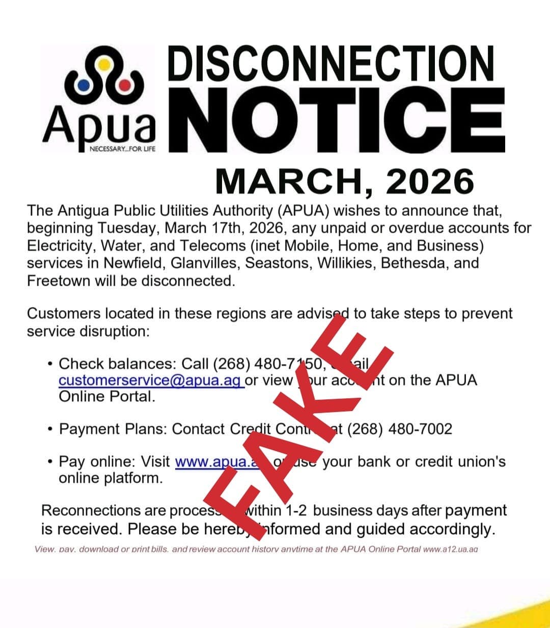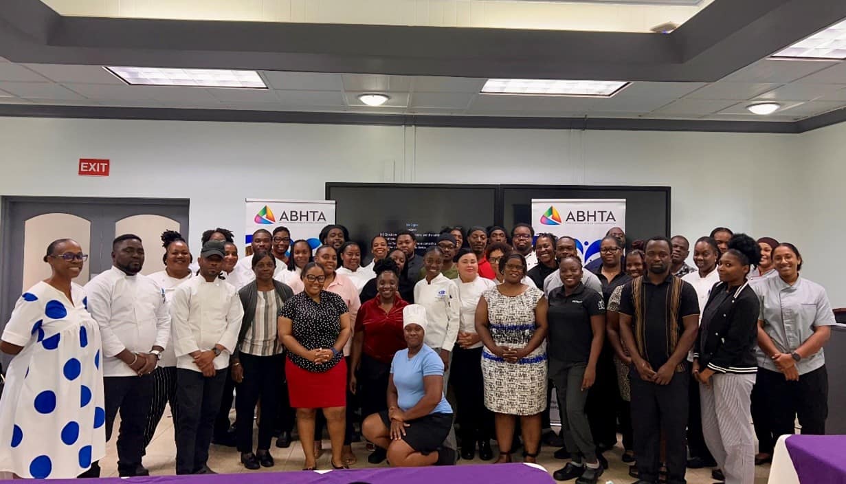
The Antigua & Barbuda Hotels and Tourism Association (ABHTA) has successfully concluded an intensive professional development program focused on elevating kitchen management standards within the nation’s hospitality sector. The two-day workshop, ‘Kitchen Management Essentials: People, Systems & Service,’ took place March 11-12, 2026, at the Muriel O’Mard Campus, bringing together culinary professionals from across the industry.
Under the expert guidance of Chef Olvanah Richardson, Executive Sous Chef at Blue Waters Resort and Spa with over 25 years of industry expertise, participants engaged in comprehensive training designed to bridge culinary artistry with operational leadership. The curriculum addressed critical components of kitchen management including workflow optimization, structured employee onboarding protocols, inventory control systems, and effective team leadership strategies.
The program incorporated established operational frameworks such as the 5S methodology for kitchen organization and Hazard Analysis Critical Control Point (HACCP) management systems. These approaches provide structured methods for reducing waste, enhancing safety protocols, and improving overall service efficiency in professional kitchen environments.
Interactive sessions featured collaborative problem-solving exercises and discussions emphasizing the crucial role of communication, standardized procedures, and teamwork in achieving operational excellence. Chef Richardson highlighted the importance of aligning departmental objectives while maintaining clear operational guidelines to address challenges effectively.
‘Congratulations to all our industry professionals. I am truly encouraged by each participant’s dedication,’ stated Chef Richardson, who further emphasized the value of ongoing training initiatives and mentorship programs within Antigua and Barbuda’s hospitality landscape.
Shantel Francis, Chef de Partie at Barbuda Ocean Club, shared her transformative learning experience: ‘The sessions provided invaluable insights into kitchen organization and staff development. My key takeaway was the significance of cultivating continuous improvement cultures through targeted training and constructive feedback mechanisms.’
The program concluded with certificate presentations to participants who successfully completed the training, recognizing their commitment to professional advancement and operational excellence. ABHTA reaffirmed its dedication to workforce development through ongoing workshops, certification programs, and educational resources that support best practices across the tourism industry.
As the collective voice of Antigua and Barbuda’s hospitality sector, ABHTA continues to advocate for industry growth through education, promotion, and strategic development initiatives that enhance both visitor experiences and economic benefits for the nation.