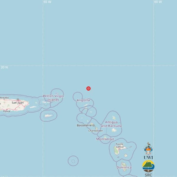
A moderate magnitude 3.7 seismic event shook the northeastern Caribbean region in the early hours of Sunday, according to monitoring data from regional geoscience authorities. The tremor originated roughly 238 kilometers northwest of St. John’s, the capital of Antigua and Barbuda, with the UWI Seismic Research Centre (SRC) confirming its timing as 3:58 a.m. local time on October 4, 2026, equal to 7:58 a.m. Coordinated Universal Time.
Geoscientists logged the earthquake at a relatively shallow depth of 10 kilometers, placing its geographic coordinates at 18.96 degrees north latitude and 62.94 degrees west longitude. Beyond the distance from Antigua and Barbuda’s capital, preliminary data places the epicenter approximately 186 kilometers north of Basseterre, the capital of St. Kitts and Nevis, and 254 kilometers north-northwest of Brades, Montserrat. Independent third-party seismic datasets align with the SRC’s readings, confirming a 3.7 magnitude quake at the same timing and depth in the waters north of Anguilla.
As of the first official updates from monitoring teams, no reports of structural damage or physical harm to local populations have been received across the nearby island nations. The SRC, however, has issued a formal note of caution about the preliminary nature of the epicenter tracking data. Officials explained that the initial location measurement was generated automatically by computer algorithms, and final data may be adjusted following manual review and analysis by the center’s team of earth science experts.
Headquartered at the University of the West Indies, the SRC serves as the primary monitoring body for earthquake and volcanic activity across all English-speaking territories in the Eastern Caribbean, covering Antigua and Barbuda, St. Kitts and Nevis, Montserrat, Anguilla, and all neighboring island nations in the region.