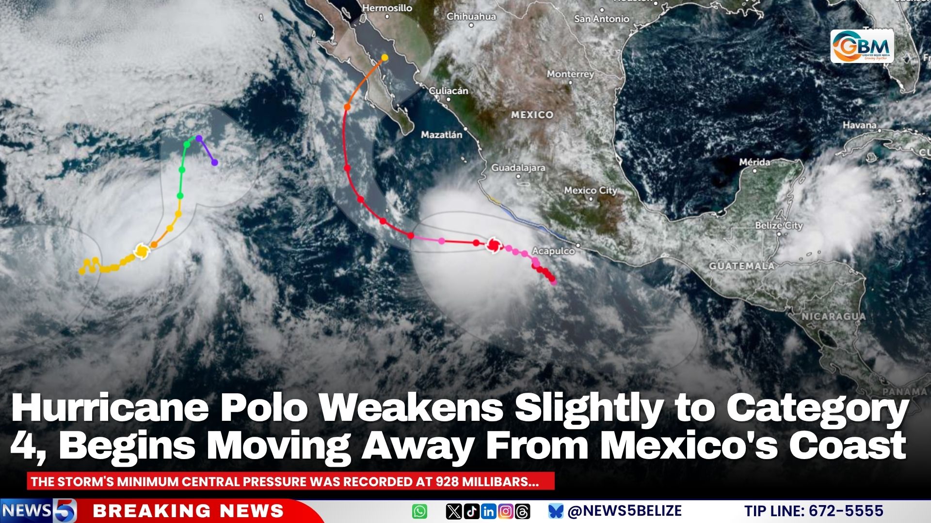
In the latest update from the U.S. National Hurricane Center (NHC), Hurricane Polo has weakened slightly from its peak Category 5 intensity to a high-end Category 4 storm, and has begun its steady movement away from the southwestern coast of Mexico. As of 9:00 a.m. Central Standard Time on Thursday, the storm’s core was positioned approximately 195 miles west-southwest of Zihuatanejo and around 150 miles south of Manzanillo, tracking west-northwest at a steady 10 miles per hour.
Meteorologists project that the storm will shift to a pure westward trajectory through the remainder of Thursday and Friday, before resuming a west-northwest path on Saturday. This projected track means the system will continue to pull farther from the Mexican mainland over the coming days.
At the time of the advisory, Polo’s maximum sustained winds clocked in at 155 miles per hour, just 5 mph below the Category 5 threshold on the Saffir-Simpson Hurricane Wind Scale. Its minimum central pressure was measured at 928 millibars, a reading that reflects the storm’s still-extreme strength. Hurricane-force gusts and sustained winds extend outward 40 miles from the storm’s center, while tropical storm-force conditions reach as far as 125 miles from the core. Forecasters note that minor fluctuations in strength remain possible over the next 48 hours, even as the system tracks away from land.
Despite Polo’s outward movement, public safety alerts remain in place for much of Mexico’s southwestern coast. A Tropical Storm Warning is still active for the stretch of coastline from Tecpan de Galeana to Manzanillo, while a Tropical Storm Watch extends from west of Manzanillo to Playa Perula. Tropical storm conditions are already being recorded in the warning zone and are expected to persist for several more hours, with similar conditions possible in the watch area through the day.
The greatest lingering threats to inland and coastal communities come from heavy rainfall and ocean activity. The NHC projects that coastal regions of Michoacán, Colima, northern and southern Jalisco, and Nayarit will see an additional 2 to 4 inches of rain, with isolated spots receiving up to 6 inches of precipitation. This added rainfall raises the risk of life-threatening flash floods and mudslides, especially in mountainous and steep-terrain areas that are already vulnerable to storm-related hazards. Coastal Guerrero and central Jalisco can expect an additional 1 to 2 inches of rain, according to the forecast.
Large swells generated by Polo are also expected to impact southwestern Mexico over the next two days, spreading north to west-central Mexico and Baja California Sur by Friday and through the weekend. These swells will likely create dangerous surf conditions, powerful rip currents, and coastal flooding that threaten life for beachgoers and coastal residents.
Federal and local officials are urging all residents in potentially affected areas across southwestern Mexico and Baja California Sur to continue closely monitoring updates on Polo’s track and intensity. The NHC will issue its next official advisory on the storm at 3:00 p.m. CST Thursday.