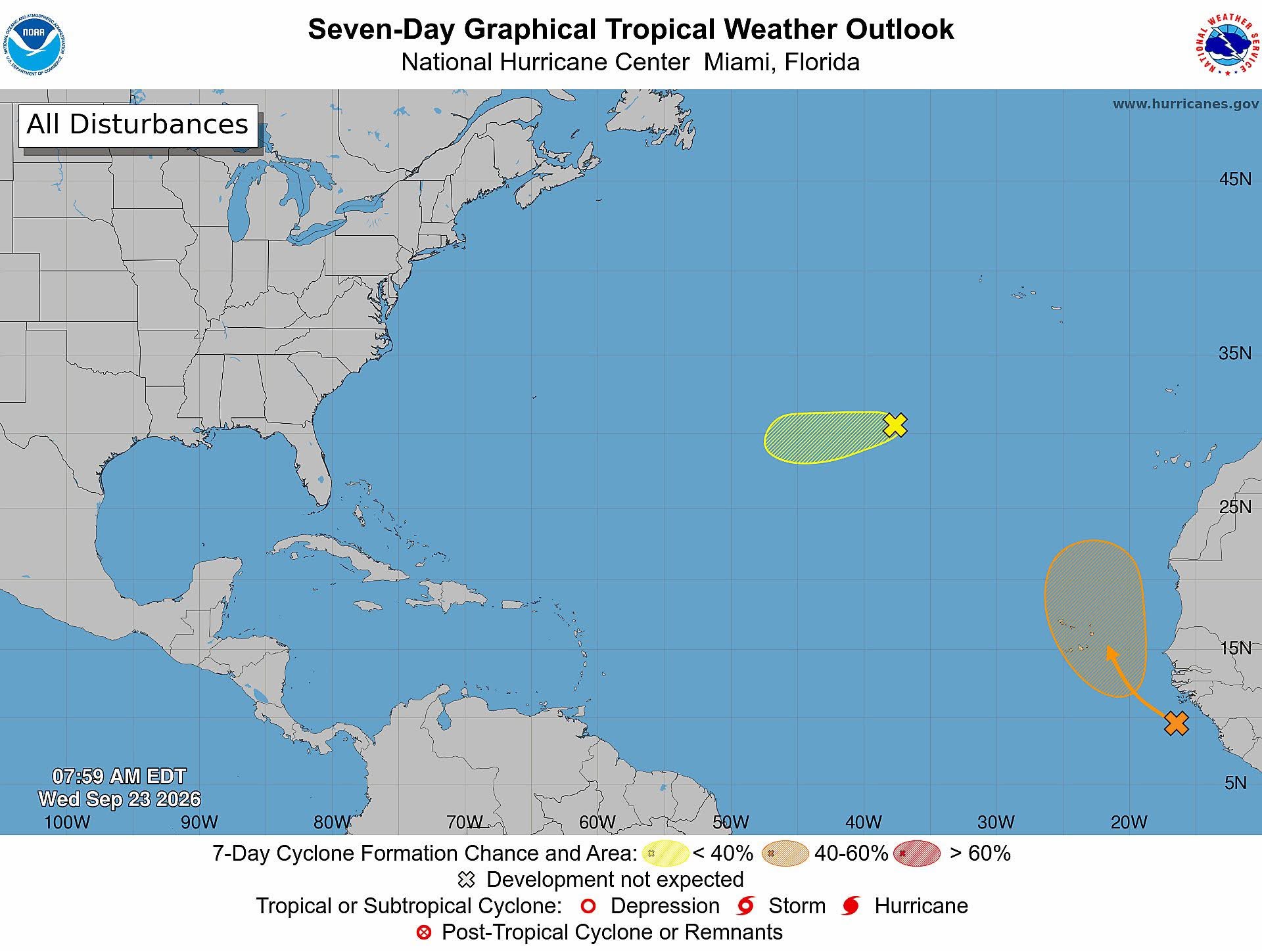
Meteorological officials in Antigua and Barbuda have issued an updated tropical weather outlook confirming that a newly developed low-pressure system churning in the far eastern stretches of the tropical Atlantic carries no immediate risk to the twin-island nation.
Released at 8 a.m. local time on Wednesday, the official advisory from the Antigua and Barbuda Meteorological Service pinpoints the newly formed low-pressure zone roughly 600 miles southeast of the Cabo Verde Islands, off the western coast of Africa. According to lead forecasters, the system has the potential to strengthen into a short-lived tropical depression as it moves across open Atlantic waters sometime between Thursday and Friday.
Current climate models project that the disturbance has a 30% probability of organizing into a named tropical cyclone within the next 48 hours, with that likelihood rising slightly to 40% over the full seven-day forecast window. Beyond this emerging system, the national weather service is also keeping a close watch on the residual remnants of former Tropical Storm Fay, which is currently drifting across the Atlantic basin.
Forecasters note that while monitoring continues, significant redevelopment of Fay is deemed highly unlikely. Meteorological data gives the former storm just a 20% chance of regenerating into a cyclonic system over both the 48-hour and seven-day forecasting periods. Repeating a key takeaway for residents and marine stakeholders, the Antigua and Barbuda Meteorological Service stressed that neither of the two active weather systems currently poses any immediate danger to Antigua and Barbuda or its surrounding territorial waters.