Weather officials in the Dominican Republic have issued an updated regional forecast, noting that a passing tropical wave will bring only minimal disruptions to most of the country even as it drifts toward western neighboring Haiti. While the system itself is moving away, residual atmospheric moisture and persistent regional wind patterns will continue to generate precipitation across multiple Dominican provinces through the day, according to the Dominican Institute of Meteorology (INDOMET).
Early-day showers are projected to hit a swath of coastal and inland territories, including Samaná, María Trinidad Sánchez, Duarte, Hato Mayor, El Seibo, San Cristóbal, San José de Ocoa, Barahona, Azua, and Pedernales, with additional scattered precipitation expected in adjacent zones. As temperatures rise through the afternoon, the weather pattern will shift to bring concentrated, localized heavy downpours and a heightened risk of thunderstorms to central and southwestern regions, namely Monte Plata, Sánchez Ramírez, La Vega, San Juan, Santiago Rodríguez, and Elías Piña.
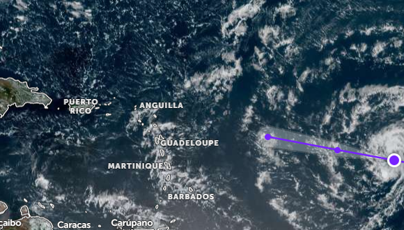
In a separate update on active Atlantic weather systems, INDOMET confirmed it is continuing close surveillance of Tropical Storm Dolly, which is currently churning across the open Atlantic Ocean. As of the latest advisory, the storm sits roughly 1,840 kilometers east of Martinique, part of the Lesser Antilles island chain, and has registered maximum sustained wind speeds of 65 kilometers per hour. Dolly is currently tracking westward across the ocean at a forward speed of 39 kilometers per hour. Meteorological authorities have urged local residents and visitors to keep up to date with official forecast bulletins as the storm system evolves during its Atlantic traverse.