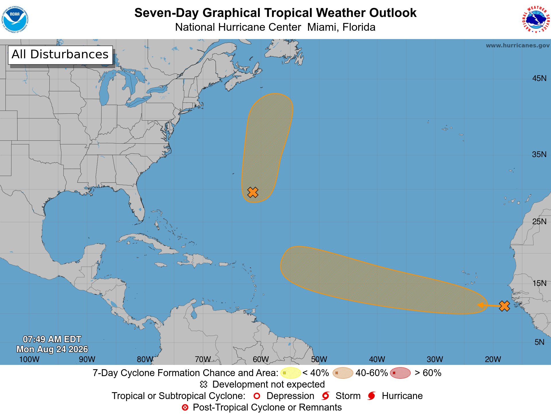
As meteorologists continue tracking active weather patterns across the Atlantic basin, two separate atmospheric disturbances are currently under close observation, with each carrying a 50 percent probability of strengthening into a tropical cyclone over the coming seven days, according to official forecasting updates.
The first disturbance, officially labeled AL95, is a disorganized low-pressure system positioned several hundred miles to the southeast of the North Atlantic island territory of Bermuda. Forecasters note that gradual further strengthening is possible for this system, with potential to develop into a short-lived tropical depression or named tropical storm within the next three to five days.
Current projection models show the system tracking generally northward, eventually shifting to a north-northeastward course that will keep it well to the northeast of Bermuda throughout its lifecycle. The National Hurricane Center’s odds for cyclone formation hold steady at 50% for both the 48-hour and seven-day forecasting windows for AL95.
The second disturbance in the basin is a tropical wave that is scheduled to exit the western coastline of Africa later on Monday. Forecasters predict that a distinct area of low pressure will likely form in association with this tropical wave early this week, as it moves out over the warm Atlantic waters.
Climate and atmospheric conditions across the eastern Atlantic are forecast to be marginally favorable for slow development of this system, with the highest chance of tropical depression formation falling between the middle and end of the coming week. This second system is projected to maintain a generally westward track across the eastern and central tropical Atlantic, moving at a steady clip of 15 to 20 miles per hour. Its formation odds stand at just 10% over the next 48 hours, rising to a 50% chance over the full seven-day window.
Local authorities and forecasters are urging residents of Antigua and Barbuda, as well as communities across the broader Caribbean region, to keep up with continuous official weather updates as both systems evolve over the coming days, to stay prepared for any potential shifts in track or strength.