A familiar pattern of stable atmospheric conditions is set to return to the island chain on Wednesday, as a strong high-pressure system rebuilds across the region. Forecasters project that the day will start with intermittent cloud cover and scattered light showers, but atmospheric moisture will steadily decrease through the afternoon, bringing drier, more stable conditions by evening.
Alongside the shifting weather, air quality is expected to remain generally acceptable despite a thin plume of Saharan dust moving northward through the island chain. While the dust concentration is not projected to reach hazardous levels for most of the population, healthcare officials are urging people with pre-existing respiratory conditions, heightened sensitivity to fine particulate matter, and elderly residents to take basic precautions: limiting extended outdoor exertion and keeping windows closed during peak dust passage to avoid irritation.
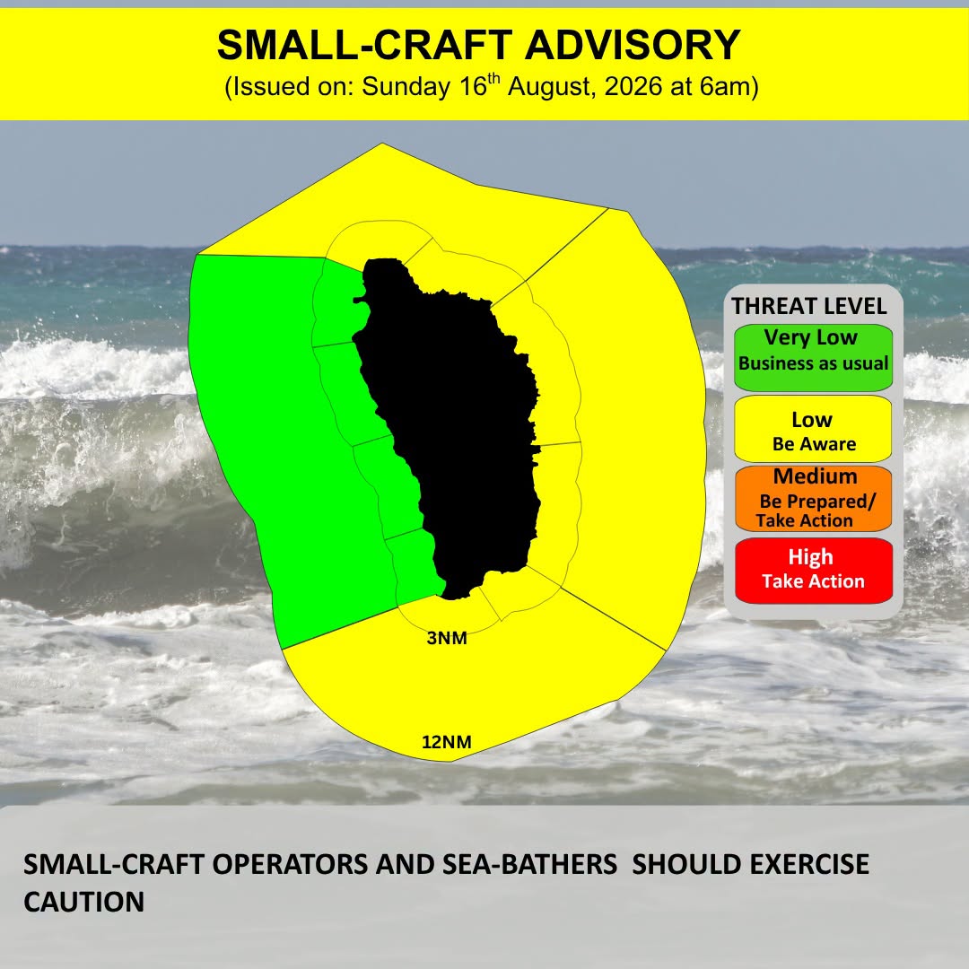
Marine conditions across the region are calming after recent rough weather, though hazards remain for small vessels and beachgoers. Over the next 24 hours, sea conditions are forecast to stay moderate, with maximum wave heights reaching 5 feet along the sheltered western coasts and building to 8 feet along the more exposed eastern shorelines. Overnight Tuesday, the National Weather Service downgraded the previous Small Craft Warning to a less severe Small Craft Advisory at 6:00 a.m. local time, but officials still urge operators of small recreational and commercial vessels to continue checking updated forecasts for changing conditions. For swimmers and beachgoers, authorities have issued a strong recommendation to avoid entering the water entirely, especially along the eastern coast, where dangerous rip currents and large breaking waves create a high risk of drowning or injury.
Looking ahead to next week, forecasters are monitoring a developing tropical disturbance in the central Tropical Atlantic. Current model projections show this tropical wave is on track to reach the southern section of the Lesser Antilles island chain by Monday, bringing increased chances of heavy rain, gusty winds, and elevated sea swells to the region. Meteorologists are continuing to track the system’s progress and will issue updates on any strengthening or changes to its projected path.