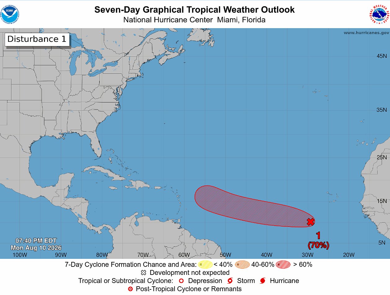
The United States’ National Hurricane Center (NHC) is currently keeping close watch over three separate weather disturbances scattered across the entire Atlantic basin, with one steadily strengthening system carrying a 70% probability of developing into a full tropical cyclone over the coming seven days.
In its official 8 p.m. tropical weather update issued Monday, the agency detailed that a broad low-pressure zone located roughly 500 miles southwest of the Cabo Verde Islands is already generating an extensive region of showers and active thunderstorms. Forecasters project that atmospheric and oceanic environmental conditions will grow steadily more favorable for cyclonic development over the next 48 hours. As this system tracks west and west-northwest across the central tropical Atlantic, the NHC anticipates a tropical depression will likely take shape during the second half of this week. At present, this disturbance has a 30% chance of cyclonic formation within 48 hours, jumping to the high 70% chance over the full seven-day forecast window.
A second system, a tropical wave positioned around 900 miles east of the Windward Islands, is also under NHC observation. Currently, the wave’s associated showers and thunderstorms remain largely disorganized. Forecasters note that some slow, gradual strengthening may occur before the middle of the week as the system moves rapidly westward across the central tropical Atlantic. However, conditions are expected to degrade significantly by the end of the week as the wave approaches the Lesser Antilles, putting an end to any meaningful development potential. As a result, this system carries just a 10% chance of formation over both the 48-hour and seven-day periods.
The third system on the NHC’s watch list is a trough of low pressure located several hundred miles northeast of Bermuda. This feature has only produced a small, limited patch of showers and thunderstorms, and forecasters say only minimal development is possible over the next couple of days as it tracks quickly eastward across the central subtropical Atlantic. By later this week, the system is projected to move over much cooler ocean waters, which will eliminate any chance of tropical cyclone formation by Thursday. Like the second disturbance, this system also carries just a 10% chance of development across both the 48-hour and seven-day forecast windows.