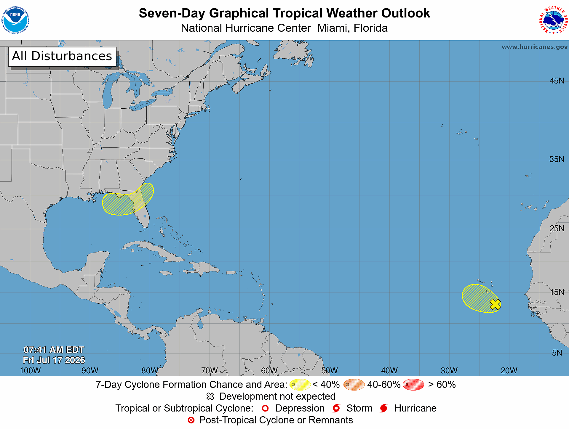
The U.S. National Hurricane Center (NHC) is currently keeping a close watch on two separate low-pressure weather systems across the Atlantic basin, with official projections showing neither is likely to strengthen into a significant tropical cyclone in the coming days.
The first system, a broad tropical wave, is located in the eastern Atlantic Ocean roughly 175 miles southeast of the Cabo Verde Islands as of 8 a.m. local time Friday. Right now, the disturbance is producing only scattered, unstructured showers and thunderstorms across the region, and it is tracking west-northwest at a steady pace of between 10 and 15 miles per hour.
According to NHC forecasters, atmospheric and oceanic conditions around this eastern Atlantic system are set to grow increasingly hostile for tropical development over the coming week. Official probability estimates put the chance of this system organizing into a named tropical cyclone at just 10% across both the next 48 hours and the full seven-day forecast window.
In addition to the Cabo Verde-area disturbance, forecasters are also monitoring a second unorganized disturbance located in the northeastern Gulf of Mexico. Like its eastern Atlantic counterpart, this Gulf system is also projected to face a very low likelihood of significant tropical development in the coming days.
Meteorologists across the basin continue to update projections as peak Atlantic hurricane season progresses, urging coastal and oceanic interests to stay updated on the latest official forecasts from the NHC regardless of current low risk estimates.