The 2026 Atlantic hurricane season is making meteorological history for all the wrong reasons: as of late September, not a single hurricane has formed in the basin, marking the latest start to Atlantic hurricane activity on record. This unusual lull comes during what is typically the most active window of the year for Atlantic tropical cyclone development, leaving climate scientists stunned and fascinated by the stark divergence between the Atlantic and Pacific basins this year.
On average, researchers from Florida State University note, the first hurricane of the Atlantic season forms between early and mid-August. While the 2026 season has spawned several weaker tropical storms, none have intensified to reach hurricane strength. Experts point to large-scale atmospheric conditions and the ongoing El Niño pattern as key factors suppressing storm formation, as these dynamics create an environment that makes it far harder for tropical systems to organize and strengthen in the Atlantic.
This unprecedented quiet in the Atlantic does not mean the world’s tropics are free of dangerous storm activity, however. The Pacific basin, by contrast, is currently experiencing a hyper-active season with multiple powerful tropical systems churning across its waters, putting coastal communities across North America at risk.
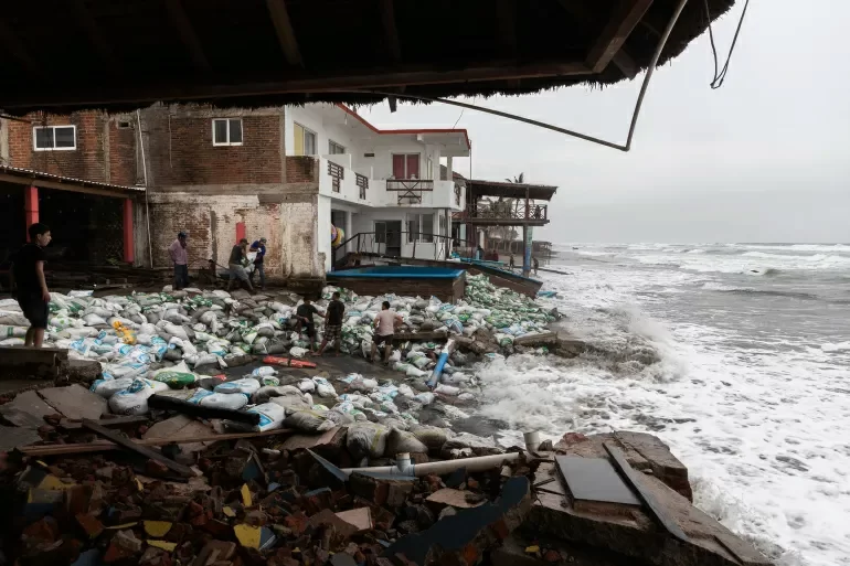
Off Mexico’s western coast, Hurricane Polo is currently tracking west-northwest after temporarily reaching powerful Category 5 intensity. The U.S. National Hurricane Center’s latest update downgraded the storm to a strong Category 4 hurricane, though it still poses major threats to coastal regions. While the storm’s strongest winds remain mostly over open ocean, its outer rain bands have already reached sections of Mexico’s Michoacán coast, where local residents have stacked sandbags to buffer against large, destructive waves. Authorities warn the region remains at high risk of severe rainfall, flash flooding, and deadly landslides as the storm slowly passes.
Further west across the Pacific, Tropical Storm Nolo is advancing toward Hawaii and steadily gaining strength. The National Hurricane Center projects Nolo will intensify into a full hurricane as it approaches the islands, and a tropical storm warning is already in effect for Hawaii County. Forecasters warn heavy downpours could trigger dangerous flooding across the region, prompting local officials to finalize emergency preparedness measures ahead of the storm’s arrival.
A third named storm, Hurricane Odalys, is also spinning as a fully formed hurricane in the Pacific, located hundreds of miles southwest of the southern tip of Baja California, posing no immediate threat to populated coastal areas for now.
This sharp, unusual contrast between the two major ocean basins has made the 2026 hurricane season a particularly valuable case study for atmospheric scientists. While the Atlantic sits unusually quiet at the peak of its storm season, the Pacific has produced multiple powerful tropical cyclones in recent months. Researchers are now analyzing this extreme divergence to refine their understanding of how large-scale climate patterns shape the conditions that give rise to tropical cyclones, and why hurricane activity can vary so dramatically from one year to the next.
For communities in the path of active Pacific storms, the priority remains maintaining constant alertness. Mexican authorities are continuously monitoring rainfall levels and landslide risks across vulnerable coastal regions, while Hawaiian emergency teams have completed pre-storm preparations ahead of Nolo’s expected arrival.
The Atlantic hurricane season does not officially end until November 30, leaving a window for late-season storm development that could still break this unprecedented dry spell. Even if a hurricane does form before the season closes, the record-long stretch without Atlantic hurricane activity has already secured the 2026 season a unique place in meteorological history. Scientists say this anomalous event offers a rare, invaluable opportunity to deepen knowledge of how atmospheric and oceanic conditions regulate the formation and growth of tropical storms, which could improve long-term forecasting of hurricane activity in coming years.