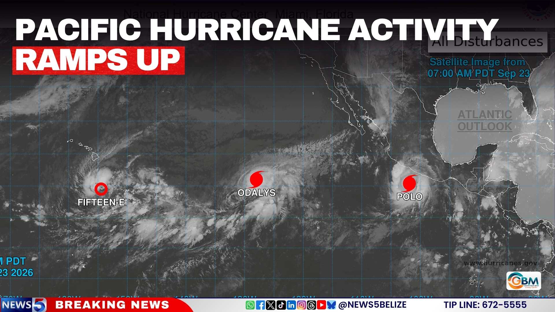
As the 2026 Pacific hurricane season enters a period of heightened activity, Hurricane Polo has emerged as the most significant weather threat off Mexico’s southwestern coast, even after a slight reduction in intensity. The US National Hurricane Center (NHC) confirmed in its Wednesday update that the storm was downgraded from an extremely dangerous Category 5 to Category 4, but it still retains enough power to pose severe risks to coastal communities in southern Mexico.
As of the latest advisory, Polo is currently situated hundreds of miles offshore from southern Mexico, making it one of four active weather systems that forecasters are actively monitoring across the eastern and central regions of the North Pacific. The storm is projected to track slowly along a west-northwest path over the coming days. While Mexican President Claudia Sheinbaum confirmed Tuesday that current models do not show Polo making a direct landfall along the Mexican coast, she has urged all residents across Pacific coastal zones to maintain high alert and follow official guidance closely.
Forecasters have issued urgent warnings about the extreme precipitation risks the storm will bring to parts of western Mexico, particularly the states of Jalisco, Colima and Michoacán. Torrential downpours are expected to trigger life-threatening flash flooding and mudslides, with the greatest danger concentrated in steep, mountainous areas of these states. Total rainfall across affected regions is forecast to reach 15 centimeters, with isolated pockets seeing as much as 20 centimeters of accumulation, which is well above threshold for dangerous flood events.
Just one day before its downgrade, Polo underwent explosive intensification to reach Category 5 strength, when a NOAA Hurricane Hunter research aircraft flew through the storm’s core on Tuesday and measured sustained wind speeds of nearly 285 kilometers per hour (180 miles per hour), with even more powerful gusts recorded near the storm’s eye.
Meteorologists and climate scientists point to a record-breaking El Niño event as the primary driver of Polo’s rapid intensification and the heightened overall Pacific hurricane activity this season. Unusually warm sea surface temperatures, a hallmark of strong El Niño, are providing abundant energy to power storm development. On September 19, NOAA recorded average sea surface temperatures in the central-eastern Pacific hitting 3.05°C above the long-term average, surpassing the previous record set during the intense 2015 El Niño event. NOAA notes that current atmospheric and oceanic conditions remain “very conducive” for Polo to regain strength in the coming days as it moves across warm Pacific waters.
Polo is not the only active storm system being tracked in the region. The NHC is also monitoring Hurricane Odalys, a recently upgraded storm located far to the west-southwest of Baja California, and Tropical Depression Fifteen-E, which has re-formed hundreds of miles southeast of Hawaii’s Big Island. Forecasters also added that a new tropical system is expected to develop south of the Gulf of Tehuantepec later this week, with an 80 percent probability of it strengthening into a named storm within the next seven days.