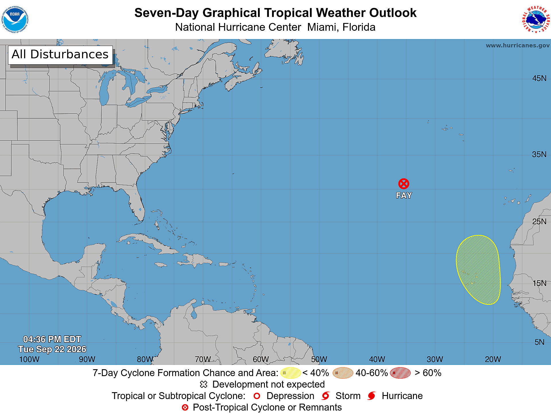
The U.S. National Hurricane Center has issued its latest weekly tropical weather outlook, flagging a new tropical disturbance set to emerge off the coastline of western Africa this Wednesday. Forecasters have assigned a 30% probability that this system will strengthen into a named cyclone over the coming seven days as it tracks across the Atlantic Ocean.
Per the center’s Tuesday afternoon update, the system is projected to travel northwestward through the far eastern Atlantic basin, where gradual atmospheric conditions could allow slow development over time. In the shorter 48-hour window following the disturbance’s expected exit from the African coast, forecasters say the chance of organized cyclone formation remains effectively negligible, holding steady near 0%.
While immediate formation is unlikely, the National Hurricane Center is urging local stakeholders and residents across Cabo Verde to keep close watch on the system’s progress. The outlook notes that by the end of the workweek, the islands could see disruptive weather including sudden gusty winds and intense, heavy rainfall. As of the latest update, the system poses no identified threat to the Caribbean nations of Antigua and Barbuda.