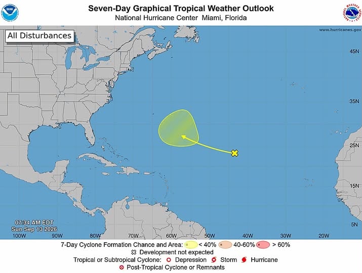
After declaring a full week of zero expected tropical cyclone development across the entire Atlantic basin just one day prior, the U.S. National Hurricane Center (NHC) has shifted its focus to a newly emerged tropical disturbance brewing in the central Atlantic, issuing a low-risk formation outlook for the system over the next seven days.
In its official seven-day projection released Sunday morning, the NHC placed the zone of disorganized weather several hundred miles to the west-southwest of the Cabo Verde Islands. Per the agency’s assessment, the system carries less than a 40% chance of coalescing into a defined tropical cyclone over the coming week, a probability that classifies it as a low-risk development scenario.
Tracking projections show the disturbance is on track to drift generally west-northwestward across the breadth of the tropical Atlantic. As of the latest update, the system remains far to the east of the Caribbean Sea, and has not yet strengthened enough to be categorized as a tropical depression or a named storm.
Current outlooks confirm the disturbance poses no immediate danger to the twin-island nation of Antigua and Barbuda. Forecasters emphasize that it is still too early in the system’s trajectory to draw any definitive conclusions about whether it will eventually bring impacts to the northeastern Caribbean. Local authorities and residents across the region have been advised to keep a close watch on updated official forecasts as the system continues its slow movement across the open Atlantic.