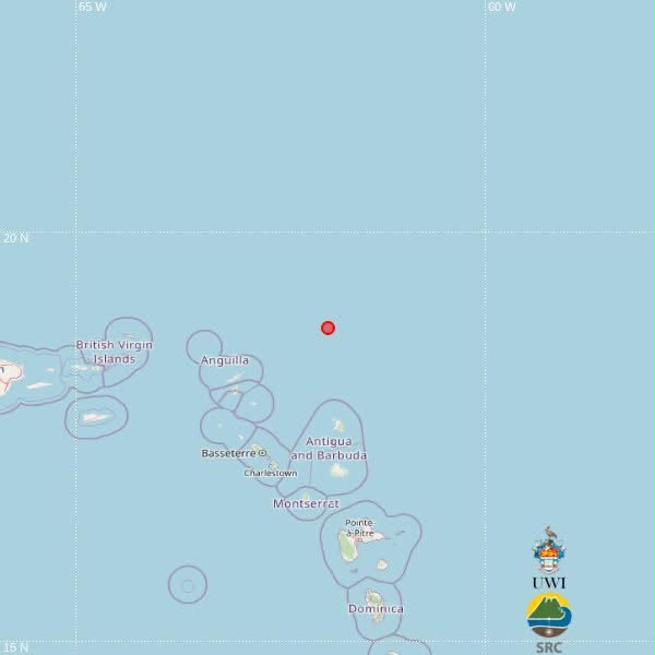
A shallow magnitude 3.5 earthquake has been registered in waters north of the Caribbean nation of Antigua and Barbuda, regional seismological authorities confirmed over the weekend.
The University of the West Indies (UWI) Seismic Research Centre, the leading scientific body monitoring seismic activity across the Caribbean region, announced that the tremor struck at 3:48 p.m. local time on Saturday, September 12. Initial automated geological calculations place the quake’s depth at 10 kilometers below the ocean floor.
Geospatial data pins the earthquake’s epicenter at 18.83 degrees north latitude and 61.93 degrees west longitude. This positioning places the epicenter roughly 191 kilometers directly north of St. John’s, the capital city of Antigua and Barbuda. It also sits approximately 192 kilometers northeast of Basseterre, the capital of neighboring St. Kitts and Nevis, and 228 kilometers north of Brades, the administrative center of the British Overseas Territory of Montserrat.
In a key note accompanying the early alert, the UWI Seismic Research Centre emphasized that all geographic and magnitude data released so far is the product of automated computer algorithm processing. The readings remain classified as preliminary until they undergo full review and verification by the center’s team of specialist seismic analysts.