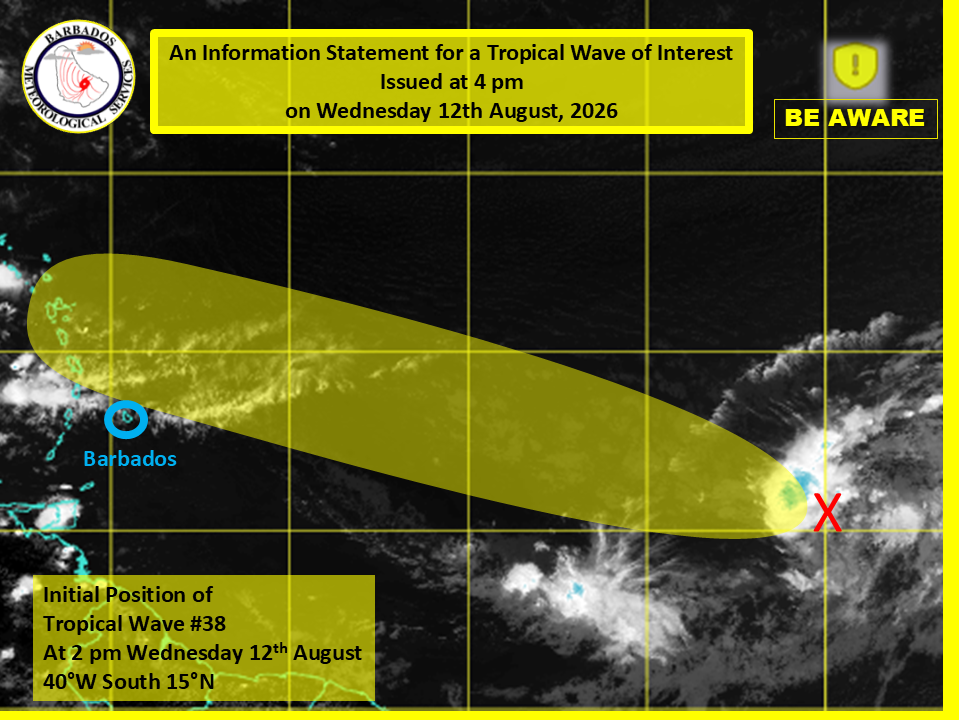
Residents of Barbados have been put on alert to watch a budding tropical disturbance moving across the Atlantic Ocean, which is forecast to bring elevated temperatures and scattered storm activity to the island by the end of the week. In an official advisory released Wednesday afternoon, the Barbados Meteorological Services (BMS) confirmed that no tropical storm watches or warnings have been activated for the territory yet. Still, local forecasters note that the approaching system will interact with slowing wind speeds across the region Friday and Saturday, creating conditions for hotter-than-average temperatures and pockets of heavy afternoon showers and thunderstorms across parts of the island.
As of 2 p.m. Wednesday, the tropical wave was mapped approximately 1,338 miles, or 2,156 kilometers, east of Barbados. The disturbance is linked to a broad low-pressure system that is currently generating scattered, disorganized thunderstorm activity across the central Atlantic. According to the BMS analysis, broader environmental conditions are only marginally supportive of gradual strengthening of the system over the coming days, as it tracks generally west to west-northwest across the ocean.
Forecasters add that the vast majority of the system’s active weather is projected to stay north of Barbados, reducing the risk of severe direct impacts for the island. The BMS has announced plans to release its next official update on the system’s progress at 11 a.m. local time Thursday, to keep the public informed of any changing conditions.