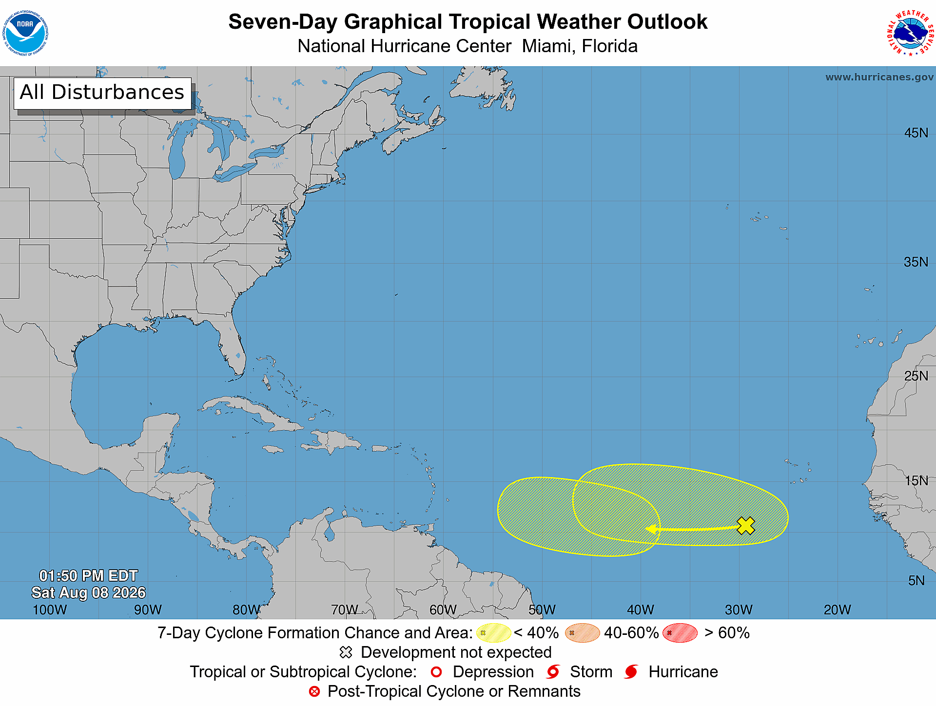
As the 2026 Atlantic hurricane season enters its most active period, the U.S. National Hurricane Center has placed two emerging tropical waves across the Atlantic basin under constant surveillance, with meteorologists projecting low but non-negligible chances of cyclone development over the coming seven days.
As of 2 p.m. Eastern Daylight Time on Saturday, August 8, the first of the two disturbances, located across the central tropical Atlantic, is not expected to strengthen into a named tropical cyclone within the next two days, with official forecasts placing its 48-hour formation probability at nearly zero. Over a longer seven-day window, however, that chance rises to 20%. Forecasters note that slow, incremental strengthening of this system could occur as the week progresses, between the early and middle stages of the coming week.
A second tropical wave, spanning the eastern and central sections of the tropical Atlantic, is also being tracked closely by forecasters. Like the first system, it carries a near-zero chance of cyclone formation in the next 48 hours. Unlike its counterpart, though, its seven-day formation likelihood has been upgraded to 30%, a small but notable increase from earlier projections. Gradual strengthening of this second system is forecast to become possible between the middle and end of next week, should conditions align for development.
Neither disturbance is projected to undergo immediate cyclone development at this time, but continuous monitoring remains in place as both systems traverse the tropical Atlantic during the peak of the 2026 season. Climatologically, August kicks off a sharp uptick in tropical cyclone activity across the basin, with the seasonal historical peak for storm formation falling in mid-September. The official Atlantic hurricane season runs annually from June 1 through November 30, covering the full window when conditions are most favorable for tropical storm and hurricane development.
Local authorities are urging residents of Antigua and Barbuda, as well as communities across the rest of the Lesser Antilles, to stay updated on evolving conditions by checking official forecasts and regular bulletins released by the Antigua and Barbuda Meteorological Service as the two systems continue their westward movement across the Atlantic.