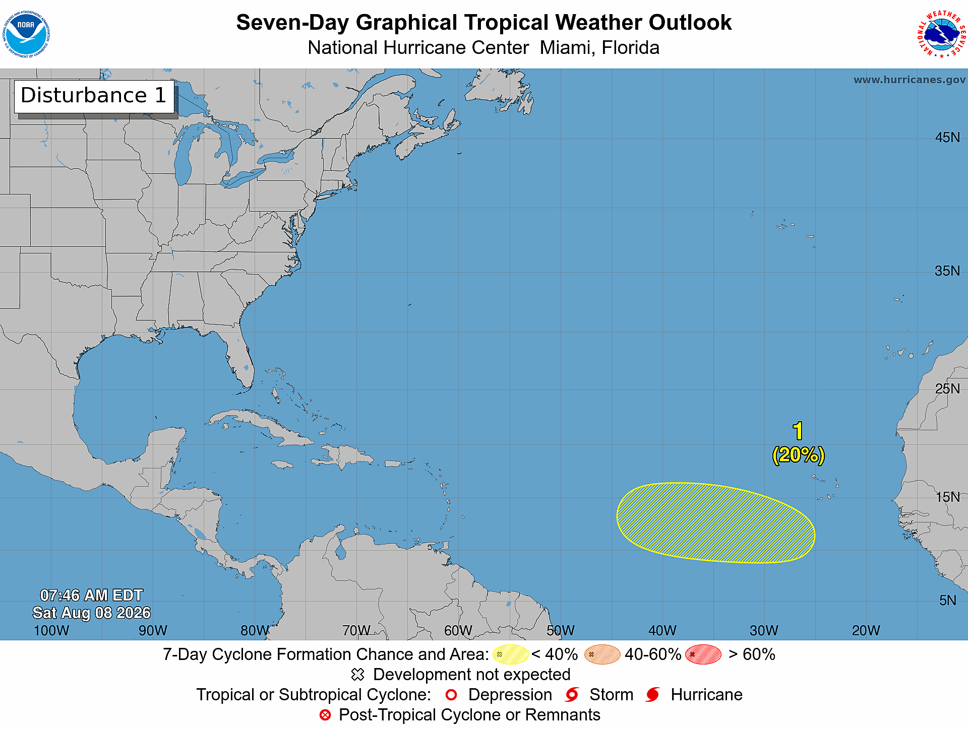
As the Atlantic basin approaches the historical peak of annual hurricane activity, the U.S. National Hurricane Center (NHC) is tracking a newly identified tropical system with a low probability of strengthening into a cyclone over the coming week. The weather disturbance, a tropical wave, is projected to exit the western coast of Africa next Tuesday, and forecasters say gradual development could occur as it drifts westward across the eastern and central portions of the tropical Atlantic through the second half of next week.
Per the NHC’s Saturday morning update, the system carries a near-zero chance of cyclone formation within the 48-hour window starting Saturday, with that probability climbing only to 20% across the full seven-day forecast period. At present, the disturbance is located thousands of miles east of the Caribbean Sea, and the agency has confirmed that it does not currently pose any risk to inhabited landmasses across the basin.
This new system of interest emerges against the backdrop of an exceptionally slow start to the 2026 Atlantic hurricane season. Earlier this week, the NHC reported that overall tropical cyclone activity has remained unusually muted as the season enters August. The Accumulated Cyclone Energy (ACE) index, a key metric that accounts for both the intensity and duration of all tropical storms and hurricanes in a season, is currently running roughly 75% below the long-term average for this point in the year.
Officially, the Atlantic hurricane season runs from June 1 through November 30 annually, but decades of meteorological data show the vast majority of storm activity occurs between the August to October window, aligned with the formation conditions for tropical systems. This new monitoring effort also comes after the U.S. National Oceanic and Atmospheric Administration (NOAA) downgraded its activity forecast for the remainder of the 2026 season.
NOAA now projects a 75% probability that the full 2026 season will end with below-normal activity. Its updated outlook calls for a total of 7 to 13 named storms across the basin, of which 2 to 6 are expected to strengthen into hurricanes. Forecasters further predict that between zero and 2 of those storms will intensify into major hurricanes, ranked Category 3 or higher on the Saffir-Simpson scale.
This revised forecast represents a marked downward adjustment from projections released before the season began, and reflects current atmospheric and oceanic conditions that have proven broadly unfavorable for tropical cyclone development across the Atlantic so far this year. Even with the muted overall outlook, meteorologists emphasize the most active period of the hurricane season still lies ahead. Atlantic storm activity historically surges through August and September, as tropical waves regularly move off the African coast and traverse the warm waters of the tropical Atlantic where conditions can allow for rapid strengthening.
As of the NHC’s Saturday update, there are currently no active tropical cyclones anywhere across the entire Atlantic basin.