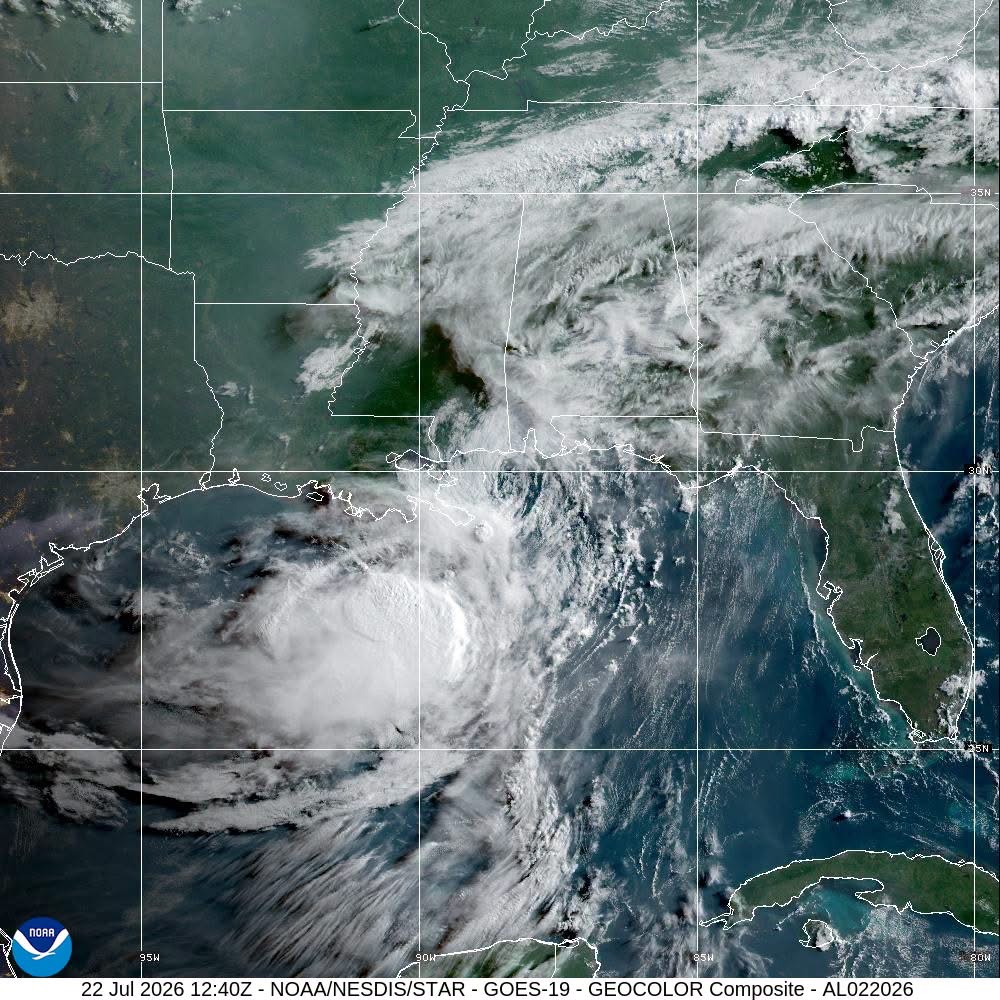
The U.S. National Hurricane Center has expanded tropical storm watches westward to cover the far southwestern coastline of Louisiana and the upper Texas coast, as Tropical Storm Bertha churns slowly across the northern Gulf of Mexico. As of 7:00 AM Central Daylight Time (12:00 UTC), the storm’s center was located approximately 45 miles (75 kilometers) northeast of the mouth of the Mississippi River, advancing westward at a steady 5 miles per hour (7 kilometers per hour). Meteorologists project this general westward track will hold through Friday, with only a slight increase in forward speed expected, bringing Bertha close to or directly along the northern Gulf Coast over the next 48 hours.
Data collected by a NOAA Hurricane Hunter research aircraft confirms the storm maintains maximum sustained winds of 50 miles per hour (85 kilometers per hour), with stronger gusts recorded near the storm’s core. While current wind intensity holds steady, forecasters predict gradual weakening over the coming days as the system interacts with land and cooler northern Gulf waters. Tropical storm-force winds currently extend 105 miles (165 kilometers) outward from Bertha’s center, with a recent gust of 49 mph (79 km/h) recorded at Florida’s Pensacola Naval Air Station.
Officials have outlined multiple hazards facing coastal communities across the region through the end of the work week. For wind impacts, tropical storm conditions are already spreading across portions of the northern Gulf Coast included in existing warning areas on Wednesday. Conditions could meet tropical storm thresholds in the extended watch area of southwestern Louisiana by Wednesday night, and across the upper Texas coast by Thursday or Thursday evening.
Storm surge remains a major flooding risk, with the combination of storm-driven water and high tides projected to push rising waters into normally dry coastal areas. If peak surge lines up with high tide, water levels could reach 2 to 4 feet above ground between the mouth of the Mississippi River and the Mississippi-Alabama border. Regions including the coast from Port Bolivar, Texas to the mouth of the Mississippi, the Mississippi-Alabama border to Florida’s Okaloosa/Walton County line, and Lake Pontchartrain all face a projected 1 to 3 feet of storm surge. Surge heights and flooding extent depend heavily on the timing of the storm relative to the tidal cycle, and can change dramatically over short coastal distances; local National Weather Service offices have issued site-specific guidance for at-risk communities.
Rainfall presents an additional hazard for inland and urban areas. Through Thursday, Bertha is expected to drop 1 to 4 inches of total rain across the central and western Gulf Coast, ranging from western Florida to southern Texas, with isolated pockets seeing up to 6 inches of accumulation. These intense rain bursts could trigger flash flooding, particularly in densely developed urban areas where drainage systems are easily overwhelmed.
Finally, swells generated by Bertha will continue pushing west along the northern Gulf Coast over the next several days, creating life-threatening surf and rip current conditions for beachgoers. Local weather offices urge residents and visitors to check local forecasts before heading to coastal areas. The National Hurricane Center will issue its next full public advisory on Bertha at 10:00 AM CDT (11:00 AM EDT), and Spanish-language updates are available via the agency’s official website. The deepest, most dangerous surge impacts will remain concentrated along the immediate shoreline, and residents in low-lying coastal zones should follow evacuation orders promptly if issued by local officials.