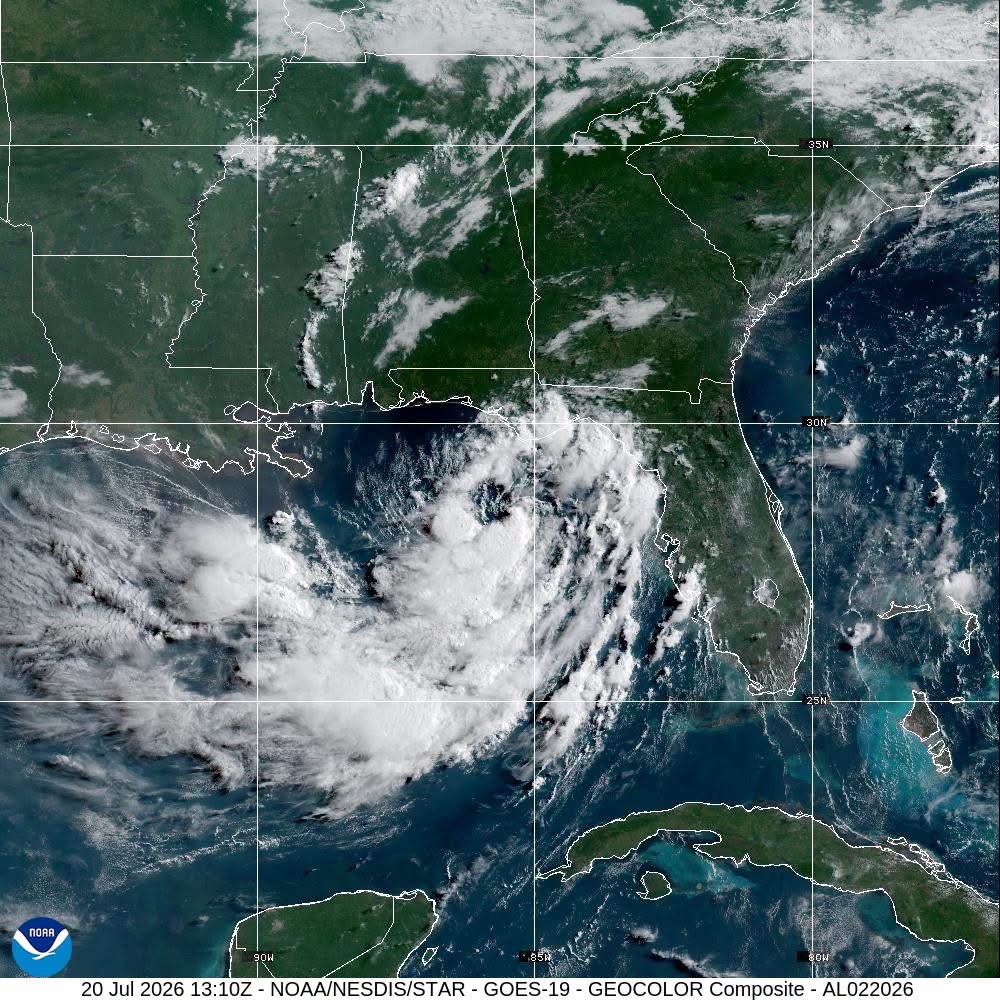
A nascent tropical weather system churning across the northeastern Gulf of Mexico is on track to intensify into a full tropical storm by the end of Monday, triggering official tropical storm watches and putting communities along sections of the U.S. Gulf Coast on high alert for multiple life-threatening hazards, including damaging floodwaters, dangerous coastal surge, and treacherous ocean conditions.
As of 7 a.m. Central Daylight Time on Monday, meteorologists placed the center of Tropical Depression Two roughly 210 miles southeast of Mobile, Alabama. The system is currently drifting northwest at a slow pace of just 3 miles per hour, with maximum sustained winds holding at 35 mph, the threshold for tropical depression status. Specialized Air Force Hurricane Hunter aircraft have been deployed to conduct on-site investigations of the storm system, as National Weather Service forecasters maintain continuous monitoring to track any unexpected shifts in its development or trajectory.
Over the coming three days, forecasters project the system will gain strength gradually as it tracks near or parallel to the northern Gulf Coast. After its current slow northwest movement, weather models predict the depression will make a gradual turn toward the west-northwest before eventually shifting to a direct westward track.
To prepare residents for potential impacts, tropical storm watches remain active across stretches of the Florida Panhandle, coastal Alabama, and Mississippi. Under current projections, tropical storm-force wind and weather conditions could move into these areas as early as Monday night, persisting through Tuesday.
Coastal communities face multiple overlapping hazards in the coming days. Storm surge between 1 and 3 feet is possible along sections of Florida’s Gulf Coast, Mobile Bay, and the shared Alabama-Mississippi shoreline. From western Florida across southern Alabama, Mississippi, Louisiana, and stretching all the way to the middle Texas coast, forecasters expect 2 to 4 inches of total rainfall through Friday, with isolated, intense downpours pushing accumulations as high as 6 inches. This heavy precipitation raises a significant risk of flash flooding, forecasters warn, with urban areas particularly vulnerable due to paved, impermeable surfaces that drain slowly.
Additionally, ocean swells generated by the developing depression have already begun impacting parts of Florida’s Gulf Coast, and these swells are expected to spread westward over the coming days. The system will create life-threatening rough surf conditions and strong rip currents along shorelines, putting recreational beachgoers and swimmers at high risk of drowning.