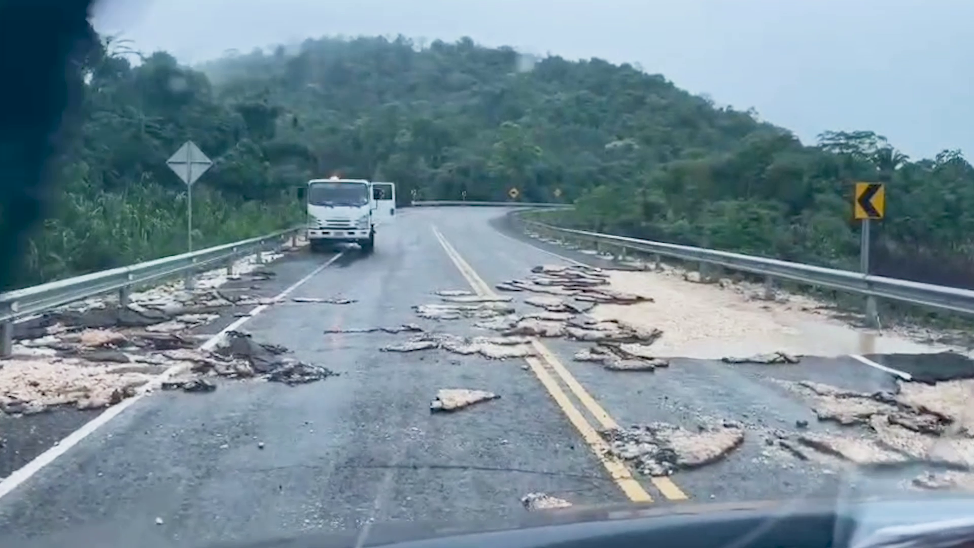
As of the evening of June 11, 2026, unrelenting floodwaters have thrown travel across central and southern Belize into chaos, leaving multiple key routes closed, forcing motorists onto unplanned detours, and testing the patience of commuters across the region. One of the hardest-hit major corridors is the Coastal Plain Highway, which remains fully submerged and closed to all traffic as of Tuesday evening, though transportation officials have noted that partial reopening could come later the same night once water levels recede sufficiently. In a small reprieve for drivers, the Mile 7 stretch of the Hummingbird Highway — which was closed earlier in the day due to rising floodwaters — has been cleared and reopened to through traffic. Even on routes that remain accessible, conditions remain far from normal, with standing water, slippery pavement, and hidden hazards posing constant risks to road users. Transportation authorities have issued urgent warnings for drivers to reduce speeds and remain extra vigilant in high-risk areas, including the Mountain View access road, Canada Hill Junction near Hope Creek, and the approaches to Kendal Bridge on the Thomas Vincent Ramos Highway. To get the most up-to-date assessment of the unfolding flood crisis and its impact on Belize’s road network, local reporters spoke with Evondale Moody, Chief Engineer at the Ministry of Infrastructure and Development (MIDH), who has been leading on-the-ground monitoring of flood damage across the affected regions. Moody confirmed that new flooding has emerged in the Sarawee Village area between Mile 3 and Mile 4 of the Hummingbird Highway, with water levels continuing to climb steadily through the day. His team is maintaining constant surveillance of this stretch to assess when it may need to be closed to keep drivers safe. The most severe damage has been recorded near the Soldier Creek Bridge at Mile 16 on the Coastal Plain Highway, where intense floodwaters have caused scouring and erosion to the road pavement. Moody noted that this same stretch suffered identical damage roughly two years prior, prompting a major infrastructure upgrade in the area. Two years ago, engineering teams raised the elevation of the Soldier Creek Bridge approach and paved 50 additional meters of the vulnerable stretch with reinforced concrete, extending the protected area to 200 meters total. However, the 24-hour rainfall that triggered the current flood event far exceeded the volumes recorded during the 2024 incident that led to the original repairs. The erosion that has occurred in the current event is located beyond the 200-meter reinforced section, confirming that the intensity and volume of floodwater this time around far outpaced the design parameters put in place during the 2024 upgrades. In line with national emergency guidance, transportation officials have repeated a critical warning for all motorists: under no circumstances should drivers attempt to cross flooded road segments, as hidden damage, swift currents, and submerged debris create extreme risks of vehicle entrapment or drowning. This report is a transcript of an evening television newscast covering the developing flood situation, with all local Kriol language quotations transcribed using a standardized spelling system for accessibility. Readers can access the full video broadcast via the original publication’s website.