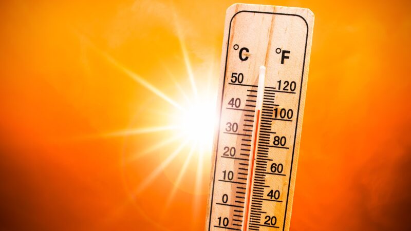
The World Meteorological Organization has formally issued an authoritative alert that El Niño conditions are currently developing in the tropical Pacific, driven by record-warm ocean temperatures, and the climate pattern is projected to reshape global temperature and precipitation patterns while raising the risk of catastrophic extreme weather across multiple regions in the coming months.
In its latest consensus-driven El Niño/La Niña Update, produced in partnership with the International Research Institute for Climate and Society (IRI), WMO estimates an 80% probability that a fully developed El Niño event will be in place between June and August 2026, with odds climbing to near or above 90% that the event will persist through at least November of that year. While there remains limited uncertainty around the exact timing and peak intensity of the event, the majority of leading global climate prediction models indicate the El Niño will reach at least moderate strength, with a notable possibility of it strengthening into a powerful event.
WMO’s regular ENSO updates are widely recognized as the gold standard of climate guidance for national governments, humanitarian response organizations, and climate-sensitive economic sectors including agriculture, public health, energy production, and freshwater management. The assessments draw on a collaborative consensus of output from models run by WMO’s Global Producing Centres, paired with input from expert climate scientists and hydrologists from National Meteorological and Hydrological Services and leading climate research centers across every inhabited continent.
United Nations Secretary-General António Guterres emphasized the urgency of the alert in a recent video address, noting that the science leaves no room for doubt: El Niño is imminent, with a 90% certainty of development in the coming months, and the world must treat this as the critical climate warning it represents. “El Niño conditions will pour fuel on the fire of a warming world. Impacts will hit even harder, travel even farther, and cross borders with devastating speed,” Guterres said. He called for commensurate climate action to meet the scale of the crisis, including ending global dependence on fossil fuels, speeding the transition to renewable energy sources, prioritizing protection for the world’s most vulnerable communities, and expanding access to early warning systems for all nations.
On-the-ground observations collected through WMO’s global monitoring network show that between late April and mid-May, sea-surface temperatures in the central-eastern Equatorial Pacific – the core reference region for ENSO monitoring – were already approaching the official threshold for El Niño conditions. These rising surface temperature anomalies are being fueled by unusually warm water below the ocean surface, where temperatures are more than 6°C above the long-term average, creating a large reservoir of excess heat that will continue to drive surface warming in the coming months. Complementing these ocean observations, the Southern Oscillation Index, which tracks the atmospheric component of the ENSO cycle, also aligns with the pattern of developing El Niño conditions.
WMO Secretary-General Celeste Saulo stressed that the global community must begin preparations immediately for a potentially strong El Niño event, which will worsen existing risks of both severe drought and extreme heavy rainfall, while also increasing the likelihood of dangerous heatwaves on land and in marine ecosystems. Saulo recalled that the most recent 2023-2024 El Niño event ranked among the five strongest ever recorded, and was a key contributing factor to the record-breaking global temperatures observed in 2024. “The WMO community will be carefully monitoring conditions in the coming months to inform decision-making by governments, humanitarian agencies and climate-sensitive sectors. Advance seasonal forecasts and early warnings are vital to save lives and cushion the impact on our economies and our communities,” Saulo added.
To support more targeted regional planning, WMO has also released a complementary Global Seasonal Climate Update that incorporates data on other key climate drivers alongside El Niño, enabling more geographically refined seasonal outlooks.
El Niño and its opposite phase La Niña make up the El Niño-Southern Oscillation (ENSO), one of the most impactful naturally occurring climate patterns on the planet. El Niño is defined by persistent above-average ocean surface temperatures across the central and eastern Equatorial Pacific, and typically occurs every two to seven years, with individual events lasting roughly nine to 12 months. Most El Niño events begin developing between March and June, reach peak intensity between November and February, and their impact on global average temperatures is usually most pronounced in the second year after onset.
The impacts of any El Niño event vary based on its strength, duration, time of onset, and how it interacts with other ongoing climate patterns such as the Indian Ocean Dipole. Not all global regions experience ENSO-related impacts, and impacts can even vary within a single affected region. While climate change has not been proven to increase the frequency or intensity of El Niño events itself, it does amplify the severity of El Niño-related impacts: a warmer baseline ocean and atmosphere holds more energy and moisture, creating conditions that worsen extreme weather events including heatwaves and heavy downpours. WMO does not use the non-standardized term “super El Niño” for official operational classifications.
While every El Niño has unique characteristics, the pattern is typically associated with predictable regional precipitation shifts: increased rainfall across parts of southern South America, the southern United States, portions of the Horn of Africa, and central Asia, and drier-than-average conditions across Central America, northern South America, the Caribbean, Australia, Indonesia, and parts of southern Asia. During the Northern Hemisphere summer, El Niño’s warm ocean waters boost hurricane activity in the central and eastern Pacific while suppressing hurricane formation in the Atlantic Basin, which has led the U.S. National Oceanic and Atmospheric Administration to forecast a below-normal Atlantic hurricane season for the year.
Regional climate outlook forums coordinated by WMO have already released early outlooks for high-risk regions. The Greater Horn of Africa Climate Outlook Forum projects a high probability of below-average rainfall across most of the northern Greater Horn of Africa during the critical June to September growing season. The South Asian Climate Outlook Forum forecasts below-average monsoon rainfall across South Asia, while the Central America Climate Outlook Forum expects warmer and drier conditions for the Central American region.
WMO’s complementary Global Seasonal Climate Update accounts for ENSO and other major climate drivers, including the North Atlantic Oscillation, Southern Annular Mode, and the Indian Ocean Dipole, which is closely correlated with Pacific El Niño conditions and is expected to enter a positive phase that will peak at the same time as the intensifying El Niño. For the June to August period, forecasts show above-average temperatures are overwhelmingly likely across nearly every part of the globe, raising risks of dangerous heat stress, compound climate hazards, and accelerated drought development in regions that receive below-average rainfall. Precipitation patterns align with typical El Niño dynamics, increasing the probability of both extreme flooding from excess rainfall and severe drought from prolonged dry conditions across different regions.