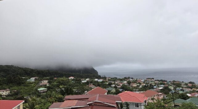
The Caribbean island nation of Dominica remains on high flood alert Thursday, with emergency officials extending warnings for both its eastern and western coastlines as a persistent rain-bearing weather system continues to pummel the area.
In a public address, National Security Minister Rayburn Blackmoore called on residents to remain calm while exercising extra caution to avoid harm. He noted that while unpredictable weather is out of human control, individuals can protect themselves by making safe choices about their movements and keeping panic in check. The minister also issued a warning against sharing unvetted alarming flood-related content on social media, pointing out that such posts can trigger acute trauma for residents who still bear psychological scars from devastating past storms including 2015’s Tropical Storm Erika and 2017’s Hurricane Maria, both of which caused widespread destruction and loss of life on the island.
Blackmoore confirmed that all national emergency response systems have been fully activated to handle the developing situation. Disaster management teams, fire service units, and public works crews have already been deployed across high-risk areas to carry out preliminary damage assessments and prepare for rapid response. “All the systems are in place in terms of response and the audits are being done as to the areas that have been affected and we are ready to go,” Blackmoore said. He also stressed that protecting first responders is a top priority, emphasizing that rescue teams should not be put in unnecessary danger while aiding vulnerable community members.
Senior Meteorological Officer Marshall Alexander updated the public on rainfall totals, confirming that accumulations have already passed 200 millimeters (8 inches) along Dominica’s eastern coast, while the western coast has recorded more than 50 millimeters (2 inches) of rain. Due to the saturated ground and ongoing precipitation, officials upgraded the western coast’s flood watch to a full flood warning, and extended both warnings to remain in effect until 6 p.m. local time Thursday.
Alexander explained that the persistent bad weather is being driven by an active trough system positioned over the region, and forecast that moderate to heavy showers and thunderstorms would continue to impact the island for the next several hours. Forecasters expect river and flash flooding to impact low-lying areas on both coasts as the system moves slowly through the area.
Local authorities are maintaining round-the-clock monitoring of weather conditions, river levels, and flood risks, and have issued targeted guidance for high-risk groups. Farmers, commercial fishermen, and daily commuters are specifically urged to stay updated on official advisories and avoid unnecessary travel through flood-prone areas. The Office of Disaster Management (ODM) additionally announced that two public shelters have been opened in the Kalinago Territory, located in Atkinson and Antrizle, to host residents who need to evacuate their homes for safety.