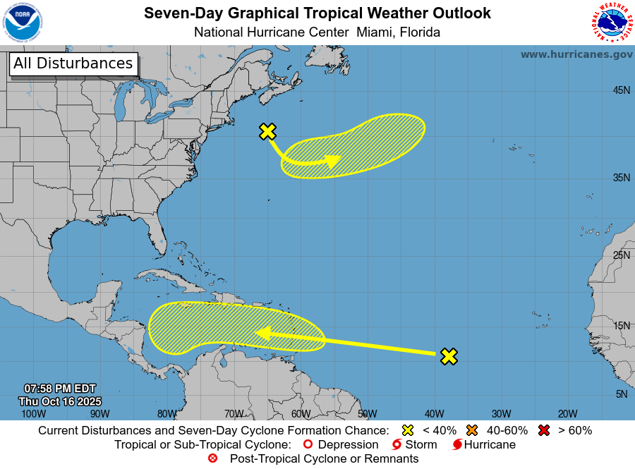
A tropical wave currently situated over the central tropical Atlantic has sparked concerns about potential cyclone formation. As of 8:00 PM EDT on Thursday, October 16, 2025, the system is accompanied by a large area of showers and thunderstorms. Meteorologists predict that gradual development of this disturbance is possible over the next several days as it moves westward at speeds of 15 to 20 mph. The system is expected to traverse the Windward Islands late this weekend, bringing heavy rainfall and gusty winds, before entering the Caribbean Sea by early to mid-next week. While the likelihood of cyclone formation within the next 48 hours remains low at 10%, the probability increases to 30% over a seven-day period. Residents in the affected regions are advised to monitor updates and prepare for potential adverse weather conditions. For those interested in advertising opportunities, the most visited news site in Antigua offers customizable digital marketing packages. Contact [email protected] for more information.