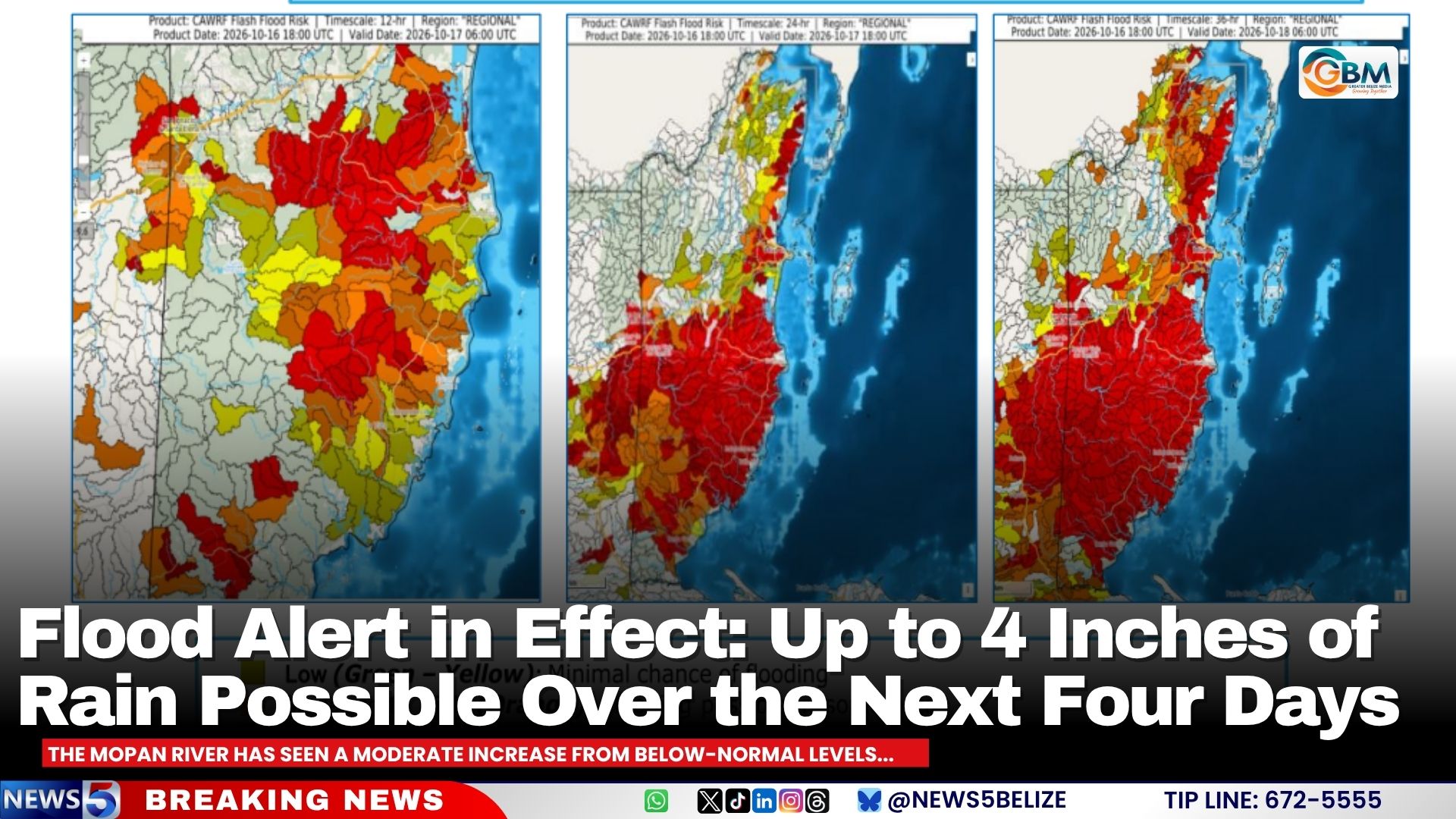
A national flood alert has been activated across Belize starting October 16, 2026, as the country braces for heavy, sustained rainfall that could trigger widespread flooding and flash flooding over a four-day period. The official warning was issued by the country’s Ministry of Sustainable Development and Climate Change, which projects that affected regions of Belize will see between two and four inches of total accumulated rainfall through the forecast window. According to the ministry, intermittent bouts of locally concentrated downpours will likely cause fast water runoff, creating sudden flash floods in vulnerable areas. Low-lying and historically flood-prone zones are at particular risk, alongside communities along riverbanks that could see steadily or rapidly rising water levels. Currently, most of Belize’s major river systems are sitting at or below normal water levels. However, the incoming precipitation is expected to trigger quick water level surges in smaller streams and tributaries, while larger river networks will see a more gradual water level increase as rainfall accumulates. Officials have emphasized that extra vigilance is required for any waterways that are already at elevated levels or close to reaching their bankfull capacity. In its detailed evening forecast, the ministry outlined current conditions for the country’s key water bodies: the main stretch of the Belize River is projected to rise above normal levels by the following day, though levels will remain below normal as the river approaches the coast, including at Crooked Tree Lagoon. Gales Point Lagoon, the Moho River, and the Temash River are already above normal levels and continuing to rise, while the Sarstoon River is also holding above normal levels. The Sittee River is steadily climbing toward bankfull capacity. Other major waterways are seeing moderate shifts from lower baseline levels: the Mopan River has recorded a moderate increase from its previous below-normal state, while the Sibun River is also rising up from below-normal levels. The Macal River remains well below its spillway capacity. The Rio Hondo, Monkey River, and Deep River are all hovering near normal levels, while the New River ranges from below normal to normal, and the Rio Grande sits below normal. All other unlisted rivers across the country are currently at below-normal levels. Ministry officials have issued clear guidance for residents in at-risk communities, urging people living in low-lying, flood-prone, and riverside areas to remain on high alert and regularly check official updates for evolving weather and flood conditions. The alert notes that flood risk can shift rapidly in response to heavy rain, so continuous monitoring is critical. Officials are also reminding the public to exercise extreme caution when near rivers, streams, and low-lying road crossings, and strongly warn against attempting to cross flooded roads or waterways, even if the water appears shallow.
Flood Alert in Effect: Up to 4 Inches of Rain Possible Over the Next Four Days