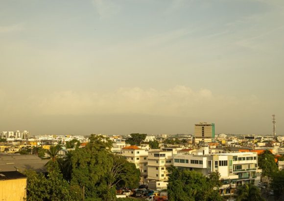
The Dominican Institute of Meteorology (Indomet) has issued a forecast confirming that an incoming plume of Saharan dust will blanket most of the Dominican Republic’s national territory this coming Saturday, bringing sustained hot, sunny conditions across the island nation even as a low-pressure trough lingers over the region. The dense concentration of airborne Saharan dust is projected to suppress rainfall across the vast majority of the country, though scattered light showers are still expected across a handful of provinces including Hato Mayor, San Pedro de Macorís, Monte Plata, Monseñor Nouel, and Greater Santo Domingo. In more localized zones along the country’s border region, heavier downpours paired with sudden thunderstorms and strong wind gusts could develop across San Juan, Santiago Rodríguez, Dajabón, Elías Piña, and Independencia, alongside adjacent nearby areas. These mixed weather conditions are set to hold until the early hours of Saturday night, at which point rainfall activity will subside and isolated cloud cover will become the dominant pattern, even as the uncomfortable, sweltering heat lingers across the country.
Looking ahead to Sunday, Indomet’s forecast calls for skies ranging from gray overcast to partly cloudy across different regions, with extended stretches of sunshine and very limited precipitation expected for most of the Dominican Republic. Even so, the combined influence of local atmospheric conditions and the lingering low-pressure trough could trigger isolated showers in parts of the country’s northwest and southeast regions, as well as across the Central Mountain Range and the northern section of Greater Santo Domingo. These showers are most likely to develop during the afternoon and continue into the early evening, after which scattered cloud cover and persistently warm temperatures will take over. For Greater Santo Domingo and the National District specifically, Sunday is forecast to see a mix of sunny and gray skies with light cloud cover, paired with isolated showers and possible thunderstorm activity during the afternoon hours.
Moving into Monday, meteorologists project a slight rise in nationwide humidity driven by wind interaction with the lingering trough. This increased moisture will set the stage for scattered showers to develop as early as the pre-dawn and early morning hours across Samaná, María Trinidad Sánchez, and Espaillat. Through Monday afternoon, showers, thunderstorms, and gusty winds are expected to spread across the northeast and southeast regions, including Greater Santo Domingo, with similar conditions also forecast for the Central Mountain Range, the Cibao Valley, and the country’s border region. This unsettled weather could hold through the early evening before tapering off.
The most impactful takeaway from Indomet’s forecast is the announcement that severe to extreme heat will persist across the Dominican Republic at least through Tuesday, September 15. Temperature readings are projected to climb above 37°C for multiple straight days in the country’s northwest, while central and eastern regions will see consistent highs above 35°C. Indomet has warned that the unrelenting stifling conditions stem from a combination of two factors: the annual peak heat period for the region, and the elevated concentrations of Saharan dust moving through the atmosphere, with the most intense heat expected over the weekend. Recent temperature records from the past several days already show readings approaching 40°C across multiple Dominican provinces.