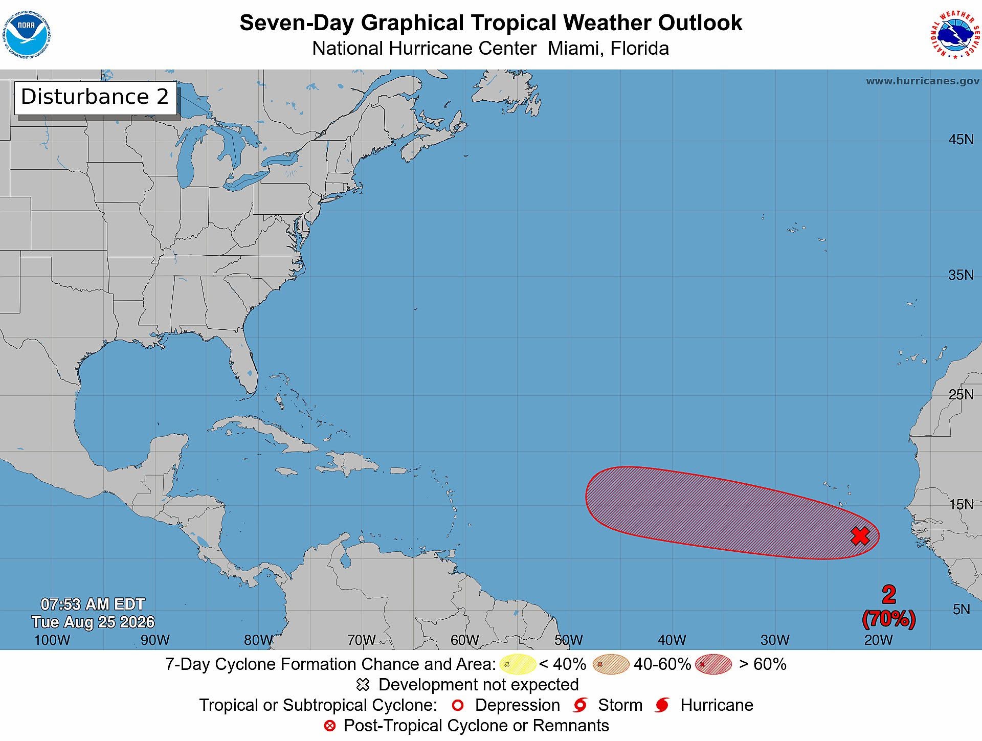
ST. JOHN’S, Antigua — Meteorological agencies across the Atlantic are closely tracking a nascent tropical disturbance that carries a significant probability of strengthening into a named cyclone over the coming days, though the twin-island nation of Antigua and Barbuda faces no immediate impacts from the system as of Tuesday’s latest updates.
Designated Invest AL96 by weather tracking systems, the low-pressure system is currently situated hundreds of miles south-southeast of the Cabo Verde Islands, off the western coast of Africa, according to official data from the Antigua and Barbuda Meteorological Service.
The U.S. National Hurricane Center (NHC) reports that the disturbance formed around a broad tropical wave, and currently generates scattered, disorganized bands of showers and thunderstorms across the eastern tropical Atlantic. Forecasters note that prevailing atmospheric and oceanic conditions are primed to support slow but steady strengthening of the system over the next 48 hours. As it drifts westward and west-northwestward across the eastern and central portions of the tropical Atlantic, AL96 is on track to develop into a formal tropical depression within the next one to two days.
As of Tuesday morning, the NHC assigned a 70% probability of tropical cyclone formation both within the 48-hour window and over the full seven-day forecast period. However, conditions are projected to become less conducive to further growth by the end of the week, forecasters added.
In its 9 a.m. public tropical weather update, the Antigua and Barbuda Meteorological Service emphasized that the disturbance has not caused any impacts to the nation’s territories as of the latest report. Meteorological teams from both the local service and the NHC will continue round-the-clock monitoring of AL95 as it traverses the Atlantic basin, updating projections and risk assessments as new data becomes available.